Directions to Power Fact Electric, Inc. (Everett) with public transportation
The following transit lines have routes that pass near Power Fact Electric, Inc.
 Bus: 109, 110, 111, 104.
- Train: NEWBURYPORT/ROCKPORT.
- Subway: ORANGE LINE, BLUE LINE.
How to get to Power Fact Electric, Inc. by bus?
Click on the bus route to see step by step directions with maps, line arrival times and updated time schedules.
From Pine Street Inn, Boston
65 minFrom Public Garden (Boston Public Garden), Boston
50 minFrom 240 Mount Vernon Street, Boston
116 minFrom Massachusetts, Boston
75 minFrom Coolidge Corner Theatre, Brookline
84 minFrom Doubletree-Boston Bayside, Boston
118 minFrom The Lenox Hotel - Boston, Boston
73 minFrom Roxbury Community College, Boston
94 minFrom Fan Pier Park, Boston
51 minFrom Boston Common, Boston
46 min
How to get to Power Fact Electric, Inc. by train?
Click on the train route to see step by step directions with maps, line arrival times and updated time schedules.
How to get to Power Fact Electric, Inc. by subway?
Click on the subway route to see step by step directions with maps, line arrival times and updated time schedules.
From Pine Street Inn, Boston
79 minFrom Public Garden (Boston Public Garden), Boston
76 minFrom 240 Mount Vernon Street, Boston
84 minFrom Massachusetts, Boston
119 minFrom Coolidge Corner Theatre, Brookline
98 minFrom Doubletree-Boston Bayside, Boston
86 minFrom The Lenox Hotel - Boston, Boston
76 minFrom Roxbury Community College, Boston
79 minFrom Fan Pier Park, Boston
80 minFrom Boston Common, Boston
69 min
Bus stops near Power Fact Electric, Inc. in Everett
Subway stations near Power Fact Electric, Inc. in Everett
Train station near Power Fact Electric, Inc. in Everett
- Chelsea, 64 min walk,VIEW
Bus lines to Power Fact Electric, Inc. in Everett
What are the closest stations to Power Fact Electric, Inc.?
The closest stations to Power Fact Electric, Inc. are:
- Elm St @ Abbott Ave is 273 yards away, 4 min walk.
- Broadway @ Ferry St is 477 yards away, 6 min walk.
- Broadway @ Timothy Ave is 511 yards away, 7 min walk.
- Wood Island is 3118 yards away, 37 min walk.
- Wellington is 3987 yards away, 47 min walk.
- Chelsea is 5182 yards away, 64 min walk.
Which bus lines stop near Power Fact Electric, Inc.?
These bus lines stop near Power Fact Electric, Inc.: 109, 110, 111.
Which train line stops near Power Fact Electric, Inc.?
NEWBURYPORT/ROCKPORT (#125 | Newburyport)
Which subway line stops near Power Fact Electric, Inc.?
ORANGE LINE (Oak Grove)
What’s the nearest bus station to Power Fact Electric, Inc. in Everett?
The nearest bus station to Power Fact Electric, Inc. in Everett is Elm St @ Abbott Ave. It’s a 4 min walk away.
What time is the first subway to Power Fact Electric, Inc. in Everett?
The BLUE LINE is the first subway that goes to Power Fact Electric, Inc. in Everett. It stops nearby at 5:10 AM.
What time is the last subway to Power Fact Electric, Inc. in Everett?
The BLUE LINE is the last subway that goes to Power Fact Electric, Inc. in Everett. It stops nearby at 2:01 AM.
What time is the first train to Power Fact Electric, Inc. in Everett?
The NEWBURYPORT/ROCKPORT is the first train that goes to Power Fact Electric, Inc. in Everett. It stops nearby at 5:40 AM.
What time is the last train to Power Fact Electric, Inc. in Everett?
The NEWBURYPORT/ROCKPORT is the last train that goes to Power Fact Electric, Inc. in Everett. It stops nearby at 12:06 AM.
What time is the first bus to Power Fact Electric, Inc. in Everett?
The 104 is the first bus that goes to Power Fact Electric, Inc. in Everett. It stops nearby at 4:33 AM.
What time is the last bus to Power Fact Electric, Inc. in Everett?
The 110 is the last bus that goes to Power Fact Electric, Inc. in Everett. It stops nearby at 2:13 AM.
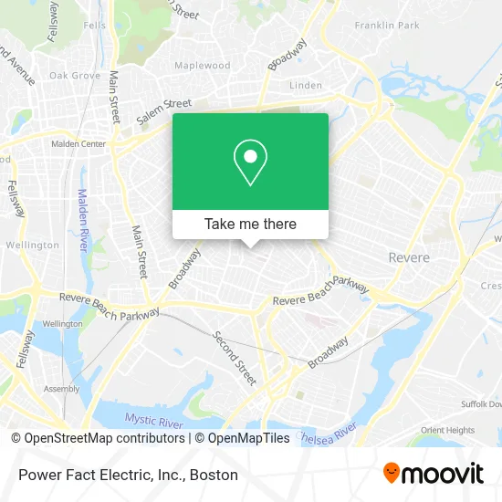
See Power Fact Electric, Inc., Everett, on the map
Public Transit to Power Fact Electric, Inc. in Everett
Wondering how to get to Power Fact Electric, Inc. in Everett? Moovit helps you find the best way to get to Power Fact Electric, Inc. with step-by-step directions from the nearest public transit station.
Moovit provides free maps and live directions to help you navigate through your city. View schedules, routes, timetables, and find out how long does it take to get to Power Fact Electric, Inc. in real time.
Looking for the nearest stop or station to Power Fact Electric, Inc.? Check out this list of stops closest to your destination: Elm St @ Abbott Ave; Broadway @ Ferry St; Broadway @ Timothy Ave; Wood Island; Wellington; Chelsea.
Bus: 109, 110, 111, 104.Train: NEWBURYPORT/ROCKPORT.Subway: ORANGE LINE, BLUE LINE.
Want to see if there’s another route that gets you there at an earlier time? Moovit helps you find alternative routes or times. Get directions from and directions to Power Fact Electric, Inc. easily from the Moovit App or Website.
We make riding to Power Fact Electric, Inc. easy, which is why over 1.7 million users, including users in Everett, trust Moovit as the best app for public transit. You don’t need to download an individual bus app or train app, Moovit is your all-in-one transit app that helps you find the best bus time or train time available.
For information on prices of bus, subway and train, costs and ride fares to Power Fact Electric, Inc., please check the Moovit app.
Use the app to navigate to popular places including to the airport, hospital, stadium, grocery store, mall, coffee shop, school, college, and university.
Power Fact Electric, Inc. Address: 38 Garland St street in Everett
- Whidden Memorial Hospital,
- Cha Everett Hospital Emergency Department,
- CHA Everett Hospital-ER,
- Advanced Locks,
- Exclusive,
- San Santiago Botanica,
- Natural Start Learning Center,
- Waggles Pet Care,
- Bella Imagen Salon1,
- ATM,
- Everett High School,
- Everett High,
- The Port Boston Distillery,
- Woodlawn Cemetery,
- M & M Retail,
- Corner Store,
- Glendale Convenience Store,
- Ferry St & George St,
- PSPS Legal Support Services,
- Executive Protection Training Institute
Places Near Power Fact Electric, Inc. (Everett)
- Quincy Market, Boston,
- Museum Of Science, Boston,
- Td Garden, Boston,
- Wang Theater, Boston,
- Boston Children's Hospital, Boston,
- Castle Island, Boston,
- Wilbur Theatre, Boston,
- Massachusetts General Hospital, Boston,
- Cheers, Boston,
- Prudential Center, Boston,
- Faneuil Hall, Boston,
- Boston Common, Boston,
- Boston Convention & Exhibition Center, Boston,
- Mgm Music Hall, Boston,
- Boston Medical Center, Boston,
- House Of Blues, Boston,
- Isabella Stewart Gardner Museum, Boston,
- North End, Boston,
- Seaport District, Boston,
- Leader Bank Pavilion (Leader Bank Pavillion), Boston
How to get to popular places in Boston with public transit
Get around Everett by public transit!
Traveling around Everett has never been so easy. See step by step directions as you travel to any attraction, street or major public transit station. View bus and train schedules, arrival times, service alerts and detailed routes on a map, so you know exactly how to get to anywhere in Everett.
When traveling to any destination around Everett use Moovit's Live Directions with Get Off Notifications to know exactly where and how far to walk, how long to wait for your line, and how many stops are left. Moovit will alert you when it's time to get off — no need to constantly re-check whether yours is the next stop.
Wondering how to use public transit in Everett or how to pay for public transit in Everett? Moovit public transit app can help you navigate your way with public transit easily, and at minimum cost. It includes public transit fees, ticket prices, and costs. Looking for a map of Everett public transit lines? Moovit public transit app shows all public transit maps in Everett with all Bus, Train, Subway and Ferry routes and stops on an interactive map.
Boston has 4 transit type(s), including: Bus, Train, Subway and Ferry, operated by several transit agencies, including MBTA, Southeastern Regional Transit Authority, MetroWest Regional Transit Authority, Rhode Island Public Transit Authority, WRTA, Lowell Regional Transit Authority, Merrimack Valley Transit, Montachusett Regional Transit Authority, Cape Cod Regional Transit Authority, Brockton Area Transit Authority, Martha's Vineyard Transit Authority, the WAVE - Nantucket Regional Transit Authority, GATRA, Cape Ann Transportation Authority and Massport