How to get to Power Home Remodeling by bus?
Click on the bus route to see step by step directions with maps, line arrival times and updated time schedules.
From Hampton Inn & Suites-Hampton Watertown Boston (Hampton Inn & Suites Watertown Boston), Watertown Town
48 minFrom Mount Auburn, Cambridge
64 minFrom Brighton, Boston
79 minFrom AC Hotel Boston Cambridge, Cambridge
127 minFrom Brighton, Boston
82 minFrom Chestnut Hill, Boston
84 minFrom Brighton District Court, Boston
77 minFrom Alumni Stadium, Boston
82 minFrom Boston College (BC), Boston
82 min
Bus stop near Power Home Remodeling in Waltham
- Main St @ Stow St, 7 min walk,VIEW
Train station near Power Home Remodeling in Waltham
- Kendal Green, 22 min walk,VIEW
Bus lines to Power Home Remodeling in Waltham
- 70, Market Place Dr,VIEW
What are the closest stations to Power Home Remodeling?
The closest stations to Power Home Remodeling are:
- Main St @ Stow St is 527 yards away, 7 min walk.
- Kendal Green is 1856 yards away, 22 min walk.
Which bus line stops near Power Home Remodeling?
70 (Cedarwood)
What’s the nearest train station to Power Home Remodeling in Waltham?
The nearest train station to Power Home Remodeling in Waltham is Kendal Green. It’s a 22 min walk away.
What’s the nearest bus station to Power Home Remodeling in Waltham?
The nearest bus station to Power Home Remodeling in Waltham is Main St @ Stow St. It’s a 7 min walk away.
What time is the first train to Power Home Remodeling in Waltham?
The FITCHBURG is the first train that goes to Power Home Remodeling in Waltham. It stops nearby at 5:27 AM.
What time is the last train to Power Home Remodeling in Waltham?
The FITCHBURG is the last train that goes to Power Home Remodeling in Waltham. It stops nearby at 12:19 AM.
What time is the first bus to Power Home Remodeling in Waltham?
The 70 is the first bus that goes to Power Home Remodeling in Waltham. It stops nearby at 4:57 AM.
What time is the last bus to Power Home Remodeling in Waltham?
The 70 is the last bus that goes to Power Home Remodeling in Waltham. It stops nearby at 12:12 AM.
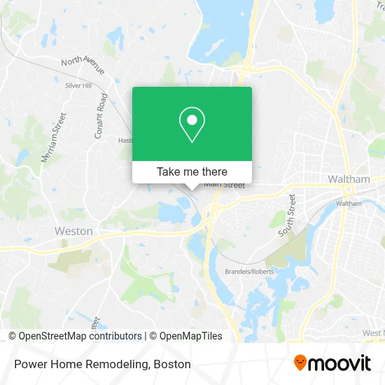
See Power Home Remodeling, Waltham, on the map
Public Transit to Power Home Remodeling in Waltham
Wondering how to get to Power Home Remodeling in Waltham? Moovit helps you find the best way to get to Power Home Remodeling with step-by-step directions from the nearest public transit station.
Moovit provides free maps and live directions to help you navigate through your city. View schedules, routes, timetables, and find out how long does it take to get to Power Home Remodeling in real time.
Looking for the nearest stop or station to Power Home Remodeling? Check out this list of stops closest to your destination: Main St @ Stow St; Kendal Green.
Bus: 70.Train: FITCHBURG.
Want to see if there’s another route that gets you there at an earlier time? Moovit helps you find alternative routes or times. Get directions from and directions to Power Home Remodeling easily from the Moovit App or Website.
We make riding to Power Home Remodeling easy, which is why over 1.7 million users, including users in Waltham, trust Moovit as the best app for public transit. You don’t need to download an individual bus app or train app, Moovit is your all-in-one transit app that helps you find the best bus time or train time available.
For information on prices of bus, subway and train, costs and ride fares to Power Home Remodeling, please check the Moovit app.
Use the app to navigate to popular places including to the airport, hospital, stadium, grocery store, mall, coffee shop, school, college, and university.
Power Home Remodeling Address: 201 Jones Road 2ND, Fl W street in Waltham
- Luisa Lugo, Financial Professional - New York Life,
- Chris Battersby, Financial Advisor - Atlantic Planning Group,
- New York Life Insurance,
- Anja Nickel, Financial Advisor - Abn Financial Strategies, Llc,
- Timothy Libby, Founder - Real Financial Strategies & Solutions, Llc,
- Todd Bajor New York Life Insurance,
- The National Center on Family Homelessness,
- Dean Financial Group,
- Daniel T. Maher, Financial Services Professional - New York Life,
- Hai Nguyen, Financial Professional - New York Life,
- Cannistraro,
- Cesar Casado, Partner With New York Life,
- Aron Levy, Financial Services Professional With Nylife Securities Llc,
- Cameron Spezzano, Agent With New York Life,
- Gabriel Donascimento, Registered Representative With Nylife Securities Llc,
- Olivia Demauro, Financial Strategist,
- Anyeli Pérez, Agent With New York Life,
- New York Life Insurance: Anthony Gaita ,
- Christian Hutcheson, Wealth Architect,
- La Legacy Financial, Llc
Places Near Power Home Remodeling (Waltham)
- Cheers, Boston,
- Boston Children's Hospital, Boston,
- Quincy Market, Boston,
- Leader Bank Pavilion (Leader Bank Pavillion), Boston,
- Isabella Stewart Gardner Museum, Boston,
- Td Garden, Boston,
- Museum Of Science, Boston,
- Prudential Center, Boston,
- North End, Boston,
- Boston Common, Boston,
- House Of Blues, Boston,
- Faneuil Hall, Boston,
- Wilbur Theatre, Boston,
- Wang Theater, Boston,
- Boston Convention & Exhibition Center, Boston,
- Mgm Music Hall, Boston,
- Boston Medical Center, Boston,
- Seaport District, Boston,
- Castle Island, Boston,
- Massachusetts General Hospital, Boston
How to get to popular places in Boston with public transit
Get around Waltham by public transit!
Traveling around Waltham has never been so easy. See step by step directions as you travel to any attraction, street or major public transit station. View bus and train schedules, arrival times, service alerts and detailed routes on a map, so you know exactly how to get to anywhere in Waltham.
When traveling to any destination around Waltham use Moovit's Live Directions with Get Off Notifications to know exactly where and how far to walk, how long to wait for your line, and how many stops are left. Moovit will alert you when it's time to get off — no need to constantly re-check whether yours is the next stop.
Wondering how to use public transit in Waltham or how to pay for public transit in Waltham? Moovit public transit app can help you navigate your way with public transit easily, and at minimum cost. It includes public transit fees, ticket prices, and costs. Looking for a map of Waltham public transit lines? Moovit public transit app shows all public transit maps in Waltham with all Bus, Train, Subway and Ferry routes and stops on an interactive map.
Boston has 4 transit type(s), including: Bus, Train, Subway and Ferry, operated by several transit agencies, including MBTA, Southeastern Regional Transit Authority, MetroWest Regional Transit Authority, Rhode Island Public Transit Authority, WRTA, Lowell Regional Transit Authority, Merrimack Valley Transit, Montachusett Regional Transit Authority, Cape Cod Regional Transit Authority, Brockton Area Transit Authority, Martha's Vineyard Transit Authority, the WAVE - Nantucket Regional Transit Authority, GATRA, Cape Ann Transportation Authority and Massport