Directions to Power House Ministry Inc (Boston) with public transportation
The following transit lines have routes that pass near Power House Ministry Inc
 Bus: 22, 42, 29, 44, ORANGE LINE SHUTTLE.
- Train: NEEDHAM, FRANKLIN/FOXBORO, PROVIDENCE/STOUGHTON.
- Subway: ORANGE LINE, GREEN LINE E.
How to get to Power House Ministry Inc by bus?
Click on the bus route to see step by step directions with maps, line arrival times and updated time schedules.
From Dedham District Court, Dedham
50 minFrom Mass Ave, Cambridge
53 minFrom AC Hotel Boston Cambridge, Cambridge
97 minFrom Ac Hotel Cambridge, Cambridge
91 minFrom TownePlace Suites Boston Logan Airport/Chelsea, Chelsea
70 minFrom Boston Black Falcon Cruise Terminal, Boston
60 minFrom Hampton Inn Boston Logan Airport Chelsea, Chelsea
88 minFrom MGH 50 Staniford Street 3rd flr, Boston
50 minFrom Massport Bus 77 Chelsea Employee Parking, Chelsea
70 minFrom Harvard Upper Busway, Cambridge
56 min
How to get to Power House Ministry Inc by train?
Click on the train route to see step by step directions with maps, line arrival times and updated time schedules.
How to get to Power House Ministry Inc by subway?
Click on the subway route to see step by step directions with maps, line arrival times and updated time schedules.
From Mass Ave, Cambridge
41 minFrom AC Hotel Boston Cambridge, Cambridge
60 minFrom Ac Hotel Cambridge, Cambridge
53 minFrom TownePlace Suites Boston Logan Airport/Chelsea, Chelsea
50 minFrom MGH 50 Staniford Street 3rd flr, Boston
37 minFrom Massport Bus 77 Chelsea Employee Parking, Chelsea
50 minFrom Harvard Upper Busway, Cambridge
38 min
Bus stops near Power House Ministry Inc in Boston
Subway stations near Power House Ministry Inc in Boston
Train station near Power House Ministry Inc in Boston
- Forest Hills, 21 min walk,VIEW
Bus lines to Power House Ministry Inc in Boston
- 42, Nubian,VIEW
- 22, Kenmore Via Ruggles,VIEW
- 29, Jackson Square,VIEW
- 44, Ruggles,VIEW
- ORANGE LINE SHUTTLE, Forest Hills - Jackson Square,VIEW
- ORANGE LINE SHUTTLE, Forest Hills - Back Bay (Shuttle),VIEW
- ORANGE LINE SHUTTLE, Forest Hills - Jackson Square (Shuttle),VIEW
- ORANGE LINE SHUTTLE, Forest Hills - Ruggles,VIEW
- ORANGE LINE SHUTTLE, Forest Hills - Copley,VIEW
- ORANGE LINE SHUTTLE, Forest Hills - Back Bay via Ruggles Busway (Shuttle),VIEW
- ORANGE LINE SHUTTLE, Forest Hills - Back Bay via Copley (Shuttle),VIEW
What are the closest stations to Power House Ministry Inc?
The closest stations to Power House Ministry Inc are:
- Washington St @ Forest Hills St is 21 yards away, 1 min walk.
- Columbus Ave @ Walnut Ave is 188 yards away, 3 min walk.
- Jackson Square is 224 yards away, 3 min walk.
- Stony Brook - Amory St @ Boylston St is 689 yards away, 9 min walk.
- Heath Street is 1586 yards away, 19 min walk.
- Forest Hills is 1733 yards away, 21 min walk.
Which bus lines stop near Power House Ministry Inc?
These bus lines stop near Power House Ministry Inc: 22, 42.
Which train line stops near Power House Ministry Inc?
NEEDHAM (#625 | Needham Heights)
Which subway line stops near Power House Ministry Inc?
ORANGE LINE (Forest Hills)
What’s the nearest subway station to Power House Ministry Inc in Boston?
The nearest subway station to Power House Ministry Inc in Boston is Jackson Square. It’s a 3 min walk away.
What’s the nearest train station to Power House Ministry Inc in Boston?
The nearest train station to Power House Ministry Inc in Boston is Forest Hills. It’s a 21 min walk away.
What’s the nearest bus station to Power House Ministry Inc in Boston?
The nearest bus station to Power House Ministry Inc in Boston is Washington St @ Forest Hills St. It’s a 1 min walk away.
What time is the first subway to Power House Ministry Inc in Boston?
The ORANGE LINE is the first subway that goes to Power House Ministry Inc in Boston. It stops nearby at 5:15 AM.
What time is the last subway to Power House Ministry Inc in Boston?
The GREEN LINE E is the last subway that goes to Power House Ministry Inc in Boston. It stops nearby at 2:00 AM.
What time is the first train to Power House Ministry Inc in Boston?
The NEEDHAM is the first train that goes to Power House Ministry Inc in Boston. It stops nearby at 7:34 AM.
What time is the last train to Power House Ministry Inc in Boston?
The PROVIDENCE/STOUGHTON is the last train that goes to Power House Ministry Inc in Boston. It stops nearby at 12:08 AM.
What time is the first bus to Power House Ministry Inc in Boston?
The 42 is the first bus that goes to Power House Ministry Inc in Boston. It stops nearby at 5:01 AM.
What time is the last bus to Power House Ministry Inc in Boston?
The 22 is the last bus that goes to Power House Ministry Inc in Boston. It stops nearby at 2:10 AM.
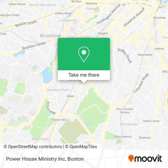
See Power House Ministry Inc, Boston, on the map
Public Transit to Power House Ministry Inc in Boston
Wondering how to get to Power House Ministry Inc in Boston? Moovit helps you find the best way to get to Power House Ministry Inc with step-by-step directions from the nearest public transit station.
Moovit provides free maps and live directions to help you navigate through your city. View schedules, routes, timetables, and find out how long does it take to get to Power House Ministry Inc in real time.
Looking for the nearest stop or station to Power House Ministry Inc? Check out this list of stops closest to your destination: Washington St @ Forest Hills St; Columbus Ave @ Walnut Ave; Jackson Square; Stony Brook - Amory St @ Boylston St; Heath Street; Forest Hills.
Bus: 22, 42, 29, 44, ORANGE LINE SHUTTLE, ORANGE LINE SHUTTLE, ORANGE LINE SHUTTLE, ORANGE LINE SHUTTLE, ORANGE LINE SHUTTLE.Train: NEEDHAM, FRANKLIN/FOXBORO, PROVIDENCE/STOUGHTON.Subway: ORANGE LINE, GREEN LINE E.
Want to see if there’s another route that gets you there at an earlier time? Moovit helps you find alternative routes or times. Get directions from and directions to Power House Ministry Inc easily from the Moovit App or Website.
We make riding to Power House Ministry Inc easy, which is why over 1.7 million users, including users in Boston, trust Moovit as the best app for public transit. You don’t need to download an individual bus app or train app, Moovit is your all-in-one transit app that helps you find the best bus time or train time available.
For information on prices of subway, bus and train, costs and ride fares to Power House Ministry Inc, please check the Moovit app.
Use the app to navigate to popular places including to the airport, hospital, stadium, grocery store, mall, coffee shop, school, college, and university.
Power House Ministry Inc Address: 3140 Washington St street in Boston
- D Fantasy,
- Educadoras de Niños Pequeños,
- El Tiburon Market,
- Emergency 1 Locksmith,
- AAA Restaurant,
- SUBWAY Income Tax,
- Father Jack Roussin Community Center,
- Kimberly Gonzalez,
- Eleven,
- A Massage Now,
- Latino Beauty Salon (Latino Salon Roxbury),
- Amazon Locker-Effervescent,
- El Barrio Convenience,
- Learning Together Family Day Care,
- Boost Mobile,
- Tonys Barber Shop,
- Accutemp Engineering,
- Rafael Hernandez School (Hernandez Schoolyard),
- Kevins Jewelry,
- Tito & Manny
Places Near Power House Ministry Inc (Boston)
- North End, Boston,
- Massachusetts General Hospital, Boston,
- Boston Medical Center, Boston,
- Wilbur Theatre, Boston,
- Quincy Market, Boston,
- Seaport District, Boston,
- Cheers, Boston,
- Boston Children's Hospital, Boston,
- Prudential Center, Boston,
- Td Garden, Boston,
- Castle Island, Boston,
- Mgm Music Hall, Boston,
- House Of Blues, Boston,
- Isabella Stewart Gardner Museum, Boston,
- Faneuil Hall, Boston,
- Leader Bank Pavilion (Leader Bank Pavillion), Boston,
- Boston Common, Boston,
- Boston Convention & Exhibition Center, Boston,
- Wang Theater, Boston,
- Museum Of Science, Boston
How to get to popular places in Boston with public transit
Get around Boston by public transit!
Traveling around Boston has never been so easy. See step by step directions as you travel to any attraction, street or major public transit station. View bus and train schedules, arrival times, service alerts and detailed routes on a map, so you know exactly how to get to anywhere in Boston.
When traveling to any destination around Boston use Moovit's Live Directions with Get Off Notifications to know exactly where and how far to walk, how long to wait for your line, and how many stops are left. Moovit will alert you when it's time to get off — no need to constantly re-check whether yours is the next stop.
Wondering how to use public transit in Boston or how to pay for public transit in Boston? Moovit public transit app can help you navigate your way with public transit easily, and at minimum cost. It includes public transit fees, ticket prices, and costs. Looking for a map of Boston public transit lines? Moovit public transit app shows all public transit maps in Boston with all Bus, Train, Subway and Ferry routes and stops on an interactive map.
Boston has 4 transit type(s), including: Bus, Train, Subway and Ferry, operated by several transit agencies, including MBTA, Southeastern Regional Transit Authority, MetroWest Regional Transit Authority, Rhode Island Public Transit Authority, WRTA, Lowell Regional Transit Authority, Merrimack Valley Transit, Montachusett Regional Transit Authority, Cape Cod Regional Transit Authority, Brockton Area Transit Authority, Martha's Vineyard Transit Authority, the WAVE - Nantucket Regional Transit Authority, GATRA, Cape Ann Transportation Authority and Massport