Directions to Power Supply Mall (Boston) with public transportation
The following transit lines have routes that pass near Power Supply Mall
 Bus: 14, PROVIDENCE/STOUGHTON LINE SHUTTLE.
- Train: PROVIDENCE/STOUGHTON.
How to get to Power Supply Mall by bus?
Click on the bus route to see step by step directions with maps, line arrival times and updated time schedules.
How to get to Power Supply Mall by train?
Click on the train route to see step by step directions with maps, line arrival times and updated time schedules.
Bus stop near Power Supply Mall in Boston
- Central St at Station St, 7 min walk,VIEW
Train station near Power Supply Mall in Boston
- Stoughton, 22 min walk,VIEW
Bus lines to Power Supply Mall in Boston
- 14, Cobbs Corner,VIEW
What are the closest stations to Power Supply Mall?
The closest stations to Power Supply Mall are:
- Central St at Station St is 596 yards away, 7 min walk.
- Stoughton is 1881 yards away, 22 min walk.
Which bus lines stop near Power Supply Mall?
These bus lines stop near Power Supply Mall: 14, PROVIDENCE/STOUGHTON LINE SHUTTLE.
Which train line stops near Power Supply Mall?
PROVIDENCE/STOUGHTON (#917 | Stoughton)
What’s the nearest train station to Power Supply Mall in Boston?
The nearest train station to Power Supply Mall in Boston is Stoughton. It’s a 22 min walk away.
What’s the nearest bus station to Power Supply Mall in Boston?
The nearest bus station to Power Supply Mall in Boston is Central St at Station St. It’s a 7 min walk away.
What time is the first bus to Power Supply Mall in Boston?
The 14 is the first bus that goes to Power Supply Mall in Boston. It stops nearby at 6:44 AM.
What time is the last bus to Power Supply Mall in Boston?
The 14 is the last bus that goes to Power Supply Mall in Boston. It stops nearby at 9:07 PM.
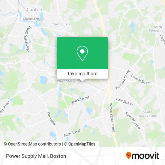
See Power Supply Mall, Boston, on the map
Public Transit to Power Supply Mall in Boston
Wondering how to get to Power Supply Mall in Boston? Moovit helps you find the best way to get to Power Supply Mall with step-by-step directions from the nearest public transit station.
Moovit provides free maps and live directions to help you navigate through your city. View schedules, routes, timetables, and find out how long does it take to get to Power Supply Mall in real time.
Looking for the nearest stop or station to Power Supply Mall? Check out this list of stops closest to your destination: Central St at Station St; Stoughton.
Bus: 14, PROVIDENCE/STOUGHTON LINE SHUTTLE.Train: PROVIDENCE/STOUGHTON.
Want to see if there’s another route that gets you there at an earlier time? Moovit helps you find alternative routes or times. Get directions from and directions to Power Supply Mall easily from the Moovit App or Website.
We make riding to Power Supply Mall easy, which is why over 1.7 million users, including users in Boston, trust Moovit as the best app for public transit. You don’t need to download an individual bus app or train app, Moovit is your all-in-one transit app that helps you find the best bus time or train time available.
For information on prices of bus and train, costs and ride fares to Power Supply Mall, please check the Moovit app.
Use the app to navigate to popular places including to the airport, hospital, stadium, grocery store, mall, coffee shop, school, college, and university.
Power Supply Mall Address: 409 Canton St street in Boston
- Riordan Brothers Integration,
- Allstate Trading Company,
- Tradebe,
- Allstar Waterproofing & Building Restoration,
- Comeau & Kelly Construction,
- M&D Core, Inc.,
- Canson Realty,
- Construction Sales,
- Hardy Insurance Agency,
- Downes and Reader Hardwood Co.,
- Kidsports Indoor Playground And Laser Tag,
- Stoughton Emergency Management Agency - Ma,
- New England Bulkhead,
- Precision Automotive Solutions,
- Blusky Restoration Contractors,
- Lisa's Family Daycare,
- Fitness Center,
- Richard L. Wilkins Elementary School,
- Wilkins School Pto,
- West Elementary
Places Near Power Supply Mall (Boston)
- North End, Boston,
- Massachusetts General Hospital, Boston,
- Boston Medical Center, Boston,
- Wilbur Theatre, Boston,
- Quincy Market, Boston,
- Seaport District, Boston,
- Cheers, Boston,
- Boston Children's Hospital, Boston,
- Prudential Center, Boston,
- Td Garden, Boston,
- Castle Island, Boston,
- Mgm Music Hall, Boston,
- House Of Blues, Boston,
- Isabella Stewart Gardner Museum, Boston,
- Faneuil Hall, Boston,
- Leader Bank Pavilion (Leader Bank Pavillion), Boston,
- Boston Common, Boston,
- Boston Convention & Exhibition Center, Boston,
- Wang Theater, Boston,
- Museum Of Science, Boston
How to get to popular places in Boston with public transit
Get around Boston by public transit!
Traveling around Boston has never been so easy. See step by step directions as you travel to any attraction, street or major public transit station. View bus and train schedules, arrival times, service alerts and detailed routes on a map, so you know exactly how to get to anywhere in Boston.
When traveling to any destination around Boston use Moovit's Live Directions with Get Off Notifications to know exactly where and how far to walk, how long to wait for your line, and how many stops are left. Moovit will alert you when it's time to get off — no need to constantly re-check whether yours is the next stop.
Wondering how to use public transit in Boston or how to pay for public transit in Boston? Moovit public transit app can help you navigate your way with public transit easily, and at minimum cost. It includes public transit fees, ticket prices, and costs. Looking for a map of Boston public transit lines? Moovit public transit app shows all public transit maps in Boston with all Bus, Train, Subway and Ferry routes and stops on an interactive map.
Boston has 4 transit type(s), including: Bus, Train, Subway and Ferry, operated by several transit agencies, including MBTA, Southeastern Regional Transit Authority, MetroWest Regional Transit Authority, Rhode Island Public Transit Authority, WRTA, Lowell Regional Transit Authority, Merrimack Valley Transit, Montachusett Regional Transit Authority, Cape Cod Regional Transit Authority, Brockton Area Transit Authority, Martha's Vineyard Transit Authority, the WAVE - Nantucket Regional Transit Authority, GATRA, Cape Ann Transportation Authority and Massport