Directions to Powers Field (Hingham) with public transportation
The following transit lines have routes that pass near Powers Field
 Bus: 220.
- Train: GREENBUSH.
- Ferry: BUMPKIN ISLAND FERRY, GEORGES ISLAND FERRY, HEWITT'S COVE FERRY, PEDDOCKS ISLAND FERRY.
How to get to Powers Field by bus?
Click on the bus route to see step by step directions with maps, line arrival times and updated time schedules.
From Archbishop Williams High School, Braintree Town
58 minFrom Quincy Center Station, Quincy
35 minFrom Nantasket Beach, Hull
52 minFrom South Shore Hospital Outpatient Center, Weymouth Town
112 minFrom Quincy Market, Quincy
35 minFrom Walmart, Quincy
58 minFrom South Shore Hospital- Pratt 5, Weymouth Town
122 minFrom Braintree, MA, Braintree Town
98 minFrom Quincy, MA, Quincy
39 min
How to get to Powers Field by train?
Click on the train route to see step by step directions with maps, line arrival times and updated time schedules.
Bus stop near Powers Field in Hingham
- Central St @ Central Jr Hs, 2 min walk,VIEW
Train station near Powers Field in Hingham
- Nantasket Junction, 36 min walk,VIEW
Ferry station near Powers Field in Hingham
- Hewitt's Cove, 50 min walk,VIEW
Bus lines to Powers Field in Hingham
- 220, Hingham Depot Via Shipyard,VIEW
What are the closest stations to Powers Field?
The closest stations to Powers Field are:
- Central St @ Central Jr Hs is 140 yards away, 2 min walk.
- Nantasket Junction is 3031 yards away, 36 min walk.
- Hewitt's Cove is 4208 yards away, 50 min walk.
Which bus line stops near Powers Field?
220 (Hingham Depot Via Shipyard)
Which train line stops near Powers Field?
GREENBUSH (#1061 | Greenbush)
What’s the nearest bus station to Powers Field in Hingham?
The nearest bus station to Powers Field in Hingham is Central St @ Central Jr Hs. It’s a 2 min walk away.
What time is the first train to Powers Field in Hingham?
The GREENBUSH is the first train that goes to Powers Field in Hingham. It stops nearby at 5:29 AM.
What time is the last train to Powers Field in Hingham?
The GREENBUSH is the last train that goes to Powers Field in Hingham. It stops nearby at 12:29 AM.
What time is the first bus to Powers Field in Hingham?
The 220 is the first bus that goes to Powers Field in Hingham. It stops nearby at 8:54 AM.
What time is the last bus to Powers Field in Hingham?
The 220 is the last bus that goes to Powers Field in Hingham. It stops nearby at 6:25 PM.
What time is the first ferry to Powers Field in Hingham?
The GEORGES ISLAND FERRY is the first ferry that goes to Powers Field in Hingham. It stops nearby at 10:00 AM.
What time is the last ferry to Powers Field in Hingham?
The HEWITT'S COVE FERRY is the last ferry that goes to Powers Field in Hingham. It stops nearby at 3:40 PM.
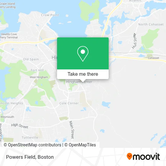
See Powers Field, Hingham, on the map
Public Transit to Powers Field in Hingham
Wondering how to get to Powers Field in Hingham? Moovit helps you find the best way to get to Powers Field with step-by-step directions from the nearest public transit station.
Moovit provides free maps and live directions to help you navigate through your city. View schedules, routes, timetables, and find out how long does it take to get to Powers Field in real time.
Looking for the nearest stop or station to Powers Field? Check out this list of stops closest to your destination: Central St @ Central Jr Hs; Nantasket Junction; Hewitt's Cove.
Bus: 220.Train: GREENBUSH.Ferry: BUMPKIN ISLAND FERRY, GEORGES ISLAND FERRY, HEWITT'S COVE FERRY, PEDDOCKS ISLAND FERRY.
Want to see if there’s another route that gets you there at an earlier time? Moovit helps you find alternative routes or times. Get directions from and directions to Powers Field easily from the Moovit App or Website.
We make riding to Powers Field easy, which is why over 1.7 million users, including users in Hingham, trust Moovit as the best app for public transit. You don’t need to download an individual bus app or train app, Moovit is your all-in-one transit app that helps you find the best bus time or train time available.
For information on prices of bus and train, costs and ride fares to Powers Field, please check the Moovit app.
Use the app to navigate to popular places including to the airport, hospital, stadium, grocery store, mall, coffee shop, school, college, and university.
Powers Field Address: HING-1310810000001280 street in Hingham
- The Barn,
- School St & Short St,
- Anytime Any Place Locksmith,
- Wampatuck State Park (Wompatuck State Park),
- A D T Security Services,
- Hingham Town of,
- Hingham Recreation,
- Around The Clock Locksmith,
- South Shore Home Repair,
- Tory Dolan - Bootcamp,
- Hingham Center for Active Living,
- Hingham, Massachusetts,
- Sullivan Painting,
- Astrue David,
- Dean and Hamilton Realtors,
- Research Collaborative,
- Old Ship Church/Meeting House,
- Medicare Insurance Advisors Hingham,
- Jennifer Bardsley Interior Design,
- Patriot Cinemas Loring Hall Cinema
Places Near Powers Field (Hingham)
- Faneuil Hall, Boston,
- Wang Theater, Boston,
- Prudential Center, Boston,
- Leader Bank Pavilion (Leader Bank Pavillion), Boston,
- House Of Blues, Boston,
- North End, Boston,
- Boston Medical Center, Boston,
- Boston Children's Hospital, Boston,
- Boston Common, Boston,
- Quincy Market, Boston,
- Isabella Stewart Gardner Museum, Boston,
- Mgm Music Hall, Boston,
- Boston Convention & Exhibition Center, Boston,
- Museum Of Science, Boston,
- Wilbur Theatre, Boston,
- Castle Island, Boston,
- Massachusetts General Hospital, Boston,
- Seaport District, Boston,
- Td Garden, Boston,
- Cheers, Boston
How to get to popular places in Boston with public transit
Get around Hingham by public transit!
Traveling around Hingham has never been so easy. See step by step directions as you travel to any attraction, street or major public transit station. View bus and train schedules, arrival times, service alerts and detailed routes on a map, so you know exactly how to get to anywhere in Hingham.
When traveling to any destination around Hingham use Moovit's Live Directions with Get Off Notifications to know exactly where and how far to walk, how long to wait for your line, and how many stops are left. Moovit will alert you when it's time to get off — no need to constantly re-check whether yours is the next stop.
Wondering how to use public transit in Hingham or how to pay for public transit in Hingham? Moovit public transit app can help you navigate your way with public transit easily, and at minimum cost. It includes public transit fees, ticket prices, and costs. Looking for a map of Hingham public transit lines? Moovit public transit app shows all public transit maps in Hingham with all Bus, Train, Subway and Ferry routes and stops on an interactive map.
Boston has 4 transit type(s), including: Bus, Train, Subway and Ferry, operated by several transit agencies, including MBTA, Southeastern Regional Transit Authority, MetroWest Regional Transit Authority, Rhode Island Public Transit Authority, WRTA, Lowell Regional Transit Authority, Merrimack Valley Transit, Montachusett Regional Transit Authority, Cape Cod Regional Transit Authority, Brockton Area Transit Authority, Martha's Vineyard Transit Authority, the WAVE - Nantucket Regional Transit Authority, GATRA, Cape Ann Transportation Authority and Massport