Prairie / 104th stop - Thursday schedule
| Line | Direction | Time |
|---|---|---|
| 212 | Hawthorne - Lennox Station | 5:49 AM |
| 211/215 | Redondo Beach Transit Center | 5:52 AM |
| 212 | Hawthorne - Lennox Station | 6:10 AM |
| 212 | Hawthorne - Lennox Station | 6:31 AM |
| 212 | Hawthorne - Lennox Station | 6:51 AM |
| 211/215 | Redondo Beach Transit Center | 6:57 AM |
| 212 | Hawthorne - Lennox Station | 7:14 AM |
| 212 | Hawthorne - Lennox Station | 7:35 AM |
| 212 | Hawthorne - Lennox Station | 7:56 AM |
| 211/215 | Redondo Beach Transit Center | 7:57 AM |
| 212 | Hawthorne - Lennox Station | 8:16 AM |
| 212 | Hawthorne - Lennox Station | 8:35 AM |
| 211/215 | Redondo Beach Transit Center | 8:49 AM |
| 212 | Hawthorne - Lennox Station | 8:55 AM |
| 212 | Hawthorne - Lennox Station | 9:15 AM |
| 212 | Hawthorne - Lennox Station | 9:35 AM |
| 211/215 | Redondo Beach Transit Center | 9:46 AM |
| 212 | Hawthorne - Lennox Station | 9:55 AM |
| 212 | Hawthorne - Lennox Station | 10:14 AM |
| 212 | Hawthorne - Lennox Station | 10:32 AM |
| 212 | Hawthorne - Lennox Station | 10:52 AM |
| 212 | Hawthorne - Lennox Station | 11:12 AM |
| 212 | Hawthorne - Lennox Station | 11:33 AM |
| 212 | Hawthorne - Lennox Station | 11:53 AM |
| 212 | Hawthorne - Lennox Station | 12:13 PM |
Directions to Prairie / 104th stop (Inglewood) with public transit
The following transit lines have routes that pass near Prairie / 104th
 Bus: 10, 117, 211/215, 212, THE LINK - LENNOX.
- Subway: C LINE, K LINE.
How to get to Prairie / 104th stop by bus?
Click on the bus route to see step by step directions with maps, line arrival times and updated time schedules.
How to get to Prairie / 104th stop by subway?
Click on the subway route to see step by step directions with maps, line arrival times and updated time schedules.
Bus stops near Prairie / 104th stop in Inglewood
- 104th St & Praire Ave, 1 min walk,
- Prairie / 104th, 2 min walk,
- Prairie Av at Century Bl, 6 min walk,
- Century / Prairie, 6 min walk,
Subway stations near Prairie / 104th station in Inglewood
- Downtown Inglewood Station - East Portal, 40 min walk,
- Aviation / Century Station, 47 min walk,
Bus lines to Prairie / 104th stop in Inglewood
- THE LINK - LENNOX, Loop,
- 212, Hollywood - Highland Station,
- 211/215, Inglewood,
- 10, Downtown Inglewood Station,
- 117, LAX / Metro Transit Center,
What are the closest stations to Prairie / 104th?
The closest stations to Prairie / 104th are:
- 104th St & Praire Ave stop is 59 yards away, 1 min walk.
- Prairie / 104th stop is 79 yards away, 2 min walk.
- Prairie Av at Century Bl stop is 449 yards away, 6 min walk.
- Century / Prairie stop is 490 yards away, 6 min walk.
- Downtown Inglewood Station - East Portal is 3408 yards away, 40 min walk.
- Aviation / Century Station is 4008 yards away, 47 min walk.
Which bus lines stop near Prairie / 104th?
These bus lines stop near Prairie / 104th: 10, 117, 211/215, 212, THE LINK - LENNOX.
Which subway line stops near Prairie / 104th?
C LINE (Westbound to LAX / Metro Transit Center)
What’s the nearest bus station to Prairie / 104th in Inglewood?
The nearest bus station to Prairie / 104th in Inglewood is 104th St & Praire Ave. It’s a 1 min walk away.
What time is the first subway to Prairie / 104th in Inglewood?
The C LINE is the first subway that goes to Prairie / 104th in Inglewood. It stops nearby at 3:47 AM.
What time is the last subway to Prairie / 104th in Inglewood?
The C LINE is the last subway that goes to Prairie / 104th in Inglewood. It stops nearby at 12:47 AM.
What time is the first bus to Prairie / 104th in Inglewood?
The 212 is the first bus that goes to Prairie / 104th in Inglewood. It stops nearby at 4:45 AM.
What time is the last bus to Prairie / 104th in Inglewood?
The 117 is the last bus that goes to Prairie / 104th in Inglewood. It stops nearby at 1:27 AM.
Prairie / 104th station
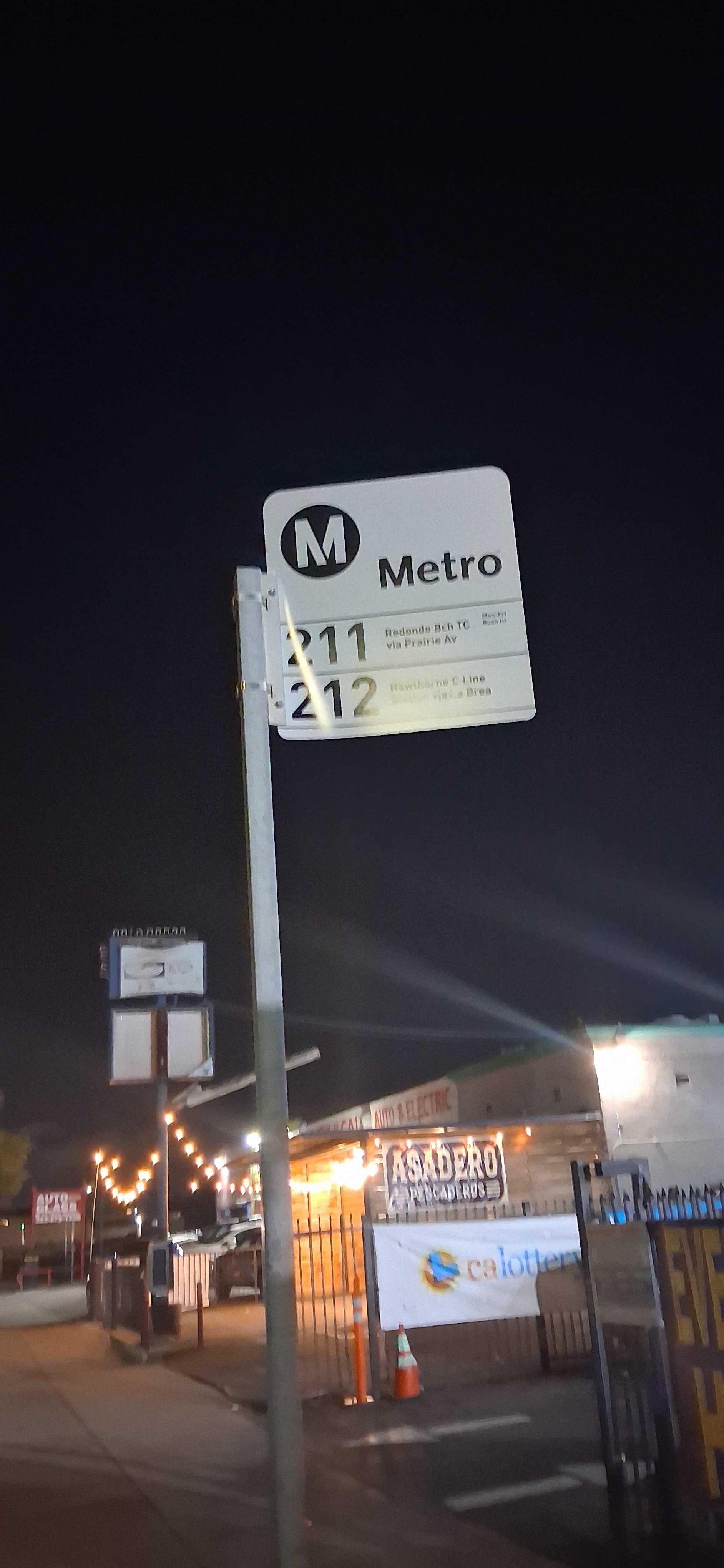 Taken by Anonymous
See Prairie / 104th stop, Inglewood, on the map
Public transit to Prairie / 104th stop (ID: 13826) in Inglewood
Looking for directions to Prairie / 104th in Inglewood, United States?
Download the Moovit App to find the current schedule and step-by-step directions for Bus or Subway routes that pass through Prairie / 104th.
Looking for the nearest stops closest to Prairie / 104th ? Check out this list of closest stops to your destination: 104th St & Praire Ave; Prairie / 104th; Prairie Av at Century Bl; Century / Prairie; Downtown Inglewood Station - East Portal; Aviation / Century Station.
Bus: 10, 117, 211/215, 212, THE LINK - LENNOX.Subway: C LINE, K LINE.
We make riding on public transit to Prairie / 104th easy, which is why over 1.7 billion users, including users in Inglewood trust Moovit as the best app for public transit.
Use the app to navigate to popular places including to the airport, hospital, stadium, grocery store, mall, coffee shop, school, college, and university.
Prairie / 104th stop’s code is 13826
The first line to this stop is 212, at 5:49 AM, and the last line is 212 at 12:55 AM.
4010 W 104th St, Inglewood, CA, USA
This stop serves Metro’s lines
- 104th St & Praire Ave,
- Prairie / 104th,
- Prairie Av at Century Bl,
- Century / Prairie
Bus stops near Prairie / 104th stop
- Downtown Inglewood Station - East Portal,
- Aviation / Century Station
Subway stations near Prairie / 104th station
- Santa Ana / California,
- 119th St & Wilmington Ave (Westbound),
- Katella-Disneyland,
- Van Nuys / Riverside,
- Venice / Sepulveda,
- Washington Blvd & Eastern Ave,
- Wilshire / Normandie Station,
- Garvey / Santa Anita,
- Burbank Airport - North,
- Washington Blvd / LA Cienega Blvd,
- Union Ave & Pico Blvd (Northbound),
- Expo / Western,
- Palmdale Metrolink Station,
- Mcbean Pkwy & Valencia Blvd,
- Central Ave & Florence Ave,
- Plummer & Reseda,
- Martin Luther King Jr / Vermont,
- Pico Station,
- Cherry & 10th SW,
- Garvey / Alhambra
Popular public transit stations in Inglewood
Get around Inglewood by public transit!
Traveling around Inglewood has never been so easy. See step by step directions as you travel to any attraction, street or major public transit station. View bus and train schedules, arrival times, service alerts and detailed routes on a map, so you know exactly how to get to anywhere in Inglewood.
When traveling to any destination around Inglewood use Moovit's Live Directions with Get Off Notifications to know exactly where and how far to walk, how long to wait for your line, and how many stops are left. Moovit will alert you when it's time to get off — no need to constantly re-check whether yours is the next stop.
Wondering how to use public transit in Inglewood or how to pay for public transit in Inglewood? Moovit public transit app can help you navigate your way with public transit easily, and at minimum cost. It includes public transit fees, ticket prices, and costs. Looking for a map of Inglewood public transit lines? Moovit public transit app shows all public transit maps in Inglewood with all Bus, Train, Subway, Ferry and Funicular routes and stops on an interactive map.
Los Angeles has 5 transit type(s), including: Bus, Train, Subway, Ferry and Funicular, operated by several transit agencies, including Metro, Metro Event Service, Alhambra Community Transit (ACT), Arcadia Transit, Artesia Transit, AVTA, Baldwin Park Transit, Beach Cities Transit, Beaumont Transit, Bell Gardens Town Trolley, Bellflower Bus, Big Blue Bus, Burbank Bus, Calabasas Trolley and Camarillo Area Transit