Directions to Pratt, Bator & Popov, Llp (Boston) with public transportation
The following transit lines have routes that pass near Pratt, Bator & Popov, Llp
 Bus: 354, 504, 93, SL4, SL5.
- Train: FITCHBURG, FRAMINGHAM/WORCESTER, LOWELL.
- Subway: GREEN LINE B, GREEN LINE D, ORANGE LINE, RED LINE, BLUE LINE.
- Ferry: CHARLESTOWN FERRY.
How to get to Pratt, Bator & Popov, Llp by bus?
Click on the bus route to see step by step directions with maps, line arrival times and updated time schedules.
From FOUR POINTS BY SHERATON Boston Newton, Newton
35 minFrom The Burren, Somerville
51 minFrom Regent Theatre, Arlington
54 minFrom The Mall At Chestnut Hill, Newton
79 minFrom Davis Sq, Somerville
50 minFrom Wollaston Beach, Quincy
117 minFrom Qea, Quincy
104 minFrom AC Hotel Boston Cambridge, Cambridge
64 minFrom Allston, Boston
63 minFrom Arlington, MA, Arlington
76 min
How to get to Pratt, Bator & Popov, Llp by train?
Click on the train route to see step by step directions with maps, line arrival times and updated time schedules.
How to get to Pratt, Bator & Popov, Llp by subway?
Click on the subway route to see step by step directions with maps, line arrival times and updated time schedules.
Bus stops near Pratt, Bator & Popov, Llp in Boston
- Pearl St @ Congress St, 1 min walk,VIEW
- Congress St @ State St, 2 min walk,VIEW
- State, 4 min walk,VIEW
- State - Devonshire St @ State St, 4 min walk,VIEW
- State St @ Washington Mall - State St Sta, 4 min walk,VIEW
- Federal St @ Franklin St, 5 min walk,VIEW
- Downtown Crossing - Franklin St @ Washington St, 6 min walk,VIEW
Subway stations near Pratt, Bator & Popov, Llp in Boston
Ferry station near Pratt, Bator & Popov, Llp in Boston
- Long Wharf (South), 9 min walk,VIEW
Bus lines to Pratt, Bator & Popov, Llp in Boston
- 4, North Station,VIEW
- 15, Haymarket Via Fields Corner & Nubian,VIEW
- 39, Haymarket Via Forest Hills,VIEW
- 57, Haymarket Via Kenmore,VIEW
- 92, Sullivan,VIEW
- 93, Sullivan Via Navy Yard,VIEW
- RED LINE SHUTTLE, Harvard - JFK/UMass via Congress Street,VIEW
- RED LINE SHUTTLE, Harvard - Broadway,VIEW
- RED LINE SHUTTLE, Kendall/MIT - JFK/UMass,VIEW
- RED LINE SHUTTLE, JFK/UMass - Kendall/MIT (Shuttle),VIEW
- ORANGE LINE SHUTTLE, State (Shuttle),VIEW
- RED LINE SHUTTLE, Jfk/Umass (Shuttle),VIEW
- 116, Maverick - Wonderland,VIEW
- 354, Boston (Express) via Woburn - Burlington (Express) via Woburn,VIEW
- BLUE LINE SHUTTLE, Airport - Government Center (Express),VIEW
- BLUE LINE SHUTTLE, Airport - Government Center via Maverick,VIEW
- BLUE LINE SHUTTLE, Orient Heights - Government Center (Local),VIEW
- BLUE LINE SHUTTLE, Orient Heights - Government Center (Express),VIEW
- BLUE LINE SHUTTLE, Airport - Government Center (Local),VIEW
- BLUE LINE SHUTTLE, Wonderland - Government Center,VIEW
What are the closest stations to Pratt, Bator & Popov, Llp?
The closest stations to Pratt, Bator & Popov, Llp are:
- Pearl St @ Congress St is 36 yards away, 1 min walk.
- Congress St @ State St is 137 yards away, 2 min walk.
- State Street is 147 yards away, 2 min walk.
- State is 241 yards away, 4 min walk.
- State - Devonshire St @ State St is 267 yards away, 4 min walk.
- State St @ Washington Mall - State St Sta is 274 yards away, 4 min walk.
- Federal St @ Franklin St is 338 yards away, 5 min walk.
- Downtown Crossing - Franklin St @ Washington St is 434 yards away, 6 min walk.
- Downtown Crossing is 470 yards away, 6 min walk.
- Government Center is 493 yards away, 7 min walk.
- Long Wharf (South) is 700 yards away, 9 min walk.
Which bus lines stop near Pratt, Bator & Popov, Llp?
These bus lines stop near Pratt, Bator & Popov, Llp: 354, 504, 93, SL4, SL5.
Which train lines stop near Pratt, Bator & Popov, Llp?
These train lines stop near Pratt, Bator & Popov, Llp: FITCHBURG, FRAMINGHAM/WORCESTER, LOWELL.
Which subway lines stop near Pratt, Bator & Popov, Llp?
These subway lines stop near Pratt, Bator & Popov, Llp: GREEN LINE B, GREEN LINE D, ORANGE LINE, RED LINE.
What’s the nearest subway station to Pratt, Bator & Popov, Llp in Boston?
The nearest subway station to Pratt, Bator & Popov, Llp in Boston is State Street. It’s a 2 min walk away.
What’s the nearest bus station to Pratt, Bator & Popov, Llp in Boston?
The nearest bus station to Pratt, Bator & Popov, Llp in Boston is Pearl St @ Congress St. It’s a 1 min walk away.
What’s the nearest ferry station to Pratt, Bator & Popov, Llp in Boston?
The nearest ferry station to Pratt, Bator & Popov, Llp in Boston is Long Wharf (South). It’s a 9 min walk away.
What time is the first subway to Pratt, Bator & Popov, Llp in Boston?
The GREEN LINE E is the first subway that goes to Pratt, Bator & Popov, Llp in Boston. It stops nearby at 5:05 AM.
What time is the last subway to Pratt, Bator & Popov, Llp in Boston?
The GREEN LINE E is the last subway that goes to Pratt, Bator & Popov, Llp in Boston. It stops nearby at 2:20 AM.
What time is the first bus to Pratt, Bator & Popov, Llp in Boston?
The 57 is the first bus that goes to Pratt, Bator & Popov, Llp in Boston. It stops nearby at 5:02 AM.
What time is the last bus to Pratt, Bator & Popov, Llp in Boston?
The 116 is the last bus that goes to Pratt, Bator & Popov, Llp in Boston. It stops nearby at 1:58 AM.
What time is the first ferry to Pratt, Bator & Popov, Llp in Boston?
The CHARLESTOWN FERRY is the first ferry that goes to Pratt, Bator & Popov, Llp in Boston. It stops nearby at 6:30 AM.
What time is the last ferry to Pratt, Bator & Popov, Llp in Boston?
The CHARLESTOWN FERRY is the last ferry that goes to Pratt, Bator & Popov, Llp in Boston. It stops nearby at 8:25 PM.
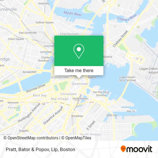
See Pratt, Bator & Popov, Llp, Boston, on the map
Public Transit to Pratt, Bator & Popov, Llp in Boston
Wondering how to get to Pratt, Bator & Popov, Llp in Boston? Moovit helps you find the best way to get to Pratt, Bator & Popov, Llp with step-by-step directions from the nearest public transit station.
Moovit provides free maps and live directions to help you navigate through your city. View schedules, routes, timetables, and find out how long does it take to get to Pratt, Bator & Popov, Llp in real time.
Looking for the nearest stop or station to Pratt, Bator & Popov, Llp? Check out this list of stops closest to your destination: Pearl St @ Congress St; Congress St @ State St; State Street; State; State - Devonshire St @ State St; State St @ Washington Mall - State St Sta; Federal St @ Franklin St; Downtown Crossing - Franklin St @ Washington St; Downtown Crossing; Government Center; Long Wharf (South).
Bus: 354, 504, 93, SL4, SL5, 4, 15, 39, 57, 92, RED LINE SHUTTLE, RED LINE SHUTTLE, RED LINE SHUTTLE, RED LINE SHUTTLE.Train: FITCHBURG, FRAMINGHAM/WORCESTER, LOWELL.Subway: GREEN LINE B, GREEN LINE D, ORANGE LINE, RED LINE, BLUE LINE, GREEN LINE C, GREEN LINE E.Ferry: CHARLESTOWN FERRY.
Want to see if there’s another route that gets you there at an earlier time? Moovit helps you find alternative routes or times. Get directions from and directions to Pratt, Bator & Popov, Llp easily from the Moovit App or Website.
We make riding to Pratt, Bator & Popov, Llp easy, which is why over 1.7 million users, including users in Boston, trust Moovit as the best app for public transit. You don’t need to download an individual bus app or train app, Moovit is your all-in-one transit app that helps you find the best bus time or train time available.
For information on prices of bus, subway and train, costs and ride fares to Pratt, Bator & Popov, Llp, please check the Moovit app.
Use the app to navigate to popular places including to the airport, hospital, stadium, grocery store, mall, coffee shop, school, college, and university.
Pratt, Bator & Popov, Llp Address: 50 Congress St Ste 832 street in Boston
- WESTERN UNION,
- Garage at Post Office Square (Post Office Square Park),
- Brown Brothers Harriman & Co,
- Financial District,
- Hyatt Centric Faneuil,
- MBTA State Street Station,
- Talking Mode,
- Chariot Global Transportaton,
- Jerry Remy's / Sam Adams Beergarden,
- L.E.M. Electrical Services,
- Mike and Sons Car Details,
- Priv,
- Hynes Convention Center MBTA Station,
- Italian Lessons Boston,
- Honore,
- Boston, Massachusetts,
- Boston Consulting Group,
- Credit Union 1,
- Boston Massacre Site (Site of the Boston Massacre),
- One Liberty Square
Places Near Pratt, Bator & Popov, Llp (Boston)
- Prudential Center, Boston,
- Boston Children's Hospital, Boston,
- Massachusetts General Hospital, Boston,
- Seaport District, Boston,
- Wilbur Theatre, Boston,
- Leader Bank Pavilion (Leader Bank Pavillion), Boston,
- Isabella Stewart Gardner Museum, Boston,
- Boston Convention & Exhibition Center, Boston,
- Castle Island, Boston,
- North End, Boston,
- Cheers, Boston,
- House Of Blues, Boston,
- Mgm Music Hall, Boston,
- Faneuil Hall, Boston,
- Wang Theater, Boston,
- Quincy Market, Boston,
- Td Garden, Boston,
- Boston Common, Boston,
- Boston Medical Center, Boston,
- Museum Of Science, Boston
How to get to popular places in Boston with public transit
Get around Boston by public transit!
Traveling around Boston has never been so easy. See step by step directions as you travel to any attraction, street or major public transit station. View bus and train schedules, arrival times, service alerts and detailed routes on a map, so you know exactly how to get to anywhere in Boston.
When traveling to any destination around Boston use Moovit's Live Directions with Get Off Notifications to know exactly where and how far to walk, how long to wait for your line, and how many stops are left. Moovit will alert you when it's time to get off — no need to constantly re-check whether yours is the next stop.
Wondering how to use public transit in Boston or how to pay for public transit in Boston? Moovit public transit app can help you navigate your way with public transit easily, and at minimum cost. It includes public transit fees, ticket prices, and costs. Looking for a map of Boston public transit lines? Moovit public transit app shows all public transit maps in Boston with all Bus, Train, Subway and Ferry routes and stops on an interactive map.
Boston has 4 transit type(s), including: Bus, Train, Subway and Ferry, operated by several transit agencies, including MBTA, Southeastern Regional Transit Authority, MetroWest Regional Transit Authority, Rhode Island Public Transit Authority, WRTA, Lowell Regional Transit Authority, Merrimack Valley Transit, Montachusett Regional Transit Authority, Cape Cod Regional Transit Authority, Brockton Area Transit Authority, Martha's Vineyard Transit Authority, the WAVE - Nantucket Regional Transit Authority, GATRA, Cape Ann Transportation Authority and Massport