Directions to Precinct Bar (Somerville) with public transportation
The following transit lines have routes that pass near Precinct Bar
 Bus: 83, 85, 88, 90, 80.
- Train: FITCHBURG, RED LINE.
- Subway: GREEN LINE E, GREEN LINE B, GREEN LINE C, GREEN LINE D.
How to get to Precinct Bar by bus?
Click on the bus route to see step by step directions with maps, line arrival times and updated time schedules.
From St. Elizabeth's Medical Center, Boston
58 minFrom Brighton District Court, Boston
57 minFrom Six Flags New England, Newton
78 minFrom Folkman Auditorium, Children's Hospital Boston, Boston
40 minFrom JFK Library, Boston
113 minFrom Bentley University, Waltham
100 minFrom Hebrew Rehab Center, Boston
96 minFrom Santarpio's Pizza, Boston
66 minFrom Spaulding Rehab, Boston
94 minFrom Dorchester, Boston
93 min
How to get to Precinct Bar by subway?
Click on the subway route to see step by step directions with maps, line arrival times and updated time schedules.
From St. Elizabeth's Medical Center, Boston
73 minFrom Brighton District Court, Boston
78 minFrom Folkman Auditorium, Children's Hospital Boston, Boston
52 minFrom JFK Library, Boston
63 minFrom Hebrew Rehab Center, Boston
64 minFrom Santarpio's Pizza, Boston
41 minFrom Spaulding Rehab, Boston
69 minFrom Dorchester, Boston
66 min
Bus stops near Precinct Bar in Somerville
Subway stations near Precinct Bar in Somerville
Train station near Precinct Bar in Somerville
- Porter, 20 min walk,VIEW
Bus lines to Precinct Bar in Somerville
- 80, Lechmere,VIEW
- 88, Lechmere,VIEW
- 90, Assembly,VIEW
- GREEN LINE E SHUTTLE, East Somerville (Shuttle),VIEW
- GREEN LINE E SHUTTLE, Government Center - Medford/Tufts (Shuttle),VIEW
- GREEN LINE E SHUTTLE, North Station - Medford/Tufts (Shuttle),VIEW
- GREEN LINE E SHUTTLE, Medford/Tufts - North Station,VIEW
- GREEN LINE SHUTTLE, Medford/Tufts - Government Center via Union Square,VIEW
What are the closest stations to Precinct Bar?
The closest stations to Precinct Bar are:
- Pearl St @ Walnut St is 31 yards away, 1 min walk.
- Highland Ave @ Walnut St is 302 yards away, 4 min walk.
- Gilman Square - Medford St Opp Gilman Sq Station is 384 yards away, 5 min walk.
- Medford St @ School St is 425 yards away, 6 min walk.
- Gilman Square is 1199 yards away, 15 min walk.
- Union Square is 1619 yards away, 20 min walk.
- Porter is 1656 yards away, 20 min walk.
Which bus lines stop near Precinct Bar?
These bus lines stop near Precinct Bar: 83, 85, 88, 90.
Which subway line stops near Precinct Bar?
GREEN LINE E (Lechmere)
What’s the nearest subway station to Precinct Bar in Somerville?
The nearest subway station to Precinct Bar in Somerville is Gilman Square. It’s a 15 min walk away.
What’s the nearest train station to Precinct Bar in Somerville?
The nearest train station to Precinct Bar in Somerville is Porter. It’s a 20 min walk away.
What’s the nearest bus station to Precinct Bar in Somerville?
The nearest bus station to Precinct Bar in Somerville is Pearl St @ Walnut St. It’s a 1 min walk away.
What time is the first subway to Precinct Bar in Somerville?
The GREEN LINE E is the first subway that goes to Precinct Bar in Somerville. It stops nearby at 4:49 AM.
What time is the last subway to Precinct Bar in Somerville?
The GREEN LINE E is the last subway that goes to Precinct Bar in Somerville. It stops nearby at 2:38 AM.
What time is the first train to Precinct Bar in Somerville?
The FITCHBURG is the first train that goes to Precinct Bar in Somerville. It stops nearby at 5:47 AM.
What time is the last train to Precinct Bar in Somerville?
The FITCHBURG is the last train that goes to Precinct Bar in Somerville. It stops nearby at 12:17 AM.
What time is the first bus to Precinct Bar in Somerville?
The 80 is the first bus that goes to Precinct Bar in Somerville. It stops nearby at 5:14 AM.
What time is the last bus to Precinct Bar in Somerville?
The 88 is the last bus that goes to Precinct Bar in Somerville. It stops nearby at 1:26 AM.
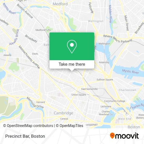
See Precinct Bar, Somerville, on the map
Public Transit to Precinct Bar in Somerville
Wondering how to get to Precinct Bar in Somerville? Moovit helps you find the best way to get to Precinct Bar with step-by-step directions from the nearest public transit station.
Moovit provides free maps and live directions to help you navigate through your city. View schedules, routes, timetables, and find out how long does it take to get to Precinct Bar in real time.
Looking for the nearest stop or station to Precinct Bar? Check out this list of stops closest to your destination: Pearl St @ Walnut St; Highland Ave @ Walnut St; Gilman Square - Medford St Opp Gilman Sq Station; Medford St @ School St; Gilman Square; Union Square; Porter.
Bus: 83, 85, 88, 90, 80, GREEN LINE E SHUTTLE.Train: FITCHBURG, RED LINE.Subway: GREEN LINE E, GREEN LINE B, GREEN LINE C, GREEN LINE D.
Want to see if there’s another route that gets you there at an earlier time? Moovit helps you find alternative routes or times. Get directions from and directions to Precinct Bar easily from the Moovit App or Website.
We make riding to Precinct Bar easy, which is why over 1.7 million users, including users in Somerville, trust Moovit as the best app for public transit. You don’t need to download an individual bus app or train app, Moovit is your all-in-one transit app that helps you find the best bus time or train time available.
For information on prices of bus, subway and train, costs and ride fares to Precinct Bar, please check the Moovit app.
Use the app to navigate to popular places including to the airport, hospital, stadium, grocery store, mall, coffee shop, school, college, and university.
Location: Somerville, Boston
- Susan E Schur,
- Somerville City Hall,
- Porter Square Books,
- Medicare Insurance Advisors Somerville,
- ATM,
- Reavis Field,
- Fabville,
- ChargePoint,
- Straus Robert B Psychothrpst,
- Cha Teen Connection at Somerville High,
- Paradigm Partnership,
- Langmaid Building,
- Centro Apostolico Y Profetico Portadores de Su Gloria,
- PCJ Auto Repair Service,
- A L Prime Energy,
- Sarma,
- Richard Baldwin - Unitedhealthcare Licensed Sales Agent,
- Scritches & Boops,
- Powerstroke Building,
- Avon Street Community Garden
Places Near Precinct Bar (Somerville)
- Boston Convention & Exhibition Center, Boston,
- Cheers, Boston,
- Museum Of Science, Boston,
- Castle Island, Boston,
- Quincy Market, Boston,
- Boston Medical Center, Boston,
- Isabella Stewart Gardner Museum, Boston,
- Mgm Music Hall, Boston,
- Boston Children's Hospital, Boston,
- Faneuil Hall, Boston,
- Td Garden, Boston,
- Wang Theater, Boston,
- Seaport District, Boston,
- House Of Blues, Boston,
- Wilbur Theatre, Boston,
- Leader Bank Pavilion (Leader Bank Pavillion), Boston,
- Prudential Center, Boston,
- Boston Common, Boston,
- North End, Boston,
- Massachusetts General Hospital, Boston
How to get to popular places in Boston with public transit
Get around Somerville by public transit!
Traveling around Somerville has never been so easy. See step by step directions as you travel to any attraction, street or major public transit station. View bus and train schedules, arrival times, service alerts and detailed routes on a map, so you know exactly how to get to anywhere in Somerville.
When traveling to any destination around Somerville use Moovit's Live Directions with Get Off Notifications to know exactly where and how far to walk, how long to wait for your line, and how many stops are left. Moovit will alert you when it's time to get off — no need to constantly re-check whether yours is the next stop.
Wondering how to use public transit in Somerville or how to pay for public transit in Somerville? Moovit public transit app can help you navigate your way with public transit easily, and at minimum cost. It includes public transit fees, ticket prices, and costs. Looking for a map of Somerville public transit lines? Moovit public transit app shows all public transit maps in Somerville with all Bus, Train, Subway and Ferry routes and stops on an interactive map.
Boston has 4 transit type(s), including: Bus, Train, Subway and Ferry, operated by several transit agencies, including MBTA, Southeastern Regional Transit Authority, MetroWest Regional Transit Authority, Rhode Island Public Transit Authority, WRTA, Lowell Regional Transit Authority, Merrimack Valley Transit, Montachusett Regional Transit Authority, Cape Cod Regional Transit Authority, Brockton Area Transit Authority, Martha's Vineyard Transit Authority, the WAVE - Nantucket Regional Transit Authority, GATRA, Cape Ann Transportation Authority and Massport