How to get to Precision Soccer Video Anlyss by bus?
Click on the bus route to see step by step directions with maps, line arrival times and updated time schedules.
From Burlington, MA, Burlington
103 minFrom Choi's Health Spa, Saugus
113 minFrom GE Aviation, Lynn
116 minFrom Market Basket, Revere
72 minFrom Malden, MA, Malden
35 minFrom Boda Borg, Malden
35 minFrom Four Points by Sheraton Boston Logan Airport, Revere
106 minFrom Malden Catholic High School, Malden
74 minFrom Burlington, Ma, Burlington
106 min
How to get to Precision Soccer Video Anlyss by train?
Click on the train route to see step by step directions with maps, line arrival times and updated time schedules.
Bus stop near Precision Soccer Video Anlyss in Wakefield
- North Ave @ Church St, 3 min walk,VIEW
Train station near Precision Soccer Video Anlyss in Wakefield
- Reading, 55 min walk,VIEW
Bus lines to Precision Soccer Video Anlyss in Wakefield
- 137, Malden,VIEW
What are the closest stations to Precision Soccer Video Anlyss?
The closest stations to Precision Soccer Video Anlyss are:
- North Ave @ Church St is 199 yards away, 3 min walk.
- Reading is 4606 yards away, 55 min walk.
Which bus line stops near Precision Soccer Video Anlyss?
137 (Reading Depot)
Which train line stops near Precision Soccer Video Anlyss?
HAVERHILL (#229 | Haverhill)
What’s the nearest bus station to Precision Soccer Video Anlyss in Wakefield?
The nearest bus station to Precision Soccer Video Anlyss in Wakefield is North Ave @ Church St. It’s a 3 min walk away.
What time is the first train to Precision Soccer Video Anlyss in Wakefield?
The HAVERHILL is the first train that goes to Precision Soccer Video Anlyss in Wakefield. It stops nearby at 5:18 AM.
What time is the last train to Precision Soccer Video Anlyss in Wakefield?
The HAVERHILL is the last train that goes to Precision Soccer Video Anlyss in Wakefield. It stops nearby at 12:13 AM.
What time is the first bus to Precision Soccer Video Anlyss in Wakefield?
The 137 is the first bus that goes to Precision Soccer Video Anlyss in Wakefield. It stops nearby at 5:11 AM.
What time is the last bus to Precision Soccer Video Anlyss in Wakefield?
The 137 is the last bus that goes to Precision Soccer Video Anlyss in Wakefield. It stops nearby at 10:43 PM.
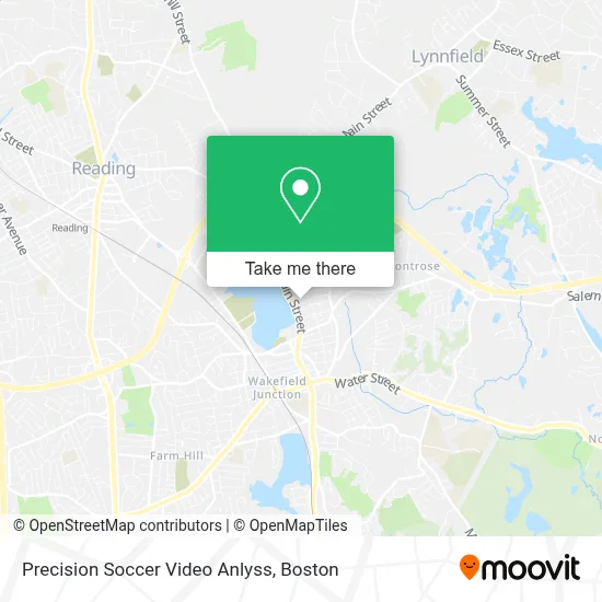
See Precision Soccer Video Anlyss, Wakefield, on the map
Public Transit to Precision Soccer Video Anlyss in Wakefield
Wondering how to get to Precision Soccer Video Anlyss in Wakefield? Moovit helps you find the best way to get to Precision Soccer Video Anlyss with step-by-step directions from the nearest public transit station.
Moovit provides free maps and live directions to help you navigate through your city. View schedules, routes, timetables, and find out how long does it take to get to Precision Soccer Video Anlyss in real time.
Looking for the nearest stop or station to Precision Soccer Video Anlyss? Check out this list of stops closest to your destination: North Ave @ Church St; Reading.
Bus: 137.Train: HAVERHILL.
Want to see if there’s another route that gets you there at an earlier time? Moovit helps you find alternative routes or times. Get directions from and directions to Precision Soccer Video Anlyss easily from the Moovit App or Website.
We make riding to Precision Soccer Video Anlyss easy, which is why over 1.7 million users, including users in Wakefield, trust Moovit as the best app for public transit. You don’t need to download an individual bus app or train app, Moovit is your all-in-one transit app that helps you find the best bus time or train time available.
For information on prices of bus, train and subway, costs and ride fares to Precision Soccer Video Anlyss, please check the Moovit app.
Use the app to navigate to popular places including to the airport, hospital, stadium, grocery store, mall, coffee shop, school, college, and university.
Precision Soccer Video Anlyss Address: 11 White Ave street in Wakefield
- Affordable Home Contractors,
- Kelly House,
- Benchmark Healthcare,
- Boiling Point Tanning Salon,
- J and B Butcher,
- The Energy Barre,
- Spaulding Playground,
- Boating,
- Cordis St @ Pleasant St,
- Fit4mom Wakefield Lake - Stroller Strides & Stroller Barre,
- Palmer's Pub,
- Southern Baptist Convention,
- South County Artificial Limb,
- The Speech Therapy Center,
- Veterans Memorial Common,
- Luise Richard,
- Commonwealth Business Solutions,
- Nawadaha Fa,
- Lake Quannapowitt,
- Michael Doherty DDS
Places Near Precision Soccer Video Anlyss (Wakefield)
- Leader Bank Pavilion (Leader Bank Pavillion), Boston,
- House Of Blues, Boston,
- Quincy Market, Boston,
- Wang Theater, Boston,
- Boston Medical Center, Boston,
- Massachusetts General Hospital, Boston,
- Museum Of Science, Boston,
- Td Garden, Boston,
- Cheers, Boston,
- Boston Convention & Exhibition Center, Boston,
- Boston Common, Boston,
- Wilbur Theatre, Boston,
- Castle Island, Boston,
- Boston Children's Hospital, Boston,
- North End, Boston,
- Isabella Stewart Gardner Museum, Boston,
- Faneuil Hall, Boston,
- Seaport District, Boston,
- Prudential Center, Boston,
- Mgm Music Hall, Boston
How to get to popular places in Boston with public transit
Get around Wakefield by public transit!
Traveling around Wakefield has never been so easy. See step by step directions as you travel to any attraction, street or major public transit station. View bus and train schedules, arrival times, service alerts and detailed routes on a map, so you know exactly how to get to anywhere in Wakefield.
When traveling to any destination around Wakefield use Moovit's Live Directions with Get Off Notifications to know exactly where and how far to walk, how long to wait for your line, and how many stops are left. Moovit will alert you when it's time to get off — no need to constantly re-check whether yours is the next stop.
Wondering how to use public transit in Wakefield or how to pay for public transit in Wakefield? Moovit public transit app can help you navigate your way with public transit easily, and at minimum cost. It includes public transit fees, ticket prices, and costs. Looking for a map of Wakefield public transit lines? Moovit public transit app shows all public transit maps in Wakefield with all Bus, Train, Subway and Ferry routes and stops on an interactive map.
Boston has 4 transit type(s), including: Bus, Train, Subway and Ferry, operated by several transit agencies, including MBTA, Southeastern Regional Transit Authority, MetroWest Regional Transit Authority, Rhode Island Public Transit Authority, WRTA, Lowell Regional Transit Authority, Merrimack Valley Transit, Montachusett Regional Transit Authority, Cape Cod Regional Transit Authority, Brockton Area Transit Authority, Martha's Vineyard Transit Authority, the WAVE - Nantucket Regional Transit Authority, GATRA, Cape Ann Transportation Authority and Massport