How to get to Prema Pun by bus?
Click on the bus route to see step by step directions with maps, line arrival times and updated time schedules.
From Landmark Center, Boston
70 minFrom Royal Sonesta Hotel, Cambridge
65 minFrom Harvard Vanguard - Kenmore, Boston
72 minFrom Cambridge, MA, Cambridge
46 minFrom Hyatt Regency Cambridge - Overlooking Boston, Cambridge
62 minFrom Hotel Commonwealth, Boston
60 minFrom Bunker Hill Monument, Boston
58 minFrom Boston Marriott Cambridge, Cambridge
53 minFrom Kendall Square, Cambridge
57 minFrom Warren Tavern, Boston
62 min
How to get to Prema Pun by train?
Click on the train route to see step by step directions with maps, line arrival times and updated time schedules.
Bus stops near Prema Pun in Arlington
Subway station near Prema Pun in Arlington
- Alewife, 6 min walk,VIEW
What are the closest stations to Prema Pun?
The closest stations to Prema Pun are:
- 905 Massachusetts Ave is 424 yards away, 6 min walk.
- Alewife is 436 yards away, 6 min walk.
- Summer St @ Oak Hill Dr is 751 yards away, 10 min walk.
- Belmont is 3060 yards away, 36 min walk.
- West Medford is 5080 yards away, 60 min walk.
Which bus lines stop near Prema Pun?
These bus lines stop near Prema Pun: 67, 77.
Which train line stops near Prema Pun?
FITCHBURG (#409 | Wachusett)
What’s the nearest subway station to Prema Pun in Arlington?
The nearest subway station to Prema Pun in Arlington is Alewife. It’s a 6 min walk away.
What’s the nearest bus station to Prema Pun in Arlington?
The nearest bus station to Prema Pun in Arlington is 905 Massachusetts Ave. It’s a 6 min walk away.
What time is the first subway to Prema Pun in Arlington?
The RED LINE is the first subway that goes to Prema Pun in Arlington. It stops nearby at 5:15 AM.
What time is the last subway to Prema Pun in Arlington?
The RED LINE is the last subway that goes to Prema Pun in Arlington. It stops nearby at 2:06 AM.
What time is the first train to Prema Pun in Arlington?
The LOWELL is the first train that goes to Prema Pun in Arlington. It stops nearby at 5:29 AM.
What time is the last train to Prema Pun in Arlington?
The LOWELL is the last train that goes to Prema Pun in Arlington. It stops nearby at 12:20 AM.
What time is the first bus to Prema Pun in Arlington?
The 77 is the first bus that goes to Prema Pun in Arlington. It stops nearby at 4:51 AM.
What time is the last bus to Prema Pun in Arlington?
The 77 is the last bus that goes to Prema Pun in Arlington. It stops nearby at 1:25 AM.
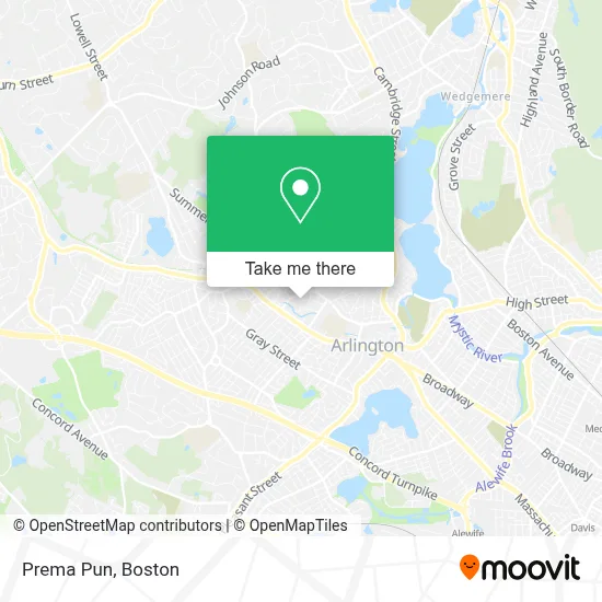
See Prema Pun, Arlington, on the map
Public Transit to Prema Pun in Arlington
Wondering how to get to Prema Pun in Arlington? Moovit helps you find the best way to get to Prema Pun with step-by-step directions from the nearest public transit station.
Moovit provides free maps and live directions to help you navigate through your city. View schedules, routes, timetables, and find out how long does it take to get to Prema Pun in real time.
Looking for the nearest stop or station to Prema Pun? Check out this list of stops closest to your destination: 905 Massachusetts Ave; Alewife; Summer St @ Oak Hill Dr; Belmont; West Medford.
Bus: 67, 77.Train: FITCHBURG, LOWELL.Subway: RED LINE.
Want to see if there’s another route that gets you there at an earlier time? Moovit helps you find alternative routes or times. Get directions from and directions to Prema Pun easily from the Moovit App or Website.
We make riding to Prema Pun easy, which is why over 1.7 million users, including users in Arlington, trust Moovit as the best app for public transit. You don’t need to download an individual bus app or train app, Moovit is your all-in-one transit app that helps you find the best bus time or train time available.
For information on prices of bus, subway and train, costs and ride fares to Prema Pun, please check the Moovit app.
Use the app to navigate to popular places including to the airport, hospital, stadium, grocery store, mall, coffee shop, school, college, and university.
Prema Pun Address: Arlington street in Arlington
- Real Motors,
- Enterprise Rent-A-Car,
- Brattle,
- CW Fuels,
- Locksmith Express,
- Arlington Glass & Screen,
- Top Notch Collision,
- Fire and Water Restoration Companies,
- Locks & Locksmith,
- Appleseed Carpentry,
- Brown & Associates,
- Tech Electric,
- DWM,
- Provo Financial Services,
- Dudley and Grove Apartments,
- Replace Door Opener,
- Grove Street Tennis Courts,
- Artilles Locksmith,
- Nesf Boston,
- Mass BJJ
Places Near Prema Pun (Arlington)
- Boston Medical Center, Boston,
- Seaport District, Boston,
- Cheers, Boston,
- Td Garden, Boston,
- North End, Boston,
- Mgm Music Hall, Boston,
- Boston Children's Hospital, Boston,
- Leader Bank Pavilion (Leader Bank Pavillion), Boston,
- Boston Convention & Exhibition Center, Boston,
- Museum Of Science, Boston,
- Faneuil Hall, Boston,
- Castle Island, Boston,
- Wilbur Theatre, Boston,
- Prudential Center, Boston,
- Wang Theater, Boston,
- Quincy Market, Boston,
- Isabella Stewart Gardner Museum, Boston,
- House Of Blues, Boston,
- Massachusetts General Hospital, Boston,
- Boston Common, Boston
How to get to popular places in Boston with public transit
Get around Arlington by public transit!
Traveling around Arlington has never been so easy. See step by step directions as you travel to any attraction, street or major public transit station. View bus and train schedules, arrival times, service alerts and detailed routes on a map, so you know exactly how to get to anywhere in Arlington.
When traveling to any destination around Arlington use Moovit's Live Directions with Get Off Notifications to know exactly where and how far to walk, how long to wait for your line, and how many stops are left. Moovit will alert you when it's time to get off — no need to constantly re-check whether yours is the next stop.
Wondering how to use public transit in Arlington or how to pay for public transit in Arlington? Moovit public transit app can help you navigate your way with public transit easily, and at minimum cost. It includes public transit fees, ticket prices, and costs. Looking for a map of Arlington public transit lines? Moovit public transit app shows all public transit maps in Arlington with all Bus, Train, Subway and Ferry routes and stops on an interactive map.
Boston has 4 transit type(s), including: Bus, Train, Subway and Ferry, operated by several transit agencies, including MBTA, Southeastern Regional Transit Authority, MetroWest Regional Transit Authority, Rhode Island Public Transit Authority, WRTA, Lowell Regional Transit Authority, Merrimack Valley Transit, Montachusett Regional Transit Authority, Cape Cod Regional Transit Authority, Brockton Area Transit Authority, Martha's Vineyard Transit Authority, the WAVE - Nantucket Regional Transit Authority, GATRA, Cape Ann Transportation Authority and Massport