Directions to Premier Value Pharmacy Compounding Network (Melrose) with public transportation
The following transit lines have routes that pass near Premier Value Pharmacy Compounding Network
 Bus: 132, 137, 131, HAVERHILL LINE SHUTTLE, HAVERHILL LINE SHUTTLE.
- Train: HAVERHILL, ORANGE LINE.
- Subway: ORANGE LINE.
How to get to Premier Value Pharmacy Compounding Network by bus?
Click on the bus route to see step by step directions with maps, line arrival times and updated time schedules.
From Costco, Everett
65 minFrom Cambridge Health Alliance (CHA), Cambridge
99 minFrom Inman Sq, Cambridge
103 minFrom Residence Inn by Marriott Boston Harbor on Tudor Wharf, Boston
80 minFrom Lynch Family Skate Park, Cambridge
88 minFrom Lechmere Station, Cambridge
99 minFrom Cambridge, MA, Cambridge
99 minFrom Hyatt Place Medford, Medford
55 minFrom Assembly Square Mall Shopping Center, Somerville
52 minFrom Hood Park, Boston
70 min
How to get to Premier Value Pharmacy Compounding Network by train?
Click on the train route to see step by step directions with maps, line arrival times and updated time schedules.
How to get to Premier Value Pharmacy Compounding Network by subway?
Click on the subway route to see step by step directions with maps, line arrival times and updated time schedules.
From Costco, Everett
60 minFrom Cambridge Health Alliance (CHA), Cambridge
83 minFrom Inman Sq, Cambridge
79 minFrom Residence Inn by Marriott Boston Harbor on Tudor Wharf, Boston
68 minFrom Lynch Family Skate Park, Cambridge
64 minFrom Lechmere Station, Cambridge
64 minFrom Cambridge, MA, Cambridge
85 minFrom Hyatt Place Medford, Medford
102 minFrom Assembly Square Mall Shopping Center, Somerville
59 minFrom Hood Park, Boston
58 min
Bus stops near Premier Value Pharmacy Compounding Network in Melrose
Train station near Premier Value Pharmacy Compounding Network in Melrose
- Oak Grove, 34 min walk,VIEW
Bus lines to Premier Value Pharmacy Compounding Network in Melrose
- 137, Malden,VIEW
- 131, Malden Via Oak Grove,VIEW
- HAVERHILL LINE SHUTTLE, Ballardvale - Malden Center,VIEW
- HAVERHILL LINE SHUTTLE, Reading - Oak Grove,VIEW
- HAVERHILL LINE SHUTTLE, Haverhill - Malden Center,VIEW
- HAVERHILL LINE SHUTTLE, Haverhill - North Station,VIEW
- HAVERHILL LINE SHUTTLE, Ballardvale - North Station,VIEW
- HAVERHILL, Haverhill,VIEW
What are the closest stations to Premier Value Pharmacy Compounding Network?
The closest stations to Premier Value Pharmacy Compounding Network are:
- Main St @ W Foster St - Melrose Sq is 629 yards away, 8 min walk.
- Main St @ E Emerson St is 806 yards away, 10 min walk.
- Melrose/Cedar Park is 1063 yards away, 13 min walk.
- Oak Grove is 2874 yards away, 34 min walk.
Which bus lines stop near Premier Value Pharmacy Compounding Network?
These bus lines stop near Premier Value Pharmacy Compounding Network: 132, 137.
Which train line stops near Premier Value Pharmacy Compounding Network?
HAVERHILL (#229 | Haverhill)
Which subway line stops near Premier Value Pharmacy Compounding Network?
ORANGE LINE (Oak Grove)
What’s the nearest bus station to Premier Value Pharmacy Compounding Network in Melrose?
The nearest bus station to Premier Value Pharmacy Compounding Network in Melrose is Main St @ W Foster St - Melrose Sq. It’s a 8 min walk away.
What time is the first subway to Premier Value Pharmacy Compounding Network in Melrose?
The ORANGE LINE is the first subway that goes to Premier Value Pharmacy Compounding Network in Melrose. It stops nearby at 5:15 AM.
What time is the last subway to Premier Value Pharmacy Compounding Network in Melrose?
The ORANGE LINE is the last subway that goes to Premier Value Pharmacy Compounding Network in Melrose. It stops nearby at 1:59 AM.
What time is the first train to Premier Value Pharmacy Compounding Network in Melrose?
The HAVERHILL is the first train that goes to Premier Value Pharmacy Compounding Network in Melrose. It stops nearby at 5:31 AM.
What time is the last train to Premier Value Pharmacy Compounding Network in Melrose?
The HAVERHILL is the last train that goes to Premier Value Pharmacy Compounding Network in Melrose. It stops nearby at 11:57 PM.
What time is the first bus to Premier Value Pharmacy Compounding Network in Melrose?
The 137 is the first bus that goes to Premier Value Pharmacy Compounding Network in Melrose. It stops nearby at 5:00 AM.
What time is the last bus to Premier Value Pharmacy Compounding Network in Melrose?
The 137 is the last bus that goes to Premier Value Pharmacy Compounding Network in Melrose. It stops nearby at 10:55 PM.
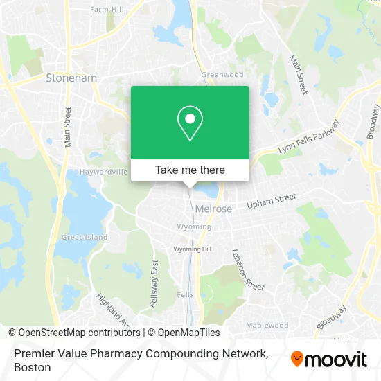
See Premier Value Pharmacy Compounding Network, Melrose, on the map
Public Transit to Premier Value Pharmacy Compounding Network in Melrose
Wondering how to get to Premier Value Pharmacy Compounding Network in Melrose? Moovit helps you find the best way to get to Premier Value Pharmacy Compounding Network with step-by-step directions from the nearest public transit station.
Moovit provides free maps and live directions to help you navigate through your city. View schedules, routes, timetables, and find out how long does it take to get to Premier Value Pharmacy Compounding Network in real time.
Looking for the nearest stop or station to Premier Value Pharmacy Compounding Network? Check out this list of stops closest to your destination: Main St @ W Foster St - Melrose Sq; Main St @ E Emerson St; Melrose/Cedar Park; Oak Grove.
Bus: 132, 137, 131, HAVERHILL LINE SHUTTLE, HAVERHILL LINE SHUTTLE, HAVERHILL LINE SHUTTLE, HAVERHILL LINE SHUTTLE, HAVERHILL LINE SHUTTLE.Train: HAVERHILL, ORANGE LINE.Subway: ORANGE LINE.
Want to see if there’s another route that gets you there at an earlier time? Moovit helps you find alternative routes or times. Get directions from and directions to Premier Value Pharmacy Compounding Network easily from the Moovit App or Website.
We make riding to Premier Value Pharmacy Compounding Network easy, which is why over 1.7 million users, including users in Melrose, trust Moovit as the best app for public transit. You don’t need to download an individual bus app or train app, Moovit is your all-in-one transit app that helps you find the best bus time or train time available.
For information on prices of bus, subway and train, costs and ride fares to Premier Value Pharmacy Compounding Network, please check the Moovit app.
Use the app to navigate to popular places including to the airport, hospital, stadium, grocery store, mall, coffee shop, school, college, and university.
Premier Value Pharmacy Compounding Network Address: 50 Tremont St Ste 203 street in Melrose
- City of Melrose,
- Krux Athletics,
- Lewis Monk Field,
- Marilyn Bozzuto,
- Trinity Episcopal Church (Trinity Church Thrift Shop),
- USPS Collection Box - Blue Box,
- Jornal dos Sports,
- Melrose Veterans Memorial Middle School,
- MBTA Melrose Cedar Park Station,
- Morelli Field,
- Journal of Abdominal Surgery,
- ADT,
- RZN,
- Enterprise Rent-A-Car,
- Melrose MA USA,
- West Emerson,
- Locksmith Available,
- Dna Automotive Repair,
- Melrose Dog Society,
- 24 Hour A Melrose Locksmith
Places Near Premier Value Pharmacy Compounding Network (Melrose)
- Boston Children's Hospital, Boston,
- Boston Common, Boston,
- Boston Medical Center, Boston,
- Boston Convention & Exhibition Center, Boston,
- Wilbur Theatre, Boston,
- Castle Island, Boston,
- Museum Of Science, Boston,
- Massachusetts General Hospital, Boston,
- Mgm Music Hall, Boston,
- Quincy Market, Boston,
- North End, Boston,
- Seaport District, Boston,
- Isabella Stewart Gardner Museum, Boston,
- House Of Blues, Boston,
- Cheers, Boston,
- Leader Bank Pavilion (Leader Bank Pavillion), Boston,
- Faneuil Hall, Boston,
- Prudential Center, Boston,
- Td Garden, Boston,
- Wang Theater, Boston
How to get to popular places in Boston with public transit
Get around Melrose by public transit!
Traveling around Melrose has never been so easy. See step by step directions as you travel to any attraction, street or major public transit station. View bus and train schedules, arrival times, service alerts and detailed routes on a map, so you know exactly how to get to anywhere in Melrose.
When traveling to any destination around Melrose use Moovit's Live Directions with Get Off Notifications to know exactly where and how far to walk, how long to wait for your line, and how many stops are left. Moovit will alert you when it's time to get off — no need to constantly re-check whether yours is the next stop.
Wondering how to use public transit in Melrose or how to pay for public transit in Melrose? Moovit public transit app can help you navigate your way with public transit easily, and at minimum cost. It includes public transit fees, ticket prices, and costs. Looking for a map of Melrose public transit lines? Moovit public transit app shows all public transit maps in Melrose with all Bus, Train, Subway and Ferry routes and stops on an interactive map.
Boston has 4 transit type(s), including: Bus, Train, Subway and Ferry, operated by several transit agencies, including MBTA, Southeastern Regional Transit Authority, MetroWest Regional Transit Authority, Rhode Island Public Transit Authority, WRTA, Lowell Regional Transit Authority, Merrimack Valley Transit, Montachusett Regional Transit Authority, Cape Cod Regional Transit Authority, Brockton Area Transit Authority, Martha's Vineyard Transit Authority, the WAVE - Nantucket Regional Transit Authority, GATRA, Cape Ann Transportation Authority and Massport