Directions to Prenzlauer Berg with public transportation
The following transit lines have routes that pass near Prenzlauer Berg
How to get to Prenzlauer Berg by bus?
Click on the bus route to see step by step directions with maps, line arrival times and updated time schedules.
How to get to Prenzlauer Berg by train?
Click on the train route to see step by step directions with maps, line arrival times and updated time schedules.
How to get to Prenzlauer Berg by subway?
Click on the subway route to see step by step directions with maps, line arrival times and updated time schedules.
Light Rail stations near Prenzlauer Berg
- Am Friedrichshain, 3 min walk,
- Mollstr./Otto-Braun-Str., 7 min walk,
- Mollstr./Prenzlauer Allee, 9 min walk,
Bus stations near Prenzlauer Berg
- Am Friedrichshain, 4 min walk,
- Mollstr./Otto-Braun-Str., 5 min walk,
- Mollstr./Prenzlauer Allee, 9 min walk,
- U Rosa-Luxemburg-Platz, 14 min walk,
Bus lines to Prenzlauer Berg
- 142, S Ostbahnhof,
- M4, S Hackescher Markt,
- 200, S+U Zoologischer Garten/Jebensstr.,
- N40, S+U Berlin Hauptbahnhof,
- U2, S+U Alexanderplatz Bhf/Memhardstr.,
What are the closest stations to Prenzlauer Berg?
The closest stations to Prenzlauer Berg are:
- Am Friedrichshain is 151 meters away, 3 min walk.
- Mollstr./Otto-Braun-Str. is 322 meters away, 5 min walk.
- Mollstr./Prenzlauer Allee is 627 meters away, 9 min walk.
- U Rosa-Luxemburg-Platz is 1019 meters away, 14 min walk.
Which train lines stop near Prenzlauer Berg?
These train lines stop near Prenzlauer Berg: RB23, RE2, S41, S7.
Which subway lines stop near Prenzlauer Berg?
These subway lines stop near Prenzlauer Berg: U2, U5, U8.
Which light rail line stops near Prenzlauer Berg?
M4
Which bus lines stop near Prenzlauer Berg?
These bus lines stop near Prenzlauer Berg: 142, 200.
What’s the nearest light rail station to Prenzlauer Berg?
The nearest light rail station to Prenzlauer Berg is Am Friedrichshain. It’s a 3 min walk away.
What’s the nearest bus stop to Prenzlauer Berg?
The nearest bus stop to Prenzlauer Berg is Am Friedrichshain. It’s a 4 min walk away.
What time is the first light rail to Prenzlauer Berg?
The M4 is the first light rail that goes to Prenzlauer Berg. It stops nearby at 3:01 AM.
What time is the last light rail to Prenzlauer Berg?
The M5 is the last light rail that goes to Prenzlauer Berg. It stops nearby at 3:05 AM.
What time is the first bus to Prenzlauer Berg?
The N40 is the first bus that goes to Prenzlauer Berg. It stops nearby at 3:00 AM.
What time is the last bus to Prenzlauer Berg?
The N40 is the last bus that goes to Prenzlauer Berg. It stops nearby at 3:30 AM.
How much is the light rail fare to Prenzlauer Berg?
The light rail fare to Prenzlauer Berg costs about €2.40 - €3.50.
How much is the bus fare to Prenzlauer Berg?
The bus fare to Prenzlauer Berg costs about €2.40 - €3.50.
How much is the subway fare to Prenzlauer Berg?
The subway fare to Prenzlauer Berg costs about €2.40 - €3.50.
How much is the train fare to Prenzlauer Berg?
The train fare to Prenzlauer Berg costs about €1.80 - €4.40.
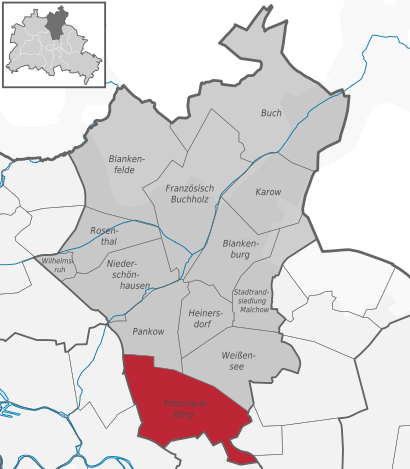
See Prenzlauer Berg on the map
Public Transportation to Prenzlauer Berg
How to get to Prenzlauer Berg in Prenzlauer Berg, Germany?
It’s easy with Moovit. Type in your street address and Moovit’s route finder will locate the fastest way to get you there! Not sure where to get off on the street? Download the Moovit App to find live directions (including where to get off on Prenzlauer Berg), see timetables and get the estimated arrival times for your favorite bus, subway, train or light rail lines.
Looking for the nearest stop or station to Prenzlauer Berg? Check out this list of closest stops available to your destination: Am Friedrichshain; Mollstr./Otto-Braun-Str.; Mollstr./Prenzlauer Allee; U Rosa-Luxemburg-Platz.
Train: RB23, RE2, S41, S7.Subway: U2, U5, U8.Light Rail: M4.Bus: 142, 200, M4, N40, U2.
Download the Moovit App to see the current schedule and routes available for Prenzlauer Berg. No need to install a special bus app to check the bus time or a train app to get train time. Moovit is the only all-in-one transit app that helps you get where you need to go.
We make riding on public transit to Prenzlauer Berg easy, which is why over 1.5 million users, including users in Prenzlauer Berg trust Moovit as the best app for public transit.
Use the app to navigate to popular places including to the airport, hospital, stadium, grocery store, mall, coffee shop, school, college, and university.
Location: Prenzlauer Berg, Berlin - Brandenburg
Popular routes to Prenzlauer Berg
Streets near Prenzlauer Berg, Prenzlauer Berg
Friedenstraße, Prenzlauer Berg,Am Märchenbrunnen, Prenzlauer Berg,Georgenkirchstraße, Friedrichshain,Heinrich-Roller-Straße, Prenzlauer Berg,Otto-Braun-Straße, Prenzlauer Berg,Am Schweizer Garten, Prenzlauer Berg,Pauline-Staegemann-Straße, Friedrichshain,Otto-Braun-Straße, Friedrichshain,Am Friedrichshain, Prenzlauer Berg,Höchste Straße, Friedrichshain,Weinstraße, Friedrichshain,Pauline-Staegemann-Straße, Berlin Mitte,Barnimstraße, Friedrichshain,Mendelssohnstraße, Prenzlauer Berg,Mollstraße, Friedrichshain,Saarbrücker Straße, Prenzlauer Berg,Mollstraße, Berlin Mitte,Raabestraße, Prenzlauer Berg,Belforter Straße, Prenzlauer Berg,Immanuelkirchstraße, Prenzlauer BergGet around Berlin - Brandenburg by public transit!
Traveling around Berlin - Brandenburg has never been so easy. See step by step directions as you travel to any attraction, street or major public transit station. View bus and train schedules, arrival times, service alerts and detailed routes on a map, so you know exactly how to get to anywhere in Berlin - Brandenburg.
When traveling to any destination around Berlin - Brandenburg use Moovit's Live Directions with Get Off Notifications to know exactly where and how far to walk, how long to wait for your line, and how many stops are left. Moovit will alert you when it's time to get off — no need to constantly re-check whether yours is the next stop.
Wondering how to use public transit in Berlin - Brandenburg or how to pay for public transit in Berlin - Brandenburg? Moovit public transit app can help you navigate your way with public transit easily, and at minimum cost. It includes public transit fees, ticket prices, and costs. Looking for a map of Berlin - Brandenburg public transit lines? Moovit public transit app shows all public transit maps in Berlin - Brandenburg with all Bus, Train, Subway, Light Rail and Ferry routes and stops on an interactive map.
Berlin - Brandenburg has 5 transit type(s), including: Bus, Train, Subway, Light Rail and Ferry, operated by several transit agencies, including BVG, VBB, S-Bahn, Cottbusverkehr, Schöneicher Rüdersdorfer Straßenbahn, Strausberger Eisenbahn GmbH, Stadtverkehrsgesellschaft Tram, Verkehrsbetriebe Brandenburg, Verkehrsverbund Potsdam, DB Regio Bus, Barnimer Busgesellschaft, Busverkehr Oder-Spree GmbH, A. Reich, ANG, Busverkehr Gerd Schmidt