How to get to Prime Storage by bus?
Click on the bus route to see step by step directions with maps, line arrival times and updated time schedules.
From Refresh Lounge at the Fontainebleau, Miami Beach
58 minFrom Radisson Hotel Miami Beach, Miami Beach
56 minFrom Sunny Isles Beach, Miami Beach
51 minFrom RAMADA-Marco Polo Beach Resort, Miami Beach
39 minFrom Aventura Mall, Miami
26 minFrom Joe Robbie Stadium, Miami Gardens
94 minFrom Miami International Autodrome F1 Track, Miami Gardens
112 minFrom Hard Rock Stadium, Miami Gardens
109 minFrom Institute of Contemporary Art, Miami
33 minFrom Hallandale Florida, Hallandale Beach
55 min
Bus stops near Prime Storage in Miami
Bus lines to Prime Storage in Miami
What are the closest stations to Prime Storage?
The closest stations to Prime Storage are:
- Biscayne Blvd@ne 135 St - Ne Corner is 102 yards away, 2 min walk.
- Biscayne Bd & Ne 135 St is 190 yards away, 3 min walk.
- Highland Park is 735 yards away, 9 min walk.
- Ne 16 Av @ Ne 135 St is 875 yards away, 11 min walk.
Which bus lines stop near Prime Storage?
These bus lines stop near Prime Storage: 135, 203, 3.
What’s the nearest bus station to Prime Storage in Miami?
The nearest bus station to Prime Storage in Miami is Biscayne Blvd@ne 135 St - Ne Corner. It’s a 2 min walk away.
What time is the first bus to Prime Storage in Miami?
The 3 is the first bus that goes to Prime Storage in Miami. It stops nearby at 3:28 AM.
What time is the last bus to Prime Storage in Miami?
The 3 is the last bus that goes to Prime Storage in Miami. It stops nearby at 2:37 AM.
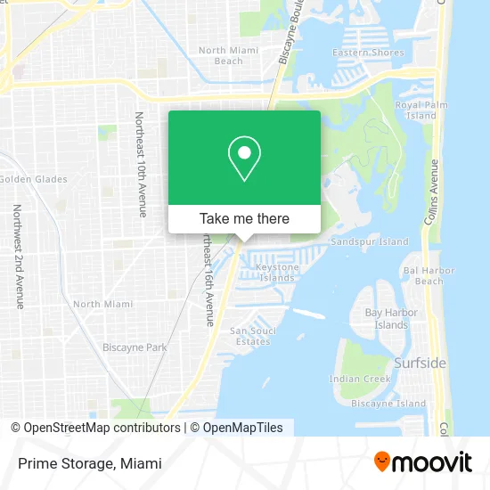
See Prime Storage, Miami, on the map
Public Transit to Prime Storage in Miami
Wondering how to get to Prime Storage in Miami? Moovit helps you find the best way to get to Prime Storage with step-by-step directions from the nearest public transit station.
Moovit provides free maps and live directions to help you navigate through your city. View schedules, routes, timetables, and find out how long does it take to get to Prime Storage in real time.
Looking for the nearest stop or station to Prime Storage? Check out this list of stops closest to your destination: Biscayne Blvd@ne 135 St - Ne Corner; Biscayne Bd & Ne 135 St; Highland Park; Ne 16 Av @ Ne 135 St.
Bus: 135, 203, 3, NOMBLU, NOMRED, NMBEACC, 16.
Want to see if there’s another route that gets you there at an earlier time? Moovit helps you find alternative routes or times. Get directions from and directions to Prime Storage easily from the Moovit App or Website.
We make riding to Prime Storage easy, which is why over 1.5 million users, including users in Miami, trust Moovit as the best app for public transit. You don’t need to download an individual bus app or train app, Moovit is your all-in-one transit app that helps you find the best bus time or train time available.
For information on prices of bus, costs and ride fares to Prime Storage, please check the Moovit app.
Use the app to navigate to popular places including to the airport, hospital, stadium, grocery store, mall, coffee shop, school, college, and university.
Prime Storage Address: 1945 NE 135th St Miami, FL 33181 street in Miami
- Top Art & Frame,
- United Food,
- Night Owl Cookies,
- STARBUCKS,
- Nwahiri Law,
- Jamba,
- Beauty Locks Hair Extensions,
- Harmonious Home Health,
- Derrick C. Morales, Attorney at Law,
- Acqualina Miami,
- Steam& Beyond,
- King Service,
- Soflo Estate - Luxury Real Estate Group,
- My Universal Transport,
- Exclusive Business Enterprises,
- Miami Strength Club,
- Aventura Penthouses,
- Jacques M. Hyppolite,
- Florida Advocates A Private Law Firm,
- A3 Chow Solution LLC
Places Near Prime Storage (Miami)
- Miami Freedom Park, Miami,
- Brickell City Centre, Miami,
- Dolphin Mall Bus, Miami,
- Little Havana, Miami,
- Port of Miami Cruise Terminal, Miami,
- Miami Design District, Miami,
- Miami-Dade County Courthouse, Miami,
- Richard E. Gerstein Justice Building, Miami,
- Sawgrass Mall, Miami,
- Marlins Park, Miami,
- Aventura Mall, Miami,
- Sawgrass mall ( FL ), Miami Beach,
- Aventura Mall, Miami Beach,
- Miami VA Hospital, Miami,
- Zoo Miami, Miami,
- Wynwood, Miami,
- Dolphin Mall, Miami,
- Bayside Marketplace, Miami,
- Hard Rock Stadium, Miami Gardens,
- Keiser University Flagship Campus, West Palm Beach
How to get to popular places in Miami with public transit
Get around Miami by public transit!
Traveling around Miami has never been so easy. See step by step directions as you travel to any attraction, street or major public transit station. View bus and train schedules, arrival times, service alerts and detailed routes on a map, so you know exactly how to get to anywhere in Miami.
When traveling to any destination around Miami use Moovit's Live Directions with Get Off Notifications to know exactly where and how far to walk, how long to wait for your line, and how many stops are left. Moovit will alert you when it's time to get off — no need to constantly re-check whether yours is the next stop.
Wondering how to use public transit in Miami or how to pay for public transit in Miami? Moovit public transit app can help you navigate your way with public transit easily, and at minimum cost. It includes public transit fees, ticket prices, and costs. Looking for a map of Miami public transit lines? Moovit public transit app shows all public transit maps in Miami with all Bus, Train, Light Rail and Ferry routes and stops on an interactive map.
Miami has 4 transit type(s), including: Bus, Train, Light Rail and Ferry, operated by several transit agencies, including Broward County Transit, Miami-Dade Transit, Metrorail, Palm Tran, Tri-Rail, Brightline, MARTY, City of Homestead Trolley, Key West Transit, Treasure Coast Connector, GoLine IRT, Amtrak, Greyhound-us, FlixBus-us and Aventura Express Shuttle Bus