How to get to Primrose School by bus?
Click on the bus route to see step by step directions with maps, line arrival times and updated time schedules.
Bus stops near Primrose School in Boston
Bus lines to Primrose School in Boston
What are the closest stations to Primrose School?
The closest stations to Primrose School are:
- Smith St & Bellevue St is 377 yards away, 5 min walk.
- Walmart & Drum Hill is 1497 yards away, 18 min walk.
Which bus lines stop near Primrose School?
These bus lines stop near Primrose School: 16, 5.
What’s the nearest bus station to Primrose School in Boston?
The nearest bus station to Primrose School in Boston is Smith St & Bellevue St. It’s a 5 min walk away.
What time is the first bus to Primrose School in Boston?
The 5 is the first bus that goes to Primrose School in Boston. It stops nearby at 5:57 AM.
What time is the last bus to Primrose School in Boston?
The 16 is the last bus that goes to Primrose School in Boston. It stops nearby at 7:41 PM.
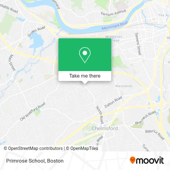
See Primrose School, Boston, on the map
Public Transit to Primrose School in Boston
Wondering how to get to Primrose School in Boston? Moovit helps you find the best way to get to Primrose School with step-by-step directions from the nearest public transit station.
Moovit provides free maps and live directions to help you navigate through your city. View schedules, routes, timetables, and find out how long does it take to get to Primrose School in real time.
Looking for the nearest stop or station to Primrose School? Check out this list of stops closest to your destination: Smith St & Bellevue St; Walmart & Drum Hill.
Bus: 16, 5, 17.
Want to see if there’s another route that gets you there at an earlier time? Moovit helps you find alternative routes or times. Get directions from and directions to Primrose School easily from the Moovit App or Website.
We make riding to Primrose School easy, which is why over 1.7 million users, including users in Boston, trust Moovit as the best app for public transit. You don’t need to download an individual bus app or train app, Moovit is your all-in-one transit app that helps you find the best bus time or train time available.
For information on prices of bus and train, costs and ride fares to Primrose School, please check the Moovit app.
Use the app to navigate to popular places including to the airport, hospital, stadium, grocery store, mall, coffee shop, school, college, and university.
Primrose School Address: 205 North Rd street in Boston
- Chelmsford Village - Pools,
- Hentz Park,
- Coinstar - Bitcoin ATM,
- Dave's Contracting Inc.,
- Chelmsford Plaza,
- Bodyworks by Susan,
- Fitness Solutions,
- Accountax Associates,
- Northeast Med Staff,
- Chelmsford Locksmith for High Security,
- Motion,
- Coin Cloud Bitcoin ATM,
- Locksmith Fast Service 01803,
- A-R & B Associates,
- Liz Ferreira Aesthetics Spa,
- Chelmsford High School,
- Ellevate Med Spa,
- Court House Lane Office Park,
- Weicker Law PLLC,
- Applewood Construction Corporation
Places Near Primrose School (Boston)
- Faneuil Hall, Boston,
- Mgm Music Hall, Boston,
- Leader Bank Pavilion (Leader Bank Pavillion), Boston,
- Castle Island, Boston,
- Museum Of Science, Boston,
- Prudential Center, Boston,
- Cheers, Boston,
- Td Garden, Boston,
- Isabella Stewart Gardner Museum, Boston,
- Boston Children's Hospital, Boston,
- Boston Medical Center, Boston,
- North End, Boston,
- House Of Blues, Boston,
- Wilbur Theatre, Boston,
- Seaport District, Boston,
- Wang Theater, Boston,
- Boston Convention & Exhibition Center, Boston,
- Massachusetts General Hospital, Boston,
- Quincy Market, Boston,
- Boston Common, Boston
How to get to popular places in Boston with public transit
Get around Boston by public transit!
Traveling around Boston has never been so easy. See step by step directions as you travel to any attraction, street or major public transit station. View bus and train schedules, arrival times, service alerts and detailed routes on a map, so you know exactly how to get to anywhere in Boston.
When traveling to any destination around Boston use Moovit's Live Directions with Get Off Notifications to know exactly where and how far to walk, how long to wait for your line, and how many stops are left. Moovit will alert you when it's time to get off — no need to constantly re-check whether yours is the next stop.
Wondering how to use public transit in Boston or how to pay for public transit in Boston? Moovit public transit app can help you navigate your way with public transit easily, and at minimum cost. It includes public transit fees, ticket prices, and costs. Looking for a map of Boston public transit lines? Moovit public transit app shows all public transit maps in Boston with all Bus, Train, Subway and Ferry routes and stops on an interactive map.
Boston has 4 transit type(s), including: Bus, Train, Subway and Ferry, operated by several transit agencies, including MBTA, Southeastern Regional Transit Authority, MetroWest Regional Transit Authority, Rhode Island Public Transit Authority, WRTA, Lowell Regional Transit Authority, Merrimack Valley Transit, Montachusett Regional Transit Authority, Cape Cod Regional Transit Authority, Brockton Area Transit Authority, Martha's Vineyard Transit Authority, the WAVE - Nantucket Regional Transit Authority, GATRA, Cape Ann Transportation Authority and Massport