Directions to Profishant (New Bedford) with public transportation
The following transit lines have routes that pass near Profishant
 Bus: 204, 221.
- Train: FALL RIVER/NEW BEDFORD.
How to get to Profishant by bus?
Click on the bus route to see step by step directions with maps, line arrival times and updated time schedules.
From Walmart Fall River Supercenter, Fall River
118 minFrom Lizzy Borden House, Fall River
92 minFrom Amazon Fulfillment Bos7, Fall River
110 minFrom Bristol Community College, Fall River
105 minFrom Charlton Memorial Hospital, Fall River
123 minFrom B.M.C. Durfee High School, Fall River
104 minFrom Falmouth MA USA, Falmouth
122 minFrom Mass Maritime Academy, Buzzards Bay
149 min
How to get to Profishant by train?
Click on the train route to see step by step directions with maps, line arrival times and updated time schedules.
Bus stops near Profishant in New Bedford
Train station near Profishant in New Bedford
- Church Street, 50 min walk,VIEW
Bus lines to Profishant in New Bedford
What are the closest stations to Profishant?
The closest stations to Profishant are:
- Chaffee St And Church St is 289 yards away, 4 min walk.
- Church St And Amanda Ave is 336 yards away, 4 min walk.
- Church Street is 4257 yards away, 50 min walk.
Which bus line stops near Profishant?
204 (Ashley Blvd)
Which train line stops near Profishant?
FALL RIVER/NEW BEDFORD (#2011 | New Bedford)
What’s the nearest bus station to Profishant in New Bedford?
The nearest bus stations to Profishant in New Bedford are Chaffee St And Church St and Church St And Amanda Ave. The closest one is a 4 min walk away.
What time is the first train to Profishant in New Bedford?
The FALL RIVER/NEW BEDFORD is the first train that goes to Profishant in New Bedford. It stops nearby at 4:22 AM.
What time is the last train to Profishant in New Bedford?
The FALL RIVER/NEW BEDFORD is the last train that goes to Profishant in New Bedford. It stops nearby at 1:28 AM.
What time is the first bus to Profishant in New Bedford?
The 204 is the first bus that goes to Profishant in New Bedford. It stops nearby at 5:52 AM.
What time is the last bus to Profishant in New Bedford?
The 204 is the last bus that goes to Profishant in New Bedford. It stops nearby at 8:36 PM.
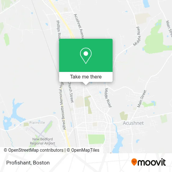
See Profishant, New Bedford, on the map
Public Transit to Profishant in New Bedford
Wondering how to get to Profishant in New Bedford? Moovit helps you find the best way to get to Profishant with step-by-step directions from the nearest public transit station.
Moovit provides free maps and live directions to help you navigate through your city. View schedules, routes, timetables, and find out how long does it take to get to Profishant in real time.
Looking for the nearest stop or station to Profishant? Check out this list of stops closest to your destination: Chaffee St And Church St; Church St And Amanda Ave; Church Street.
Bus: 204, 221.Train: FALL RIVER/NEW BEDFORD.
Want to see if there’s another route that gets you there at an earlier time? Moovit helps you find alternative routes or times. Get directions from and directions to Profishant easily from the Moovit App or Website.
We make riding to Profishant easy, which is why over 1.7 million users, including users in New Bedford, trust Moovit as the best app for public transit. You don’t need to download an individual bus app or train app, Moovit is your all-in-one transit app that helps you find the best bus time or train time available.
For information on prices of bus and train, costs and ride fares to Profishant, please check the Moovit app.
Use the app to navigate to popular places including to the airport, hospital, stadium, grocery store, mall, coffee shop, school, college, and university.
Profishant Address: 2834 Acushnet Ave street in New Bedford
- Alves Chiropractic / Boucher Weight Management Consultants,
- Ryan M Knowles DC,
- Eascare Ambulance,
- Cellular City,
- Crown & Gown Parties,
- USA Computers,
- Sherman Termite and Pest Control,
- Glitz and Glamour Salon,
- Blue Rhino,
- Coin Cloud Bitcoin ATM,
- Family First Life Lareau Group,
- Karen Boyd,
- Joe and Perky's Service Station,
- Ashley Boulevard and Chaffee Street,
- Trucchi's Supermarket,
- One New Creation Ministries,
- Hoyle Advertising,
- Woodford Holdings,
- Dr Kevin J Rodrigues,
- Oshun Physical Therapy & Pelvic Health
Places Near Profishant (New Bedford)
- Castle Island, Boston,
- Wang Theater, Boston,
- Museum Of Science, Boston,
- Wilbur Theatre, Boston,
- Massachusetts General Hospital, Boston,
- Boston Medical Center, Boston,
- Cheers, Boston,
- Mgm Music Hall, Boston,
- Boston Children's Hospital, Boston,
- Td Garden, Boston,
- House Of Blues, Boston,
- Faneuil Hall, Boston,
- Leader Bank Pavilion (Leader Bank Pavillion), Boston,
- Boston Convention & Exhibition Center, Boston,
- Seaport District, Boston,
- Quincy Market, Boston,
- Prudential Center, Boston,
- North End, Boston,
- Isabella Stewart Gardner Museum, Boston,
- Boston Common, Boston
How to get to popular places in Boston with public transit
Get around New Bedford by public transit!
Traveling around New Bedford has never been so easy. See step by step directions as you travel to any attraction, street or major public transit station. View bus and train schedules, arrival times, service alerts and detailed routes on a map, so you know exactly how to get to anywhere in New Bedford.
When traveling to any destination around New Bedford use Moovit's Live Directions with Get Off Notifications to know exactly where and how far to walk, how long to wait for your line, and how many stops are left. Moovit will alert you when it's time to get off — no need to constantly re-check whether yours is the next stop.
Wondering how to use public transit in New Bedford or how to pay for public transit in New Bedford? Moovit public transit app can help you navigate your way with public transit easily, and at minimum cost. It includes public transit fees, ticket prices, and costs. Looking for a map of New Bedford public transit lines? Moovit public transit app shows all public transit maps in New Bedford with all Bus, Train, Subway and Ferry routes and stops on an interactive map.
Boston has 4 transit type(s), including: Bus, Train, Subway and Ferry, operated by several transit agencies, including MBTA, Southeastern Regional Transit Authority, MetroWest Regional Transit Authority, Rhode Island Public Transit Authority, WRTA, Lowell Regional Transit Authority, Merrimack Valley Transit, Montachusett Regional Transit Authority, Cape Cod Regional Transit Authority, Brockton Area Transit Authority, Martha's Vineyard Transit Authority, the WAVE - Nantucket Regional Transit Authority, GATRA, Cape Ann Transportation Authority and Massport