Directions to Profitwell (Boston) with public transportation
The following transit lines have routes that pass near Profitwell
 Bus: 501, 504, 92, 93, SL3.
- Train: FRAMINGHAM/WORCESTER, HAVERHILL, LOWELL, COMMUTER RAIL SHUTTLE, FAIRMOUNT LINE SHUTTLE.
- Subway: BLUE LINE, GREEN LINE B, GREEN LINE C, GREEN LINE D, GREEN LINE E.
How to get to Profitwell by bus?
Click on the bus route to see step by step directions with maps, line arrival times and updated time schedules.
From Jamaica Plain VA Medical Center (VA Hospital), Boston
39 minFrom Vertex Pharmaceuticals, Inc., Boston
74 minFrom Assembly Square Mall Shopping Center, Somerville
60 minFrom The Mall At Chestnut Hill, Newton
67 minFrom FOUR POINTS BY SHERATON Boston Newton, Newton
26 minFrom Revere Beach, Revere
74 minFrom Malden, MA, Malden
68 minFrom Coolidge Corner Theatre, Brookline
57 minFrom Milton Academy, Milton
92 minFrom Regent Theatre, Arlington
71 min
How to get to Profitwell by train?
Click on the train route to see step by step directions with maps, line arrival times and updated time schedules.
How to get to Profitwell by subway?
Click on the subway route to see step by step directions with maps, line arrival times and updated time schedules.
From Jamaica Plain VA Medical Center (VA Hospital), Boston
36 minFrom Vertex Pharmaceuticals, Inc., Boston
56 minFrom Assembly Square Mall Shopping Center, Somerville
28 minFrom The Mall At Chestnut Hill, Newton
62 minFrom Revere Beach, Revere
46 minFrom Malden, MA, Malden
32 minFrom Coolidge Corner Theatre, Brookline
33 minFrom Milton Academy, Milton
54 min
Bus stops near Profitwell in Boston
Train station near Profitwell in Boston
- South Station, 6 min walk,VIEW
Subway stations near Profitwell in Boston
Bus lines to Profitwell in Boston
- SL5, Nubian,VIEW
- 11, City Point,VIEW
- 15, Haymarket Via Fields Corner & Nubian,VIEW
- SL4, Nubian,VIEW
- 501, Downtown Via Cambridge St And Copley (Express),VIEW
- 504, Watertown Via Copley And Newton Corner (Express),VIEW
- 7, Otis & Summer - City Point,VIEW
- 505, Downtown (Express) - Waltham (Express),VIEW
- RED LINE SHUTTLE, Harvard - JFK/UMass via Congress Street,VIEW
- RED LINE SHUTTLE, Harvard - Broadway,VIEW
- RED LINE SHUTTLE, Kendall/MIT - JFK/UMass,VIEW
- RED LINE SHUTTLE, Harvard - JFK/UMass via State Street,VIEW
- RED LINE SHUTTLE, JFK/UMass - Kendall/MIT (Shuttle),VIEW
- PETER PAN, BOSTON - WORCESTER - SPRINGFIELD - NORTHAMPTON - AMHERST,VIEW
- PETER PAN, NEW YORK - BOSTON Express Service,VIEW
- PETER PAN, BOSTON LOGAN AIRPORT - BOSTON - PROVIDENCE,VIEW
- PETER PAN, BOSTON LOGAN AIRPORT - BOSTON - FALMOUTH - WOODS HOLE,VIEW
- PETER PAN, BOSTON - NEW YORK Express Service,VIEW
- PETER PAN, BOSTON SOUTH STATION - NEWARK,VIEW
- PETER PAN, HYANNIS - BOSTON - BOSTON LOGAN AIRPORT,VIEW
What are the closest stations to Profitwell?
The closest stations to Profitwell are:
- Washington St @ Essex St is 199 yards away, 3 min walk.
- Kneeland St @ Washington St is 376 yards away, 5 min walk.
- Otis St @ Summer St is 384 yards away, 5 min walk.
- South Station Boston is 451 yards away, 6 min walk.
- South Station is 453 yards away, 6 min walk.
- Chauncy St @ Summer St is 596 yards away, 8 min walk.
- Downtown Crossing is 1007 yards away, 13 min walk.
- Boylston is 1555 yards away, 19 min walk.
- Summer St @ South Station - Red Line Entrance is 2141 yards away, 26 min walk.
- Boston-South Station is 2252 yards away, 27 min walk.
Which bus lines stop near Profitwell?
These bus lines stop near Profitwell: 501, 504, 92, 93, SL3, SL4, SL5.
Which train lines stop near Profitwell?
These train lines stop near Profitwell: FRAMINGHAM/WORCESTER, HAVERHILL, LOWELL.
Which subway lines stop near Profitwell?
These subway lines stop near Profitwell: BLUE LINE, GREEN LINE B, GREEN LINE C, GREEN LINE D, GREEN LINE E, ORANGE LINE, RED LINE.
What’s the nearest subway station to Profitwell in Boston?
The nearest subway station to Profitwell in Boston is Downtown Crossing. It’s a 13 min walk away.
What’s the nearest train station to Profitwell in Boston?
The nearest train station to Profitwell in Boston is South Station. It’s a 6 min walk away.
What’s the nearest bus station to Profitwell in Boston?
The nearest bus station to Profitwell in Boston is Washington St @ Essex St. It’s a 3 min walk away.
What time is the first subway to Profitwell in Boston?
The GREEN LINE D is the first subway that goes to Profitwell in Boston. It stops nearby at 5:09 AM.
What time is the last subway to Profitwell in Boston?
The GREEN LINE E is the last subway that goes to Profitwell in Boston. It stops nearby at 2:16 AM.
What time is the first train to Profitwell in Boston?
The PROVIDENCE/STOUGHTON is the first train that goes to Profitwell in Boston. It stops nearby at 4:20 AM.
What time is the last train to Profitwell in Boston?
The LAKE SHORE LIMITED is the last train that goes to Profitwell in Boston. It stops nearby at 8:32 PM.
What time is the first bus to Profitwell in Boston?
The SLW is the first bus that goes to Profitwell in Boston. It stops nearby at 4:19 AM.
What time is the last bus to Profitwell in Boston?
The SL1 is the last bus that goes to Profitwell in Boston. It stops nearby at 1:31 AM.
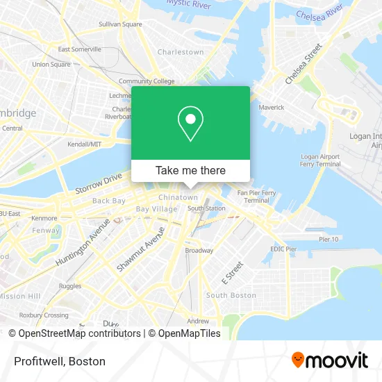
See Profitwell, Boston, on the map
Public Transit to Profitwell in Boston
Wondering how to get to Profitwell in Boston? Moovit helps you find the best way to get to Profitwell with step-by-step directions from the nearest public transit station.
Moovit provides free maps and live directions to help you navigate through your city. View schedules, routes, timetables, and find out how long does it take to get to Profitwell in real time.
Looking for the nearest stop or station to Profitwell? Check out this list of stops closest to your destination: Washington St @ Essex St; Kneeland St @ Washington St; Otis St @ Summer St; South Station Boston; South Station; Chauncy St @ Summer St; Downtown Crossing; Boylston; Summer St @ South Station - Red Line Entrance; Boston-South Station.
Bus: 501, 504, 92, 93, SL3, SL4, SL5, 11, 15.Train: FRAMINGHAM/WORCESTER, HAVERHILL, LOWELL, COMMUTER RAIL SHUTTLE, FAIRMOUNT LINE SHUTTLE, FRANKLIN LINE SHUTTLE, KINGSTON LINE SHUTTLE, SL1.Subway: BLUE LINE, GREEN LINE B, GREEN LINE C, GREEN LINE D, GREEN LINE E, ORANGE LINE, RED LINE.
Want to see if there’s another route that gets you there at an earlier time? Moovit helps you find alternative routes or times. Get directions from and directions to Profitwell easily from the Moovit App or Website.
We make riding to Profitwell easy, which is why over 1.7 million users, including users in Boston, trust Moovit as the best app for public transit. You don’t need to download an individual bus app or train app, Moovit is your all-in-one transit app that helps you find the best bus time or train time available.
For information on prices of bus, subway and train, costs and ride fares to Profitwell, please check the Moovit app.
Use the app to navigate to popular places including to the airport, hospital, stadium, grocery store, mall, coffee shop, school, college, and university.
Profitwell Address: 109 Kingston St street in Boston
- State Street Financial Center,
- AT&T Corporate Office,
- MBHP,
- Congresso Locksmith (Locks Mith),
- State Street Corporation,
- Root Cause,
- Ies,
- Wanderu,
- Dewey Square Park on the Greenway,
- Bedford Building,
- 125 Summer St,
- Wework One Lincoln Street,
- Bolt,
- Global Luxury Suites Downtown Boston,
- Boylston Chess Club,
- Chinatown Gate (China Gate Plaza Park),
- Locks & Locksmith 24 Hrs (Locks and Locksmiths),
- Verizon,
- Phillips Square Tactical Plaza,
- Moar - Massachusetts Organization for Addiction Recovery (Massachusetts Community Action)
Places Near Profitwell (Boston)
- Seaport District, Boston,
- House Of Blues, Boston,
- North End, Boston,
- Boston Medical Center, Boston,
- Boston Children's Hospital, Boston,
- Prudential Center, Boston,
- Cheers, Boston,
- Td Garden, Boston,
- Quincy Market, Boston,
- Boston Convention & Exhibition Center, Boston,
- Wilbur Theatre, Boston,
- Boston Common, Boston,
- Leader Bank Pavilion (Leader Bank Pavillion), Boston,
- Museum Of Science, Boston,
- Faneuil Hall, Boston,
- Wang Theater, Boston,
- Isabella Stewart Gardner Museum, Boston,
- Mgm Music Hall, Boston,
- Castle Island, Boston,
- Massachusetts General Hospital, Boston
How to get to popular places in Boston with public transit
Get around Boston by public transit!
Traveling around Boston has never been so easy. See step by step directions as you travel to any attraction, street or major public transit station. View bus and train schedules, arrival times, service alerts and detailed routes on a map, so you know exactly how to get to anywhere in Boston.
When traveling to any destination around Boston use Moovit's Live Directions with Get Off Notifications to know exactly where and how far to walk, how long to wait for your line, and how many stops are left. Moovit will alert you when it's time to get off — no need to constantly re-check whether yours is the next stop.
Wondering how to use public transit in Boston or how to pay for public transit in Boston? Moovit public transit app can help you navigate your way with public transit easily, and at minimum cost. It includes public transit fees, ticket prices, and costs. Looking for a map of Boston public transit lines? Moovit public transit app shows all public transit maps in Boston with all Bus, Train, Subway and Ferry routes and stops on an interactive map.
Boston has 4 transit type(s), including: Bus, Train, Subway and Ferry, operated by several transit agencies, including MBTA, Southeastern Regional Transit Authority, MetroWest Regional Transit Authority, Rhode Island Public Transit Authority, WRTA, Lowell Regional Transit Authority, Merrimack Valley Transit, Montachusett Regional Transit Authority, Cape Cod Regional Transit Authority, Brockton Area Transit Authority, Martha's Vineyard Transit Authority, the WAVE - Nantucket Regional Transit Authority, GATRA, Cape Ann Transportation Authority and Massport