Directions to Project Destiny Summer Camp (Boston) with public transportation
The following transit lines have routes that pass near Project Destiny Summer Camp
 Bus: 43, 450, 504, SL4, SL5.
- Train: HAVERHILL, NEEDHAM, FOXBORO EVENT SERVICE, FRAMINGHAM/WORCESTER, FRANKLIN/FOXBORO.
- Subway: GREEN LINE B, ORANGE LINE, GREEN LINE C, GREEN LINE D, GREEN LINE E.
How to get to Project Destiny Summer Camp by bus?
Click on the bus route to see step by step directions with maps, line arrival times and updated time schedules.
From Watertown, MA, Watertown Town
48 minFrom Chevalier Theater, Medford
44 minFrom Winthrop, Winthrop Town
92 minFrom Melrose Wakefield Hospital, Malden
107 minFrom Beth Israel Deaconess Hospital-Milton, Milton
77 minFrom West Roxbury, Boston
51 minFrom 7F Everett Street, Revere
53 minFrom Boston College (BC), Boston
64 minFrom Four Points by Sheraton Boston Logan Airport, Revere
83 minFrom Market Basket, Revere
60 min
How to get to Project Destiny Summer Camp by train?
Click on the train route to see step by step directions with maps, line arrival times and updated time schedules.
How to get to Project Destiny Summer Camp by subway?
Click on the subway route to see step by step directions with maps, line arrival times and updated time schedules.
Bus stops near Project Destiny Summer Camp in Boston
Subway stations near Project Destiny Summer Camp in Boston
Train station near Project Destiny Summer Camp in Boston
- Back Bay - South End, 8 min walk,VIEW
Bus lines to Project Destiny Summer Camp in Boston
What are the closest stations to Project Destiny Summer Camp?
The closest stations to Project Destiny Summer Camp are:
- Washington St @ Herald St is 19 yards away, 1 min walk.
- Herald St @ Harrison Ave is 222 yards away, 3 min walk.
- Tremont St @ E Berkeley St is 341 yards away, 5 min walk.
- Tufts Medical Center is 342 yards away, 5 min walk.
- Back Bay - South End is 579 yards away, 8 min walk.
- Boylston is 830 yards away, 10 min walk.
Which bus lines stop near Project Destiny Summer Camp?
These bus lines stop near Project Destiny Summer Camp: 43, 450, 504, SL4, SL5.
Which train lines stop near Project Destiny Summer Camp?
These train lines stop near Project Destiny Summer Camp: HAVERHILL, NEEDHAM.
Which subway lines stop near Project Destiny Summer Camp?
These subway lines stop near Project Destiny Summer Camp: GREEN LINE B, ORANGE LINE.
What’s the nearest subway station to Project Destiny Summer Camp in Boston?
The nearest subway station to Project Destiny Summer Camp in Boston is Tufts Medical Center. It’s a 5 min walk away.
What’s the nearest train station to Project Destiny Summer Camp in Boston?
The nearest train station to Project Destiny Summer Camp in Boston is Back Bay - South End. It’s a 8 min walk away.
What’s the nearest bus station to Project Destiny Summer Camp in Boston?
The nearest bus station to Project Destiny Summer Camp in Boston is Washington St @ Herald St. It’s a 1 min walk away.
What time is the first subway to Project Destiny Summer Camp in Boston?
The GREEN LINE D is the first subway that goes to Project Destiny Summer Camp in Boston. It stops nearby at 5:07 AM.
What time is the last subway to Project Destiny Summer Camp in Boston?
The GREEN LINE E is the last subway that goes to Project Destiny Summer Camp in Boston. It stops nearby at 2:16 AM.
What time is the first train to Project Destiny Summer Camp in Boston?
The PROVIDENCE/STOUGHTON is the first train that goes to Project Destiny Summer Camp in Boston. It stops nearby at 4:25 AM.
What time is the last train to Project Destiny Summer Camp in Boston?
The LAKE SHORE LIMITED is the last train that goes to Project Destiny Summer Camp in Boston. It stops nearby at 8:26 PM.
What time is the first bus to Project Destiny Summer Camp in Boston?
The 15 is the first bus that goes to Project Destiny Summer Camp in Boston. It stops nearby at 5:06 AM.
What time is the last bus to Project Destiny Summer Camp in Boston?
The 9 is the last bus that goes to Project Destiny Summer Camp in Boston. It stops nearby at 1:16 AM.
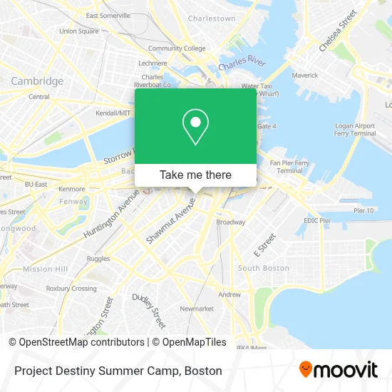
See Project Destiny Summer Camp, Boston, on the map
Public Transit to Project Destiny Summer Camp in Boston
Wondering how to get to Project Destiny Summer Camp in Boston? Moovit helps you find the best way to get to Project Destiny Summer Camp with step-by-step directions from the nearest public transit station.
Moovit provides free maps and live directions to help you navigate through your city. View schedules, routes, timetables, and find out how long does it take to get to Project Destiny Summer Camp in real time.
Looking for the nearest stop or station to Project Destiny Summer Camp? Check out this list of stops closest to your destination: Washington St @ Herald St; Herald St @ Harrison Ave; Tremont St @ E Berkeley St; Tufts Medical Center; Back Bay - South End; Boylston.
Bus: 43, 450, 504, SL4, SL5, 15, 11, 9.Train: HAVERHILL, NEEDHAM, FOXBORO EVENT SERVICE, FRAMINGHAM/WORCESTER, FRANKLIN/FOXBORO, PROVIDENCE/STOUGHTON.Subway: GREEN LINE B, ORANGE LINE, GREEN LINE C, GREEN LINE D, GREEN LINE E.
Want to see if there’s another route that gets you there at an earlier time? Moovit helps you find alternative routes or times. Get directions from and directions to Project Destiny Summer Camp easily from the Moovit App or Website.
We make riding to Project Destiny Summer Camp easy, which is why over 1.7 million users, including users in Boston, trust Moovit as the best app for public transit. You don’t need to download an individual bus app or train app, Moovit is your all-in-one transit app that helps you find the best bus time or train time available.
For information on prices of bus, subway and train, costs and ride fares to Project Destiny Summer Camp, please check the Moovit app.
Use the app to navigate to popular places including to the airport, hospital, stadium, grocery store, mall, coffee shop, school, college, and university.
Project Destiny Summer Camp Address: 120 Shawmut Ave street in Boston
- 1000 washington street boston,
- MBTA Silverline Bus SL5,
- Underground at Ink Block,
- Tatte Bakery & Cafe,
- Josiah Quincy Upper School,
- Troy Boston Apartments,
- Josiah Quincy Elementary School,
- South End Open Market @ Ink Block,
- Ming's Supermarket (Wang Jia Supermarket I),
- Whole Foods,
- Body SQD Ink Block,
- Whole Foods Market,
- Bar Mezzana,
- Dover Station MBTA,
- Wang YMCA of Chinatown,
- Myers + Chang ,
- Ink Block Fitness,
- J.J. Foley's Cafe,
- J.J. Foley's Cafe (JJ Foleys Cafe),
- Harris
Places Near Project Destiny Summer Camp (Boston)
- House Of Blues, Boston,
- Boston Children's Hospital, Boston,
- Leader Bank Pavilion (Leader Bank Pavillion), Boston,
- Prudential Center, Boston,
- North End, Boston,
- Boston Common, Boston,
- Quincy Market, Boston,
- Faneuil Hall, Boston,
- Isabella Stewart Gardner Museum, Boston,
- Wang Theater, Boston,
- Mgm Music Hall, Boston,
- Wilbur Theatre, Boston,
- Cheers, Boston,
- Castle Island, Boston,
- Museum Of Science, Boston,
- Boston Medical Center, Boston,
- Seaport District, Boston,
- Boston Convention & Exhibition Center, Boston,
- Massachusetts General Hospital, Boston,
- Td Garden, Boston
How to get to popular places in Boston with public transit
Get around Boston by public transit!
Traveling around Boston has never been so easy. See step by step directions as you travel to any attraction, street or major public transit station. View bus and train schedules, arrival times, service alerts and detailed routes on a map, so you know exactly how to get to anywhere in Boston.
When traveling to any destination around Boston use Moovit's Live Directions with Get Off Notifications to know exactly where and how far to walk, how long to wait for your line, and how many stops are left. Moovit will alert you when it's time to get off — no need to constantly re-check whether yours is the next stop.
Wondering how to use public transit in Boston or how to pay for public transit in Boston? Moovit public transit app can help you navigate your way with public transit easily, and at minimum cost. It includes public transit fees, ticket prices, and costs. Looking for a map of Boston public transit lines? Moovit public transit app shows all public transit maps in Boston with all Bus, Train, Subway and Ferry routes and stops on an interactive map.
Boston has 4 transit type(s), including: Bus, Train, Subway and Ferry, operated by several transit agencies, including MBTA, Southeastern Regional Transit Authority, MetroWest Regional Transit Authority, Rhode Island Public Transit Authority, WRTA, Lowell Regional Transit Authority, Merrimack Valley Transit, Montachusett Regional Transit Authority, Cape Cod Regional Transit Authority, Brockton Area Transit Authority, Martha's Vineyard Transit Authority, the WAVE - Nantucket Regional Transit Authority, GATRA, Cape Ann Transportation Authority and Massport