How to get to Prolash Nail Bar by bus?
Click on the bus route to see step by step directions with maps, line arrival times and updated time schedules.
From Bos21 - Amazon, Boston
45 minFrom James P. Kelleher Rose Garden, Boston
77 minFrom Hyatt Centric Faneuil, Boston
38 minFrom Eastern Standard Kitchen & Drinks, Boston
77 minFrom Boston University, Boston
75 minFrom Whole Foods, Boston
65 minFrom Home2 Suites-Boston South Bay (Home2 Stes by Hilton Boston S Bay), Boston
101 minFrom Berklee College of Music, Boston
81 minFrom Courtyard South Boston (COURTYARD by Marriott), Boston
100 minFrom MBTA-Chinatown, Boston
50 min
How to get to Prolash Nail Bar by train?
Click on the train route to see step by step directions with maps, line arrival times and updated time schedules.
How to get to Prolash Nail Bar by subway?
Click on the subway route to see step by step directions with maps, line arrival times and updated time schedules.
From Bos21 - Amazon, Boston
62 minFrom James P. Kelleher Rose Garden, Boston
72 minFrom Hyatt Centric Faneuil, Boston
44 minFrom Eastern Standard Kitchen & Drinks, Boston
69 minFrom Boston University, Boston
71 minFrom Whole Foods, Boston
58 minFrom Home2 Suites-Boston South Bay (Home2 Stes by Hilton Boston S Bay), Boston
71 minFrom Berklee College of Music, Boston
64 minFrom Courtyard South Boston (COURTYARD by Marriott), Boston
70 minFrom MBTA-Chinatown, Boston
50 min
Bus stops near Prolash Nail Bar in Revere
Subway station near Prolash Nail Bar in Revere
- Wonderland, 34 min walk,VIEW
Bus lines to Prolash Nail Bar in Revere
What are the closest stations to Prolash Nail Bar?
The closest stations to Prolash Nail Bar are:
- Broadway @ Beach St is 46 yards away, 1 min walk.
- Beach St @ Wilson St is 112 yards away, 2 min walk.
- Broadway @ Park Ave is 447 yards away, 6 min walk.
- Broadway Opp Fernwood Ave is 474 yards away, 6 min walk.
- Wonderland is 2881 yards away, 34 min walk.
Which bus lines stop near Prolash Nail Bar?
These bus lines stop near Prolash Nail Bar: 110, 116, 119.
Which train line stops near Prolash Nail Bar?
NEWBURYPORT/ROCKPORT (#125 | Newburyport)
Which subway line stops near Prolash Nail Bar?
BLUE LINE (Wonderland)
What’s the nearest bus station to Prolash Nail Bar in Revere?
The nearest bus station to Prolash Nail Bar in Revere is Broadway @ Beach St. It’s a 1 min walk away.
What time is the first subway to Prolash Nail Bar in Revere?
The BLUE LINE is the first subway that goes to Prolash Nail Bar in Revere. It stops nearby at 5:08 AM.
What time is the last subway to Prolash Nail Bar in Revere?
The BLUE LINE is the last subway that goes to Prolash Nail Bar in Revere. It stops nearby at 2:10 AM.
What time is the first bus to Prolash Nail Bar in Revere?
The 116 is the first bus that goes to Prolash Nail Bar in Revere. It stops nearby at 4:27 AM.
What time is the last bus to Prolash Nail Bar in Revere?
The 116 is the last bus that goes to Prolash Nail Bar in Revere. It stops nearby at 2:24 AM.
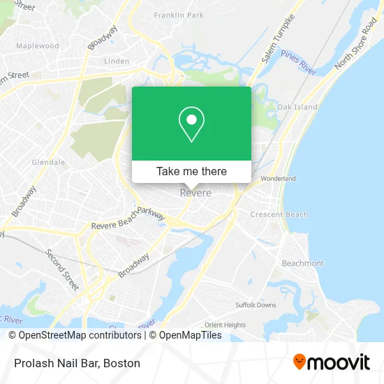
See Prolash Nail Bar, Revere, on the map
Public Transit to Prolash Nail Bar in Revere
Wondering how to get to Prolash Nail Bar in Revere? Moovit helps you find the best way to get to Prolash Nail Bar with step-by-step directions from the nearest public transit station.
Moovit provides free maps and live directions to help you navigate through your city. View schedules, routes, timetables, and find out how long does it take to get to Prolash Nail Bar in real time.
Looking for the nearest stop or station to Prolash Nail Bar? Check out this list of stops closest to your destination: Broadway @ Beach St; Beach St @ Wilson St; Broadway @ Park Ave; Broadway Opp Fernwood Ave; Wonderland.
Bus: 110, 116, 119, 411.Train: NEWBURYPORT/ROCKPORT.Subway: BLUE LINE.
Want to see if there’s another route that gets you there at an earlier time? Moovit helps you find alternative routes or times. Get directions from and directions to Prolash Nail Bar easily from the Moovit App or Website.
We make riding to Prolash Nail Bar easy, which is why over 1.7 million users, including users in Revere, trust Moovit as the best app for public transit. You don’t need to download an individual bus app or train app, Moovit is your all-in-one transit app that helps you find the best bus time or train time available.
For information on prices of bus, subway and train, costs and ride fares to Prolash Nail Bar, please check the Moovit app.
Use the app to navigate to popular places including to the airport, hospital, stadium, grocery store, mall, coffee shop, school, college, and university.
Prolash Nail Bar Address: 364 Broadway street in Revere
- TD Bank,
- Revere, MA,
- Revere Pet Clinic (Boston Pet Clinics),
- TD Bank ATM,
- Atm Walgreens,
- Rite Aid,
- MBTA Bus 116 119 411,
- Staff Sergeant James J. Hill Elementary School,
- American Legion Revere Post 61,
- Lady Grace Intimate Apparel,
- Harry Della Russo Memorial Stadium,
- Revere Beach,
- Oxigeno Beauty Salon,
- Waugh's,
- Sprint Store by Imobile,
- The Transit Museum,
- Northeastern University,
- Fardad Mobed DMD,
- Dinner Church,
- Rumney Marsh Burying Ground
Places Near Prolash Nail Bar (Revere)
- North End, Boston,
- Wilbur Theatre, Boston,
- Boston Common, Boston,
- Prudential Center, Boston,
- Boston Children's Hospital, Boston,
- Museum Of Science, Boston,
- Cheers, Boston,
- House Of Blues, Boston,
- Mgm Music Hall, Boston,
- Faneuil Hall, Boston,
- Leader Bank Pavilion (Leader Bank Pavillion), Boston,
- Td Garden, Boston,
- Quincy Market, Boston,
- Boston Convention & Exhibition Center, Boston,
- Seaport District, Boston,
- Isabella Stewart Gardner Museum, Boston,
- Boston Medical Center, Boston,
- Wang Theater, Boston,
- Castle Island, Boston,
- Massachusetts General Hospital, Boston
How to get to popular places in Boston with public transit
Get around Revere by public transit!
Traveling around Revere has never been so easy. See step by step directions as you travel to any attraction, street or major public transit station. View bus and train schedules, arrival times, service alerts and detailed routes on a map, so you know exactly how to get to anywhere in Revere.
When traveling to any destination around Revere use Moovit's Live Directions with Get Off Notifications to know exactly where and how far to walk, how long to wait for your line, and how many stops are left. Moovit will alert you when it's time to get off — no need to constantly re-check whether yours is the next stop.
Wondering how to use public transit in Revere or how to pay for public transit in Revere? Moovit public transit app can help you navigate your way with public transit easily, and at minimum cost. It includes public transit fees, ticket prices, and costs. Looking for a map of Revere public transit lines? Moovit public transit app shows all public transit maps in Revere with all Bus, Train, Subway and Ferry routes and stops on an interactive map.
Boston has 4 transit type(s), including: Bus, Train, Subway and Ferry, operated by several transit agencies, including MBTA, Southeastern Regional Transit Authority, MetroWest Regional Transit Authority, Rhode Island Public Transit Authority, WRTA, Lowell Regional Transit Authority, Merrimack Valley Transit, Montachusett Regional Transit Authority, Cape Cod Regional Transit Authority, Brockton Area Transit Authority, Martha's Vineyard Transit Authority, the WAVE - Nantucket Regional Transit Authority, GATRA, Cape Ann Transportation Authority and Massport