Directions to Promostuff (Boston) with public transportation
The following transit lines have routes that pass near Promostuff
 Bus: 43, 450, 504, EZRIDE, SL5.
- Train: FRAMINGHAM/WORCESTER, NEEDHAM.
- Subway: BLUE LINE, GREEN LINE C, GREEN LINE D, ORANGE LINE, RED LINE.
How to get to Promostuff by bus?
Click on the bus route to see step by step directions with maps, line arrival times and updated time schedules.
From Hilton Garden Inn Boston Brookline, Brookline
42 minFrom Arlington, MA, Arlington
65 minFrom Staybridge Suites Boston-Quincy, Quincy
115 minFrom Hebrew Rehab Center, Boston
78 minFrom Wollaston Beach, Quincy
132 minFrom Jamaica Pond, Boston
57 minFrom The Mall At Chestnut Hill, Newton
89 minFrom FOUR POINTS BY SHERATON Boston Newton, Newton
44 minFrom Constitution Beach, Boston
43 minFrom Spaulding Rehab, Boston
72 min
How to get to Promostuff by train?
Click on the train route to see step by step directions with maps, line arrival times and updated time schedules.
How to get to Promostuff by subway?
Click on the subway route to see step by step directions with maps, line arrival times and updated time schedules.
From Hilton Garden Inn Boston Brookline, Brookline
35 minFrom Staybridge Suites Boston-Quincy, Quincy
32 minFrom Hebrew Rehab Center, Boston
51 minFrom Wollaston Beach, Quincy
50 minFrom Jamaica Pond, Boston
41 minFrom The Mall At Chestnut Hill, Newton
66 minFrom Constitution Beach, Boston
28 minFrom Spaulding Rehab, Boston
54 min
Subway stations near Promostuff in Boston
Bus stops near Promostuff in Boston
- Congress St Opp North St, 3 min walk,VIEW
- Tremont St @ Beacon St, 3 min walk,VIEW
- Cambridge St @ Government Ctr Sta, 3 min walk,VIEW
- Government Center - Cambridge St @ Sudbury St, 4 min walk,VIEW
- Beacon St @ Park St, 4 min walk,VIEW
- Park Street - Tremont St Opp Hamilton Pl, 5 min walk,VIEW
- Congress St @ Haymarket Sta, 5 min walk,VIEW
Bus lines to Promostuff in Boston
- 4, North Station,VIEW
- 92, Sullivan,VIEW
- 93, Sullivan Via Navy Yard,VIEW
- RED LINE SHUTTLE, Jfk/Umass (Shuttle),VIEW
- RED LINE SHUTTLE, Harvard (Shuttle),VIEW
- RED LINE SHUTTLE, Kendall/MIT (Shuttle),VIEW
- 15, Haymarket Via Fields Corner & Nubian,VIEW
- 39, Haymarket Via Forest Hills,VIEW
- 57, Haymarket Via Kenmore,VIEW
- 116, Maverick - Wonderland,VIEW
- 354, Boston (Express) via Woburn - Burlington (Express) via Woburn,VIEW
- BLUE LINE SHUTTLE, Orient Heights - Government Center (Local),VIEW
- BLUE LINE SHUTTLE, Airport - Government Center (Express),VIEW
- BLUE LINE SHUTTLE, Orient Heights - Government Center (Express),VIEW
- BLUE LINE SHUTTLE, Wonderland - Government Center,VIEW
- GREEN LINE E SHUTTLE, Government Center - Medford/Tufts (Shuttle),VIEW
- GREEN LINE SHUTTLE, Medford/Tufts - Government Center via Union Square,VIEW
- GREEN LINE SHUTTLE, North Station - Government Center,VIEW
- GREEN LINE SHUTTLE, Union Square - Government Center,VIEW
- RED LINE SHUTTLE, Kendall/MIT - Broadway via Pearl Street,VIEW
What are the closest stations to Promostuff?
The closest stations to Promostuff are:
- State Street is 97 yards away, 2 min walk.
- Congress St Opp North St is 139 yards away, 3 min walk.
- Government Center is 151 yards away, 3 min walk.
- Tremont St @ Beacon St is 160 yards away, 3 min walk.
- Cambridge St @ Government Ctr Sta is 218 yards away, 3 min walk.
- Government Center - Cambridge St @ Sudbury St is 238 yards away, 4 min walk.
- Beacon St @ Park St is 297 yards away, 4 min walk.
- Park Street - Tremont St Opp Hamilton Pl is 325 yards away, 5 min walk.
- Congress St @ Haymarket Sta is 331 yards away, 5 min walk.
- Park Street is 576 yards away, 8 min walk.
Which bus lines stop near Promostuff?
These bus lines stop near Promostuff: 43, 450, 504, EZRIDE, SL5.
Which train lines stop near Promostuff?
These train lines stop near Promostuff: FRAMINGHAM/WORCESTER, NEEDHAM.
Which subway lines stop near Promostuff?
These subway lines stop near Promostuff: BLUE LINE, GREEN LINE C, GREEN LINE D, ORANGE LINE, RED LINE.
What’s the nearest subway station to Promostuff in Boston?
The nearest subway station to Promostuff in Boston is State Street. It’s a 2 min walk away.
What’s the nearest bus station to Promostuff in Boston?
The nearest bus stations to Promostuff in Boston are Congress St Opp North St, Tremont St @ Beacon St and Cambridge St @ Government Ctr Sta. The closest one is a 3 min walk away.
What time is the first subway to Promostuff in Boston?
The GREEN LINE E is the first subway that goes to Promostuff in Boston. It stops nearby at 5:03 AM.
What time is the last subway to Promostuff in Boston?
The GREEN LINE E is the last subway that goes to Promostuff in Boston. It stops nearby at 2:22 AM.
What time is the first bus to Promostuff in Boston?
The 116 is the first bus that goes to Promostuff in Boston. It stops nearby at 4:55 AM.
What time is the last bus to Promostuff in Boston?
The 116 is the last bus that goes to Promostuff in Boston. It stops nearby at 1:58 AM.
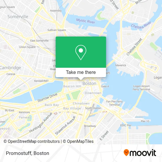
See Promostuff, Boston, on the map
Public Transit to Promostuff in Boston
Wondering how to get to Promostuff in Boston? Moovit helps you find the best way to get to Promostuff with step-by-step directions from the nearest public transit station.
Moovit provides free maps and live directions to help you navigate through your city. View schedules, routes, timetables, and find out how long does it take to get to Promostuff in real time.
Looking for the nearest stop or station to Promostuff? Check out this list of stops closest to your destination: State Street; Congress St Opp North St; Government Center; Tremont St @ Beacon St; Cambridge St @ Government Ctr Sta; Government Center - Cambridge St @ Sudbury St; Beacon St @ Park St; Park Street - Tremont St Opp Hamilton Pl; Congress St @ Haymarket Sta; Park Street.
Bus: 43, 450, 504, EZRIDE, SL5, 4, 92, 93, RED LINE SHUTTLE, RED LINE SHUTTLE, 15, 39, 57, 116, 354, BLUE LINE SHUTTLE, BLUE LINE SHUTTLE, BLUE LINE SHUTTLE.Train: FRAMINGHAM/WORCESTER, NEEDHAM.Subway: BLUE LINE, GREEN LINE C, GREEN LINE D, ORANGE LINE, RED LINE, GREEN LINE B, GREEN LINE E.
Want to see if there’s another route that gets you there at an earlier time? Moovit helps you find alternative routes or times. Get directions from and directions to Promostuff easily from the Moovit App or Website.
We make riding to Promostuff easy, which is why over 1.7 million users, including users in Boston, trust Moovit as the best app for public transit. You don’t need to download an individual bus app or train app, Moovit is your all-in-one transit app that helps you find the best bus time or train time available.
For information on prices of bus, subway and train, costs and ride fares to Promostuff, please check the Moovit app.
Use the app to navigate to popular places including to the airport, hospital, stadium, grocery store, mall, coffee shop, school, college, and university.
Promostuff Address: 6 Bowdoin St street in Boston
- Saltonstall Building,
- The Red Hat,
- Teddy's on the Hill,
- Federal Courthouse,
- Sattler College,
- Masud Co PC,
- MBTA-Bowdoin (Bowdoin MBTA Station - Blue Line),
- Bowdoin Station,
- 100 Cambridge Street Garage,
- 100 Cambridge Street Parking Facility,
- Law Offices of David S Flashenburg,
- 1 Bowdoin Street,
- Tip Tap Room,
- Temple Street Park,
- Charles F. Hurley Building,
- Adam Ritchie Brand Direction,
- Studio Theatre Suffolk University (Suffolk Free Radio),
- Boston Sports Club,
- Massachusetts State Employees Credit Union (MSECU),
- Massachusetts Unclaimed Property Division State Treasurer Deborah Goldberg
Places Near Promostuff (Boston)
- Isabella Stewart Gardner Museum, Boston,
- Mgm Music Hall, Boston,
- Wilbur Theatre, Boston,
- Boston Medical Center, Boston,
- Quincy Market, Boston,
- Leader Bank Pavilion (Leader Bank Pavillion), Boston,
- Cheers, Boston,
- Castle Island, Boston,
- House Of Blues, Boston,
- Wang Theater, Boston,
- Boston Children's Hospital, Boston,
- Seaport District, Boston,
- Faneuil Hall, Boston,
- Boston Convention & Exhibition Center, Boston,
- Massachusetts General Hospital, Boston,
- Prudential Center, Boston,
- North End, Boston,
- Td Garden, Boston,
- Museum Of Science, Boston,
- Boston Common, Boston
How to get to popular places in Boston with public transit
Get around Boston by public transit!
Traveling around Boston has never been so easy. See step by step directions as you travel to any attraction, street or major public transit station. View bus and train schedules, arrival times, service alerts and detailed routes on a map, so you know exactly how to get to anywhere in Boston.
When traveling to any destination around Boston use Moovit's Live Directions with Get Off Notifications to know exactly where and how far to walk, how long to wait for your line, and how many stops are left. Moovit will alert you when it's time to get off — no need to constantly re-check whether yours is the next stop.
Wondering how to use public transit in Boston or how to pay for public transit in Boston? Moovit public transit app can help you navigate your way with public transit easily, and at minimum cost. It includes public transit fees, ticket prices, and costs. Looking for a map of Boston public transit lines? Moovit public transit app shows all public transit maps in Boston with all Bus, Train, Subway and Ferry routes and stops on an interactive map.
Boston has 4 transit type(s), including: Bus, Train, Subway and Ferry, operated by several transit agencies, including MBTA, Southeastern Regional Transit Authority, MetroWest Regional Transit Authority, Rhode Island Public Transit Authority, WRTA, Lowell Regional Transit Authority, Merrimack Valley Transit, Montachusett Regional Transit Authority, Cape Cod Regional Transit Authority, Brockton Area Transit Authority, Martha's Vineyard Transit Authority, the WAVE - Nantucket Regional Transit Authority, GATRA, Cape Ann Transportation Authority and Massport