See Providence Williamette Falls Medical Center, Oregon City, on the map
Directions to Providence Williamette Falls Medical Center (Oregon City) with public transportation
The following transit lines have routes that pass near Providence Williamette Falls Medical Center
 Bus:
Bus: - Train:
How to get to Providence Williamette Falls Medical Center by bus?
Click on the bus route to see step by step directions with maps, line arrival times and updated time schedules.
Bus stations near Providence Williamette Falls Medical Center in Oregon City
- Washington & 16th (North),2 min walk,
- Main & 15th (North),3 min walk,
- Oregon City Transit Center (South),8 min walk,
- Oregon City Transit Center (West),8 min walk,
- Oregon City Transit Center (North),9 min walk,
Train stations near Providence Williamette Falls Medical Center in Oregon City
- Oregon City Amtrak,43 min walk,
Bus lines to Providence Williamette Falls Medical Center in Oregon City
- 79,Oregon City Transit Center (South),
- 154,Blankenship & Tannler Dr (North),
- 32,SE Jackson & Main St (West),
- 31,Webster Rd,
- 34,Linwood/River Rd,
- CAT99X,Canby,
- 33,Clackamas Community College (North),
- 99,SW 6th & W Burnside (North),
What are the closest stations to Providence Williamette Falls Medical Center?
The closest stations to Providence Williamette Falls Medical Center are:
- Washington & 16th (North) is 104 yards away, 2 min walk.
- Main & 15th (North) is 171 yards away, 3 min walk.
- Oregon City Transit Center (South) is 640 yards away, 8 min walk.
- Oregon City Transit Center (West) is 645 yards away, 8 min walk.
- Oregon City Transit Center (North) is 665 yards away, 9 min walk.
- Oregon City Amtrak is 3676 yards away, 43 min walk.
Which bus lines stop near Providence Williamette Falls Medical Center?
These bus lines stop near Providence Williamette Falls Medical Center: 32, 35, 79, 99.
What’s the nearest bus stop to Providence Williamette Falls Medical Center in Oregon City?
The nearest bus stop to Providence Williamette Falls Medical Center in Oregon City is Washington & 16th (North). It’s a 2 min walk away.
What time is the first train to Providence Williamette Falls Medical Center in Oregon City?
The AMTRAK CASCADES is the first train that goes to Providence Williamette Falls Medical Center in Oregon City. It stops nearby at 9:39 AM.
What time is the last train to Providence Williamette Falls Medical Center in Oregon City?
The AMTRAK CASCADES is the last train that goes to Providence Williamette Falls Medical Center in Oregon City. It stops nearby at 6:34 PM.
What time is the first bus to Providence Williamette Falls Medical Center in Oregon City?
The CAT99X is the first bus that goes to Providence Williamette Falls Medical Center in Oregon City. It stops nearby at 5:17 AM.
What time is the last bus to Providence Williamette Falls Medical Center in Oregon City?
The 33 is the last bus that goes to Providence Williamette Falls Medical Center in Oregon City. It stops nearby at 1:34 AM.
See Providence Williamette Falls Medical Center, Oregon City, on the map
Public Transit to Providence Williamette Falls Medical Center in Oregon City
Wondering how to get to Providence Williamette Falls Medical Center in Oregon City, United States? Moovit helps you find the best way to get to Providence Williamette Falls Medical Center with step-by-step directions from the nearest public transit station.
Moovit provides free maps and live directions to help you navigate through your city. View schedules, routes, timetables, and find out how long does it take to get to Providence Williamette Falls Medical Center in real time.
Looking for the nearest stop or station to Providence Williamette Falls Medical Center? Check out this list of stops closest to your destination: Washington & 16th (North); Main & 15th (North); Oregon City Transit Center (South); Oregon City Transit Center (West); Oregon City Transit Center (North); Oregon City Amtrak.
Bus:Train:
Want to see if there’s another route that gets you there at an earlier time? Moovit helps you find alternative routes or times. Get directions from and directions to Providence Williamette Falls Medical Center easily from the Moovit App or Website.
We make riding to Providence Williamette Falls Medical Center easy, which is why over 1.5 million users, including users in Oregon City, trust Moovit as the best app for public transit. You don’t need to download an individual bus app or train app, Moovit is your all-in-one transit app that helps you find the best bus time or train time available.
For information on prices of bus and light rail, costs and ride fares to Providence Williamette Falls Medical Center, please check the Moovit app.
Use the app to navigate to popular places including to the airport, hospital, stadium, grocery store, mall, coffee shop, school, college, and university.
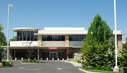
Providence Williamette Falls Medical Center Address: 519 15th St street in Oregon City
Attractions near Providence Williamette Falls Medical Center
Providence Willamette Falls Community Center - Oregon City,Dawn Parsons Hair,Mount of Olives Missions,Chase Heating & Cooling,Oregon City Children's Theatre,New West Contractors,Premier Hibachi & Sushi,Philly King,Ranch - Oregon City,Hairstylesbysteph,FedEx,Freckled Peach,Corner 14,Krazy Kokonut,From Russia with Love,Walter French's,Kusakollc ,OH Shiny,Real Life Catholic,Guiding Heart AcupunctureHow to get to popular attractions in Oregon City with public transit
Pok Pok Noi, Portland,Tanasbourne, Hillsboro,Portland Streetcar SE Water & OMSI, Portland,Lloyd Center / Northeast 11th Avenue, Portland,Nike - Jerry Rice Building,Fred Meyer Gas Station - Cornelius, Cornelius,Edith Green-Wendell Wyatt Federal Building, Portland,TriMet SE Fuller Rd MAX Station,Nike - Pete Sampras Building, Beaverton,Intel - RA3 Cafe, Hillsboro,Cully Neighborhood, Portland,TriMet SE Powell Blvd MAX Station, Portland,Washington Square Transit Center, Tigard,C-TRAN 99th St Transit Center (Stop 110), Hazel Dell,Hyatt Place Portland Airport / Cascade Station, Portland,I-5 @ Killingsworth / Alberta St., Portland,Fishers Landing, Vancouver,PSU Urban Center, Portland,IHOP, Portland,Oregon Convention Center, PortlandGet around Oregon City by public transit!
Traveling around Oregon City has never been so easy. See step by step directions as you travel to any attraction, street or major public transit station. View bus and train schedules, arrival times, service alerts and detailed routes on a map, so you know exactly how to get to anywhere in Oregon City.
When traveling to any destination around Oregon City use Moovit's Live Directions with Get Off Notifications to know exactly where and how far to walk, how long to wait for your line, and how many stops are left. Moovit will alert you when it's time to get off — no need to constantly re-check whether yours is the next stop.
Wondering how to use public transit in Oregon City or how to pay for public transit in Oregon City? Moovit public transit app can help you navigate your way with public transit easily, and at minimum cost. It includes public transit fees, ticket prices, and costs. Looking for a map of Oregon City public transit lines? Moovit public transit app shows all public transit maps in Oregon City with all bus or light rail routes and stops on an interactive map.
Oregon City has 2 transit type(s), including: bus or light rail, operated by several transit agencies, including Mount Adams Transportation Service, RiverCities Transit, TriMet , TriMet , TriMet, Portland Streetcar, Portland Aerial Tram, C-TRAN, Multnomah County Job Connector Shuttles, Washington Park Shuttle, SMART, Canby Area Transit, South Clackamas Transportation District, The Wave and Lincoln County Transit