How to get to Proving Ground by bus?
Click on the bus route to see step by step directions with maps, line arrival times and updated time schedules.
How to get to Proving Ground by train?
Click on the train route to see step by step directions with maps, line arrival times and updated time schedules.
Bus stops near Proving Ground in Salem
Bus lines to Proving Ground in Salem
- 450, Salem Depot,VIEW
- 451, North Beverly Via Tozer Rd,VIEW
- 455, West Lynn Garage Via Central Square,VIEW
- 456, Central Square,VIEW
- 435, Salem Depot,VIEW
- NEWBURYPORT LINE SHUTTLE, Newburyport (Shuttle),VIEW
- NEWBURYPORT LINE SHUTTLE, Rockport (Limited Shuttle),VIEW
- NEWBURYPORT LINE SHUTTLE, Newburyport (Limited Shuttle),VIEW
- NEWBURYPORT LINE SHUTTLE, Oak Grove (Local Shuttle),VIEW
- NEWBURYPORT LINE SHUTTLE, Newburyport (Express Shuttle),VIEW
- NEWBURYPORT/ROCKPORT LINE SHUTTLE, Beverly (Shuttle),VIEW
- ROCKPORT LINE SHUTTLE, Salem (Express Shuttle),VIEW
- ROCKPORT LINE SHUTTLE, Rockport (Local Shuttle),VIEW
- NEWBURYPORT/ROCKPORT, #193 | Newburyport,VIEW
What are the closest stations to Proving Ground?
The closest stations to Proving Ground are:
- Washington St @ Church St is 15 yards away, 1 min walk.
- Salem is 195 yards away, 3 min walk.
Which bus lines stop near Proving Ground?
These bus lines stop near Proving Ground: 450, 455.
Which train line stops near Proving Ground?
NEWBURYPORT/ROCKPORT (#51 | Rockport)
What’s the nearest bus station to Proving Ground in Salem?
The nearest bus station to Proving Ground in Salem is Washington St @ Church St. It’s a 1 min walk away.
What time is the first train to Proving Ground in Salem?
The NEWBURYPORT/ROCKPORT is the first train that goes to Proving Ground in Salem. It stops nearby at 5:16 AM.
What time is the last train to Proving Ground in Salem?
The NEWBURYPORT/ROCKPORT is the last train that goes to Proving Ground in Salem. It stops nearby at 12:31 AM.
What time is the first bus to Proving Ground in Salem?
The 455 is the first bus that goes to Proving Ground in Salem. It stops nearby at 5:00 AM.
What time is the last bus to Proving Ground in Salem?
The 450 is the last bus that goes to Proving Ground in Salem. It stops nearby at 1:19 AM.
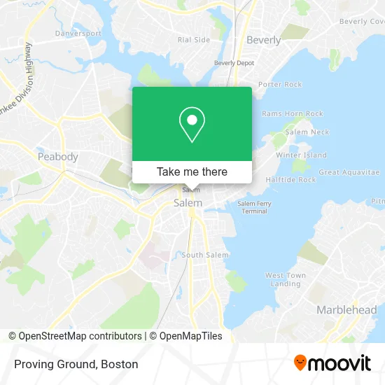
See Proving Ground, Salem, on the map
Public Transit to Proving Ground in Salem
Wondering how to get to Proving Ground in Salem? Moovit helps you find the best way to get to Proving Ground with step-by-step directions from the nearest public transit station.
Moovit provides free maps and live directions to help you navigate through your city. View schedules, routes, timetables, and find out how long does it take to get to Proving Ground in real time.
Looking for the nearest stop or station to Proving Ground? Check out this list of stops closest to your destination: Washington St @ Church St; Salem.
Bus: 450, 455, 451, 456, 435, NEWBURYPORT LINE SHUTTLE, NEWBURYPORT LINE SHUTTLE, NEWBURYPORT LINE SHUTTLE, NEWBURYPORT LINE SHUTTLE.Train: NEWBURYPORT/ROCKPORT.
Want to see if there’s another route that gets you there at an earlier time? Moovit helps you find alternative routes or times. Get directions from and directions to Proving Ground easily from the Moovit App or Website.
We make riding to Proving Ground easy, which is why over 1.7 million users, including users in Salem, trust Moovit as the best app for public transit. You don’t need to download an individual bus app or train app, Moovit is your all-in-one transit app that helps you find the best bus time or train time available.
For information on prices of bus and train, costs and ride fares to Proving Ground, please check the Moovit app.
Use the app to navigate to popular places including to the airport, hospital, stadium, grocery store, mall, coffee shop, school, college, and university.
Location: Salem, Boston
- Christmas In Salem,
- The Legacy Dialogues,
- Santuario Espiritual Del Amor,
- Yes For Salem,
- Heritage Co-OP Bank,
- Angel's Handy Man Services,
- Stellar Painting & Services,
- Meriyem's,
- Salem State University Alliance,
- Ancient Fire Henna,
- Salem, Massachusetts,
- Casey & Lundregan,
- Anytime Garage Door Repair Salem,
- Destination Salem, Massachusetts,
- Attorney Kelly Richenburg,
- Marsh Dining Hall,
- Jesse P Dole Aty at Law,
- Law Firm of Callahan & Dewan,
- Edward A McNaught III PC,
- Brix Condominiums
Places Near Proving Ground (Salem)
- Seaport District, Boston,
- Cheers, Boston,
- Castle Island, Boston,
- Leader Bank Pavilion (Leader Bank Pavillion), Boston,
- Boston Convention & Exhibition Center, Boston,
- Boston Common, Boston,
- House Of Blues, Boston,
- Td Garden, Boston,
- Faneuil Hall, Boston,
- Mgm Music Hall, Boston,
- North End, Boston,
- Quincy Market, Boston,
- Isabella Stewart Gardner Museum, Boston,
- Boston Children's Hospital, Boston,
- Massachusetts General Hospital, Boston,
- Wang Theater, Boston,
- Boston Medical Center, Boston,
- Wilbur Theatre, Boston,
- Museum Of Science, Boston,
- Prudential Center, Boston
How to get to popular places in Boston with public transit
Get around Salem by public transit!
Traveling around Salem has never been so easy. See step by step directions as you travel to any attraction, street or major public transit station. View bus and train schedules, arrival times, service alerts and detailed routes on a map, so you know exactly how to get to anywhere in Salem.
When traveling to any destination around Salem use Moovit's Live Directions with Get Off Notifications to know exactly where and how far to walk, how long to wait for your line, and how many stops are left. Moovit will alert you when it's time to get off — no need to constantly re-check whether yours is the next stop.
Wondering how to use public transit in Salem or how to pay for public transit in Salem? Moovit public transit app can help you navigate your way with public transit easily, and at minimum cost. It includes public transit fees, ticket prices, and costs. Looking for a map of Salem public transit lines? Moovit public transit app shows all public transit maps in Salem with all Bus, Train, Subway and Ferry routes and stops on an interactive map.
Boston has 4 transit type(s), including: Bus, Train, Subway and Ferry, operated by several transit agencies, including MBTA, Southeastern Regional Transit Authority, MetroWest Regional Transit Authority, Rhode Island Public Transit Authority, WRTA, Lowell Regional Transit Authority, Merrimack Valley Transit, Montachusett Regional Transit Authority, Cape Cod Regional Transit Authority, Brockton Area Transit Authority, Martha's Vineyard Transit Authority, the WAVE - Nantucket Regional Transit Authority, GATRA, Cape Ann Transportation Authority and Massport