Directions to Proxy Networks (Newton) with public transportation
The following transit lines have routes that pass near Proxy Networks
 Bus: 59.
- Train: NEEDHAM.
- Subway: GREEN LINE D.
How to get to Proxy Networks by bus?
Click on the bus route to see step by step directions with maps, line arrival times and updated time schedules.
From MBTA Jackson Square Station, Boston
106 minFrom Simmons College, Boston
73 minFrom Mount Auburn Hospital, Cambridge
49 minFrom Dana-Farber Cancer Institute, Boston
71 minFrom 98 Binney St, Boston
73 minFrom Harvard T.H. Chan School of Public Health, Boston
71 minFrom Wachusett mountain, Boston
60 minFrom VA Medical Center, Boston (Jamaica Plain), Boston
93 minFrom Raising Cane's, Boston
61 minFrom Waltham, MA, Waltham
45 min
How to get to Proxy Networks by train?
Click on the train route to see step by step directions with maps, line arrival times and updated time schedules.
How to get to Proxy Networks by subway?
Click on the subway route to see step by step directions with maps, line arrival times and updated time schedules.
From MBTA Jackson Square Station, Boston
75 minFrom Simmons College, Boston
50 minFrom Mount Auburn Hospital, Cambridge
96 minFrom Dana-Farber Cancer Institute, Boston
53 minFrom 98 Binney St, Boston
52 minFrom Harvard T.H. Chan School of Public Health, Boston
72 minFrom Wachusett mountain, Boston
94 minFrom VA Medical Center, Boston (Jamaica Plain), Boston
55 minFrom Raising Cane's, Boston
71 min
Bus stop near Proxy Networks in Newton
- Needham St @ Charlemont St, 1 min walk,VIEW
Train station near Proxy Networks in Newton
- Needham Heights, 21 min walk,VIEW
Subway station near Proxy Networks in Newton
- Newton Centre, 28 min walk,VIEW
Bus lines to Proxy Networks in Newton
- 59, Needham Junction Via Needham St,VIEW
What are the closest stations to Proxy Networks?
The closest stations to Proxy Networks are:
- Needham St @ Charlemont St is 50 yards away, 1 min walk.
- Needham Heights is 1699 yards away, 21 min walk.
- Newton Centre is 2356 yards away, 28 min walk.
Which bus line stops near Proxy Networks?
59 (Needham Junction Via Needham St)
Which train line stops near Proxy Networks?
NEEDHAM (#625 | Needham Heights)
Which subway line stops near Proxy Networks?
GREEN LINE D (Riverside)
What’s the nearest subway station to Proxy Networks in Newton?
The nearest subway station to Proxy Networks in Newton is Newton Centre. It’s a 28 min walk away.
What’s the nearest train station to Proxy Networks in Newton?
The nearest train station to Proxy Networks in Newton is Needham Heights. It’s a 21 min walk away.
What’s the nearest bus station to Proxy Networks in Newton?
The nearest bus station to Proxy Networks in Newton is Needham St @ Charlemont St. It’s a 1 min walk away.
What time is the first subway to Proxy Networks in Newton?
The GREEN LINE D is the first subway that goes to Proxy Networks in Newton. It stops nearby at 4:48 AM.
What time is the last subway to Proxy Networks in Newton?
The GREEN LINE D is the last subway that goes to Proxy Networks in Newton. It stops nearby at 2:44 AM.
What time is the first train to Proxy Networks in Newton?
The NEEDHAM is the first train that goes to Proxy Networks in Newton. It stops nearby at 7:05 AM.
What time is the last train to Proxy Networks in Newton?
The NEEDHAM is the last train that goes to Proxy Networks in Newton. It stops nearby at 6:38 PM.
What time is the first bus to Proxy Networks in Newton?
The 59 is the first bus that goes to Proxy Networks in Newton. It stops nearby at 6:22 AM.
What time is the last bus to Proxy Networks in Newton?
The 59 is the last bus that goes to Proxy Networks in Newton. It stops nearby at 8:03 PM.
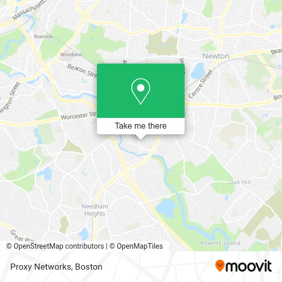
See Proxy Networks, Newton, on the map
Public Transit to Proxy Networks in Newton
Wondering how to get to Proxy Networks in Newton? Moovit helps you find the best way to get to Proxy Networks with step-by-step directions from the nearest public transit station.
Moovit provides free maps and live directions to help you navigate through your city. View schedules, routes, timetables, and find out how long does it take to get to Proxy Networks in real time.
Looking for the nearest stop or station to Proxy Networks? Check out this list of stops closest to your destination: Needham St @ Charlemont St; Needham Heights; Newton Centre.
Bus: 59.Train: NEEDHAM.Subway: GREEN LINE D.
Want to see if there’s another route that gets you there at an earlier time? Moovit helps you find alternative routes or times. Get directions from and directions to Proxy Networks easily from the Moovit App or Website.
We make riding to Proxy Networks easy, which is why over 1.7 million users, including users in Newton, trust Moovit as the best app for public transit. You don’t need to download an individual bus app or train app, Moovit is your all-in-one transit app that helps you find the best bus time or train time available.
For information on prices of bus, subway and train, costs and ride fares to Proxy Networks, please check the Moovit app.
Use the app to navigate to popular places including to the airport, hospital, stadium, grocery store, mall, coffee shop, school, college, and university.
Proxy Networks Address: 320 Congress St street in Newton
- World of Real Estate,
- Studio of Warren Patterson,
- FGC Trust,
- FedEx,
- Accelerated Receivables,
- Central Home Health Care,
- Apeak,
- New England Carpet,
- Cupixel,
- Chickadee Property Management,
- Soya's,
- Little Lukes Cafe,
- Neighborhood Restaurant Group,
- Boston Behavior Learning Centers,
- Ala Recycling Industries,
- Bio and Creditsfor Boyd Estus,
- Oscar's Moving Company,
- Grayson Real Estate Group,
- BRSB Consulting,
- Roush Edward C - Nationwide Insurance
Places Near Proxy Networks (Newton)
- Mgm Music Hall, Boston,
- Td Garden, Boston,
- Prudential Center, Boston,
- Castle Island, Boston,
- Seaport District, Boston,
- Boston Common, Boston,
- Cheers, Boston,
- House Of Blues, Boston,
- Wang Theater, Boston,
- Leader Bank Pavilion (Leader Bank Pavillion), Boston,
- Boston Children's Hospital, Boston,
- Museum Of Science, Boston,
- Massachusetts General Hospital, Boston,
- Wilbur Theatre, Boston,
- Faneuil Hall, Boston,
- Boston Convention & Exhibition Center, Boston,
- Quincy Market, Boston,
- Isabella Stewart Gardner Museum, Boston,
- Boston Medical Center, Boston,
- North End, Boston
How to get to popular places in Boston with public transit
Get around Newton by public transit!
Traveling around Newton has never been so easy. See step by step directions as you travel to any attraction, street or major public transit station. View bus and train schedules, arrival times, service alerts and detailed routes on a map, so you know exactly how to get to anywhere in Newton.
When traveling to any destination around Newton use Moovit's Live Directions with Get Off Notifications to know exactly where and how far to walk, how long to wait for your line, and how many stops are left. Moovit will alert you when it's time to get off — no need to constantly re-check whether yours is the next stop.
Wondering how to use public transit in Newton or how to pay for public transit in Newton? Moovit public transit app can help you navigate your way with public transit easily, and at minimum cost. It includes public transit fees, ticket prices, and costs. Looking for a map of Newton public transit lines? Moovit public transit app shows all public transit maps in Newton with all Bus, Train, Subway and Ferry routes and stops on an interactive map.
Boston has 4 transit type(s), including: Bus, Train, Subway and Ferry, operated by several transit agencies, including MBTA, Southeastern Regional Transit Authority, MetroWest Regional Transit Authority, Rhode Island Public Transit Authority, WRTA, Lowell Regional Transit Authority, Merrimack Valley Transit, Montachusett Regional Transit Authority, Cape Cod Regional Transit Authority, Brockton Area Transit Authority, Martha's Vineyard Transit Authority, the WAVE - Nantucket Regional Transit Authority, GATRA, Cape Ann Transportation Authority and Massport