Directions to Ps Home Remodeling (Boston) with public transportation
The following transit lines have routes that pass near Ps Home Remodeling
 Bus: 104, BB, SL3, 120, 114.
- Train: NEWBURYPORT/ROCKPORT.
- Subway: BLUE LINE.
- Ferry: EAST BOSTON FERRY, EAST.
How to get to Ps Home Remodeling by bus?
Click on the bus route to see step by step directions with maps, line arrival times and updated time schedules.
From Raising Cane's, Boston
94 minFrom Porter Square, Cambridge
102 minFrom the mall at rockingham park mall, Boston
83 minFrom AC Hotel Boston Cambridge, Cambridge
125 minFrom Brighton District Court, Boston
76 minFrom O'Bryant High School, Boston
60 minFrom Arsenal Mall, Watertown Town
96 minFrom Harvard Medical School, Boston
61 minFrom Arsenal Yards, Watertown Town
84 minFrom Takeda Pharmaceuticals, Cambridge
54 min
How to get to Ps Home Remodeling by train?
Click on the train route to see step by step directions with maps, line arrival times and updated time schedules.
How to get to Ps Home Remodeling by subway?
Click on the subway route to see step by step directions with maps, line arrival times and updated time schedules.
From Raising Cane's, Boston
47 minFrom Porter Square, Cambridge
37 minFrom the mall at rockingham park mall, Boston
62 minFrom Harvard Medical School, Boston
45 minFrom AC Hotel Boston Cambridge, Cambridge
60 minFrom Brighton District Court, Boston
74 minFrom O'Bryant High School, Boston
36 minFrom Takeda Pharmaceuticals, Cambridge
38 min
Bus stops near Ps Home Remodeling in Boston
Subway station near Ps Home Remodeling in Boston
- Maverick, 4 min walk,VIEW
Ferry stations near Ps Home Remodeling in Boston
Bus lines to Ps Home Remodeling in Boston
- 120, Maverick Via Jeffries Point,VIEW
- 114, Maverick,VIEW
- 116, Haymarket Via Maverick,VIEW
- 121, Eagle Square,VIEW
- BLUE LINE SHUTTLE, Orient Heights (Local Shuttle),VIEW
- BLUE LINE SHUTTLE, Airport (Shuttle),VIEW
- BLUE LINE SHUTTLE, Maverick (Shuttle),VIEW
- BLUE LINE SHUTTLE, Airport (Local Shuttle),VIEW
- BLUE LINE SHUTTLE, Wonderland (Shuttle),VIEW
- BLUE LINE SHUTTLE, Government Center Via Maverick (Shuttle),VIEW
- BLUE LINE SHUTTLE, Airport Via Maverick (Shuttle),VIEW
- 22, Conrac Rental Car Center, Drop Off - Conrac Rental Car Center, Pick Up,VIEW
- 55, Conrac Rental Car Center, Drop Off - Conrac Rental Car Center, Pick Up,VIEW
- 221, 221,VIEW
- 551, 551,VIEW
- 552, 552,VIEW
- 33, Conrac Rental Car Center, Drop Off - Conrac Rental Car Center, Pick Up,VIEW
- 331, 331,VIEW
What are the closest stations to Ps Home Remodeling?
The closest stations to Ps Home Remodeling are:
- Sumner St @ Orleans St is 54 yards away, 1 min walk.
- Maverick is 252 yards away, 4 min walk.
- Lewis Mall Wharf is 531 yards away, 7 min walk.
- Terminal A is 587 yards away, 7 min walk.
- Conrac Rental Car Center, Drop Off is 711 yards away, 9 min walk.
- Logan Airport Ferry Terminal is 1981 yards away, 24 min walk.
Which bus lines stop near Ps Home Remodeling?
These bus lines stop near Ps Home Remodeling: 104, BB, SL3.
Which train line stops near Ps Home Remodeling?
NEWBURYPORT/ROCKPORT (#27 | Rockport)
Which subway line stops near Ps Home Remodeling?
BLUE LINE (Wonderland)
What’s the nearest subway station to Ps Home Remodeling in Boston?
The nearest subway station to Ps Home Remodeling in Boston is Maverick. It’s a 4 min walk away.
What’s the nearest bus station to Ps Home Remodeling in Boston?
The nearest bus station to Ps Home Remodeling in Boston is Sumner St @ Orleans St. It’s a 1 min walk away.
What’s the nearest ferry station to Ps Home Remodeling in Boston?
The nearest ferry station to Ps Home Remodeling in Boston is Lewis Mall Wharf. It’s a 7 min walk away.
What time is the first subway to Ps Home Remodeling in Boston?
The BLUE LINE is the first subway that goes to Ps Home Remodeling in Boston. It stops nearby at 5:12 AM.
What time is the last subway to Ps Home Remodeling in Boston?
The BLUE LINE is the last subway that goes to Ps Home Remodeling in Boston. It stops nearby at 1:59 AM.
What time is the first bus to Ps Home Remodeling in Boston?
The 552 is the first bus that goes to Ps Home Remodeling in Boston. It stops nearby at 3:00 AM.
What time is the last bus to Ps Home Remodeling in Boston?
The 552 is the last bus that goes to Ps Home Remodeling in Boston. It stops nearby at 3:12 AM.
What time is the first ferry to Ps Home Remodeling in Boston?
The EAST is the first ferry that goes to Ps Home Remodeling in Boston. It stops nearby at 5:55 AM.
What time is the last ferry to Ps Home Remodeling in Boston?
The HINGHAM/HULL FERRY is the last ferry that goes to Ps Home Remodeling in Boston. It stops nearby at 10:05 PM.
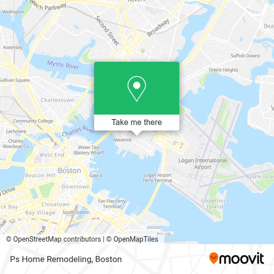
See Ps Home Remodeling, Boston, on the map
Public Transit to Ps Home Remodeling in Boston
Wondering how to get to Ps Home Remodeling in Boston? Moovit helps you find the best way to get to Ps Home Remodeling with step-by-step directions from the nearest public transit station.
Moovit provides free maps and live directions to help you navigate through your city. View schedules, routes, timetables, and find out how long does it take to get to Ps Home Remodeling in real time.
Looking for the nearest stop or station to Ps Home Remodeling? Check out this list of stops closest to your destination: Sumner St @ Orleans St; Maverick; Lewis Mall Wharf; Terminal A; Conrac Rental Car Center; Logan Airport Ferry Terminal.
Bus: 104, BB, SL3, 120, 114, 116, 121, BLUE LINE SHUTTLE, BLUE LINE SHUTTLE, BLUE LINE SHUTTLE, BLUE LINE SHUTTLE, 22, 55, 221, 551, 552.Train: NEWBURYPORT/ROCKPORT.Subway: BLUE LINE.Ferry: EAST BOSTON FERRY, EAST.
Want to see if there’s another route that gets you there at an earlier time? Moovit helps you find alternative routes or times. Get directions from and directions to Ps Home Remodeling easily from the Moovit App or Website.
We make riding to Ps Home Remodeling easy, which is why over 1.7 million users, including users in Boston, trust Moovit as the best app for public transit. You don’t need to download an individual bus app or train app, Moovit is your all-in-one transit app that helps you find the best bus time or train time available.
For information on prices of subway, bus and train, costs and ride fares to Ps Home Remodeling, please check the Moovit app.
Use the app to navigate to popular places including to the airport, hospital, stadium, grocery store, mall, coffee shop, school, college, and university.
Ps Home Remodeling Address: 114 Cottage St street in Boston
- USPS Collection Box - Blue Box,
- Sunrise Shuttle Pick Up,
- The Quiet Few,
- Quiet Few,
- moakley federal court house,
- Elvis's Barber Shop (Elviss Barber Shop),
- RS Auto Mechanic,
- Victory Gardens,
- Thrifty Car Rental,
- Hertz Rent A Car Returns,
- Sixt,
- Embassy Suites by Hilton Boston at Logan Airport,
- Embassy Suites Boston at Logan Airport,
- Embassy Suites-Boston,
- Embassy Suites Boston At Logan,
- Adicet Bio Lava Therapeutics In8 Bio,
- Taxi Pool,
- Dr. Dental (Dr. Dental - Maverick, East Boston, Ma),
- Jeffries Point,
- Maverick Smoke Shop
Places Near Ps Home Remodeling (Boston)
- House Of Blues, Boston,
- Boston Common, Boston,
- Quincy Market, Boston,
- Wilbur Theatre, Boston,
- Cheers, Boston,
- Boston Children's Hospital, Boston,
- Faneuil Hall, Boston,
- Prudential Center, Boston,
- Seaport District, Boston,
- Massachusetts General Hospital, Boston,
- North End, Boston,
- Castle Island, Boston,
- Isabella Stewart Gardner Museum, Boston,
- Mgm Music Hall, Boston,
- Leader Bank Pavilion (Leader Bank Pavillion), Boston,
- Boston Convention & Exhibition Center, Boston,
- Museum Of Science, Boston,
- Td Garden, Boston,
- Boston Medical Center, Boston,
- Wang Theater, Boston
How to get to popular places in Boston with public transit
Get around Boston by public transit!
Traveling around Boston has never been so easy. See step by step directions as you travel to any attraction, street or major public transit station. View bus and train schedules, arrival times, service alerts and detailed routes on a map, so you know exactly how to get to anywhere in Boston.
When traveling to any destination around Boston use Moovit's Live Directions with Get Off Notifications to know exactly where and how far to walk, how long to wait for your line, and how many stops are left. Moovit will alert you when it's time to get off — no need to constantly re-check whether yours is the next stop.
Wondering how to use public transit in Boston or how to pay for public transit in Boston? Moovit public transit app can help you navigate your way with public transit easily, and at minimum cost. It includes public transit fees, ticket prices, and costs. Looking for a map of Boston public transit lines? Moovit public transit app shows all public transit maps in Boston with all Bus, Train, Subway and Ferry routes and stops on an interactive map.
Boston has 4 transit type(s), including: Bus, Train, Subway and Ferry, operated by several transit agencies, including MBTA, Southeastern Regional Transit Authority, MetroWest Regional Transit Authority, Rhode Island Public Transit Authority, WRTA, Lowell Regional Transit Authority, Merrimack Valley Transit, Montachusett Regional Transit Authority, Cape Cod Regional Transit Authority, Brockton Area Transit Authority, Martha's Vineyard Transit Authority, the WAVE - Nantucket Regional Transit Authority, GATRA, Cape Ann Transportation Authority and Massport