Directions to Pu Eang (Boston) with public transportation
The following transit lines have routes that pass near Pu Eang
 Bus: 17, 504, 92, SL3, SL4.
- Train: FRAMINGHAM/WORCESTER, LOWELL, NEEDHAM, NEWBURYPORT/ROCKPORT.
- Subway: GREEN LINE B, GREEN LINE D, ORANGE LINE, RED LINE, GREEN LINE C.
How to get to Pu Eang by bus?
Click on the bus route to see step by step directions with maps, line arrival times and updated time schedules.
From FOUR POINTS BY SHERATON Boston Newton, Newton
23 minFrom Regent Theatre, Arlington
74 minFrom Homewood Suites by Hilton Boston Logan Airport Chelsea, Chelsea
47 minFrom Lemuel Shattuck Hospital, Boston
54 minFrom Revere Beach, Revere
77 minFrom Arlington, MA, Arlington
89 minFrom Homewood Suites by Hilton Boston Brookline-Longwood Medical, Brookline
51 minFrom Marina Bay, Quincy
134 minFrom Milton Academy, Milton
90 minFrom Boston University Track and Tennis Center, Boston
56 min
How to get to Pu Eang by train?
Click on the train route to see step by step directions with maps, line arrival times and updated time schedules.
How to get to Pu Eang by subway?
Click on the subway route to see step by step directions with maps, line arrival times and updated time schedules.
Bus stops near Pu Eang in Boston
Subway stations near Pu Eang in Boston
Bus lines to Pu Eang in Boston
- 501, Downtown Via Cambridge St And Copley (Express),VIEW
- 504, Downtown Via Copley (Express),VIEW
- 505, Waltham (Express),VIEW
- SL4, South Station,VIEW
- 11, Chauncy & Summer,VIEW
- 15, Mattapan Via Nubian & Fields Corner,VIEW
- SL5, Downtown,VIEW
- RED LINE SHUTTLE, Jfk/Umass (Shuttle),VIEW
- 39, Haymarket Via Forest Hills,VIEW
- 57, Haymarket Via Kenmore,VIEW
- 43, Park St & Tremont St,VIEW
- 7, Otis & Summer - City Point,VIEW
- RED LINE SHUTTLE, Harvard - JFK/UMass via Congress Street,VIEW
- RED LINE SHUTTLE, Harvard - Broadway,VIEW
- RED LINE SHUTTLE, Kendall/MIT - JFK/UMass,VIEW
- RED LINE SHUTTLE, JFK/UMass - Kendall/MIT (Shuttle),VIEW
- GREEN LINE E SHUTTLE, Heath Street (Shuttle),VIEW
- GREEN LINE SHUTTLE, Blandford Street (Shuttle),VIEW
What are the closest stations to Pu Eang?
The closest stations to Pu Eang are:
- Chinatown Gate is 282 yards away, 4 min walk.
- Boylston is 308 yards away, 4 min walk.
- Washington St @ Tufts Med Ctr is 435 yards away, 6 min walk.
- Chinatown is 480 yards away, 6 min walk.
- South Station - Summer St @ Surface Rd is 481 yards away, 6 min walk.
- Park Street is 558 yards away, 7 min walk.
- Chauncy St @ Summer St is 591 yards away, 8 min walk.
- Charles St S @ Park Plaza is 638 yards away, 8 min walk.
- Otis St @ Summer St is 647 yards away, 8 min walk.
- Tremont St @ Boylston Station is 796 yards away, 10 min walk.
Which bus lines stop near Pu Eang?
These bus lines stop near Pu Eang: 17, 504, 92, SL3, SL4, SL5.
Which train lines stop near Pu Eang?
These train lines stop near Pu Eang: FRAMINGHAM/WORCESTER, LOWELL, NEEDHAM, NEWBURYPORT/ROCKPORT.
Which subway lines stop near Pu Eang?
These subway lines stop near Pu Eang: GREEN LINE B, GREEN LINE D, ORANGE LINE, RED LINE.
What’s the nearest subway station to Pu Eang in Boston?
The nearest subway station to Pu Eang in Boston is Boylston. It’s a 4 min walk away.
What’s the nearest bus station to Pu Eang in Boston?
The nearest bus station to Pu Eang in Boston is Chinatown Gate. It’s a 4 min walk away.
What time is the first subway to Pu Eang in Boston?
The GREEN LINE E is the first subway that goes to Pu Eang in Boston. It stops nearby at 5:07 AM.
What time is the last subway to Pu Eang in Boston?
The GREEN LINE E is the last subway that goes to Pu Eang in Boston. It stops nearby at 2:18 AM.
What time is the first bus to Pu Eang in Boston?
The 57 is the first bus that goes to Pu Eang in Boston. It stops nearby at 5:00 AM.
What time is the last bus to Pu Eang in Boston?
The 11 is the last bus that goes to Pu Eang in Boston. It stops nearby at 1:15 AM.
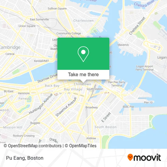
See Pu Eang, Boston, on the map
Public Transit to Pu Eang in Boston
Wondering how to get to Pu Eang in Boston? Moovit helps you find the best way to get to Pu Eang with step-by-step directions from the nearest public transit station.
Moovit provides free maps and live directions to help you navigate through your city. View schedules, routes, timetables, and find out how long does it take to get to Pu Eang in real time.
Looking for the nearest stop or station to Pu Eang? Check out this list of stops closest to your destination: Chinatown Gate; Boylston; Washington St @ Tufts Med Ctr; Chinatown; South Station - Summer St @ Surface Rd; Park Street; Chauncy St @ Summer St; Charles St S @ Park Plaza; Otis St @ Summer St; Tremont St @ Boylston Station.
Bus: 17, 504, 92, SL3, SL4, SL5, 501, 505, 11, 15, RED LINE SHUTTLE.Train: FRAMINGHAM/WORCESTER, LOWELL, NEEDHAM, NEWBURYPORT/ROCKPORT.Subway: GREEN LINE B, GREEN LINE D, ORANGE LINE, RED LINE, GREEN LINE C, GREEN LINE E.
Want to see if there’s another route that gets you there at an earlier time? Moovit helps you find alternative routes or times. Get directions from and directions to Pu Eang easily from the Moovit App or Website.
We make riding to Pu Eang easy, which is why over 1.7 million users, including users in Boston, trust Moovit as the best app for public transit. You don’t need to download an individual bus app or train app, Moovit is your all-in-one transit app that helps you find the best bus time or train time available.
For information on prices of bus, subway and train, costs and ride fares to Pu Eang, please check the Moovit app.
Use the app to navigate to popular places including to the airport, hospital, stadium, grocery store, mall, coffee shop, school, college, and university.
Pu Eang Address: Arizona, Phoenix street in Boston
- Q Restaurant USA,
- My Thai Vegan Cafe,
- Combat Zone,
- Le's Salon & Beauty (Les Salon Beauty),
- Tufts Medical Center MBTA Station - Orange & Silver Line,
- Jaho Coffee Roaster & Wine Bar,
- Royal Entertainment,
- Tufts Dental,
- Locks & Locksmith 24 Hrs (Locks and Locksmiths),
- Penang Malaysian Cuisine,
- MBTA-Chinatown,
- Happy Lamb Hot Pot,
- Chinatown Station MBTA,
- Phillips Square Tactical Plaza,
- Tupper Building (Tufts Medical Center),
- Department of Transitional Assistance (DTA) HQ,
- Fong Massage Therapy,
- Urban College Of Boston,
- Tufts University - Health Sciences Bookstore,
- Global Luxury Suites Downtown Boston
Places Near Pu Eang (Boston)
- Boston Medical Center, Boston,
- Leader Bank Pavilion (Leader Bank Pavillion), Boston,
- House Of Blues, Boston,
- Mgm Music Hall, Boston,
- Museum Of Science, Boston,
- Castle Island, Boston,
- Boston Convention & Exhibition Center, Boston,
- Isabella Stewart Gardner Museum, Boston,
- Td Garden, Boston,
- Wang Theater, Boston,
- Massachusetts General Hospital, Boston,
- Quincy Market, Boston,
- Boston Common, Boston,
- North End, Boston,
- Wilbur Theatre, Boston,
- Seaport District, Boston,
- Cheers, Boston,
- Faneuil Hall, Boston,
- Boston Children's Hospital, Boston,
- Prudential Center, Boston
How to get to popular places in Boston with public transit
Get around Boston by public transit!
Traveling around Boston has never been so easy. See step by step directions as you travel to any attraction, street or major public transit station. View bus and train schedules, arrival times, service alerts and detailed routes on a map, so you know exactly how to get to anywhere in Boston.
When traveling to any destination around Boston use Moovit's Live Directions with Get Off Notifications to know exactly where and how far to walk, how long to wait for your line, and how many stops are left. Moovit will alert you when it's time to get off — no need to constantly re-check whether yours is the next stop.
Wondering how to use public transit in Boston or how to pay for public transit in Boston? Moovit public transit app can help you navigate your way with public transit easily, and at minimum cost. It includes public transit fees, ticket prices, and costs. Looking for a map of Boston public transit lines? Moovit public transit app shows all public transit maps in Boston with all Bus, Train, Subway and Ferry routes and stops on an interactive map.
Boston has 4 transit type(s), including: Bus, Train, Subway and Ferry, operated by several transit agencies, including MBTA, Southeastern Regional Transit Authority, MetroWest Regional Transit Authority, Rhode Island Public Transit Authority, WRTA, Lowell Regional Transit Authority, Merrimack Valley Transit, Montachusett Regional Transit Authority, Cape Cod Regional Transit Authority, Brockton Area Transit Authority, Martha's Vineyard Transit Authority, the WAVE - Nantucket Regional Transit Authority, GATRA, Cape Ann Transportation Authority and Massport