Directions to Pub 6 Bar & Grill (New Bedford) with public transportation
The following transit lines have routes that pass near Pub 6 Bar & Grill
 Bus: 204, 221, 208.
- Train: FALL RIVER/NEW BEDFORD.
How to get to Pub 6 Bar & Grill by bus?
Click on the bus route to see step by step directions with maps, line arrival times and updated time schedules.
From Amazon Fulfillment Bos7, Fall River
104 minFrom Bristol Community College, Fall River
99 minFrom Walmart Fall River Supercenter, Fall River
111 minFrom Bedford Industrial Park, New Bedford
48 minFrom RMV New Bedford, New Bedford
46 minFrom B.M.C. Durfee High School, Fall River
97 minFrom Lizzy Borden House, Fall River
86 minFrom Charlton Memorial Hospital, Fall River
117 minFrom Mass Maritime Academy, Buzzards Bay
142 min
How to get to Pub 6 Bar & Grill by train?
Click on the train route to see step by step directions with maps, line arrival times and updated time schedules.
Bus stops near Pub 6 Bar & Grill in New Bedford
Train station near Pub 6 Bar & Grill in New Bedford
- Church Street, 25 min walk,VIEW
Bus lines to Pub 6 Bar & Grill in New Bedford
What are the closest stations to Pub 6 Bar & Grill?
The closest stations to Pub 6 Bar & Grill are:
- Ashley Blvd And Carlisle St is 736 yards away, 9 min walk.
- King's Highway Stop & Shop is 738 yards away, 9 min walk.
- Church Street is 2096 yards away, 25 min walk.
Which bus lines stop near Pub 6 Bar & Grill?
These bus lines stop near Pub 6 Bar & Grill: 204, 221.
Which train line stops near Pub 6 Bar & Grill?
FALL RIVER/NEW BEDFORD (#2011 | New Bedford)
What’s the nearest train station to Pub 6 Bar & Grill in New Bedford?
The nearest train station to Pub 6 Bar & Grill in New Bedford is Church Street. It’s a 25 min walk away.
What’s the nearest bus station to Pub 6 Bar & Grill in New Bedford?
The nearest bus stations to Pub 6 Bar & Grill in New Bedford are Ashley Blvd And Carlisle St and King's Highway Stop & Shop. The closest one is a 9 min walk away.
What time is the first train to Pub 6 Bar & Grill in New Bedford?
The FALL RIVER/NEW BEDFORD is the first train that goes to Pub 6 Bar & Grill in New Bedford. It stops nearby at 4:16 AM.
What time is the last train to Pub 6 Bar & Grill in New Bedford?
The FALL RIVER/NEW BEDFORD is the last train that goes to Pub 6 Bar & Grill in New Bedford. It stops nearby at 1:38 AM.
What time is the first bus to Pub 6 Bar & Grill in New Bedford?
The 204 is the first bus that goes to Pub 6 Bar & Grill in New Bedford. It stops nearby at 5:47 AM.
What time is the last bus to Pub 6 Bar & Grill in New Bedford?
The 204 is the last bus that goes to Pub 6 Bar & Grill in New Bedford. It stops nearby at 8:40 PM.
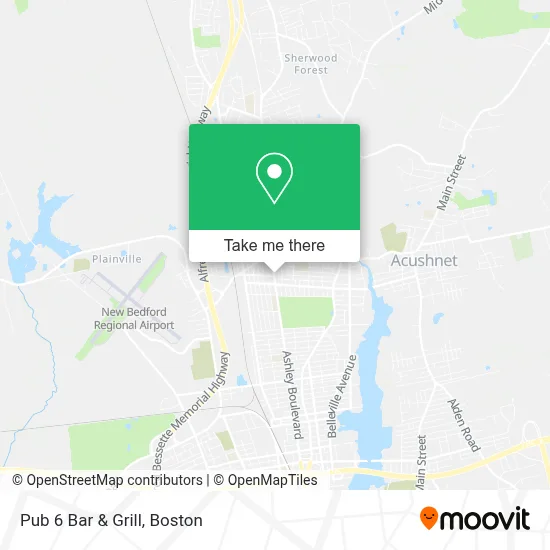
See Pub 6 Bar & Grill, New Bedford, on the map
Public Transit to Pub 6 Bar & Grill in New Bedford
Wondering how to get to Pub 6 Bar & Grill in New Bedford? Moovit helps you find the best way to get to Pub 6 Bar & Grill with step-by-step directions from the nearest public transit station.
Moovit provides free maps and live directions to help you navigate through your city. View schedules, routes, timetables, and find out how long does it take to get to Pub 6 Bar & Grill in real time.
Looking for the nearest stop or station to Pub 6 Bar & Grill? Check out this list of stops closest to your destination: Ashley Blvd And Carlisle St; King's Highway Stop & Shop; Church Street.
Bus: 204, 221, 208.Train: FALL RIVER/NEW BEDFORD.
Want to see if there’s another route that gets you there at an earlier time? Moovit helps you find alternative routes or times. Get directions from and directions to Pub 6 Bar & Grill easily from the Moovit App or Website.
We make riding to Pub 6 Bar & Grill easy, which is why over 1.7 million users, including users in New Bedford, trust Moovit as the best app for public transit. You don’t need to download an individual bus app or train app, Moovit is your all-in-one transit app that helps you find the best bus time or train time available.
For information on prices of bus and train, costs and ride fares to Pub 6 Bar & Grill, please check the Moovit app.
Use the app to navigate to popular places including to the airport, hospital, stadium, grocery store, mall, coffee shop, school, college, and university.
Pub 6 Bar & Grill Address: 736 Ashley Blvd street in New Bedford
- New England Auto Undercoating,
- Ashley Boulevard Market,
- Fancy Nail Salon,
- Haven Realty Co.,
- Lisa Bowman, Realtor,
- Jessica Roberts, Real Estate Agent,
- Cvs Store #00799,
- Cristina Pereira,
- Cvs Pharmacy,
- Station #3,
- Courtney Gomes, Realtor at Alferes Realty,
- Brandan Burke - Amaral & Associates Real Estate,
- Jenn And Nancy- Alferes Realty,
- Courtney Gomes, Realtor,
- Citizens Bank,
- Dunkin',
- Libertyx Bitcoin ATM,
- Cheryl's Labc,
- Style And Grace Beauty Bar,
- Wandering Brus
Places Near Pub 6 Bar & Grill (New Bedford)
- Isabella Stewart Gardner Museum, Boston,
- Mgm Music Hall, Boston,
- Wilbur Theatre, Boston,
- Boston Medical Center, Boston,
- Quincy Market, Boston,
- Leader Bank Pavilion (Leader Bank Pavillion), Boston,
- Cheers, Boston,
- Castle Island, Boston,
- House Of Blues, Boston,
- Wang Theater, Boston,
- Boston Children's Hospital, Boston,
- Seaport District, Boston,
- Faneuil Hall, Boston,
- Boston Convention & Exhibition Center, Boston,
- Massachusetts General Hospital, Boston,
- Prudential Center, Boston,
- North End, Boston,
- Td Garden, Boston,
- Museum Of Science, Boston,
- Boston Common, Boston
How to get to popular places in Boston with public transit
Get around New Bedford by public transit!
Traveling around New Bedford has never been so easy. See step by step directions as you travel to any attraction, street or major public transit station. View bus and train schedules, arrival times, service alerts and detailed routes on a map, so you know exactly how to get to anywhere in New Bedford.
When traveling to any destination around New Bedford use Moovit's Live Directions with Get Off Notifications to know exactly where and how far to walk, how long to wait for your line, and how many stops are left. Moovit will alert you when it's time to get off — no need to constantly re-check whether yours is the next stop.
Wondering how to use public transit in New Bedford or how to pay for public transit in New Bedford? Moovit public transit app can help you navigate your way with public transit easily, and at minimum cost. It includes public transit fees, ticket prices, and costs. Looking for a map of New Bedford public transit lines? Moovit public transit app shows all public transit maps in New Bedford with all Bus, Train, Subway and Ferry routes and stops on an interactive map.
Boston has 4 transit type(s), including: Bus, Train, Subway and Ferry, operated by several transit agencies, including MBTA, Southeastern Regional Transit Authority, MetroWest Regional Transit Authority, Rhode Island Public Transit Authority, WRTA, Lowell Regional Transit Authority, Merrimack Valley Transit, Montachusett Regional Transit Authority, Cape Cod Regional Transit Authority, Brockton Area Transit Authority, Martha's Vineyard Transit Authority, the WAVE - Nantucket Regional Transit Authority, GATRA, Cape Ann Transportation Authority and Massport