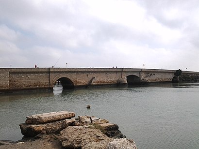
See Puente Zuazo, San Fernando, on the map
Directions to Puente Zuazo (San Fernando) with public transportation
The following transit lines have routes that pass near Puente Zuazo
 Bus:
Bus: - Train:
How to get to Puente Zuazo by bus?
Click on the bus route to see step by step directions with maps, line arrival times and updated time schedules.
How to get to Puente Zuazo by train?
Click on the train route to see step by step directions with maps, line arrival times and updated time schedules.
Bus stations near Puente Zuazo in San Fernando
- San Juan Bosco 2 (San Fernando),3 min walk,
- Avda. San Juan Bosco,3 min walk,
- Plaza Del Castillo,5 min walk,
- Plaza de Juan,5 min walk,
Train stations near Puente Zuazo in San Fernando
- Estación de Tren Tres Caminos,17 min walk,
- San Fernando Centro,47 min walk,
Bus lines to Puente Zuazo in San Fernando
- 1,Casería de Ossío,
- PLAYA CAMPOSOTO,Playa,
- M-011,Plaza de España,
- M-120,Río Iro,
- M-021,Cádiz-Cementerio Mancomunado,
- M-911,Cádiz-Conil-Barbate (Por La Barca/Por Los Caños),
- M-912,Cádiz-Conil-Atlanterra (Por Vejer/Por Los Caños),
- M-914,Cádiz-Conil-Caños De Meca,
- M-962,Chipiona-Sanlúcar De Barrameda-San Fernando (Por Puerto Real Y Hospital),
What are the closest stations to Puente Zuazo?
The closest stations to Puente Zuazo are:
- San Juan Bosco 2 (San Fernando) is 209 meters away, 3 min walk.
- Avda. San Juan Bosco is 210 meters away, 3 min walk.
- Plaza Del Castillo is 345 meters away, 5 min walk.
- Plaza de Juan is 372 meters away, 5 min walk.
- Estación de Tren Tres Caminos is 1285 meters away, 17 min walk.
- San Fernando Centro is 3692 meters away, 47 min walk.
Which bus lines stop near Puente Zuazo?
These bus lines stop near Puente Zuazo: 1, M-011, M-120, M-912.
Which train line stops near Puente Zuazo?
T1
What’s the nearest train station to Puente Zuazo in San Fernando?
The nearest train station to Puente Zuazo in San Fernando is Estación de Tren Tres Caminos. It’s a 17 min walk away.
What’s the nearest bus stop to Puente Zuazo in San Fernando?
The nearest bus stops to Puente Zuazo in San Fernando are San Juan Bosco 2 (San Fernando) and Avda. San Juan Bosco. The closest one is a 3 min walk away.
What time is the first train to Puente Zuazo in San Fernando?
The T1 is the first train that goes to Puente Zuazo in San Fernando. It stops nearby at 6:14 AM.
What time is the last train to Puente Zuazo in San Fernando?
The T1 is the last train that goes to Puente Zuazo in San Fernando. It stops nearby at 12:10 AM.
What time is the first bus to Puente Zuazo in San Fernando?
The M-011 is the first bus that goes to Puente Zuazo in San Fernando. It stops nearby at 6:00 AM.
What time is the last bus to Puente Zuazo in San Fernando?
The M-011 is the last bus that goes to Puente Zuazo in San Fernando. It stops nearby at 11:46 PM.
See Puente Zuazo, San Fernando, on the map
Public Transit to Puente Zuazo in San Fernando
Wondering how to get to Puente Zuazo in San Fernando, Spain? Moovit helps you find the best way to get to Puente Zuazo with step-by-step directions from the nearest public transit station.
Moovit provides free maps and live directions to help you navigate through your city. View schedules, routes, timetables, and find out how long does it take to get to Puente Zuazo in real time.
Looking for the nearest stop or station to Puente Zuazo? Check out this list of stops closest to your destination: San Juan Bosco 2 (San Fernando); Avda. San Juan Bosco; Plaza Del Castillo; Plaza de Juan; Estación de Tren Tres Caminos; San Fernando Centro.
Bus:Train:
Want to see if there’s another route that gets you there at an earlier time? Moovit helps you find alternative routes or times. Get directions from and directions to Puente Zuazo easily from the Moovit App or Website.
We make riding to Puente Zuazo easy, which is why over 1.5 million users, including users in San Fernando, trust Moovit as the best app for public transit. You don’t need to download an individual bus app or train app, Moovit is your all-in-one transit app that helps you find the best bus time or train time available.
For information on prices of bus and train, costs and ride fares to Puente Zuazo, please check the Moovit app.
Use the app to navigate to popular places including to the airport, hospital, stadium, grocery store, mall, coffee shop, school, college, and university.
Location: San Fernando, Bahia de Cadiz
Attractions near Puente Zuazo
Recinto Ferial,Aparcamiento Venta de Vargas,Venta de Vargas,Museo Camarón de La Isla,Plaza de Juan Vargas,Avenida del Cid 1,Ambulatorio Cayetano Roldán,Calle Montañeses de la Isla,Estación de Autobuses Socibus,Venta de Vargas,Marambay,Caf. Bazar Chino,Castillo de San Romualdo,Navantia S.a.,Panaderia y Pasteleria Santa Ana S L,Parada Principal De Autobuses San Fernando,Feria de San Fernando,Bar Bolerin,Plazoleta de Las Vacas,Farmacia RealHow to get to popular attractions in San Fernando with public transit
Urbanizacion El Pinar, Jerez De La Frontera,Plaza Jesús Nazareno, Cádiz,Zara, Cádiz,Playa del Rompidillo, Rota,Plaza de España, Cádiz,Rota, Rota,Urbanización Colomina-Pto. Príncipe, El Puerto De Santa María,Rotonda Reyes Catolicos, San Fernando,ILUNION Tartessus Sancti Petri, Chiclana De La Frontera,Barrio de Santa María, Cádiz,Puerto Deportivo de Rota, Rota,La Galeria Sala Club, Jerez De La Frontera,Alcampo, Sanlúcar De Barrameda,Poligono San benito, Jerez De La Frontera,Sancti Petri, Chiclana De La Frontera,Urbanizacion la Rosaleda, Chiclana De La Frontera,Chiringuito Las Dunas,Centro Comercial Area Sur, Jerez De La Frontera,Cafe Bar Nebraska, Cádiz,Cadiz, CádizGet around San Fernando by public transit!
Traveling around San Fernando has never been so easy. See step by step directions as you travel to any attraction, street or major public transit station. View bus and train schedules, arrival times, service alerts and detailed routes on a map, so you know exactly how to get to anywhere in San Fernando.
When traveling to any destination around San Fernando use Moovit's Live Directions with Get Off Notifications to know exactly where and how far to walk, how long to wait for your line, and how many stops are left. Moovit will alert you when it's time to get off — no need to constantly re-check whether yours is the next stop.
Wondering how to use public transit in San Fernando or how to pay for public transit in San Fernando? Moovit public transit app can help you navigate your way with public transit easily, and at minimum cost. It includes public transit fees, ticket prices, and costs. Looking for a map of San Fernando public transit lines? Moovit public transit app shows all public transit maps in San Fernando with all bus or train routes and stops on an interactive map.
San Fernando has 2 transit type(s), including: bus or train, operated by several transit agencies, including Renfe Cercanías, Red de Consorcios de Transporte de Andalucía, Líneas Urbanas de Cádiz, CMTBC - Chiclana (Urbanos), Autobuses Urbanos de el Puerto de Santa María, CMTBC - Rota (Urbanos), CMTBC - Puerto Real (Urbanos), CMTBC - Jerez (Urbanos), CMTBC - UTE VJA-089 (DAMAS), Jerez (Pedanías), CMTBC - Transportes Generales Comes S.A., UTE VJA-089 (DAMAS), Líneas Urbanas de San Fernando, CMTBC - Belizon y Rodriguez S.L., CMTBC - Sanlúcar (Urbanos) and CMTBC - Arcos (Urbanos)