How to get to Puesto de Chocolate y Churros by bus?
Click on the bus route to see step by step directions with maps, line arrival times and updated time schedules.
From Calle Utebo, 8, Madrid
55 minFrom Centro Comercial Zielo, Área Metropolitana De Madrid Y Corredor Del Henares
65 minFrom Cuatro Vientos, Madrid
73 minFrom ILUNION Pio XII, Madrid
33 minFrom Parquesur, Leganés
65 minFrom Hotel Marriott Madrid Auditorium, Madrid
43 minFrom Las Tablas, Área Metropolitana De Madrid Y Corredor Del Henares
74 minFrom Calle Quintanavides, Madrid
70 minFrom Calle General López Pozas 10, Madrid
47 minFrom C.C. Parquesur, Leganés
66 min
How to get to Puesto de Chocolate y Churros by train?
Click on the train route to see step by step directions with maps, line arrival times and updated time schedules.
From Calle Utebo, 8, Madrid
65 minFrom Centro Comercial Zielo, Área Metropolitana De Madrid Y Corredor Del Henares
70 minFrom ILUNION Pio XII, Madrid
63 minFrom Parquesur, Leganés
69 minFrom Calle Quintanavides, Madrid
77 minFrom Calle General López Pozas 10, Madrid
58 minFrom C.C. Parquesur, Leganés
70 min
How to get to Puesto de Chocolate y Churros by metro?
Click on the metro route to see step by step directions with maps, line arrival times and updated time schedules.
From Calle Utebo, 8, Madrid
31 minFrom Cuatro Vientos, Madrid
42 minFrom ILUNION Pio XII, Madrid
23 minFrom Parquesur, Leganés
50 minFrom Las Tablas, Área Metropolitana De Madrid Y Corredor Del Henares
43 minFrom Calle Quintanavides, Madrid
58 minFrom Calle General López Pozas 10, Madrid
28 minFrom C.C. Parquesur, Leganés
51 min
Bus stops near Puesto de Chocolate y Churros in Madrid
Metro station near Puesto de Chocolate y Churros in Madrid
- Sainz De Baranda, 1 min walk,VIEW
Bus lines to Puesto de Chocolate y Churros in Madrid
- 30, Avenida de Felipe II - Pavones,VIEW
- 56, Diego de Leon - Numancia,VIEW
- 143, Plaza de Manuel Becerra - Villa de Vallecas,VIEW
- 156, Plaza de Manuel Becerra - Plaza de Legazpi,VIEW
- N8, Plaza de Cibeles - Pavones,VIEW
- NC1, Cuatro Caminos - Estacion de Atocha,VIEW
- SC2, Cuatro Caminos - Legazpi,VIEW
- NC2, Cuatro Caminos - Estacion de Atocha,VIEW
- SC1, Cuatro Caminos - Legazpi,VIEW
- 2, Reina Victoria,VIEW
- 15, La Elipa,VIEW
- 215, Parque Roma,VIEW
What are the closest stations to Puesto de Chocolate y Churros?
The closest stations to Puesto de Chocolate y Churros are:
- Sainz De Baranda is 26 meters away, 1 min walk.
- Metro Sainz De Baranda is 87 meters away, 2 min walk.
Which bus lines stop near Puesto de Chocolate y Churros?
These bus lines stop near Puesto de Chocolate y Churros: 15, 156, 2, 203.
Which train lines stop near Puesto de Chocolate y Churros?
These train lines stop near Puesto de Chocolate y Churros: C10, C5, C7.
Which metro lines stop near Puesto de Chocolate y Churros?
These metro lines stop near Puesto de Chocolate y Churros: M-6, M-9.
What’s the nearest metro station to Puesto de Chocolate y Churros in Madrid?
The nearest metro station to Puesto de Chocolate y Churros in Madrid is Sainz De Baranda. It’s a 1 min walk away.
What’s the nearest bus station to Puesto de Chocolate y Churros in Madrid?
The nearest bus station to Puesto de Chocolate y Churros in Madrid is Sainz De Baranda. It’s a 1 min walk away.
What time is the first metro to Puesto de Chocolate y Churros in Madrid?
The M-6 is the first metro that goes to Puesto de Chocolate y Churros in Madrid. It stops nearby at 6:05 AM.
What time is the last metro to Puesto de Chocolate y Churros in Madrid?
The M-9 is the last metro that goes to Puesto de Chocolate y Churros in Madrid. It stops nearby at 2:00 AM.
What time is the first bus to Puesto de Chocolate y Churros in Madrid?
The 2 is the first bus that goes to Puesto de Chocolate y Churros in Madrid. It stops nearby at 7:04 AM.
What time is the last bus to Puesto de Chocolate y Churros in Madrid?
The N8 is the last bus that goes to Puesto de Chocolate y Churros in Madrid. It stops nearby at 3:18 AM.
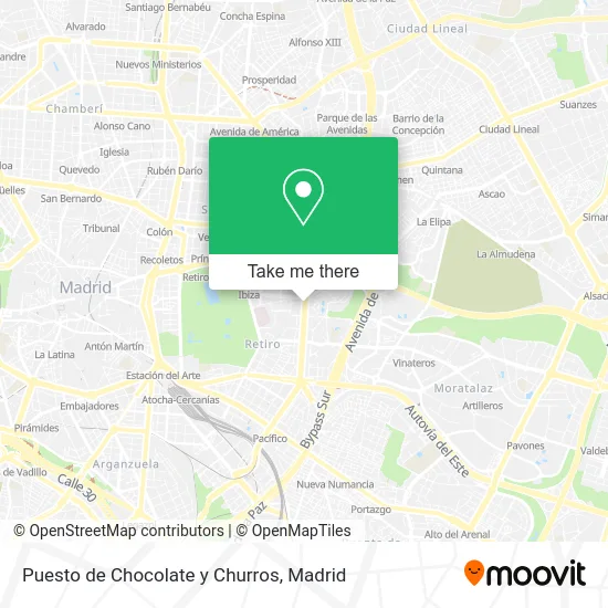
See Puesto de Chocolate y Churros, Madrid, on the map
Public Transit to Puesto de Chocolate y Churros in Madrid
Wondering how to get to Puesto de Chocolate y Churros in Madrid? Moovit helps you find the best way to get to Puesto de Chocolate y Churros with step-by-step directions from the nearest public transit station.
Moovit provides free maps and live directions to help you navigate through your city. View schedules, routes, timetables, and find out how long does it take to get to Puesto de Chocolate y Churros in real time.
Looking for the nearest stop or station to Puesto de Chocolate y Churros? Check out this list of stops closest to your destination: Sainz De Baranda; Metro Sainz De Baranda.
Bus: 15, 156, 2, 203, 30, 56, 143, N8, NC2, SC1, 215.Train: C10, C5, C7.Metro: M-6, M-9.
Want to see if there’s another route that gets you there at an earlier time? Moovit helps you find alternative routes or times. Get directions from and directions to Puesto de Chocolate y Churros easily from the Moovit App or Website.
We make riding to Puesto de Chocolate y Churros easy, which is why over 1.5 million users, including users in Madrid, trust Moovit as the best app for public transit. You don’t need to download an individual bus app or train app, Moovit is your all-in-one transit app that helps you find the best bus time or train time available.
For information on prices of metro, bus and train, costs and ride fares to Puesto de Chocolate y Churros, please check the Moovit app.
Use the app to navigate to popular places including to the airport, hospital, stadium, grocery store, mall, coffee shop, school, college, and university.
Puesto de Chocolate y Churros Address: Plaza de Manuel Becerra street in Madrid
- Dr. Esquerdo - Sainz de Baranda,
- Calle del Doctor Esquerdo 101,
- Parada autobús 4712,
- Calle del Doctor Esquerdo / Calle Alcalde Sainz de Baranda,
- Parroquia De San Estanislao De Kostka,
- Estación de Sáinz de Baranda,
- PEUGEOT PSA Retail Madrid-Dr. Esquerdo,
- Sainz de Baranda - Dr. Esquerdo,
- 10A,
- Doctor Esquerdo 105,
- Luís Juan Carranza Sánchez,
- Calle Doctor Esquerdo,
- Banco Sabadell,
- Clinica Retiro II,
- Calle Alcalde Sainz de Baranda, 54,
- Farmacia - Calle Doctor Esquerdo 89,
- Calle de José Martinez de Velasco,
- Piscina M86,
- Cash Converters,
- Colegio Fuhem Montserrat
Places Near Puesto de Chocolate y Churros (Madrid)
- Centro Comercial Oasiz Madrid, Área Metropolitana De Madrid Y Corredor Del Henares,
- Tres Aguas, Alcorcón,
- Nassica, Área Metropolitana De Madrid Y Corredor Del Henares,
- Hospital Universitario La Paz, Madrid,
- Plenilunio, Área Metropolitana De Madrid Y Corredor Del Henares,
- Rastro De Madrid, Área Metropolitana De Madrid Y Corredor Del Henares,
- Estadio Wanda Metropolitano, Área Metropolitana De Madrid Y Corredor Del Henares,
- Hospital Clínico Universitario San Carlos, Madrid,
- Wizink Center, Madrid,
- Calle de López de Hoyos 169, Madrid,
- Centro Comercial La Vaguada, Área Metropolitana De Madrid Y Corredor Del Henares,
- Mendez Alvaro, Madrid,
- Sala La Riviera, Madrid,
- Plaza Mayor, Madrid,
- Centro Comercial La Gavia, Área Metropolitana De Madrid Y Corredor Del Henares,
- Mercadillo de Majadahonda, Majadahonda,
- Palacio De Vistalegre, Área Metropolitana De Madrid Y Corredor Del Henares,
- Estacion de Chamartin, Madrid,
- Centro Comercial Islazul, Área Metropolitana De Madrid Y Corredor Del Henares,
- Hospital Universitario Ramón y Cajal, Madrid
How to get to popular places in Madrid with public transit
Get around Madrid by public transit!
Traveling around Madrid has never been so easy. See step by step directions as you travel to any attraction, street or major public transit station. View bus and train schedules, arrival times, service alerts and detailed routes on a map, so you know exactly how to get to anywhere in Madrid.
When traveling to any destination around Madrid use Moovit's Live Directions with Get Off Notifications to know exactly where and how far to walk, how long to wait for your line, and how many stops are left. Moovit will alert you when it's time to get off — no need to constantly re-check whether yours is the next stop.
Wondering how to use public transit in Madrid or how to pay for public transit in Madrid? Moovit public transit app can help you navigate your way with public transit easily, and at minimum cost. It includes public transit fees, ticket prices, and costs. Looking for a map of Madrid public transit lines? Moovit public transit app shows all public transit maps in Madrid with all Bus, Train, Metro and Light Rail routes and stops on an interactive map.
Madrid has 4 transit type(s), including: Bus, Train, Metro and Light Rail, operated by several transit agencies, including Metro de Madrid, Metro Ligero, Tranvía de Parla, Renfe Cercanías - Servicios de Autobús especiales, Renfe Cercanias, Renfe Cercanías, EMT, Interurbanos, Urbanos de Alcalá de Henares, Urbanos de Alcobendas, Urbanos de Alcorcón, Urbanos de Algete, Urbanos de Aranjuez, Urbanos de Arganda del Rey and Urbanos de Arroyomolinos