See Punta della Dogana, Venezia, on the map
Directions to Punta della Dogana (Venezia) with public transportation
The following transit lines have routes that pass near Punta della Dogana
 Ferry:
Ferry stations near Punta della Dogana in Venezia
- Sacca Fisola "A",5 min walk,
- Sacca Fisola "B",6 min walk,
- Giudecca Hilton,11 min walk,
What are the closest stations to Punta della Dogana?
The closest stations to Punta della Dogana are:
- Sacca Fisola "A" is 376 meters away, 5 min walk.
- Sacca Fisola "B" is 438 meters away, 6 min walk.
- Giudecca Hilton is 786 meters away, 11 min walk.
Which ferry lines stop near Punta della Dogana?
These ferry lines stop near Punta della Dogana: 2, 4.1, 4.2.
What’s the nearest ferry station to Punta della Dogana in Venezia?
The nearest ferry station to Punta della Dogana in Venezia is Sacca Fisola "A". It’s a 5 min walk away.
What time is the first ferry to Punta della Dogana in Venezia?
The N is the first ferry that goes to Punta della Dogana in Venezia. It stops nearby at 3:06 AM.
What time is the last ferry to Punta della Dogana in Venezia?
The N is the last ferry that goes to Punta della Dogana in Venezia. It stops nearby at 3:06 AM.
See Punta della Dogana, Venezia, on the map
Public Transit to Punta della Dogana in Venezia
Wondering how to get to Punta della Dogana in Venezia, Italy? Moovit helps you find the best way to get to Punta della Dogana with step-by-step directions from the nearest public transit station.
Moovit provides free maps and live directions to help you navigate through your city. View schedules, routes, timetables, and find out how long does it take to get to Punta della Dogana in real time.
Looking for the nearest stop or station to Punta della Dogana? Check out this list of stops closest to your destination: Sacca Fisola "A"; Sacca Fisola "B"; Giudecca Hilton.
Ferry:
Want to see if there’s another route that gets you there at an earlier time? Moovit helps you find alternative routes or times. Get directions from and directions to Punta della Dogana easily from the Moovit App or Website.
We make riding to Punta della Dogana easy, which is why over 1.5 million users, including users in Venezia, trust Moovit as the best app for public transit. You don’t need to download an individual bus app or train app, Moovit is your all-in-one transit app that helps you find the best bus time or train time available.
For information on prices of ferry and bus, costs and ride fares to Punta della Dogana, please check the Moovit app.
Use the app to navigate to popular places including to the airport, hospital, stadium, grocery store, mall, coffee shop, school, college, and university.
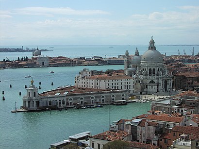
Punta della Dogana Address: Dorsoduro, 2 street in Venezia
Attractions near Punta della Dogana
Rio De Sacca Fisola,Ristorante ai Campi Sportivi,Campo San Gerardo,Parrocchia San Gerardo Sagredo,Piscina Sacca Fisola,Amazon Counter-la Cantinetta,Centro Sportivo San Biagio - Piscina Amedeo Chimisso,Costantini Gianluca,La Cantinetta Sas di Menin Giancarlo,Il Cerchio Società Cooperativa Sociale a Responsabilità Limitata,Calle del Bisato,Il Cerchio Soc Coop Sociale Onlus,Sacca Fisola,Tagliapietra Matteo,Calle del Teatro in Saca 1, Sacca Fisola,Campo Calcio Sacca Fisola,Samuel Palmari,Calle dei Figheri, 8,Bar Da Anna Sacca Fisola,Veritas - Sacca FisolaHow to get to popular attractions in Venezia with public transit
Foresteria Fondazione Levi Hotel, Venezia,Carpenedo, Venezia,Imbarcadero ACTV - Sacca Fisola,Centro Commerciale Valecenter, Marcon,Cipressina, Venezia,Sme Marghera, Venezia,Piazzale Roma, Venezia,Gazzera, Venezia,ACTV Capolinea 7/Mirano, Venezia,Sant'Angelo, Venezia,Salute,Giardini Della Biennale, Venezia,Sala Darsena, Venezia,Concordia Sagittaria, Concordia Sagittaria,Hotel Ariston, Venezia,Piazzale Rossarol, Venezia,Lido, Venezia,Supermercato Lando Noale, Noale,Piscine del Parco della Bissuola, Venezia,San Marco Vallaresso, VeneziaGet around Venezia by public transit!
Traveling around Venezia has never been so easy. See step by step directions as you travel to any attraction, street or major public transit station. View bus and train schedules, arrival times, service alerts and detailed routes on a map, so you know exactly how to get to anywhere in Venezia.
When traveling to any destination around Venezia use Moovit's Live Directions with Get Off Notifications to know exactly where and how far to walk, how long to wait for your line, and how many stops are left. Moovit will alert you when it's time to get off — no need to constantly re-check whether yours is the next stop.
Wondering how to use public transit in Venezia or how to pay for public transit in Venezia? Moovit public transit app can help you navigate your way with public transit easily, and at minimum cost. It includes public transit fees, ticket prices, and costs. Looking for a map of Venezia public transit lines? Moovit public transit app shows all public transit maps in Venezia with all ferry or bus routes and stops on an interactive map.
Venezia has 2 transit type(s), including: ferry or bus, operated by several transit agencies, including ACTV, ACTV, ACTV, Alilaguna S.p.A., Mobilità di Marca, ATVO, Trenitalia and Sistemi Territoriali