Directions to Purespace Junk Removal (Boston) with public transportation
The following transit lines have routes that pass near Purespace Junk Removal
 Bus: 22.
How to get to Purespace Junk Removal by bus?
Click on the bus route to see step by step directions with maps, line arrival times and updated time schedules.
Bus stop near Purespace Junk Removal in Boston
- Pontiac Opposite Holburn, 4 min walk,VIEW
Bus lines to Purespace Junk Removal in Boston
- 22, Ccri Warwick Via Pontiac Ave,VIEW
What are the closest stations to Purespace Junk Removal?
The closest stations to Purespace Junk Removal are:
- Pontiac Opposite Holburn is 337 yards away, 4 min walk.
Which bus line stops near Purespace Junk Removal?
22 (Ccri Warwick Via Pontiac Ave)
What’s the nearest bus station to Purespace Junk Removal in Boston?
The nearest bus station to Purespace Junk Removal in Boston is Pontiac Opposite Holburn. It’s a 4 min walk away.
What time is the first bus to Purespace Junk Removal in Boston?
The 22 is the first bus that goes to Purespace Junk Removal in Boston. It stops nearby at 6:37 AM.
What time is the last bus to Purespace Junk Removal in Boston?
The 22 is the last bus that goes to Purespace Junk Removal in Boston. It stops nearby at 10:00 PM.
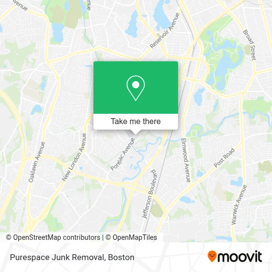
See Purespace Junk Removal, Boston, on the map
Public Transit to Purespace Junk Removal in Boston
Wondering how to get to Purespace Junk Removal in Boston? Moovit helps you find the best way to get to Purespace Junk Removal with step-by-step directions from the nearest public transit station.
Moovit provides free maps and live directions to help you navigate through your city. View schedules, routes, timetables, and find out how long does it take to get to Purespace Junk Removal in real time.
Looking for the nearest stop or station to Purespace Junk Removal? Check out this list of stops closest to your destination: Pontiac Opposite Holburn.
Bus: 22.
Want to see if there’s another route that gets you there at an earlier time? Moovit helps you find alternative routes or times. Get directions from and directions to Purespace Junk Removal easily from the Moovit App or Website.
We make riding to Purespace Junk Removal easy, which is why over 1.7 million users, including users in Boston, trust Moovit as the best app for public transit. You don’t need to download an individual bus app or train app, Moovit is your all-in-one transit app that helps you find the best bus time or train time available.
For information on prices of bus and train, costs and ride fares to Purespace Junk Removal, please check the Moovit app.
Use the app to navigate to popular places including to the airport, hospital, stadium, grocery store, mall, coffee shop, school, college, and university.
Purespace Junk Removal Address: 20 hamilton road street in Boston
- Ri Homes for Sale,
- J&S Auto Repair,
- Sciolto Vito L Attorney,
- Skin Care by Andi,
- For Curious Collectors,
- Eden Park Properties,
- Flagstar Bank,
- The Arnold Group,
- Fima Investments,
- Ana-Lia S Fine Consignment,
- Hartman Electrical Services,
- We Learn Women Expanding,
- Spectral,
- Manuel Carvalho,
- Gentry Moving,
- Cranston Locksmith PRO Locksmith,
- Learning Blossoms,
- Pocasset,
- Smoke X,
- Paynes Harbor View Inn
Places Near Purespace Junk Removal (Boston)
- Boston Common, Boston,
- Boston Medical Center, Boston,
- Td Garden, Boston,
- Seaport District, Boston,
- Massachusetts General Hospital, Boston,
- Castle Island, Boston,
- Museum Of Science, Boston,
- Boston Children's Hospital, Boston,
- Wilbur Theatre, Boston,
- Quincy Market, Boston,
- Cheers, Boston,
- House Of Blues, Boston,
- Wang Theater, Boston,
- Leader Bank Pavilion (Leader Bank Pavillion), Boston,
- Mgm Music Hall, Boston,
- Prudential Center, Boston,
- Isabella Stewart Gardner Museum, Boston,
- North End, Boston,
- Faneuil Hall, Boston,
- Boston Convention & Exhibition Center, Boston
How to get to popular places in Boston with public transit
Get around Boston by public transit!
Traveling around Boston has never been so easy. See step by step directions as you travel to any attraction, street or major public transit station. View bus and train schedules, arrival times, service alerts and detailed routes on a map, so you know exactly how to get to anywhere in Boston.
When traveling to any destination around Boston use Moovit's Live Directions with Get Off Notifications to know exactly where and how far to walk, how long to wait for your line, and how many stops are left. Moovit will alert you when it's time to get off — no need to constantly re-check whether yours is the next stop.
Wondering how to use public transit in Boston or how to pay for public transit in Boston? Moovit public transit app can help you navigate your way with public transit easily, and at minimum cost. It includes public transit fees, ticket prices, and costs. Looking for a map of Boston public transit lines? Moovit public transit app shows all public transit maps in Boston with all Bus, Train, Subway and Ferry routes and stops on an interactive map.
Boston has 4 transit type(s), including: Bus, Train, Subway and Ferry, operated by several transit agencies, including MBTA, Southeastern Regional Transit Authority, MetroWest Regional Transit Authority, Rhode Island Public Transit Authority, WRTA, Lowell Regional Transit Authority, Merrimack Valley Transit, Montachusett Regional Transit Authority, Cape Cod Regional Transit Authority, Brockton Area Transit Authority, Martha's Vineyard Transit Authority, the WAVE - Nantucket Regional Transit Authority, GATRA, Cape Ann Transportation Authority and Massport