Directions to Purple (Somerville) with public transportation
The following transit lines have routes that pass near Purple
 Bus: 85, 90, 89, 101, 89/93.
- Subway: ORANGE LINE, GREEN LINE B, GREEN LINE C, GREEN LINE E.
How to get to Purple by bus?
Click on the bus route to see step by step directions with maps, line arrival times and updated time schedules.
From Forest Hills Station MBTA, Boston
78 minFrom World Trade Center, Boston
58 minFrom Lemuel Shattuck Hospital, Boston
89 minFrom Showa Boston Institute, Boston
106 minFrom Mount Auburn, Cambridge
49 minFrom The Lenox Hotel - Boston, Boston
72 minFrom Courtyard Boston Downtown / Tremont, Boston
55 minFrom Dorchester, Boston
96 minFrom Residence Inn by Marriott Boston Downtown/South End, Boston
61 minFrom Franklin Park Zoo, Boston
93 min
How to get to Purple by subway?
Click on the subway route to see step by step directions with maps, line arrival times and updated time schedules.
From Forest Hills Station MBTA, Boston
33 minFrom World Trade Center, Boston
40 minFrom Lemuel Shattuck Hospital, Boston
49 minFrom The Lenox Hotel - Boston, Boston
29 minFrom Courtyard Boston Downtown / Tremont, Boston
24 minFrom Dorchester, Boston
48 minFrom Residence Inn by Marriott Boston Downtown/South End, Boston
37 minFrom Franklin Park Zoo, Boston
57 min
Bus stops near Purple in Somerville
Bus lines to Purple in Somerville
What are the closest stations to Purple?
The closest stations to Purple are:
- Gilman Square is 141 yards away, 2 min walk.
- Broadway @ Cross St is 245 yards away, 3 min walk.
- Grand Union Blvd @ Foley St is 252 yards away, 4 min walk.
- Wellington is 382 yards away, 5 min walk.
- Mystic Ave @ Temple Rd is 474 yards away, 6 min walk.
- Gateway Center @ Target is 3577 yards away, 42 min walk.
Which bus lines stop near Purple?
These bus lines stop near Purple: 85, 90.
Which subway line stops near Purple?
ORANGE LINE (Oak Grove)
What’s the nearest subway station to Purple in Somerville?
The nearest subway station to Purple in Somerville is Gilman Square. It’s a 2 min walk away.
What’s the nearest bus station to Purple in Somerville?
The nearest bus station to Purple in Somerville is Broadway @ Cross St. It’s a 3 min walk away.
What time is the first subway to Purple in Somerville?
The GREEN LINE E is the first subway that goes to Purple in Somerville. It stops nearby at 4:49 AM.
What time is the last subway to Purple in Somerville?
The GREEN LINE E is the last subway that goes to Purple in Somerville. It stops nearby at 2:36 AM.
What time is the first bus to Purple in Somerville?
The 89/93 is the first bus that goes to Purple in Somerville. It stops nearby at 4:42 AM.
What time is the last bus to Purple in Somerville?
The 89 is the last bus that goes to Purple in Somerville. It stops nearby at 1:48 AM.
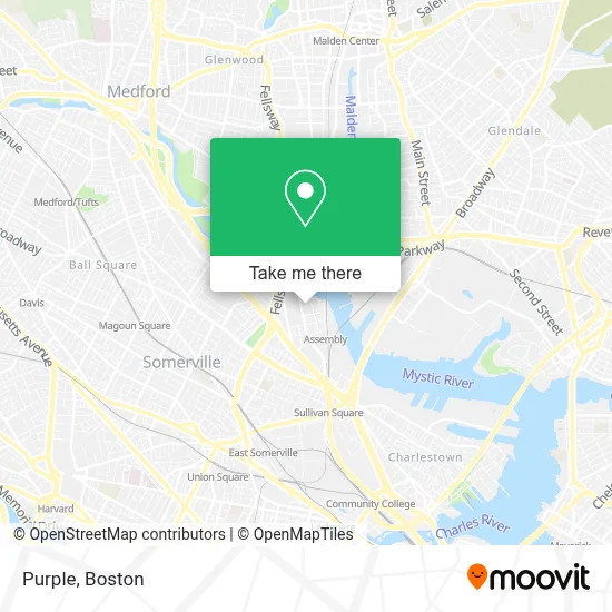
See Purple, Somerville, on the map
Public Transit to Purple in Somerville
Wondering how to get to Purple in Somerville? Moovit helps you find the best way to get to Purple with step-by-step directions from the nearest public transit station.
Moovit provides free maps and live directions to help you navigate through your city. View schedules, routes, timetables, and find out how long does it take to get to Purple in real time.
Looking for the nearest stop or station to Purple? Check out this list of stops closest to your destination: Gilman Square; Broadway @ Cross St; Grand Union Blvd @ Foley St; Wellington; Mystic Ave @ Temple Rd; Gateway Center @ Target.
Bus: 85, 90, 89, 101, 89/93, ORANGE LINE SHUTTLE, ORANGE LINE SHUTTLE, 95, 97, 99.Subway: ORANGE LINE, GREEN LINE B, GREEN LINE C, GREEN LINE E.
Want to see if there’s another route that gets you there at an earlier time? Moovit helps you find alternative routes or times. Get directions from and directions to Purple easily from the Moovit App or Website.
We make riding to Purple easy, which is why over 1.7 million users, including users in Somerville, trust Moovit as the best app for public transit. You don’t need to download an individual bus app or train app, Moovit is your all-in-one transit app that helps you find the best bus time or train time available.
For information on prices of bus and subway, costs and ride fares to Purple, please check the Moovit app.
Use the app to navigate to popular places including to the airport, hospital, stadium, grocery store, mall, coffee shop, school, college, and university.
Purple Address: 330 Artisan Way street in Somerville
- Assembly Square Marketplace,
- Samsonite,
- Nike Factory Store,
- Converse Outlet,
- Legal Sea Foods ,
- LEGOLAND Discovery Center Boston,
- Assembly Row / Artisan Way,
- Legoland Discovery Center,
- Artisan West Garage,
- Saks Off 5th,
- AMC Assembly Row Parking Garage,
- Saks Fifth Avenue,
- Assembly Row Waterfront Trail,
- Amc Assembly Row 12,
- Yogasix Assembly Row,
- Assembly Row / Canal St,
- EvGateway,
- Athleta,
- Salt + Stone,
- Lets Party Together LL
Places Near Purple (Somerville)
- Wang Theater, Boston,
- Museum Of Science, Boston,
- Massachusetts General Hospital, Boston,
- Isabella Stewart Gardner Museum, Boston,
- Seaport District, Boston,
- Boston Common, Boston,
- Wilbur Theatre, Boston,
- Boston Medical Center, Boston,
- Td Garden, Boston,
- House Of Blues, Boston,
- Boston Convention & Exhibition Center, Boston,
- Leader Bank Pavilion (Leader Bank Pavillion), Boston,
- North End, Boston,
- Castle Island, Boston,
- Cheers, Boston,
- Prudential Center, Boston,
- Mgm Music Hall, Boston,
- Faneuil Hall, Boston,
- Quincy Market, Boston,
- Boston Children's Hospital, Boston
How to get to popular places in Boston with public transit
Get around Somerville by public transit!
Traveling around Somerville has never been so easy. See step by step directions as you travel to any attraction, street or major public transit station. View bus and train schedules, arrival times, service alerts and detailed routes on a map, so you know exactly how to get to anywhere in Somerville.
When traveling to any destination around Somerville use Moovit's Live Directions with Get Off Notifications to know exactly where and how far to walk, how long to wait for your line, and how many stops are left. Moovit will alert you when it's time to get off — no need to constantly re-check whether yours is the next stop.
Wondering how to use public transit in Somerville or how to pay for public transit in Somerville? Moovit public transit app can help you navigate your way with public transit easily, and at minimum cost. It includes public transit fees, ticket prices, and costs. Looking for a map of Somerville public transit lines? Moovit public transit app shows all public transit maps in Somerville with all Bus, Train, Subway and Ferry routes and stops on an interactive map.
Boston has 4 transit type(s), including: Bus, Train, Subway and Ferry, operated by several transit agencies, including MBTA, Southeastern Regional Transit Authority, MetroWest Regional Transit Authority, Rhode Island Public Transit Authority, WRTA, Lowell Regional Transit Authority, Merrimack Valley Transit, Montachusett Regional Transit Authority, Cape Cod Regional Transit Authority, Brockton Area Transit Authority, Martha's Vineyard Transit Authority, the WAVE - Nantucket Regional Transit Authority, GATRA, Cape Ann Transportation Authority and Massport