Directions to Putnam Club (Boston) with public transportation
The following transit lines have routes that pass near Putnam Club
 Bus: 4, 426, 43, 450, EZRIDE.
- Train: FAIRMOUNT, FRAMINGHAM/WORCESTER, KINGSTON.
- Subway: GREEN LINE D, ORANGE LINE, HAVERHILL LINE SHUTTLE, HAVERHILL LINE SHUTTLE, LOWELL LINE SHUTTLE.
- Ferry: LOVEJOY - FAN PIER - PIER 10.
How to get to Putnam Club by bus?
Click on the bus route to see step by step directions with maps, line arrival times and updated time schedules.
From Staybridge Suites Boston-Quincy, Quincy
125 minFrom Wollaston Beach, Quincy
142 minFrom Comfort Inn & Suites Logan International Airport, Revere
38 minFrom Suffolk Downs, Boston
44 minFrom Saugus, MA, Saugus
51 minFrom Uphams Corner, Boston
69 minFrom Watertown Mall, Watertown Town
68 minFrom FOUR POINTS BY SHERATON Boston Newton, Newton
50 minFrom Regina Pizzeria, Boston
58 minFrom Lower Mills, Boston
108 min
How to get to Putnam Club by train?
Click on the train route to see step by step directions with maps, line arrival times and updated time schedules.
How to get to Putnam Club by subway?
Click on the subway route to see step by step directions with maps, line arrival times and updated time schedules.
Bus stops near Putnam Club in Boston
- Sudbury St @ Congress St - Haymarket Sta, 2 min walk,VIEW
- North Station - Nashua St @ Red Auerbach Way, 2 min walk,VIEW
- North Station, 4 min walk,VIEW
- North Station - Haverhill St @ Causeway St, 4 min walk,VIEW
- N Washington St @ Cooper St, 5 min walk,VIEW
- Portland St @ Causeway St, 5 min walk,VIEW
- N Washington St @ Medford St, 6 min walk,VIEW
Subway station near Putnam Club in Boston
- Causeway St (East), 5 min walk,VIEW
Ferry station near Putnam Club in Boston
- North Station (Lovejoy Wharf), 17 min walk,VIEW
Bus lines to Putnam Club in Boston
- 354, Burlington (Express) Via Woburn,VIEW
- RED LINE SHUTTLE, Jfk/Umass (Shuttle),VIEW
- GREEN LINE E SHUTTLE, Government Center - Medford/Tufts (Shuttle),VIEW
- GREEN LINE E SHUTTLE, North Station - Medford/Tufts (Shuttle),VIEW
- GREEN LINE E SHUTTLE, Medford/Tufts - North Station,VIEW
- GREEN LINE SHUTTLE, Union Square - North Station,VIEW
- GREEN LINE SHUTTLE, Medford/Tufts - Government Center via Union Square,VIEW
- GREEN LINE SHUTTLE, Lechmere - North Station,VIEW
- GREEN LINE SHUTTLE, North Station - Sullivan Square via East Somerville,VIEW
- GREEN LINE SHUTTLE, Union Square - Government Center,VIEW
- EZRIDE, Inbound To North Station From Erie St,VIEW
- EZRIDE, Outbound North Station To Erie St Via Lechmere And Kendall,VIEW
- EZRIDE, Outbound To Erie St From North Station,VIEW
- EZRIDE, Inbound To North Station Via Kendall And Lechmere,VIEW
- GREEN LINE SHUTTLE, North Station (Shuttle),VIEW
- ORANGE LINE SHUTTLE, North Station (Local Shuttle),VIEW
- ORANGE LINE SHUTTLE, Oak Grove (Express Shuttle),VIEW
- ORANGE LINE SHUTTLE, Oak Grove (Local Shuttle),VIEW
- ORANGE LINE SHUTTLE, Wellington (Express Shuttle),VIEW
- 92, Sullivan,VIEW
What are the closest stations to Putnam Club?
The closest stations to Putnam Club are:
- Sudbury St @ Congress St - Haymarket Sta is 90 yards away, 2 min walk.
- North Station - Nashua St @ Red Auerbach Way is 118 yards away, 2 min walk.
- North Station is 247 yards away, 4 min walk.
- North Station - Haverhill St @ Causeway St is 285 yards away, 4 min walk.
- N Washington St @ Cooper St is 341 yards away, 5 min walk.
- Portland St @ Causeway St is 363 yards away, 5 min walk.
- Causeway St (East) is 371 yards away, 5 min walk.
- N Washington St @ Medford St is 458 yards away, 6 min walk.
- North Station (Lovejoy Wharf) is 1379 yards away, 17 min walk.
Which bus lines stop near Putnam Club?
These bus lines stop near Putnam Club: 4, 426, 43, 450, EZRIDE, SL5.
Which train lines stop near Putnam Club?
These train lines stop near Putnam Club: FAIRMOUNT, FRAMINGHAM/WORCESTER, KINGSTON.
Which subway lines stop near Putnam Club?
These subway lines stop near Putnam Club: GREEN LINE D, ORANGE LINE.
What’s the nearest subway station to Putnam Club in Boston?
The nearest subway station to Putnam Club in Boston is Causeway St (East). It’s a 5 min walk away.
What’s the nearest bus station to Putnam Club in Boston?
The nearest bus stations to Putnam Club in Boston are Sudbury St @ Congress St - Haymarket Sta and North Station - Nashua St @ Red Auerbach Way. The closest one is a 2 min walk away.
What’s the nearest ferry station to Putnam Club in Boston?
The nearest ferry station to Putnam Club in Boston is North Station (Lovejoy Wharf). It’s a 17 min walk away.
What time is the first subway to Putnam Club in Boston?
The GREEN LINE E is the first subway that goes to Putnam Club in Boston. It stops nearby at 4:57 AM.
What time is the last subway to Putnam Club in Boston?
The GREEN LINE E is the last subway that goes to Putnam Club in Boston. It stops nearby at 2:28 AM.
What time is the first bus to Putnam Club in Boston?
The 111 is the first bus that goes to Putnam Club in Boston. It stops nearby at 4:49 AM.
What time is the last bus to Putnam Club in Boston?
The 111 is the last bus that goes to Putnam Club in Boston. It stops nearby at 2:16 AM.
What time is the first ferry to Putnam Club in Boston?
The LOVEJOY - FAN PIER - PIER 10 is the first ferry that goes to Putnam Club in Boston. It stops nearby at 6:20 AM.
What time is the last ferry to Putnam Club in Boston?
The LOVEJOY - FAN PIER - PIER 10 is the last ferry that goes to Putnam Club in Boston. It stops nearby at 7:35 PM.
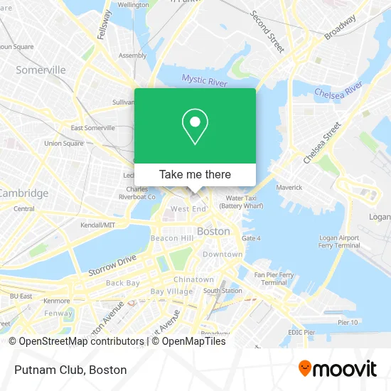
See Putnam Club, Boston, on the map
Public Transit to Putnam Club in Boston
Wondering how to get to Putnam Club in Boston? Moovit helps you find the best way to get to Putnam Club with step-by-step directions from the nearest public transit station.
Moovit provides free maps and live directions to help you navigate through your city. View schedules, routes, timetables, and find out how long does it take to get to Putnam Club in real time.
Looking for the nearest stop or station to Putnam Club? Check out this list of stops closest to your destination: Sudbury St @ Congress St - Haymarket Sta; North Station - Nashua St @ Red Auerbach Way; North Station; North Station - Haverhill St @ Causeway St; N Washington St @ Cooper St; Portland St @ Causeway St; Causeway St (East); N Washington St @ Medford St; North Station (Lovejoy Wharf).
Bus: 4, 426, 43, 450, EZRIDE, SL5, 354, RED LINE SHUTTLE, GREEN LINE E SHUTTLE, GREEN LINE E SHUTTLE, GREEN LINE E SHUTTLE, GREEN LINE SHUTTLE, GREEN LINE SHUTTLE, GREEN LINE SHUTTLE, ORANGE LINE SHUTTLE, ORANGE LINE SHUTTLE, ORANGE LINE SHUTTLE, ORANGE LINE SHUTTLE.Train: FAIRMOUNT, FRAMINGHAM/WORCESTER, KINGSTON.Subway: GREEN LINE D, ORANGE LINE, HAVERHILL LINE SHUTTLE, HAVERHILL LINE SHUTTLE, LOWELL LINE SHUTTLE, LOWELL LINE SHUTTLE, NEWBURYPORT/ROCKPORT LINE SHUTTLE.Ferry: LOVEJOY - FAN PIER - PIER 10.
Want to see if there’s another route that gets you there at an earlier time? Moovit helps you find alternative routes or times. Get directions from and directions to Putnam Club easily from the Moovit App or Website.
We make riding to Putnam Club easy, which is why over 1.7 million users, including users in Boston, trust Moovit as the best app for public transit. You don’t need to download an individual bus app or train app, Moovit is your all-in-one transit app that helps you find the best bus time or train time available.
For information on prices of subway, bus and train, costs and ride fares to Putnam Club, please check the Moovit app.
Use the app to navigate to popular places including to the airport, hospital, stadium, grocery store, mall, coffee shop, school, college, and university.
Putnam Club Address: 126 Causeway St street in Boston
- Td Garden,
- Boston North Station,
- Boston Bruins,
- Fitchburg / South Acton Commuter Rail,
- Delaware North,
- Tip O'Neil Building,
- Chargepoint,
- Track 2,
- The Hub on Causeway,
- MBTA Commuter Rail Reading / Haverhill Line,
- TD Garden-East Entrance,
- Coinstar,
- Reelhouse Oyster Bar (Reel House Oyster Bar),
- Big Night Live,
- Reggae Fest,
- Starbucks,
- Citizenm,
- Section 330,
- Banners Kitchen & Tap - Coming Soon,
- TD Garden (Boston Garden)
Places Near Putnam Club (Boston)
- Isabella Stewart Gardner Museum, Boston,
- Museum Of Science, Boston,
- Cheers, Boston,
- Castle Island, Boston,
- Mgm Music Hall, Boston,
- Wilbur Theatre, Boston,
- Boston Common, Boston,
- Quincy Market, Boston,
- North End, Boston,
- Massachusetts General Hospital, Boston,
- Prudential Center, Boston,
- Faneuil Hall, Boston,
- Boston Convention & Exhibition Center, Boston,
- House Of Blues, Boston,
- Leader Bank Pavilion (Leader Bank Pavillion), Boston,
- Td Garden, Boston,
- Boston Medical Center, Boston,
- Boston Children's Hospital, Boston,
- Wang Theater, Boston,
- Seaport District, Boston
How to get to popular places in Boston with public transit
Get around Boston by public transit!
Traveling around Boston has never been so easy. See step by step directions as you travel to any attraction, street or major public transit station. View bus and train schedules, arrival times, service alerts and detailed routes on a map, so you know exactly how to get to anywhere in Boston.
When traveling to any destination around Boston use Moovit's Live Directions with Get Off Notifications to know exactly where and how far to walk, how long to wait for your line, and how many stops are left. Moovit will alert you when it's time to get off — no need to constantly re-check whether yours is the next stop.
Wondering how to use public transit in Boston or how to pay for public transit in Boston? Moovit public transit app can help you navigate your way with public transit easily, and at minimum cost. It includes public transit fees, ticket prices, and costs. Looking for a map of Boston public transit lines? Moovit public transit app shows all public transit maps in Boston with all Bus, Train, Subway and Ferry routes and stops on an interactive map.
Boston has 4 transit type(s), including: Bus, Train, Subway and Ferry, operated by several transit agencies, including MBTA, Southeastern Regional Transit Authority, MetroWest Regional Transit Authority, Rhode Island Public Transit Authority, WRTA, Lowell Regional Transit Authority, Merrimack Valley Transit, Montachusett Regional Transit Authority, Cape Cod Regional Transit Authority, Brockton Area Transit Authority, Martha's Vineyard Transit Authority, the WAVE - Nantucket Regional Transit Authority, GATRA, Cape Ann Transportation Authority and Massport