How to get to Q.A.S. Mexico (Bodega) by bus?
Click on the bus route to see step by step directions with maps, line arrival times and updated time schedules.
From Godinez Escape System, Aguascalientes
63 minFrom Junta Distrital 03 INE, Aguascalientes
42 minFrom Quesos Chilchota !, Aguascalientes
35 minFrom NMAC Building., Aguascalientes
57 minFrom Universidad Cuauhtemoc, Aguascalientes
52 minFrom Derma Plastic, Aguascalientes
47 minFrom Ceva Logistics, Aguascalientes
61 minFrom Hospital Imss No. 3, Aguascalientes
52 minFrom Imeco, Aguascalientes
70 minFrom PNA Holding Mexico (KATUN), Aguascalientes
56 min
Bus stops near Q.A.S. Mexico (Bodega) in Aguascalientes
Bus lines to Q.A.S. Mexico (Bodega) in Aguascalientes
- RUTA 42, Bellavista,VIEW
- RUTA 45, Valle De Los Cactus - Uaa,VIEW
- RUTA 50, Universidad Tecnológica,VIEW
- RUTA 19, Vistas De Oriente,VIEW
- RUTA 24, Vistas De Oriente - Los Negritos,VIEW
- RUTA 25, Las Palmas,VIEW
- RUTA 35, Uaa,VIEW
- RUTA 41, Terminal Oriente (Penal),VIEW
- RUTA 39, Centro (Jardínde Zaragoza),VIEW
- RUTA 48, Centro (Panteón De La Cruz),VIEW
What are the closest stations to Q.A.S. Mexico (Bodega)?
The closest stations to Q.A.S. Mexico (Bodega) are:
- Avenida Siglo Xxi, 5343 is 340 meters away, 5 min walk.
- Avenida Ojocaliente, 973c is 444 meters away, 6 min walk.
- San Francisco De Los Viveros, 1102 is 690 meters away, 9 min walk.
- Hacienda De Ojocaliente, 132 is 1197 meters away, 16 min walk.
Which bus lines stop near Q.A.S. Mexico (Bodega)?
These bus lines stop near Q.A.S. Mexico (Bodega): RUTA 19, RUTA 24, RUTA 42, RUTA 50.
What’s the nearest bus station to Q.A.S. Mexico (Bodega) in Aguascalientes?
The nearest bus station to Q.A.S. Mexico (Bodega) in Aguascalientes is Avenida Siglo Xxi, 5343. It’s a 5 min walk away.
What time is the first bus to Q.A.S. Mexico (Bodega) in Aguascalientes?
The RUTA 41 is the first bus that goes to Q.A.S. Mexico (Bodega) in Aguascalientes. It stops nearby at 5:46 AM.
What time is the last bus to Q.A.S. Mexico (Bodega) in Aguascalientes?
The RUTA 45 is the last bus that goes to Q.A.S. Mexico (Bodega) in Aguascalientes. It stops nearby at 10:35 PM.
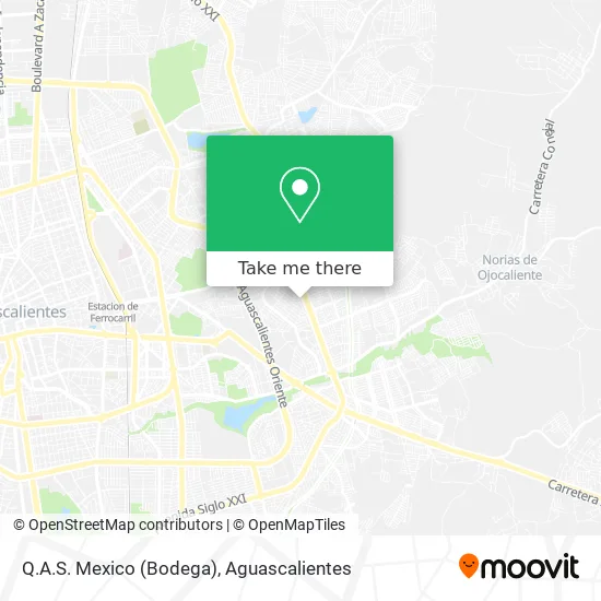
See Q.A.S. Mexico (Bodega), Aguascalientes, on the map
Public Transit to Q.A.S. Mexico (Bodega) in Aguascalientes
Wondering how to get to Q.A.S. Mexico (Bodega) in Aguascalientes? Moovit helps you find the best way to get to Q.A.S. Mexico (Bodega) with step-by-step directions from the nearest public transit station.
Moovit provides free maps and live directions to help you navigate through your city. View schedules, routes, timetables, and find out how long does it take to get to Q.A.S. Mexico (Bodega) in real time.
Looking for the nearest stop or station to Q.A.S. Mexico (Bodega)? Check out this list of stops closest to your destination: Avenida Siglo Xxi; Avenida Ojocaliente; San Francisco De Los Viveros; Hacienda De Ojocaliente.
Bus: RUTA 19, RUTA 24, RUTA 42, RUTA 50, RUTA 45, RUTA 25, RUTA 35, RUTA 41, RUTA 39, RUTA 48.
Want to see if there’s another route that gets you there at an earlier time? Moovit helps you find alternative routes or times. Get directions from and directions to Q.A.S. Mexico (Bodega) easily from the Moovit App or Website.
We make riding to Q.A.S. Mexico (Bodega) easy, which is why over 1.5 million users, including users in Aguascalientes, trust Moovit as the best app for public transit. You don’t need to download an individual bus app or train app, Moovit is your all-in-one transit app that helps you find the best bus time or train time available.
For information on prices of bus, costs and ride fares to Q.A.S. Mexico (Bodega), please check the Moovit app.
Use the app to navigate to popular places including to the airport, hospital, stadium, grocery store, mall, coffee shop, school, college, and university.
Location: Aguascalientes
- El Colorado,
- Tortas Gigantes Los Unicos,
- Caja Popular Oblatos,
- LIBERTAD,
- Dulceria La Cereza,
- Hojalateria y Pintura Mata,
- EL SOL DE ORO CASA DE EMPEÑO,
- Secundaria Tecnica, 33,
- Abarrotes-El Salto de los Salados,
- Cañada Honda 201,
- Osteria Italiana Haciendas,
- Banamex,
- Pizza Valle,
- Banco Azteca,
- Peluqueria Arturo,
- Súper Pollo,
- Hacienda Cotorina 105,
- Peñuelas,
- Bodega Aurrera Haciendas,
- El Agostaderito
Places Near Q.A.S. Mexico (Bodega) (Aguascalientes)
- Terminal De Combis, Aguascalientes,
- Ciudad industrial, Aguascalientes,
- Villasuncion, Aguascalientes,
- Universidad Autónoma de Aguascalientes, Aguascalientes,
- Isla San Marcos, Aguascalientes,
- clinica 3 uaa, Aguascalientes,
- Jesús María, Aguascalientes,
- Blvd. Luis Donaldo Colosio, Aguascalientes,
- Nuevo Hospital Hidalgo, Aguascalientes,
- Villas de Nuestra Señora de la Asunción, Aguascalientes,
- Parque Las Tres Centurias, Aguascalientes,
- Aeropuerto de Aguascalientes S.A. de C.V., Aguascalientes,
- Centro, Aguascalientes,
- Imss Clinica 1, Aguascalientes,
- Agropecuario, Aguascalientes,
- Central De Autobuses, Aguascalientes,
- La Isla San Marcos, Aguascalientes,
- ESPACIOS, Aguascalientes,
- Hospital Imss No. 3, Aguascalientes,
- Centro Comercial Altaria, Aguascalientes
How to get to popular places in Aguascalientes with public transit
Get around Aguascalientes by public transit!
Traveling around Aguascalientes has never been so easy. See step by step directions as you travel to any attraction, street or major public transit station. View bus and train schedules, arrival times, service alerts and detailed routes on a map, so you know exactly how to get to anywhere in Aguascalientes.
When traveling to any destination around Aguascalientes use Moovit's Live Directions with Get Off Notifications to know exactly where and how far to walk, how long to wait for your line, and how many stops are left. Moovit will alert you when it's time to get off — no need to constantly re-check whether yours is the next stop.
Wondering how to use public transit in Aguascalientes or how to pay for public transit in Aguascalientes? Moovit public transit app can help you navigate your way with public transit easily, and at minimum cost. It includes public transit fees, ticket prices, and costs. Looking for a map of Aguascalientes public transit lines? Moovit public transit app shows all public transit maps in Aguascalientes with all bus routes and stops on an interactive map.
Aguascalientes has 1 transit type(s), including: bus, operated by several transit agencies, including Coordinación General de Movilidad