Directions to Qew Monument (Toronto) with public transportation
The following transit lines have routes that pass near Qew Monument
How to get to Qew Monument by bus?
Click on the bus route to see step by step directions with maps, line arrival times and updated time schedules.
How to get to Qew Monument by train?
Click on the train route to see step by step directions with maps, line arrival times and updated time schedules.
How to get to Qew Monument by subway?
Click on the subway route to see step by step directions with maps, line arrival times and updated time schedules.
Streetcar stations near Qew Monument in Toronto
- The Queensway At South Kingsway, 9 min walk,
Bus stations near Qew Monument in Toronto
- The Queensway At South Kingsway, 11 min walk,
Bus lines to Qew Monument in Toronto
- 80A, Keele Station,
- 77, Windermere Pl at Windermere Ave,
- 80, Sherway Gardens Rd at Sherway Gate Mall West Side,
What are the closest stations to Qew Monument?
The closest stations to Qew Monument are:
- The Queensway At South Kingsway is 625 meters away, 9 min walk.
Which bus lines stop near Qew Monument?
These bus lines stop near Qew Monument: 145, 80.
Which train line stops near Qew Monument?
UP
Which subway line stops near Qew Monument?
2
Which Streetcar line stops near Qew Monument?
501
What’s the nearest Streetcar station to Qew Monument in Toronto?
The nearest Streetcar station to Qew Monument in Toronto is The Queensway At South Kingsway. It’s a 9 min walk away.
What’s the nearest bus stop to Qew Monument in Toronto?
The nearest bus stop to Qew Monument in Toronto is The Queensway At South Kingsway. It’s a 11 min walk away.
See Qew Monument, Toronto, on the map
Public Transit to Qew Monument in Toronto
Wondering how to get to Qew Monument in Toronto, Canada? Moovit helps you find the best way to get to Qew Monument with step-by-step directions from the nearest public transit station.
Moovit provides free maps and live directions to help you navigate through your city. View schedules, routes, timetables, and find out how long does it take to get to Qew Monument in real time.
Looking for the nearest stop or station to Qew Monument? Check out this list of stops closest to your destination: The Queensway At South Kingsway.
Bus: 145, 80, 80A, 77.Train: UP.Subway: 2.Streetcar: 501.
Want to see if there’s another route that gets you there at an earlier time? Moovit helps you find alternative routes or times. Get directions from and directions to Qew Monument easily from the Moovit App or Website.
We make riding to Qew Monument easy, which is why over 1.5 million users, including users in Toronto, trust Moovit as the best app for public transit. You don’t need to download an individual bus app or train app, Moovit is your all-in-one transit app that helps you find the best bus time or train time available.
For information on prices of bus, subway, Streetcar and train, costs and ride fares to Qew Monument, please check the Moovit app.
Use the app to navigate to popular places including to the airport, hospital, stadium, grocery store, mall, coffee shop, school, college, and university.
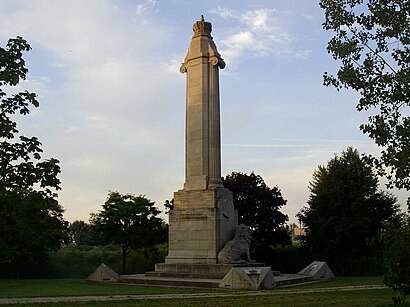
Qew Monument Address: Lake Shore Boulevard West street in Toronto
Attractions near Qew Monument
The Lion Monument,St. Anthony Church,Humber Bay Arch Bridge,Grenadier Gardens,Humber River Footbridge,D & E Lake Fine Art,Martin Goodman Trail Dog Park,On my bike,Humber Marshes,GO Transit Rail Services,Sheldon Lookout Rock,Martin Goodman Trail,Sheldon's Lookout,Palace Pier Park,Park Lake Gym,NXT Swimming Pool,Nxt Tennis Court,TTC Bus #145 - Downtown / Humber Bay Express,1 Palace Pier Court,Palace Place GymHow to get to popular attractions in Toronto with public transit
Kingston Road, Toronto,Veld Music Festival, Toronto,Exit 74/Casablanca Boulevard/W, Grimsby,St. Joseph's Health Centre, Toronto,Toronto Island Ferry Terminal, Toronto,GO Bus Stop - Yonge Street And Innisfil Beach Rd, Innisfil,Ashbridge's Bay Park, Toronto,Holiday Inn Express Toronto Downtown Hotel Toronto, Toronto,Joseph Brant Hospital, Burlington,TTC 192 Airport Rocket, Toronto,Velvet Underground, Toronto,16th Avenue & Yonge Street, Richmond Hill,Porter Airline Passenger Pickup, Toronto,Ryerson University, Toronto,Real Sports Bar & Grill, Toronto,The Marilyn Denis Show, Toronto,Flamboro Downs, Hamilton,Appleby GO Station, Burlington,Hwy 401 at Bathurst, Toronto,greyhound bus Kitchener to Toronto, KitchenerGet around Toronto by public transit!
Traveling around Toronto has never been so easy. See step by step directions as you travel to any attraction, street or major public transit station. View bus and train schedules, arrival times, service alerts and detailed routes on a map, so you know exactly how to get to anywhere in Toronto.
When traveling to any destination around Toronto use Moovit's Live Directions with Get Off Notifications to know exactly where and how far to walk, how long to wait for your line, and how many stops are left. Moovit will alert you when it's time to get off — no need to constantly re-check whether yours is the next stop.
Wondering how to use public transit in Toronto or how to pay for public transit in Toronto? Moovit public transit app can help you navigate your way with public transit easily, and at minimum cost. It includes public transit fees, ticket prices, and costs. Looking for a map of Toronto public transit lines? Moovit public transit app shows all public transit maps in Toronto with all Bus, Train, Subway, Streetcar and Ferry routes and stops on an interactive map.
Toronto has 5 transit type(s), including: Bus, Train, Subway, Streetcar and Ferry, operated by several transit agencies, including TTC, TTC Streetcar, Toronto Subway, GO Transit Bus, GO Transit, Amtrak, York Region Transit, Grand River Transit, Guelph Transit, grt, Hamilton Street Railway, MiWay, Brampton Transit, Burlington Transit, Oakville Transit