Directions to Qhht Boston (Milton) with public transportation
The following transit lines have routes that pass near Qhht Boston
 Bus: 32, 716.
- Train: FAIRMOUNT, PROVIDENCE/STOUGHTON, FAIRMOUNT LINE SHUTTLE, FRANKLIN/FOXBORO.
How to get to Qhht Boston by bus?
Click on the bus route to see step by step directions with maps, line arrival times and updated time schedules.
From Franklin Park Zoo, Boston
43 minFrom Jamaica Plain V.A., Boston
63 minFrom Centre St, Boston
52 minFrom Marina Bay, Quincy
107 minFrom Hotel Hilton Boston/Woburn, Boston
57 minFrom Mspca, Boston
62 minFrom The Strand Theater, Boston
64 minFrom Uphams Corner, Boston
72 minFrom Marina Bay, Quincy
114 minFrom Forest Hills Station MBTA, Boston
40 min
How to get to Qhht Boston by train?
Click on the train route to see step by step directions with maps, line arrival times and updated time schedules.
Bus stop near Qhht Boston in Milton
- Blue Hill Ave Opp Curry College, 1 min walk,VIEW
Bus lines to Qhht Boston in Milton
- 716, Mattapan,VIEW
What are the closest stations to Qhht Boston?
The closest stations to Qhht Boston are:
- Blue Hill Ave Opp Curry College is 7 yards away, 1 min walk.
- Readville is 1082 yards away, 14 min walk.
- Fairmount is 1109 yards away, 14 min walk.
Which bus lines stop near Qhht Boston?
These bus lines stop near Qhht Boston: 32, 716.
Which train lines stop near Qhht Boston?
These train lines stop near Qhht Boston: FAIRMOUNT, PROVIDENCE/STOUGHTON.
What’s the nearest train station to Qhht Boston in Milton?
The nearest train stations to Qhht Boston in Milton are Readville and Fairmount. The closest one is a 14 min walk away.
What’s the nearest bus station to Qhht Boston in Milton?
The nearest bus station to Qhht Boston in Milton is Blue Hill Ave Opp Curry College. It’s a 1 min walk away.
What time is the first train to Qhht Boston in Milton?
The FAIRMOUNT is the first train that goes to Qhht Boston in Milton. It stops nearby at 4:33 AM.
What time is the last train to Qhht Boston in Milton?
The PROVIDENCE/STOUGHTON is the last train that goes to Qhht Boston in Milton. It stops nearby at 12:20 AM.
What time is the first bus to Qhht Boston in Milton?
The 716 is the first bus that goes to Qhht Boston in Milton. It stops nearby at 5:57 AM.
What time is the last bus to Qhht Boston in Milton?
The 716 is the last bus that goes to Qhht Boston in Milton. It stops nearby at 8:23 PM.
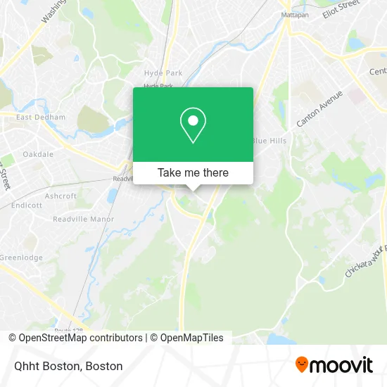
See Qhht Boston, Milton, on the map
Public Transit to Qhht Boston in Milton
Wondering how to get to Qhht Boston in Milton? Moovit helps you find the best way to get to Qhht Boston with step-by-step directions from the nearest public transit station.
Moovit provides free maps and live directions to help you navigate through your city. View schedules, routes, timetables, and find out how long does it take to get to Qhht Boston in real time.
Looking for the nearest stop or station to Qhht Boston? Check out this list of stops closest to your destination: Blue Hill Ave Opp Curry College; Readville; Fairmount.
Bus: 32, 716.Train: FAIRMOUNT, PROVIDENCE/STOUGHTON, FAIRMOUNT LINE SHUTTLE, FRANKLIN/FOXBORO.
Want to see if there’s another route that gets you there at an earlier time? Moovit helps you find alternative routes or times. Get directions from and directions to Qhht Boston easily from the Moovit App or Website.
We make riding to Qhht Boston easy, which is why over 1.7 million users, including users in Milton, trust Moovit as the best app for public transit. You don’t need to download an individual bus app or train app, Moovit is your all-in-one transit app that helps you find the best bus time or train time available.
For information on prices of bus, train and subway, costs and ride fares to Qhht Boston, please check the Moovit app.
Use the app to navigate to popular places including to the airport, hospital, stadium, grocery store, mall, coffee shop, school, college, and university.
Location: Milton, Boston
- Tech Connection,
- Scholars Hall,
- Academic and Performance Center,
- Curry College Bookstore,
- Curry College Student Center,
- Church of God,
- Paul's Bridge,
- Curry College,
- Eustis Estate Museum and Study Center,
- Tims Hardwood Floors,
- Curry College Keith Auditorium,
- WMLN,
- Saint Pius X Church,
- Sun Pizza,
- Woodmere,
- JXN Services,
- Perri Electric,
- Varian Medical Systems,
- Northland Construction,
- Chiropractic Deep
Places Near Qhht Boston (Milton)
- North End, Boston,
- Boston Children's Hospital, Boston,
- Cheers, Boston,
- Leader Bank Pavilion (Leader Bank Pavillion), Boston,
- Wang Theater, Boston,
- Prudential Center, Boston,
- Wilbur Theatre, Boston,
- Td Garden, Boston,
- House Of Blues, Boston,
- Boston Medical Center, Boston,
- Boston Convention & Exhibition Center, Boston,
- Mgm Music Hall, Boston,
- Faneuil Hall, Boston,
- Massachusetts General Hospital, Boston,
- Seaport District, Boston,
- Quincy Market, Boston,
- Museum Of Science, Boston,
- Castle Island, Boston,
- Boston Common, Boston,
- Isabella Stewart Gardner Museum, Boston
How to get to popular places in Boston with public transit
Get around Milton by public transit!
Traveling around Milton has never been so easy. See step by step directions as you travel to any attraction, street or major public transit station. View bus and train schedules, arrival times, service alerts and detailed routes on a map, so you know exactly how to get to anywhere in Milton.
When traveling to any destination around Milton use Moovit's Live Directions with Get Off Notifications to know exactly where and how far to walk, how long to wait for your line, and how many stops are left. Moovit will alert you when it's time to get off — no need to constantly re-check whether yours is the next stop.
Wondering how to use public transit in Milton or how to pay for public transit in Milton? Moovit public transit app can help you navigate your way with public transit easily, and at minimum cost. It includes public transit fees, ticket prices, and costs. Looking for a map of Milton public transit lines? Moovit public transit app shows all public transit maps in Milton with all Bus, Train, Subway and Ferry routes and stops on an interactive map.
Boston has 4 transit type(s), including: Bus, Train, Subway and Ferry, operated by several transit agencies, including MBTA, Southeastern Regional Transit Authority, MetroWest Regional Transit Authority, Rhode Island Public Transit Authority, WRTA, Lowell Regional Transit Authority, Merrimack Valley Transit, Montachusett Regional Transit Authority, Cape Cod Regional Transit Authority, Brockton Area Transit Authority, Martha's Vineyard Transit Authority, the WAVE - Nantucket Regional Transit Authority, GATRA, Cape Ann Transportation Authority and Massport