How to get to Quali Graphie by bus?
Click on the bus route to see step by step directions with maps, line arrival times and updated time schedules.
How to get to Quali Graphie by train?
Click on the train route to see step by step directions with maps, line arrival times and updated time schedules.
Bus stops near Quali Graphie in Nancy
Light Rail stations near Quali Graphie in Nancy
- Gare - Saint-Léon, 14 min walk,VIEW
Train stations near Quali Graphie in Nancy
- Nancy, 25 min walk,VIEW
Bus lines to Quali Graphie in Nancy
What are the closest stations to Quali Graphie?
The closest stations to Quali Graphie are:
- Domaine Sainte-Anne is 218 meters away, 4 min walk.
- Messier is 238 meters away, 4 min walk.
- Préville is 271 meters away, 4 min walk.
- Victoire is 476 meters away, 7 min walk.
- Gare - Saint-Léon is 1031 meters away, 14 min walk.
- Nancy is 1874 meters away, 25 min walk.
Which bus lines stop near Quali Graphie?
These bus lines stop near Quali Graphie: T3, T4.
Which train line stops near Quali Graphie?
C44 (Nancy)
What’s the nearest light rail station to Quali Graphie in Nancy?
The nearest light rail station to Quali Graphie in Nancy is Gare - Saint-Léon. It’s a 14 min walk away.
What’s the nearest train station to Quali Graphie in Nancy?
The nearest train station to Quali Graphie in Nancy is Nancy. It’s a 25 min walk away.
What’s the nearest bus station to Quali Graphie in Nancy?
The nearest bus stations to Quali Graphie in Nancy are Domaine Sainte-Anne, Messier and Préville. The closest one is a 4 min walk away.
What time is the first light rail to Quali Graphie in Nancy?
The T1 is the first light rail that goes to Quali Graphie in Nancy. It stops nearby at 5:01 AM.
What time is the last light rail to Quali Graphie in Nancy?
The T1 is the last light rail that goes to Quali Graphie in Nancy. It stops nearby at 12:36 AM.
What time is the first train to Quali Graphie in Nancy?
The C50+ is the first train that goes to Quali Graphie in Nancy. It stops nearby at 6:50 AM.
What time is the last train to Quali Graphie in Nancy?
The C40 is the last train that goes to Quali Graphie in Nancy. It stops nearby at 1:16 AM.
What time is the first bus to Quali Graphie in Nancy?
The 43 is the first bus that goes to Quali Graphie in Nancy. It stops nearby at 3:54 AM.
What time is the last bus to Quali Graphie in Nancy?
The T3 is the last bus that goes to Quali Graphie in Nancy. It stops nearby at 12:38 AM.
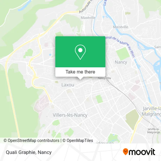
See Quali Graphie, Nancy, on the map
Public Transit to Quali Graphie in Nancy
Wondering how to get to Quali Graphie in Nancy? Moovit helps you find the best way to get to Quali Graphie with step-by-step directions from the nearest public transit station.
Moovit provides free maps and live directions to help you navigate through your city. View schedules, routes, timetables, and find out how long does it take to get to Quali Graphie in real time.
Looking for the nearest stop or station to Quali Graphie? Check out this list of stops closest to your destination: Domaine Sainte-Anne; Messier; Préville; Victoire; Gare - Saint-Léon; Nancy.
Bus: T3, T4, 43.Train: C44, 071A, 805A, 805B, INCONNU, C40, C42+, C43+, C46+, C50+, C41, C42, C43, C46.
Want to see if there’s another route that gets you there at an earlier time? Moovit helps you find alternative routes or times. Get directions from and directions to Quali Graphie easily from the Moovit App or Website.
We make riding to Quali Graphie easy, which is why over 1.5 million users, including users in Nancy, trust Moovit as the best app for public transit. You don’t need to download an individual bus app or train app, Moovit is your all-in-one transit app that helps you find the best bus time or train time available.
For information on prices of bus and train, costs and ride fares to Quali Graphie, please check the Moovit app.
Use the app to navigate to popular places including to the airport, hospital, stadium, grocery store, mall, coffee shop, school, college, and university.
Quali Graphie Address: 29 Rue du Sergent Bobillot 54000 Nancy street in Nancy
- O Plato,
- hôtel Hilton,
- Friperie Évelyne David,
- Rectorat,
- Rue Abbé Gridel,
- Un Lit sous les Étoiles de Nancy,
- Immobiliasre du Parc,
- Sophie Muller-Conseiller Immobilier,
- Vujovic Dragan,
- Nrv,
- 73 Avenue Anatole France,
- Rolland Christian,
- Ncpc Immobilier,
- Jpgm,
- Aurélie Carchon,
- Arrêt de bus Médreville,
- Arrêt de Bus - Sacré Coeur,
- Maltezeanu Nataly,
- Elres,
- Domaine Du Parc De Santifontaine
Places Near Quali Graphie (Nancy)
- Essey-Lès-Nancy, Essey-Lès-Nancy,
- Kinepolis Nancy, Nancy,
- Villa Majorelle, Nancy,
- Clinique Pasteur, Essey-Lès-Nancy,
- Villers-Lès-Nancy, Villers-Lès-Nancy,
- centre d'imagerie jacques callot, Maxéville,
- Cora, Houdemont,
- Dépose-Minute, Nancy,
- Rue Colette, Nancy,
- Hopital de Brabois CHU, VandUvre-Lès-Nancy,
- Hôpital Central, Nancy,
- Clinique Majorelle, Nancy,
- E.Leclerc, VandUvre-Lès-Nancy,
- Nancy Thermal, Nancy,
- Haut Du Lièvre, Nancy,
- Piscine Nancy Thermal, Nancy,
- Polyclinique De Gentilly, Nancy,
- Zénith De Nancy, Maxéville,
- Tomblaine, Tomblaine,
- Maxéville, Maxéville
How to get to popular places in Nancy with public transit
Get around Nancy by public transit!
Traveling around Nancy has never been so easy. See step by step directions as you travel to any attraction, street or major public transit station. View bus and train schedules, arrival times, service alerts and detailed routes on a map, so you know exactly how to get to anywhere in Nancy.
When traveling to any destination around Nancy use Moovit's Live Directions with Get Off Notifications to know exactly where and how far to walk, how long to wait for your line, and how many stops are left. Moovit will alert you when it's time to get off — no need to constantly re-check whether yours is the next stop.
Wondering how to use public transit in Nancy or how to pay for public transit in Nancy? Moovit public transit app can help you navigate your way with public transit easily, and at minimum cost. It includes public transit fees, ticket prices, and costs. Looking for a map of Nancy public transit lines? Moovit public transit app shows all public transit maps in Nancy with all Bus, Train and Light Rail routes and stops on an interactive map.
Nancy has 3 transit type(s), including: Bus, Train and Light Rail, operated by several transit agencies, including Réseau STAN, SNCF VOYAGEURS and OCEdefault