Directions to Quansett Bakery (North Westport) with public transportation
The following transit lines have routes that pass near Quansett Bakery
 Bus: 9.
How to get to Quansett Bakery by bus?
Click on the bus route to see step by step directions with maps, line arrival times and updated time schedules.
From Bristol Community College, Fall River
36 minFrom B.M.C. Durfee High School, Fall River
64 minFrom Walmart Fall River Supercenter, Fall River
25 minFrom Lizzy Borden House, Fall River
23 minFrom Amazon Fulfillment Bos7, Fall River
66 minFrom RMV New Bedford, New Bedford
119 minFrom Bedford Industrial Park, New Bedford
122 minFrom Charlton Memorial Hospital, Fall River
54 min
Bus stop near Quansett Bakery in North Westport
- 1011 State Rd, 10 min walk,VIEW
Bus lines to Quansett Bakery in North Westport
- 9, Fall River To New Bedford Via Umass Dartmouth,VIEW
What are the closest stations to Quansett Bakery?
The closest stations to Quansett Bakery are:
- 1011 State Rd is 830 yards away, 10 min walk.
Which bus line stops near Quansett Bakery?
9 (Fall River To New Bedford Via Umass Dartmouth)
What’s the nearest bus station to Quansett Bakery in North Westport?
The nearest bus station to Quansett Bakery in North Westport is 1011 State Rd. It’s a 10 min walk away.
What time is the first bus to Quansett Bakery in North Westport?
The 9 is the first bus that goes to Quansett Bakery in North Westport. It stops nearby at 6:32 AM.
What time is the last bus to Quansett Bakery in North Westport?
The 9 is the last bus that goes to Quansett Bakery in North Westport. It stops nearby at 9:23 PM.
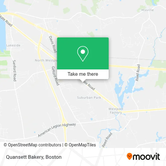
See Quansett Bakery, North Westport, on the map
Public Transit to Quansett Bakery in North Westport
Wondering how to get to Quansett Bakery in North Westport? Moovit helps you find the best way to get to Quansett Bakery with step-by-step directions from the nearest public transit station.
Moovit provides free maps and live directions to help you navigate through your city. View schedules, routes, timetables, and find out how long does it take to get to Quansett Bakery in real time.
Looking for the nearest stop or station to Quansett Bakery? Check out this list of stops closest to your destination: 1011 State Rd.
Bus: 9.
Want to see if there’s another route that gets you there at an earlier time? Moovit helps you find alternative routes or times. Get directions from and directions to Quansett Bakery easily from the Moovit App or Website.
We make riding to Quansett Bakery easy, which is why over 1.7 million users, including users in North Westport, trust Moovit as the best app for public transit. You don’t need to download an individual bus app or train app, Moovit is your all-in-one transit app that helps you find the best bus time or train time available.
For information on prices of bus, costs and ride fares to Quansett Bakery, please check the Moovit app.
Use the app to navigate to popular places including to the airport, hospital, stadium, grocery store, mall, coffee shop, school, college, and university.
Quansett Bakery Address: 875 State Rd street in North Westport
- Weighless Nutrition Center,
- Orev Creations,
- The Cutting Lounge,
- Soph,
- Jaxx Boutique,
- Shred Nations,
- Thepolishroom,
- Soma Imports,
- Richie's Used Auto Parts,
- Luna Rose Skin Studio,
- Top Quality Auto Sales,
- Messier Motors,
- Icars Westport,
- Upended,
- Secured Sound Plus,
- National Tire & Battery,
- Growth Point Printing,
- 42 Degreesnorth,
- Omo Ola Auto Sales,
- Dr. Daniel Gonzalez D.M.D
Places Near Quansett Bakery (North Westport)
- House Of Blues, Boston,
- Boston Children's Hospital, Boston,
- Leader Bank Pavilion (Leader Bank Pavillion), Boston,
- Prudential Center, Boston,
- North End, Boston,
- Boston Common, Boston,
- Quincy Market, Boston,
- Faneuil Hall, Boston,
- Isabella Stewart Gardner Museum, Boston,
- Wang Theater, Boston,
- Mgm Music Hall, Boston,
- Wilbur Theatre, Boston,
- Cheers, Boston,
- Castle Island, Boston,
- Museum Of Science, Boston,
- Boston Medical Center, Boston,
- Seaport District, Boston,
- Boston Convention & Exhibition Center, Boston,
- Massachusetts General Hospital, Boston,
- Td Garden, Boston
How to get to popular places in Boston with public transit
Get around North Westport by public transit!
Traveling around North Westport has never been so easy. See step by step directions as you travel to any attraction, street or major public transit station. View bus and train schedules, arrival times, service alerts and detailed routes on a map, so you know exactly how to get to anywhere in North Westport.
When traveling to any destination around North Westport use Moovit's Live Directions with Get Off Notifications to know exactly where and how far to walk, how long to wait for your line, and how many stops are left. Moovit will alert you when it's time to get off — no need to constantly re-check whether yours is the next stop.
Wondering how to use public transit in North Westport or how to pay for public transit in North Westport? Moovit public transit app can help you navigate your way with public transit easily, and at minimum cost. It includes public transit fees, ticket prices, and costs. Looking for a map of North Westport public transit lines? Moovit public transit app shows all public transit maps in North Westport with all Bus, Train, Subway and Ferry routes and stops on an interactive map.
Boston has 4 transit type(s), including: Bus, Train, Subway and Ferry, operated by several transit agencies, including MBTA, Southeastern Regional Transit Authority, MetroWest Regional Transit Authority, Rhode Island Public Transit Authority, WRTA, Lowell Regional Transit Authority, Merrimack Valley Transit, Montachusett Regional Transit Authority, Cape Cod Regional Transit Authority, Brockton Area Transit Authority, Martha's Vineyard Transit Authority, the WAVE - Nantucket Regional Transit Authority, GATRA, Cape Ann Transportation Authority and Massport