See Quarry Lakes Regional Rec Area, Fremont, on the map
Directions to Quarry Lakes Regional Rec Area (Fremont) with public transportation
The following transit lines have routes that pass near Quarry Lakes Regional Rec Area
 Bus:
Bus: - Train:
- BART:
How to get to Quarry Lakes Regional Rec Area by bus?
Click on the bus route to see step by step directions with maps, line arrival times and updated time schedules.
How to get to Quarry Lakes Regional Rec Area by train?
Click on the train route to see step by step directions with maps, line arrival times and updated time schedules.
How to get to Quarry Lakes Regional Rec Area by BART?
Click on the BART route to see step by step directions with maps, line arrival times and updated time schedules.
Bus stations near Quarry Lakes Regional Rec Area in Fremont
- Alvarado-Niles Rd & Osprey Dr,13 min walk,
Train stations near Quarry Lakes Regional Rec Area in Fremont
- Fremont,49 min walk,
Bus lines to Quarry Lakes Regional Rec Area in Fremont
- 216,Union City BART,
What are the closest stations to Quarry Lakes Regional Rec Area?
The closest stations to Quarry Lakes Regional Rec Area are:
- Alvarado-Niles Rd & Osprey Dr is 1076 yards away, 13 min walk.
- Fremont is 4132 yards away, 49 min walk.
Which bus lines stop near Quarry Lakes Regional Rec Area?
These bus lines stop near Quarry Lakes Regional Rec Area: 210, 216, 99.
Which train line stops near Quarry Lakes Regional Rec Area?
AMTRAK THRUWAY CONNECTING SERVICE
Which BART lines stop near Quarry Lakes Regional Rec Area?
These BART lines stop near Quarry Lakes Regional Rec Area: GREEN, ORANGE.
What’s the nearest bus stop to Quarry Lakes Regional Rec Area in Fremont?
The nearest bus stop to Quarry Lakes Regional Rec Area in Fremont is Alvarado-Niles Rd & Osprey Dr. It’s a 13 min walk away.
What time is the first train to Quarry Lakes Regional Rec Area in Fremont?
The ACETRAIN is the first train that goes to Quarry Lakes Regional Rec Area in Fremont. It stops nearby at 5:45 AM.
What time is the last train to Quarry Lakes Regional Rec Area in Fremont?
The CC is the last train that goes to Quarry Lakes Regional Rec Area in Fremont. It stops nearby at 7:30 PM.
What time is the first bus to Quarry Lakes Regional Rec Area in Fremont?
The 216 is the first bus that goes to Quarry Lakes Regional Rec Area in Fremont. It stops nearby at 7:03 AM.
What time is the last bus to Quarry Lakes Regional Rec Area in Fremont?
The 216 is the last bus that goes to Quarry Lakes Regional Rec Area in Fremont. It stops nearby at 7:40 PM.
How much is the bus fare to Quarry Lakes Regional Rec Area?
The bus fare to Quarry Lakes Regional Rec Area costs about $2.25.
How much is the train fare to Quarry Lakes Regional Rec Area?
The train fare to Quarry Lakes Regional Rec Area costs about $4.75.
How much is the BART fare to Quarry Lakes Regional Rec Area?
The BART fare to Quarry Lakes Regional Rec Area costs about $2.30 - $9.40.
See Quarry Lakes Regional Rec Area, Fremont, on the map
Public Transit to Quarry Lakes Regional Rec Area in Fremont
Wondering how to get to Quarry Lakes Regional Rec Area in Fremont, United States? Moovit helps you find the best way to get to Quarry Lakes Regional Rec Area with step-by-step directions from the nearest public transit station.
Moovit provides free maps and live directions to help you navigate through your city. View schedules, routes, timetables, and find out how long does it take to get to Quarry Lakes Regional Rec Area in real time.
Looking for the nearest stop or station to Quarry Lakes Regional Rec Area? Check out this list of stops closest to your destination: Alvarado-Niles Rd & Osprey Dr; Fremont.
Bus:Train:BART:
Want to see if there’s another route that gets you there at an earlier time? Moovit helps you find alternative routes or times. Get directions from and directions to Quarry Lakes Regional Rec Area easily from the Moovit App or Website.
We make riding to Quarry Lakes Regional Rec Area easy, which is why over 1.5 million users, including users in Fremont, trust Moovit as the best app for public transit. You don’t need to download an individual bus app or train app, Moovit is your all-in-one transit app that helps you find the best bus time or train time available.
For information on prices of bus, BART and train, costs and ride fares to Quarry Lakes Regional Rec Area, please check the Moovit app.
Get to Quarry Lakes Regional Rec Area with public transit and pay for the ride in the Moovit app. In addition to all info you may need for your trip to Quarry Lakes Regional Rec Area, including live directions, real-time arrivals and fare prices, you can also buy public transit passes for your rides. No need for cash or paper tickets to get to Quarry Lakes Regional Rec Area - everything you need is accessible in the app with a click of the button.
Use the app to navigate to popular places including to the airport, hospital, stadium, grocery store, mall, coffee shop, school, college, and university.
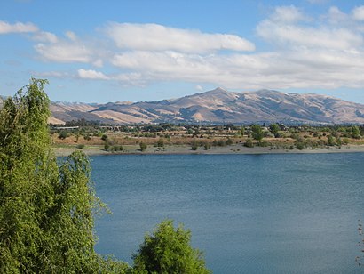
Quarry Lakes Regional Rec Area Address: 2100 Isherwood Way street in Fremont
Attractions near Quarry Lakes Regional Rec Area
2100 Isherwood Way,Barnard Dr,Sikh Gurdwara,Gurdwara Sahib Fremont,Brookvale Supplies Policies & Info,Alvarado Niles Rd / Union Sq,Creekside Village Apartments,Little Free Library - Brookvale Area Fremont,Jimmy Chen Contractor,Safeway,Usk Manufacturing,American High School,Master Shivadurga,Pandit Jairam (Pandit Jai Ram Ji),Union City BART,Suju's Coffee (Coffee House),Centerville Islamic Center,Cross Electrical, Inc.,Thornton Avenue,Kelly Hair SalonHow to get to popular attractions in Fremont with public transit
PayPal, San Jose,Santa Clara, CA, Santa Clara,Campbell, CA, Campbell,Regal Cinemas Hacienda Crossings 21 & IMAX, Dublin,Nordstrom Broadway Plaza in Walnut Creek, Walnut Creek,Charles M. Schulz - Sonoma County Airport (STS),Jelly Belly Factory, Fairfield,Westgate Shopping Center, San Jose,Lombard Street, Russian Hill, Sf,The Home Depot, Concord,Japantown (日本町), San Jose,Silicon Valley, Santa Clara,Apple Valley Fair, San Jose,City of Menlo Park, Menlo Park,Nordstrom Valley Fair, San Jose,AMC Saratoga 14, San Jose,eBay Headquarters, San Jose,Renaissance ClubSport Walnut Creek Hotel, Contra Costa Centre,Whole Foods Market, Walnut Creek,The Castro, Castro/Upper MarketGet around Fremont by public transit!
Traveling around Fremont has never been so easy. See step by step directions as you travel to any attraction, street or major public transit station. View bus and train schedules, arrival times, service alerts and detailed routes on a map, so you know exactly how to get to anywhere in Fremont.
When traveling to any destination around Fremont use Moovit's Live Directions with Get Off Notifications to know exactly where and how far to walk, how long to wait for your line, and how many stops are left. Moovit will alert you when it's time to get off — no need to constantly re-check whether yours is the next stop.
Wondering how to use public transit in Fremont or how to pay for public transit in Fremont? Moovit public transit app can help you navigate your way with public transit easily, and at minimum cost. It includes public transit fees, ticket prices, and costs. Looking for a map of Fremont public transit lines? Moovit public transit app shows all public transit maps in Fremont with all bus, BART or train routes and stops on an interactive map.
Fremont has 3 transit type(s), including: bus, BART or train, operated by several transit agencies, including BART, Bay Area Rapid Transit, Muni Metro, Caltrain, VTA, Capitol Corridor, Sonoma Marin Area Rail Transit, MUNI, VTA, SF Cable Car, AC Transit, Dumbarton Express, Golden Gate Transit, County Connection and SamTrans