Directions to Quebra Galho (Duque De Caxias) with public transportation
The following transit lines have routes that pass near Quebra Galho
 Bus: 016, 09, 415M, PETRÓPOLIS - MADUREIRA, 06.
- Train: RAMAL SARACURUNA.
How to get to Quebra Galho by bus?
Click on the bus route to see step by step directions with maps, line arrival times and updated time schedules.
From Figueira, Duque De Caxias
31 minFrom São João De Meriti, São João De Meriti
52 minFrom Hospital Municipal Ronaldo Gazolla, Acari
49 minFrom Hospital Municipal Francisco Da Silva Telles, Irajá
44 minFrom Vicente De Carvalho, Vicente De Carvalho
48 minFrom Cemitério E Irajá, Irajá
47 minFrom Favela Nova Holanda, Maré
38 minFrom Passarela 9, Bonsucesso
39 minFrom Ilha do Governador, Jardim Carioca
63 minFrom Avenida dos Italianos, Rocha Miranda
61 min
How to get to Quebra Galho by train?
Click on the train route to see step by step directions with maps, line arrival times and updated time schedules.
Bus stops near Quebra Galho in Duque De Caxias
- Estrada Vereador Oscar Dias Oliveira, 217, 3 min walk,VIEW
- Ponto Final - Santa Tereza / Chacrinha, 3 min walk,VIEW
- Rodovia Washington Luiz (Sentido Rio) | Rua Da Chacrinha, 5 min walk,VIEW
- Rua Deputado Sá Rêgo, 935, 5 min walk,VIEW
- Avenida Expedicionário José Amaro, 950, 6 min walk,VIEW
- Rodovia Washington Luiz, 4099, 6 min walk,VIEW
- Avenida Expedicionário José Amaro, 937, 7 min walk,VIEW
- Ponto Fiscal - União, 25 min walk,VIEW
Train station near Quebra Galho in Duque De Caxias
- Corte Oito, 28 min walk,VIEW
Bus lines to Quebra Galho in Duque De Caxias
- 09, Chacrinha (Via Prudente De Moraes),VIEW
- 06, Santa Tereza,VIEW
- EXECUTIVO, Piabetá - Penha,VIEW
- 01, Caxias - Xerém,VIEW
- TZ07, Jardim Gramacho - Hospital Moacyr do Carmo,VIEW
- 016, Jardim Gramacho - Hospital Duque de Caxias (Via Avenida Pistoia),VIEW
- TZ16, Parque das Missões - Hospital Moacyr do Carmo (Circular),VIEW
- 017, Variante - Periquitos (Via Itatiaia),VIEW
- 018, Olavo Bilac - Cohab (Via Fórum),VIEW
- 022, Centenário - Carrefour (Via 25 de Agosto / Corte 8),VIEW
- 023, Caxias - Nova Campinas,VIEW
- 026, Caxias ↔ Nova Campinas (Via Maracanã),VIEW
- 26M, Caxias - Morabi (Via Hosp. de Saracuruna),VIEW
- 28, Olavo Bilac - Variante (Via Caxias Shopping - Circular),VIEW
- 125C, Magé - Central,VIEW
- 127C, Magé - Castelo (via Túnel Marcello Alencar),VIEW
- 415M, Magé - Caxias (Integração Barra da Tijuca),VIEW
- 416C, Parque São José - Central (Via Gramacho),VIEW
- 417T, Xerém - Barra da Tijuca (via Linha Vermelha / Washington Luiz),VIEW
- 444L, Piabetá - Penha,VIEW
What are the closest stations to Quebra Galho?
The closest stations to Quebra Galho are:
- Estrada Vereador Oscar Dias Oliveira, 217 is 184 meters away, 3 min walk.
- Ponto Final - Santa Tereza / Chacrinha is 217 meters away, 3 min walk.
- Rodovia Washington Luiz (Sentido Rio) | Rua Da Chacrinha is 321 meters away, 5 min walk.
- Rua Deputado Sá Rêgo, 935 is 349 meters away, 5 min walk.
- Avenida Expedicionário José Amaro, 950 is 404 meters away, 6 min walk.
- Rodovia Washington Luiz, 4099 is 429 meters away, 6 min walk.
- Avenida Expedicionário José Amaro, 937 is 473 meters away, 7 min walk.
- Ponto Fiscal - União is 1922 meters away, 25 min walk.
- Corte Oito is 2198 meters away, 28 min walk.
Which bus lines stop near Quebra Galho?
These bus lines stop near Quebra Galho: 016, 09, 415M, PETRÓPOLIS - MADUREIRA.
Which train line stops near Quebra Galho?
RAMAL SARACURUNA (Gramacho)
What’s the nearest train station to Quebra Galho in Duque De Caxias?
The nearest train station to Quebra Galho in Duque De Caxias is Corte Oito. It’s a 28 min walk away.
What’s the nearest bus station to Quebra Galho in Duque De Caxias?
The nearest bus stations to Quebra Galho in Duque De Caxias are Estrada Vereador Oscar Dias Oliveira, 217 and Ponto Final - Santa Tereza / Chacrinha. The closest one is a 3 min walk away.
What time is the first train to Quebra Galho in Duque De Caxias?
The RAMAL SARACURUNA is the first train that goes to Quebra Galho in Duque De Caxias. It stops nearby at 4:22 AM.
What time is the last train to Quebra Galho in Duque De Caxias?
The RAMAL SARACURUNA is the last train that goes to Quebra Galho in Duque De Caxias. It stops nearby at 11:24 PM.
What time is the first bus to Quebra Galho in Duque De Caxias?
The 416C is the first bus that goes to Quebra Galho in Duque De Caxias. It stops nearby at 4:02 AM.
What time is the last bus to Quebra Galho in Duque De Caxias?
The 022 is the last bus that goes to Quebra Galho in Duque De Caxias. It stops nearby at 2:31 AM.
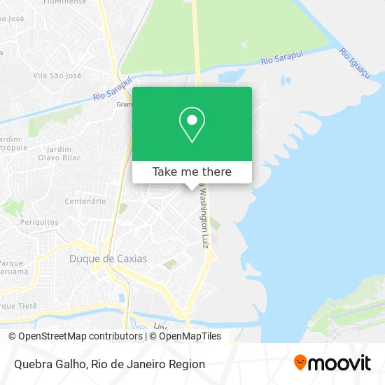
See Quebra Galho, Duque De Caxias, on the map
Public Transit to Quebra Galho in Duque De Caxias
Wondering how to get to Quebra Galho in Duque De Caxias? Moovit helps you find the best way to get to Quebra Galho with step-by-step directions from the nearest public transit station.
Moovit provides free maps and live directions to help you navigate through your city. View schedules, routes, timetables, and find out how long does it take to get to Quebra Galho in real time.
Looking for the nearest stop or station to Quebra Galho? Check out this list of stops closest to your destination: Estrada Vereador Oscar Dias Oliveira; Ponto Final - Santa Tereza / Chacrinha; Rodovia Washington Luiz (Sentido Rio) | Rua Da Chacrinha; Rua Deputado Sá Rêgo; Avenida Expedicionário José Amaro; Rodovia Washington Luiz; Avenida Expedicionário José Amaro; Ponto Fiscal - União; Corte Oito.
Bus: 016, 09, 415M, PETRÓPOLIS - MADUREIRA, 06, EXECUTIVO, 01, TZ07, TZ16, TZ21, 424C.Train: RAMAL SARACURUNA.
Want to see if there’s another route that gets you there at an earlier time? Moovit helps you find alternative routes or times. Get directions from and directions to Quebra Galho easily from the Moovit App or Website.
We make riding to Quebra Galho easy, which is why over 1.5 million users, including users in Duque De Caxias, trust Moovit as the best app for public transit. You don’t need to download an individual bus app or train app, Moovit is your all-in-one transit app that helps you find the best bus time or train time available.
For information on prices of bus and train, costs and ride fares to Quebra Galho, please check the Moovit app.
Use the app to navigate to popular places including to the airport, hospital, stadium, grocery store, mall, coffee shop, school, college, and university.
Quebra Galho Address: Avenida Leandro da Mota, 1400 Vila São Luís Duque de Caxias-RJ 25065-175 street in Duque De Caxias
- Lar dos Biscoitos,
- Fenix,
- Vibe Studio de Dança Luciana Archanjo,
- Lava Truck,
- Ile Ase Iya Omi Talade,
- Salao da Regina,
- Igreja Evangelica Boas Novas,
- Fernanda Design-Rudnick,
- Rua Treze de Maio,
- Estrada Vereador Oscar Dias Oliveira,
- Chacrinha,
- Crci Distribuidora,
- Rua 13 de Maio,
- E. E. Euclides da Cunha (Escola Estadual Euclides da Cunha),
- Rua Marechal Hermes,
- Rei da Cracudinha,
- Vila São Luís,
- Loja Temperos do Amor,
- Tcm Caxiense Transportes,
- Rua Prudente de Morais / Rua Olegário Mariano
Places Near Quebra Galho (Duque De Caxias)
- Praia do Arpoador, Ipanema,
- Rodoviária Novo Rio (Rodoviária do Rio de Janeiro), Santo Cristo,
- Niterói, Niterói,
- Museu Do Amanhã, Centro,
- Shopping Nova América, Del Castilho,
- Hospital Federal Do Andaraí, Andaraí,
- Rua Ulysses Guimarães 16, Cidade Nova,
- Shopping Rio Sul, Botafogo,
- Hospital Municipal Ronaldo Gazolla, Acari,
- Hospital Federal Cardoso Fontes, Jacarepaguá,
- Feirão De Malhas, Duque De Caxias,
- Rua Licínio Cardoso, São Francisco Xavier,
- Feira Livre da Gloria, Glória,
- Rio De Janeiro,
- Avenida Venezuela 134, Saúde,
- Shopping Downtown, Barra Da Tijuca,
- Shopping RioSul, Botafogo,
- Hospital Pedro Ernesto, Vila Isabel,
- Avenida Rio Branco, Centro,
- Norte Shopping, Cachambi
How to get to popular places in Rio de Janeiro Region with public transit
Get around Duque De Caxias by public transit!
Traveling around Duque De Caxias has never been so easy. See step by step directions as you travel to any attraction, street or major public transit station. View bus and train schedules, arrival times, service alerts and detailed routes on a map, so you know exactly how to get to anywhere in Duque De Caxias.
When traveling to any destination around Duque De Caxias use Moovit's Live Directions with Get Off Notifications to know exactly where and how far to walk, how long to wait for your line, and how many stops are left. Moovit will alert you when it's time to get off — no need to constantly re-check whether yours is the next stop.
Wondering how to use public transit in Duque De Caxias or how to pay for public transit in Duque De Caxias? Moovit public transit app can help you navigate your way with public transit easily, and at minimum cost. It includes public transit fees, ticket prices, and costs. Looking for a map of Duque De Caxias public transit lines? Moovit public transit app shows all public transit maps in Duque De Caxias with all Bus, Train, Metro, Light Rail, Ferry, Cable Car, Gondola and Funicular routes and stops on an interactive map.
Rio de Janeiro Region has 8 transit type(s), including: Bus, Train, Metro, Light Rail, Ferry, Cable Car, Gondola and Funicular, operated by several transit agencies, including TrensRJ, Metrô Rio, VLT Carioca, Barcas Rio, BRT MOBI-Rio, Auto Viação Alpha, Auto Viação Tijuca, Gire Transportes, Transurb, Viação Nossa Senhora das Graças, Consórcio INTERSUL, Braso Lisboa (Municipal), Caprichosa Auto Ônibus, Auto Viação Três Amigos and Rodoviária Âncora Matias