How to get to Queens Chapel Manor, Maryland by bus?
Click on the bus route to see step by step directions with maps, line arrival times and updated time schedules.
From Children's Hospital, Washington
62 minFrom Bloomingdale, Washington DC, Washington
50 minFrom Arboretum, Washington
31 minFrom Thompson Washington D.C., Washington
69 minFrom Ronald Reagan Building & International Trade Center, Washington
65 minFrom Washington Monument, Washington
73 minFrom Foggy Bottom-GWU Metro Station, Washington
74 minFrom Navy Yard, Washington
67 minFrom Social Security Administration, Washington
79 minFrom L'Enfant Plaza, Washington
75 min
How to get to Queens Chapel Manor, Maryland by train?
Click on the train route to see step by step directions with maps, line arrival times and updated time schedules.
How to get to Queens Chapel Manor, Maryland by metro?
Click on the metro route to see step by step directions with maps, line arrival times and updated time schedules.
From Children's Hospital, Washington
35 minFrom L'Enfant Plaza, Washington
40 minFrom Bloomingdale, Washington DC, Washington
42 minFrom Thompson Washington D.C., Washington
45 minFrom Ronald Reagan Building & International Trade Center, Washington
45 minFrom Washington Monument, Washington
51 minFrom Foggy Bottom-GWU Metro Station, Washington
46 minFrom Navy Yard, Washington
44 minFrom Social Security Administration, Washington
40 min
Bus stops near Queens Chapel Manor, Maryland in Prince George's County
Metro station near Queens Chapel Manor, Maryland in Prince George's County
- West Hyattsville, 12 min walk,VIEW
Train station near Queens Chapel Manor, Maryland in Prince George's County
- Riverdale Marc Nb, 31 min walk,VIEW
Bus lines to Queens Chapel Manor, Maryland in Prince George's County
What are the closest stations to Queens Chapel Manor, Maryland?
The closest stations to Queens Chapel Manor, Maryland are:
- Queens Chapel Rd+#5805 is 487 yards away, 6 min walk.
- Queens Chapel Rd & Hamilton St is 512 yards away, 6 min walk.
- Hamilton St & 31st Av is 556 yards away, 7 min walk.
- Ager Rd & Lancer Dr is 577 yards away, 7 min walk.
- West Hyattsville is 1012 yards away, 12 min walk.
- Riverdale Marc Nb is 2608 yards away, 31 min walk.
Which bus lines stop near Queens Chapel Manor, Maryland?
These bus lines stop near Queens Chapel Manor, Maryland: C41, P33, P43.
Which train line stops near Queens Chapel Manor, Maryland?
MARC (Inbound - Camden)
Which metro lines stop near Queens Chapel Manor, Maryland?
These metro lines stop near Queens Chapel Manor, Maryland: GREEN, YELLOW.
What’s the nearest metro station to Queens Chapel Manor, Maryland in Prince George's County?
The nearest metro station to Queens Chapel Manor, Maryland in Prince George's County is West Hyattsville. It’s a 12 min walk away.
What’s the nearest bus station to Queens Chapel Manor, Maryland in Prince George's County?
The nearest bus stations to Queens Chapel Manor, Maryland in Prince George's County are Queens Chapel Rd+#5805 and Queens Chapel Rd & Hamilton St. The closest one is a 6 min walk away.
What time is the first metro to Queens Chapel Manor, Maryland in Prince George's County?
The GREEN is the first metro that goes to Queens Chapel Manor, Maryland in Prince George's County. It stops nearby at 5:08 AM.
What time is the last metro to Queens Chapel Manor, Maryland in Prince George's County?
The GREEN is the last metro that goes to Queens Chapel Manor, Maryland in Prince George's County. It stops nearby at 12:33 AM.
What time is the first train to Queens Chapel Manor, Maryland in Prince George's County?
The MARC is the first train that goes to Queens Chapel Manor, Maryland in Prince George's County. It stops nearby at 5:43 AM.
What time is the last train to Queens Chapel Manor, Maryland in Prince George's County?
The MARC is the last train that goes to Queens Chapel Manor, Maryland in Prince George's County. It stops nearby at 7:54 PM.
What time is the first bus to Queens Chapel Manor, Maryland in Prince George's County?
The C41 is the first bus that goes to Queens Chapel Manor, Maryland in Prince George's County. It stops nearby at 3:02 AM.
What time is the last bus to Queens Chapel Manor, Maryland in Prince George's County?
The C41 is the last bus that goes to Queens Chapel Manor, Maryland in Prince George's County. It stops nearby at 3:23 AM.
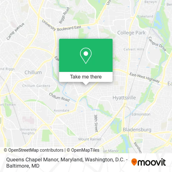
See Queens Chapel Manor, Maryland, Prince George's County, on the map
Public Transit to Queens Chapel Manor, Maryland in Prince George's County
Wondering how to get to Queens Chapel Manor, Maryland in Prince George's County? Moovit helps you find the best way to get to Queens Chapel Manor, Maryland with step-by-step directions from the nearest public transit station.
Moovit provides free maps and live directions to help you navigate through your city. View schedules, routes, timetables, and find out how long does it take to get to Queens Chapel Manor, Maryland in real time.
Looking for the nearest stop or station to Queens Chapel Manor, Maryland? Check out this list of stops closest to your destination: Queens Chapel Rd+#5805; Queens Chapel Rd & Hamilton St; Hamilton St & 31st Av; Ager Rd & Lancer Dr; West Hyattsville; Riverdale Marc Nb.
Bus: C41, P33, P43, P32.Train: MARC.Metro: GREEN, YELLOW.
Want to see if there’s another route that gets you there at an earlier time? Moovit helps you find alternative routes or times. Get directions from and directions to Queens Chapel Manor, Maryland easily from the Moovit App or Website.
We make riding to Queens Chapel Manor, Maryland easy, which is why over 1.5 million users, including users in Prince George's County, trust Moovit as the best app for public transit. You don’t need to download an individual bus app or train app, Moovit is your all-in-one transit app that helps you find the best bus time or train time available.
For information on prices of bus, metro and train, costs and ride fares to Queens Chapel Manor, Maryland, please check the Moovit app.
Use the app to navigate to popular places including to the airport, hospital, stadium, grocery store, mall, coffee shop, school, college, and university.
Queens Chapel Manor, Maryland Address: Hyattsville, MD 20782 street in Prince George's County
- Zanzibar Appliance Repair,
- Syneqx,
- Invisalign Offer,
- Post Office,
- Best Wireless,
- F8 Bus,
- Bright Cleaners,
- Sterling Coin Laundry,
- Club de la Hamilton St,
- Jda Builders,
- ALDI,
- Hang Tyme Turner,
- Van Guard Windows,
- Dr. Grace Okhuereigbe, DNP,
- A Hr Locksmith Emergency Locksmith 23,
- H & Chicken,
- KG Accounting Service,
- Romero Zulma,
- Jessica's Studio,
- Multiservices & Driving Sch
Places Near Queens Chapel Manor, Maryland (Prince George's County)
- Westfield Montgomery Mall, Montgomery County,
- Basilica of the National Shrine, Washington,
- National Museum of African American History and Culture, Washington,
- National Zoo, Washington,
- Pennsylvania Ave NW (3rd st and pennsylvania), Washington,
- Amazon Hq2, Arlington County,
- The Anthem, Washington,
- Washington National Cathedral, Washington,
- Sibley Memorial Hospital, Washington,
- Washington DC VA Medical Center, Washington,
- Camden Yards, Baltimore,
- National Theatre, Washington,
- Georgetown, Washington,
- Rock Creek Tennis Center, Washington,
- Marriott Marquis Washington, DC, Washington,
- Capital One Arena, Washington,
- Museum Of The Bible, Washington,
- M&T Bank Stadium, Baltimore,
- PG Mall, Prince George's County,
- Warner Theatre, Washington
How to get to popular places in Washington, D.C. - Baltimore, MD with public transit
Get around Prince George's County by public transit!
Traveling around Prince George's County has never been so easy. See step by step directions as you travel to any attraction, street or major public transit station. View bus and train schedules, arrival times, service alerts and detailed routes on a map, so you know exactly how to get to anywhere in Prince George's County.
When traveling to any destination around Prince George's County use Moovit's Live Directions with Get Off Notifications to know exactly where and how far to walk, how long to wait for your line, and how many stops are left. Moovit will alert you when it's time to get off — no need to constantly re-check whether yours is the next stop.
Wondering how to use public transit in Prince George's County or how to pay for public transit in Prince George's County? Moovit public transit app can help you navigate your way with public transit easily, and at minimum cost. It includes public transit fees, ticket prices, and costs. Looking for a map of Prince George's County public transit lines? Moovit public transit app shows all public transit maps in Prince George's County with all Bus, Train, Metro, Light Rail and Ferry routes and stops on an interactive map.
Washington, D.C. - Baltimore, MD has 5 transit type(s), including: Bus, Train, Metro, Light Rail and Ferry, operated by several transit agencies, including WMATA, Montgomery County Ride On, Fairfax Connector, TheBus, PRTC, DASH - Alexandria, Arlington Transit (ART), RTA of Central Maryland, MDOT MTA, MDOT MTA Light RailLink, MDOT MTA Commuter Bus, MDOT MTA Local Bus, FXBGO!, Virginia Railway Express (VRE) and MARC