Directions to Quick Lane (Needham) with public transportation
The following transit lines have routes that pass near Quick Lane
 Bus: 52, 59.
- Train: NEEDHAM.
- Subway: GREEN LINE D.
How to get to Quick Lane by bus?
Click on the bus route to see step by step directions with maps, line arrival times and updated time schedules.
From Jamaica Pond, Boston
118 minFrom Hilton Garden Inn Boston Brookline, Brookline
83 minFrom Hotel Hilton Boston/Woburn, Boston
114 minFrom Academy Of the Pacific Rim Charter Public School, Boston
143 minFrom Jamaica Plain VA Medical Center (VA Hospital), Boston
108 minFrom AC Hotel by Marriott Boston Cleveland Circle, Boston
76 minFrom Astrazeneca Hope Lodge, Boston
107 minFrom VA Medical Center, Boston (Jamaica Plain), Boston
108 minFrom New Balance, Boston
76 min
How to get to Quick Lane by train?
Click on the train route to see step by step directions with maps, line arrival times and updated time schedules.
How to get to Quick Lane by subway?
Click on the subway route to see step by step directions with maps, line arrival times and updated time schedules.
From Jamaica Pond, Boston
111 minFrom Hilton Garden Inn Boston Brookline, Brookline
65 minFrom Hotel Hilton Boston/Woburn, Boston
87 minFrom Jamaica Plain VA Medical Center (VA Hospital), Boston
75 minFrom AC Hotel by Marriott Boston Cleveland Circle, Boston
55 minFrom Astrazeneca Hope Lodge, Boston
73 minFrom VA Medical Center, Boston (Jamaica Plain), Boston
75 minFrom New Balance, Boston
94 min
Bus stop near Quick Lane in Needham
- Webster St @ Hillside Ave, 9 min walk,VIEW
Subway station near Quick Lane in Needham
- Waban, 11 min walk,VIEW
Train station near Quick Lane in Needham
- Needham Center, 24 min walk,VIEW
Bus lines to Quick Lane in Needham
- 59, Needham Junction Via Needham St,VIEW
What are the closest stations to Quick Lane?
The closest stations to Quick Lane are:
- Webster St @ Hillside Ave is 759 yards away, 9 min walk.
- Waban is 869 yards away, 11 min walk.
- Needham Center is 1994 yards away, 24 min walk.
Which bus lines stop near Quick Lane?
These bus lines stop near Quick Lane: 52, 59.
Which train line stops near Quick Lane?
NEEDHAM (#625 | Needham Heights)
Which subway line stops near Quick Lane?
GREEN LINE D (Riverside)
What’s the nearest subway station to Quick Lane in Needham?
The nearest subway station to Quick Lane in Needham is Waban. It’s a 11 min walk away.
What’s the nearest train station to Quick Lane in Needham?
The nearest train station to Quick Lane in Needham is Needham Center. It’s a 24 min walk away.
What’s the nearest bus station to Quick Lane in Needham?
The nearest bus station to Quick Lane in Needham is Webster St @ Hillside Ave. It’s a 9 min walk away.
What time is the first subway to Quick Lane in Needham?
The GREEN LINE D is the first subway that goes to Quick Lane in Needham. It stops nearby at 4:48 AM.
What time is the last subway to Quick Lane in Needham?
The GREEN LINE D is the last subway that goes to Quick Lane in Needham. It stops nearby at 2:44 AM.
What time is the first train to Quick Lane in Needham?
The NEEDHAM is the first train that goes to Quick Lane in Needham. It stops nearby at 7:05 AM.
What time is the last train to Quick Lane in Needham?
The NEEDHAM is the last train that goes to Quick Lane in Needham. It stops nearby at 6:38 PM.
What time is the first bus to Quick Lane in Needham?
The 59 is the first bus that goes to Quick Lane in Needham. It stops nearby at 6:26 AM.
What time is the last bus to Quick Lane in Needham?
The 59 is the last bus that goes to Quick Lane in Needham. It stops nearby at 7:58 PM.
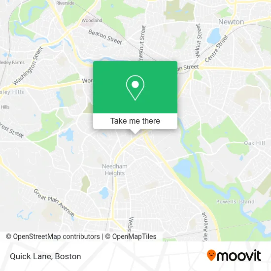
See Quick Lane, Needham, on the map
Public Transit to Quick Lane in Needham
Wondering how to get to Quick Lane in Needham? Moovit helps you find the best way to get to Quick Lane with step-by-step directions from the nearest public transit station.
Moovit provides free maps and live directions to help you navigate through your city. View schedules, routes, timetables, and find out how long does it take to get to Quick Lane in real time.
Looking for the nearest stop or station to Quick Lane? Check out this list of stops closest to your destination: Webster St @ Hillside Ave; Waban; Needham Center.
Bus: 52, 59.Train: NEEDHAM.Subway: GREEN LINE D.
Want to see if there’s another route that gets you there at an earlier time? Moovit helps you find alternative routes or times. Get directions from and directions to Quick Lane easily from the Moovit App or Website.
We make riding to Quick Lane easy, which is why over 1.7 million users, including users in Needham, trust Moovit as the best app for public transit. You don’t need to download an individual bus app or train app, Moovit is your all-in-one transit app that helps you find the best bus time or train time available.
For information on prices of bus, subway and train, costs and ride fares to Quick Lane, please check the Moovit app.
Use the app to navigate to popular places including to the airport, hospital, stadium, grocery store, mall, coffee shop, school, college, and university.
Quick Lane Address: 557 Highland Ave street in Needham
- Charles River Media Group,
- Newscenter 5 (WCVB-TV),
- Russian Cultural Center Lukomorie,
- Herbert Geller,
- JTC Printing,
- Fix It Guy,
- Garment Machinery Company, Inc.,
- Nauset,
- Ihloom Cybersecurity,
- Mass Discount Fuel,
- Rodman Insurance Agency,
- GF Spraque,
- Gretta Enterprises,
- Scott Corporation Boston,
- Number One Source,
- Genalco Inc,
- Homewood Suites,
- St Equipment & Technology,
- Laboratory & Testing Mobile Testing Service,
- Chiropractic Auto Accident Services
Places Near Quick Lane (Needham)
- Boston Convention & Exhibition Center, Boston,
- Castle Island, Boston,
- Museum Of Science, Boston,
- Wilbur Theatre, Boston,
- Seaport District, Boston,
- Quincy Market, Boston,
- House Of Blues, Boston,
- Cheers, Boston,
- Prudential Center, Boston,
- Massachusetts General Hospital, Boston,
- Isabella Stewart Gardner Museum, Boston,
- Boston Common, Boston,
- Boston Children's Hospital, Boston,
- North End, Boston,
- Td Garden, Boston,
- Wang Theater, Boston,
- Faneuil Hall, Boston,
- Mgm Music Hall, Boston,
- Boston Medical Center, Boston,
- Leader Bank Pavilion (Leader Bank Pavillion), Boston
How to get to popular places in Boston with public transit
Get around Needham by public transit!
Traveling around Needham has never been so easy. See step by step directions as you travel to any attraction, street or major public transit station. View bus and train schedules, arrival times, service alerts and detailed routes on a map, so you know exactly how to get to anywhere in Needham.
When traveling to any destination around Needham use Moovit's Live Directions with Get Off Notifications to know exactly where and how far to walk, how long to wait for your line, and how many stops are left. Moovit will alert you when it's time to get off — no need to constantly re-check whether yours is the next stop.
Wondering how to use public transit in Needham or how to pay for public transit in Needham? Moovit public transit app can help you navigate your way with public transit easily, and at minimum cost. It includes public transit fees, ticket prices, and costs. Looking for a map of Needham public transit lines? Moovit public transit app shows all public transit maps in Needham with all Bus, Train, Subway and Ferry routes and stops on an interactive map.
Boston has 4 transit type(s), including: Bus, Train, Subway and Ferry, operated by several transit agencies, including MBTA, Southeastern Regional Transit Authority, MetroWest Regional Transit Authority, Rhode Island Public Transit Authority, WRTA, Lowell Regional Transit Authority, Merrimack Valley Transit, Montachusett Regional Transit Authority, Cape Cod Regional Transit Authority, Brockton Area Transit Authority, Martha's Vineyard Transit Authority, the WAVE - Nantucket Regional Transit Authority, GATRA, Cape Ann Transportation Authority and Massport