Directions to Quick-Tag (Worcester) with public transportation
The following transit lines have routes that pass near Quick-Tag
 Bus: 1, 11, 4, GREYHOUND US0230.
How to get to Quick-Tag by bus?
Click on the bus route to see step by step directions with maps, line arrival times and updated time schedules.
Bus stops near Quick-Tag in Worcester
Bus lines to Quick-Tag in Worcester
What are the closest stations to Quick-Tag?
The closest stations to Quick-Tag are:
- Millbury St at Grammont Rd is 399 yards away, 5 min walk.
- Providence St + Millbury St is 405 yards away, 6 min walk.
Which bus lines stop near Quick-Tag?
These bus lines stop near Quick-Tag: 1, 11, 4, GREYHOUND US0230.
What’s the nearest bus station to Quick-Tag in Worcester?
The nearest bus station to Quick-Tag in Worcester is Millbury St at Grammont Rd. It’s a 5 min walk away.
What time is the first bus to Quick-Tag in Worcester?
The 11 is the first bus that goes to Quick-Tag in Worcester. It stops nearby at 5:03 AM.
What time is the last bus to Quick-Tag in Worcester?
The 11 is the last bus that goes to Quick-Tag in Worcester. It stops nearby at 11:10 PM.
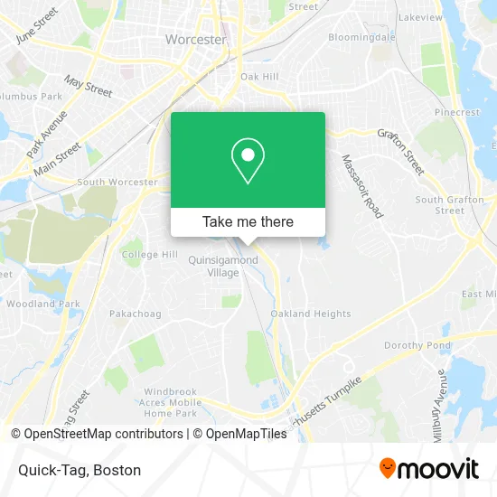
See Quick-Tag, Worcester, on the map
Public Transit to Quick-Tag in Worcester
Wondering how to get to Quick-Tag in Worcester? Moovit helps you find the best way to get to Quick-Tag with step-by-step directions from the nearest public transit station.
Moovit provides free maps and live directions to help you navigate through your city. View schedules, routes, timetables, and find out how long does it take to get to Quick-Tag in real time.
Looking for the nearest stop or station to Quick-Tag? Check out this list of stops closest to your destination: Millbury St at Grammont Rd; Providence St + Millbury St.
Bus: 1, 11, 4, GREYHOUND US0230.
Want to see if there’s another route that gets you there at an earlier time? Moovit helps you find alternative routes or times. Get directions from and directions to Quick-Tag easily from the Moovit App or Website.
We make riding to Quick-Tag easy, which is why over 1.7 million users, including users in Worcester, trust Moovit as the best app for public transit. You don’t need to download an individual bus app or train app, Moovit is your all-in-one transit app that helps you find the best bus time or train time available.
For information on prices of bus and train, costs and ride fares to Quick-Tag, please check the Moovit app.
Use the app to navigate to popular places including to the airport, hospital, stadium, grocery store, mall, coffee shop, school, college, and university.
Quick-Tag Address: 25 Tobias Boland Way street in Worcester
- Walmart Supercenter,
- USPS Collection Box - Blue Box,
- Holden Train Tracks,
- RNJ Brothers Drain Cleaning,
- Walmart Worcester,
- Carlos Carrasquillo - Storage,
- Car World Auto & Truck Center,
- Arkan Auto Repair and Transmission,
- George Floyd Mini Mart,
- Pioneer Sealcoat,
- Reliable Home Appl Service Ctr,
- Pentecost International Worship Center (P.I.W.C) Worcester,
- Eastland Partners,
- Quinsigamond Elementary School,
- Quinsigamond,
- Grace New Testament Church,
- Ogm General Construction,
- Guinette Doug,
- WW Formerly Weight Watchers,
- GNC
Places Near Quick-Tag (Worcester)
- Prudential Center, Boston,
- Td Garden, Boston,
- Boston Medical Center, Boston,
- House Of Blues, Boston,
- North End, Boston,
- Mgm Music Hall, Boston,
- Wang Theater, Boston,
- Boston Common, Boston,
- Boston Convention & Exhibition Center, Boston,
- Quincy Market, Boston,
- Cheers, Boston,
- Castle Island, Boston,
- Wilbur Theatre, Boston,
- Isabella Stewart Gardner Museum, Boston,
- Leader Bank Pavilion (Leader Bank Pavillion), Boston,
- Museum Of Science, Boston,
- Faneuil Hall, Boston,
- Seaport District, Boston,
- Boston Children's Hospital, Boston,
- Massachusetts General Hospital, Boston
How to get to popular places in Boston with public transit
Get around Worcester by public transit!
Traveling around Worcester has never been so easy. See step by step directions as you travel to any attraction, street or major public transit station. View bus and train schedules, arrival times, service alerts and detailed routes on a map, so you know exactly how to get to anywhere in Worcester.
When traveling to any destination around Worcester use Moovit's Live Directions with Get Off Notifications to know exactly where and how far to walk, how long to wait for your line, and how many stops are left. Moovit will alert you when it's time to get off — no need to constantly re-check whether yours is the next stop.
Wondering how to use public transit in Worcester or how to pay for public transit in Worcester? Moovit public transit app can help you navigate your way with public transit easily, and at minimum cost. It includes public transit fees, ticket prices, and costs. Looking for a map of Worcester public transit lines? Moovit public transit app shows all public transit maps in Worcester with all Bus, Train, Subway and Ferry routes and stops on an interactive map.
Boston has 4 transit type(s), including: Bus, Train, Subway and Ferry, operated by several transit agencies, including MBTA, Southeastern Regional Transit Authority, MetroWest Regional Transit Authority, Rhode Island Public Transit Authority, WRTA, Lowell Regional Transit Authority, Merrimack Valley Transit, Montachusett Regional Transit Authority, Cape Cod Regional Transit Authority, Brockton Area Transit Authority, Martha's Vineyard Transit Authority, the WAVE - Nantucket Regional Transit Authority, GATRA, Cape Ann Transportation Authority and Massport