Directions to Quicken Home Solutions (Boston) with public transportation
The following transit lines have routes that pass near Quicken Home Solutions
 Bus: 19, 201, 202, 15, 18.
- Train: FAIRMOUNT, FRANKLIN/FOXBORO, FAIRMOUNT LINE SHUTTLE, PROVIDENCE/STOUGHTON.
- Subway: RED LINE.
How to get to Quicken Home Solutions by bus?
Click on the bus route to see step by step directions with maps, line arrival times and updated time schedules.
From Charles W. Eliot Bridge, Boston
86 minFrom Harvard Museum Of Natural History, Cambridge
72 minFrom Cambria Hotel Boston Somerville, Somerville
84 minFrom Tufts Medical Center MBTA Station - Orange & Silver Line, Boston
45 minFrom Hilton Garden Inn Boston Brookline, Brookline
48 minFrom Symphony Hall, Boston
48 minFrom Old Town Trolley Tours of Boston, Boston
51 minFrom Hynes Convention Center MBTA Station, Boston
55 minFrom Chelsea District Court, Chelsea
88 min
How to get to Quicken Home Solutions by train?
Click on the train route to see step by step directions with maps, line arrival times and updated time schedules.
How to get to Quicken Home Solutions by subway?
Click on the subway route to see step by step directions with maps, line arrival times and updated time schedules.
From Charles W. Eliot Bridge, Boston
55 minFrom Harvard Museum Of Natural History, Cambridge
43 minFrom Cambria Hotel Boston Somerville, Somerville
54 minFrom Tufts Medical Center MBTA Station - Orange & Silver Line, Boston
28 minFrom Hilton Garden Inn Boston Brookline, Brookline
53 minFrom Symphony Hall, Boston
35 minFrom Old Town Trolley Tours of Boston, Boston
35 minFrom Hynes Convention Center MBTA Station, Boston
28 min
Bus stops near Quicken Home Solutions in Boston
Subway station near Quicken Home Solutions in Boston
- Shawmut, 19 min walk,VIEW
Train stations near Quicken Home Solutions in Boston
- Talbot Avenue, 19 min walk,VIEW
Bus lines to Quicken Home Solutions in Boston
- 15, Haymarket Via Fields Corner & Nubian,VIEW
- 18, Andrew,VIEW
- 19, Gallivan Blvd,VIEW
- 201, Avenue Louis Pasteur Via Fields Corner,VIEW
- 202, Fields Corner Via Neponset Ave,VIEW
- 210, Fields Corner,VIEW
- RED LINE SHUTTLE, Ashmont - JFK/UMass (Shuttle),VIEW
- RED LINE SHUTTLE, Ashmont - JFK/UMass,VIEW
- RED/MATTAPAN LINE SHUTTLE, Mattapan - JFK/UMass,VIEW
- RED LINE SHUTTLE, Ashmont (Shuttle),VIEW
- RED LINE SHUTTLE, Park Street (Shuttle),VIEW
- 17, Andrew,VIEW
What are the closest stations to Quicken Home Solutions?
The closest stations to Quicken Home Solutions are:
- Dorchester Ave @ Parkman St is 235 yards away, 3 min walk.
- Gibson St @ Dorchester Ave is 340 yards away, 5 min walk.
- Fields Corner - Geneva Ave @ Vinson St is 510 yards away, 7 min walk.
- Dorchester Ave @ Fields Corner Station is 518 yards away, 7 min walk.
- Fields Corner is 658 yards away, 8 min walk.
- Shawmut is 1541 yards away, 19 min walk.
- Talbot Avenue is 1632 yards away, 19 min walk.
Which bus lines stop near Quicken Home Solutions?
These bus lines stop near Quicken Home Solutions: 19, 201, 202.
Which train line stops near Quicken Home Solutions?
FAIRMOUNT (#1619 | Fairmount)
Which subway line stops near Quicken Home Solutions?
RED LINE (Ashmont/Braintree)
What’s the nearest subway station to Quicken Home Solutions in Boston?
The nearest subway station to Quicken Home Solutions in Boston is Shawmut. It’s a 19 min walk away.
What’s the nearest train station to Quicken Home Solutions in Boston?
The nearest train station to Quicken Home Solutions in Boston is Talbot Avenue. It’s a 19 min walk away.
What’s the nearest bus station to Quicken Home Solutions in Boston?
The nearest bus station to Quicken Home Solutions in Boston is Dorchester Ave @ Parkman St. It’s a 3 min walk away.
What time is the first subway to Quicken Home Solutions in Boston?
The RED LINE is the first subway that goes to Quicken Home Solutions in Boston. It stops nearby at 5:16 AM.
What time is the last subway to Quicken Home Solutions in Boston?
The RED LINE is the last subway that goes to Quicken Home Solutions in Boston. It stops nearby at 2:03 AM.
What time is the first train to Quicken Home Solutions in Boston?
The FAIRMOUNT is the first train that goes to Quicken Home Solutions in Boston. It stops nearby at 4:41 AM.
What time is the last train to Quicken Home Solutions in Boston?
The FAIRMOUNT is the last train that goes to Quicken Home Solutions in Boston. It stops nearby at 12:03 AM.
What time is the first bus to Quicken Home Solutions in Boston?
The 15 is the first bus that goes to Quicken Home Solutions in Boston. It stops nearby at 3:28 AM.
What time is the last bus to Quicken Home Solutions in Boston?
The 15 is the last bus that goes to Quicken Home Solutions in Boston. It stops nearby at 1:26 AM.
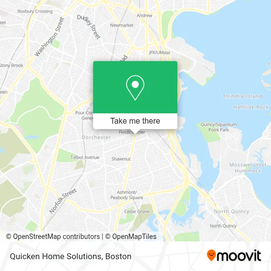
See Quicken Home Solutions, Boston, on the map
Public Transit to Quicken Home Solutions in Boston
Wondering how to get to Quicken Home Solutions in Boston? Moovit helps you find the best way to get to Quicken Home Solutions with step-by-step directions from the nearest public transit station.
Moovit provides free maps and live directions to help you navigate through your city. View schedules, routes, timetables, and find out how long does it take to get to Quicken Home Solutions in real time.
Looking for the nearest stop or station to Quicken Home Solutions? Check out this list of stops closest to your destination: Dorchester Ave @ Parkman St; Gibson St @ Dorchester Ave; Fields Corner - Geneva Ave @ Vinson St; Dorchester Ave @ Fields Corner Station; Fields Corner; Shawmut; Talbot Avenue.
Bus: 19, 201, 202, 15, 18, 210, RED LINE SHUTTLE, RED LINE SHUTTLE, RED/MATTAPAN LINE SHUTTLE.Train: FAIRMOUNT, FRANKLIN/FOXBORO, FAIRMOUNT LINE SHUTTLE, PROVIDENCE/STOUGHTON.Subway: RED LINE.
Want to see if there’s another route that gets you there at an earlier time? Moovit helps you find alternative routes or times. Get directions from and directions to Quicken Home Solutions easily from the Moovit App or Website.
We make riding to Quicken Home Solutions easy, which is why over 1.7 million users, including users in Boston, trust Moovit as the best app for public transit. You don’t need to download an individual bus app or train app, Moovit is your all-in-one transit app that helps you find the best bus time or train time available.
For information on prices of subway, bus and train, costs and ride fares to Quicken Home Solutions, please check the Moovit app.
Use the app to navigate to popular places including to the airport, hospital, stadium, grocery store, mall, coffee shop, school, college, and university.
Quicken Home Solutions Address: 1558 Dorchester Ave street in Boston
- Fasoli,
- J7 Tattoo,
- Save Another Youth Taekwondo Inc.,
- Cottonseed Locksmith,
- 1576 Dorchester Ave Parking,
- DUNKIN',
- WESTERN UNION,
- Eblens - 46,
- Remodeling Enterprises,
- Boston Police Station Area C-11,
- Geneva Always Available 24 Hour Emergency,
- Snipes,
- Mutual Oil Co.,
- Coinstar,
- PLS Check Cashing Store,
- Tri Seafood Market,
- Mt Electrician,
- METABANK,
- Fields Corner Shopping Center,
- Chua Luc Hoa Buddhist Center
Places Near Quicken Home Solutions (Boston)
- Isabella Stewart Gardner Museum, Boston,
- Mgm Music Hall, Boston,
- Wilbur Theatre, Boston,
- Boston Medical Center, Boston,
- Quincy Market, Boston,
- Leader Bank Pavilion (Leader Bank Pavillion), Boston,
- Cheers, Boston,
- Castle Island, Boston,
- House Of Blues, Boston,
- Wang Theater, Boston,
- Boston Children's Hospital, Boston,
- Seaport District, Boston,
- Faneuil Hall, Boston,
- Boston Convention & Exhibition Center, Boston,
- Massachusetts General Hospital, Boston,
- Prudential Center, Boston,
- North End, Boston,
- Td Garden, Boston,
- Museum Of Science, Boston,
- Boston Common, Boston
How to get to popular places in Boston with public transit
Get around Boston by public transit!
Traveling around Boston has never been so easy. See step by step directions as you travel to any attraction, street or major public transit station. View bus and train schedules, arrival times, service alerts and detailed routes on a map, so you know exactly how to get to anywhere in Boston.
When traveling to any destination around Boston use Moovit's Live Directions with Get Off Notifications to know exactly where and how far to walk, how long to wait for your line, and how many stops are left. Moovit will alert you when it's time to get off — no need to constantly re-check whether yours is the next stop.
Wondering how to use public transit in Boston or how to pay for public transit in Boston? Moovit public transit app can help you navigate your way with public transit easily, and at minimum cost. It includes public transit fees, ticket prices, and costs. Looking for a map of Boston public transit lines? Moovit public transit app shows all public transit maps in Boston with all Bus, Train, Subway and Ferry routes and stops on an interactive map.
Boston has 4 transit type(s), including: Bus, Train, Subway and Ferry, operated by several transit agencies, including MBTA, Southeastern Regional Transit Authority, MetroWest Regional Transit Authority, Rhode Island Public Transit Authority, WRTA, Lowell Regional Transit Authority, Merrimack Valley Transit, Montachusett Regional Transit Authority, Cape Cod Regional Transit Authority, Brockton Area Transit Authority, Martha's Vineyard Transit Authority, the WAVE - Nantucket Regional Transit Authority, GATRA, Cape Ann Transportation Authority and Massport