Directions to Quincy Bait & Tackle with public transportation
The following transit lines have routes that pass near Quincy Bait & Tackle
 Bus: 210, 211, 217, 215.
- Train: FALL RIVER/NEW BEDFORD, GREENBUSH.
- Subway: RED LINE, MATTAPAN LINE.
How to get to Quincy Bait & Tackle by bus?
Click on the bus route to see step by step directions with maps, line arrival times and updated time schedules.
From Back Bay
101 minFrom Old State House
87 minFrom The Langham Boston
97 minFrom Castle Island
93 minFrom Bostonia Public House
91 minFrom Cheers Beacon Hill
88 minFrom Beth Israel Deaconess Medical Center Is
67 minFrom Yotel
100 minFrom Residence Inn by Marriott Boston Back Bay/Fenway
84 minFrom The Wilbur
53 min
How to get to Quincy Bait & Tackle by train?
Click on the train route to see step by step directions with maps, line arrival times and updated time schedules.
How to get to Quincy Bait & Tackle by subway?
Click on the subway route to see step by step directions with maps, line arrival times and updated time schedules.
Bus stops near Quincy Bait & Tackle
Bus lines to Quincy Bait & Tackle
What are the closest stations to Quincy Bait & Tackle?
The closest stations to Quincy Bait & Tackle are:
- Highland Ave @ Wilson Ave is 354 yards away, 5 min walk.
- W Squantum St Opp Farrington St is 372 yards away, 5 min walk.
- Milton is 445 yards away, 6 min walk.
- Wollaston is 891 yards away, 11 min walk.
Which bus lines stop near Quincy Bait & Tackle?
These bus lines stop near Quincy Bait & Tackle: 210, 211.
Which train lines stop near Quincy Bait & Tackle?
These train lines stop near Quincy Bait & Tackle: FALL RIVER/NEW BEDFORD, GREENBUSH.
Which subway line stops near Quincy Bait & Tackle?
RED LINE (Ashmont/Braintree)
What’s the nearest subway station to Quincy Bait & Tackle?
The nearest subway station to Quincy Bait & Tackle is Milton. It’s a 6 min walk away.
What’s the nearest bus station to Quincy Bait & Tackle?
The nearest bus stations to Quincy Bait & Tackle are Highland Ave @ Wilson Ave and W Squantum St Opp Farrington St. The closest one is a 5 min walk away.
What time is the first subway to Quincy Bait & Tackle?
The MATTAPAN LINE is the first subway that goes to Quincy Bait & Tackle. It stops nearby at 5:06 AM.
What time is the last subway to Quincy Bait & Tackle?
The MATTAPAN LINE is the last subway that goes to Quincy Bait & Tackle. It stops nearby at 2:35 AM.
What time is the first bus to Quincy Bait & Tackle?
The 215 is the first bus that goes to Quincy Bait & Tackle. It stops nearby at 5:21 AM.
What time is the last bus to Quincy Bait & Tackle?
The 211 is the last bus that goes to Quincy Bait & Tackle. It stops nearby at 8:27 PM.
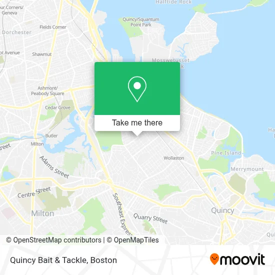
See Quincy Bait & Tackle on the map
Public Transportation to Quincy Bait & Tackle
Wondering how to get to Quincy Bait & Tackle? Moovit helps you find the best way to get to Quincy Bait & Tackle with step-by-step directions from the nearest public transit station.
Moovit provides free maps and live directions to help you navigate through your city. View schedules, routes, timetables, and find out how long does it take to get to Quincy Bait & Tackle in real time.
Looking for the nearest stop or station to Quincy Bait & Tackle? Check out this list of stops closest to your destination: Highland Ave @ Wilson Ave; W Squantum St Opp Farrington St; Milton; Wollaston.
Bus: 210, 211, 217, 215.Train: FALL RIVER/NEW BEDFORD, GREENBUSH.Subway: RED LINE, MATTAPAN LINE.
Want to see if there’s another route that gets you there at an earlier time? Moovit helps you find alternative routes or times. Get directions from and directions to Quincy Bait & Tackle easily from the Moovit App or Website.
We make riding to Quincy Bait & Tackle easy, which is why over 1.7 million users, including users in Quincy, trust Moovit as the best app for public transit. You don’t need to download an individual bus app or train app, Moovit is your all-in-one transit app that helps you find the best bus time or train time available.
For information on prices of subway, bus and train, costs and ride fares to Quincy Bait & Tackle, please check the Moovit app.
Use the app to navigate to popular places including to the airport, hospital, stadium, grocery store, mall, coffee shop, school, college, and university.
Quincy Bait & Tackle Address: 184 W Squantum St street in Quincy
- Burton Locksmith,
- Ghnk Caning Supplies,
- Mal's Tree Removal,
- Guard Locksmith of Quincy,
- VIVI Spa,
- Appliances Connection,
- Safford 1 24 Hour Emergency Locksmith,
- North Quincy,
- Montclair,
- Competiello,J W,DDS,
- Sunny Florists,
- Great Hangup,
- Tan,
- Archstone Smith Oprating Trust,
- Chuckies,
- Katy's Zero Excuses Gym,
- Eaves Avalon N. Quincy,
- Holiday Inn Express-Boston Quincy,
- Staybridge Suites Boston-Quincy,
- Vera Bradley
Places Near Quincy Bait & Tackle
- House Of Blues, Boston,
- Boston Children's Hospital, Boston,
- Leader Bank Pavilion (Leader Bank Pavillion), Boston,
- Prudential Center, Boston,
- North End, Boston,
- Boston Common, Boston,
- Quincy Market, Boston,
- Faneuil Hall, Boston,
- Isabella Stewart Gardner Museum, Boston,
- Wang Theater, Boston,
- Mgm Music Hall, Boston,
- Wilbur Theatre, Boston,
- Cheers, Boston,
- Castle Island, Boston,
- Museum Of Science, Boston,
- Boston Medical Center, Boston,
- Seaport District, Boston,
- Boston Convention & Exhibition Center, Boston,
- Massachusetts General Hospital, Boston,
- Td Garden, Boston
How to get to popular places in Boston with public transit
Get around Quincy by public transit!
Traveling around Quincy has never been so easy. See step by step directions as you travel to any attraction, street or major public transit station. View bus and train schedules, arrival times, service alerts and detailed routes on a map, so you know exactly how to get to anywhere in Quincy.
When traveling to any destination around Quincy use Moovit's Live Directions with Get Off Notifications to know exactly where and how far to walk, how long to wait for your line, and how many stops are left. Moovit will alert you when it's time to get off — no need to constantly re-check whether yours is the next stop.
Wondering how to use public transit in Quincy or how to pay for public transit in Quincy? Moovit public transit app can help you navigate your way with public transit easily, and at minimum cost. It includes public transit fees, ticket prices, and costs. Looking for a map of Quincy public transit lines? Moovit public transit app shows all public transit maps in Quincy with all Bus, Train, Subway and Ferry routes and stops on an interactive map.
Boston has 4 transit type(s), including: Bus, Train, Subway and Ferry, operated by several transit agencies, including MBTA, Southeastern Regional Transit Authority, MetroWest Regional Transit Authority, Rhode Island Public Transit Authority, WRTA, Lowell Regional Transit Authority, Merrimack Valley Transit, Montachusett Regional Transit Authority, Cape Cod Regional Transit Authority, Brockton Area Transit Authority, Martha's Vineyard Transit Authority, the WAVE - Nantucket Regional Transit Authority, GATRA, Cape Ann Transportation Authority and Massport