Directions to Quiosque 8 (Niterói) with public transportation
The following transit lines have routes that pass near Quiosque 8
 Bus: 1775D (EXECUTIVO), 2755D (EXECUTIVO), 709D, 740D, 755D.
- Ferry: CHARITAS - PRAÇA XV.
How to get to Quiosque 8 by bus?
Click on the bus route to see step by step directions with maps, line arrival times and updated time schedules.
From Praça Marechal Âncora, Centro
52 minFrom Central, Centro
52 minFrom Hospital dos Servidores do Estado, Gamboa
53 minFrom Botafogo, Botafogo
51 minFrom Praça Cristiano Otoni, Centro
47 minFrom Central Do Brasil, Centro
48 minFrom Castelo, Centro
51 minFrom Hospital Servidores Do Estado/Rj, Gamboa
52 minFrom Museu da República (Palácio do Catete), Catete
60 minFrom Praça Mauá, Centro
58 min
How to get to Quiosque 8 by ferry?
Click on the ferry route to see step by step directions with maps, line arrival times and updated time schedules.
Bus stop near Quiosque 8 in Niterói
- Avenida Prefeito Silvio Picanço 647, 3 min walk,VIEW
Bus lines to Quiosque 8 in Niterói
- 62, Santa Bárbara,VIEW
- 740D, Leblon (Jardim de Alah),VIEW
- 755D, Gávea (Via Largo Do Machado),VIEW
- 760D, Galeão ✈ (Via Cidade Universitária),VIEW
- 775D, Gávea,VIEW
- 785D, Barra Da Tijuca,VIEW
- 1760D (EXECUTIVO), Galeão ✈ (Via Linha Vermelha),VIEW
- 1775D (EXECUTIVO), Gávea,VIEW
- 1910D (EXECUTIVO), Castelo (Via Pres. Vargas) (Saída De Piratininga),VIEW
- 2740D (EXECUTIVO), Leblon (Jardim de Alah),VIEW
- 2755D (EXECUTIVO), Gávea (Via Santa Úrsula),VIEW
- 2905D (EXECUTIVO), Castelo,VIEW
- OC1, Oc1 Terminal-Barcas,VIEW
- OC2, Oc2 Terminal,VIEW
- OC3, Oc3 Terminal (Praia De Icaraí),VIEW
- OC3A, Oc3a Terminal (Via Eng.Do Mato),VIEW
- 33, 33 Terminal Rodoviário,VIEW
- 52A, 52a Baldeador,VIEW
- 740D, Leblon,VIEW
- 2740D, Leblon,VIEW
What are the closest stations to Quiosque 8?
The closest stations to Quiosque 8 are:
- Avenida Prefeito Silvio Picanço 647 is 201 meters away, 3 min walk.
Which bus lines stop near Quiosque 8?
These bus lines stop near Quiosque 8: 1775D (EXECUTIVO), 2755D (EXECUTIVO), 709D, 740D, 755D, 760D, 775D.
Which ferry line stops near Quiosque 8?
CHARITAS - PRAÇA XV (Charitas)
What’s the nearest bus station to Quiosque 8 in Niterói?
The nearest bus station to Quiosque 8 in Niterói is Avenida Prefeito Silvio Picanço 647. It’s a 3 min walk away.
What time is the first bus to Quiosque 8 in Niterói?
The 33 is the first bus that goes to Quiosque 8 in Niterói. It stops nearby at 3:14 AM.
What time is the last bus to Quiosque 8 in Niterói?
The 740D is the last bus that goes to Quiosque 8 in Niterói. It stops nearby at 2:59 AM.
What time is the first ferry to Quiosque 8 in Niterói?
The CHARITAS - PRAÇA XV is the first ferry that goes to Quiosque 8 in Niterói. It stops nearby at 6:30 AM.
What time is the last ferry to Quiosque 8 in Niterói?
The CHARITAS - PRAÇA XV is the last ferry that goes to Quiosque 8 in Niterói. It stops nearby at 9:20 PM.
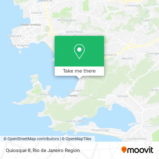
See Quiosque 8, Niterói, on the map
Public Transit to Quiosque 8 in Niterói
Wondering how to get to Quiosque 8 in Niterói? Moovit helps you find the best way to get to Quiosque 8 with step-by-step directions from the nearest public transit station.
Moovit provides free maps and live directions to help you navigate through your city. View schedules, routes, timetables, and find out how long does it take to get to Quiosque 8 in real time.
Looking for the nearest stop or station to Quiosque 8? Check out this list of stops closest to your destination: Avenida Prefeito Silvio Picanço 647.
Bus: 1775D (EXECUTIVO), 2755D (EXECUTIVO), 709D, 740D, 755D, 760D, 775D, 62.Ferry: CHARITAS - PRAÇA XV.
Want to see if there’s another route that gets you there at an earlier time? Moovit helps you find alternative routes or times. Get directions from and directions to Quiosque 8 easily from the Moovit App or Website.
We make riding to Quiosque 8 easy, which is why over 1.5 million users, including users in Niterói, trust Moovit as the best app for public transit. You don’t need to download an individual bus app or train app, Moovit is your all-in-one transit app that helps you find the best bus time or train time available.
For information on prices of bus, ferry and light rail, costs and ride fares to Quiosque 8, please check the Moovit app.
Use the app to navigate to popular places including to the airport, hospital, stadium, grocery store, mall, coffee shop, school, college, and university.
Quiosque 8 Address: Avenida Quintino Bocaiúva, Charitas Niterói-RJ 24370-001 street in Niterói
- Avenida Prefeito Silvio Picanço 555,
- Avenida Quintino Bocaiúva,
- praia de charitas,
- Condominio Charitas Bay,
- Verdanna Grill,
- Rua Clotilde Maria Linhares Pinsky 91,
- Tropical Casa de Festas,
- Rua Eurico Manoel do Carmo,
- Restaurante Siri De Niteroi,
- Affect Espaço de Desenvolvimento,
- Praia de Charitas,
- Pipit's Pet Store,
- Cáritas,
- By Lily Atelier,
- Aeroclube de Charitas,
- Charitas Aero Clube,
- Rua Murilo Portugal, 140,
- Rua Marechal Raul de Albuquerque 273,
- Cemitério São Francisco Xavier,
- Casarão Charitas
Places Near Quiosque 8 (Niterói)
- Rio De Janeiro,
- Shopping Rio Sul, Botafogo,
- Niterói, Niterói,
- Hospital Pedro Ernesto, Vila Isabel,
- Praia do Arpoador, Ipanema,
- Rua Ulysses Guimarães 16, Cidade Nova,
- Hospital Municipal Ronaldo Gazolla, Acari,
- Avenida Venezuela 134, Saúde,
- Avenida Rio Branco, Centro,
- Hospital Federal Do Andaraí, Andaraí,
- Rua Licínio Cardoso, São Francisco Xavier,
- Feira Livre da Gloria, Glória,
- Hospital Federal Cardoso Fontes, Jacarepaguá,
- Feirão De Malhas, Duque De Caxias,
- Rodoviária Novo Rio (Rodoviária do Rio de Janeiro), Santo Cristo,
- Shopping Downtown, Barra Da Tijuca,
- Shopping Nova América, Del Castilho,
- Shopping RioSul, Botafogo,
- Norte Shopping, Cachambi,
- Museu Do Amanhã, Centro
How to get to popular places in Rio de Janeiro Region with public transit
Get around Niterói by public transit!
Traveling around Niterói has never been so easy. See step by step directions as you travel to any attraction, street or major public transit station. View bus and train schedules, arrival times, service alerts and detailed routes on a map, so you know exactly how to get to anywhere in Niterói.
When traveling to any destination around Niterói use Moovit's Live Directions with Get Off Notifications to know exactly where and how far to walk, how long to wait for your line, and how many stops are left. Moovit will alert you when it's time to get off — no need to constantly re-check whether yours is the next stop.
Wondering how to use public transit in Niterói or how to pay for public transit in Niterói? Moovit public transit app can help you navigate your way with public transit easily, and at minimum cost. It includes public transit fees, ticket prices, and costs. Looking for a map of Niterói public transit lines? Moovit public transit app shows all public transit maps in Niterói with all Bus, Train, Metro, Light Rail, Ferry, Cable Car, Gondola and Funicular routes and stops on an interactive map.
Rio de Janeiro Region has 8 transit type(s), including: Bus, Train, Metro, Light Rail, Ferry, Cable Car, Gondola and Funicular, operated by several transit agencies, including TrensRJ, Metrô Rio, VLT Carioca, Barcas Rio, BRT MOBI-Rio, Auto Viação Alpha, Auto Viação Tijuca, Gire Transportes, Transurb, Viação Nossa Senhora das Graças, Consórcio INTERSUL, Braso Lisboa (Municipal), Caprichosa Auto Ônibus, Auto Viação Três Amigos and Rodoviária Âncora Matias