Directions to Qxo (Malden) with public transportation
The following transit lines have routes that pass near Qxo
 Bus: 101, 97, 108.
- Train: HAVERHILL.
- Subway: ORANGE LINE, GREEN LINE B, GREEN LINE C, GREEN LINE E.
How to get to Qxo by bus?
Click on the bus route to see step by step directions with maps, line arrival times and updated time schedules.
From 110 Francis Street Garage, Boston
67 minFrom Hyatt Regency Cambridge, Cambridge
51 minFrom St. Elizabeth's Medical Center, Boston
90 minFrom Boston Theatre District, Boston
61 minFrom Dudley Station, Boston
107 minFrom Mission Hill, Boston
105 minFrom O'Bryant High School, Boston
89 minFrom Hatch Shell, Boston
66 minFrom davio's, Boston
67 minFrom Mass Eye & Ear, Boston
90 min
How to get to Qxo by train?
Click on the train route to see step by step directions with maps, line arrival times and updated time schedules.
How to get to Qxo by subway?
Click on the subway route to see step by step directions with maps, line arrival times and updated time schedules.
From 110 Francis Street Garage, Boston
62 minFrom Hyatt Regency Cambridge, Cambridge
63 minFrom St. Elizabeth's Medical Center, Boston
79 minFrom Boston Theatre District, Boston
34 minFrom Dudley Station, Boston
51 minFrom Mission Hill, Boston
57 minFrom O'Bryant High School, Boston
47 minFrom Hatch Shell, Boston
47 minFrom davio's, Boston
39 minFrom Mass Eye & Ear, Boston
58 min
Bus stops near Qxo in Malden
Train station near Qxo in Malden
- Oak Grove, 27 min walk,VIEW
What are the closest stations to Qxo?
The closest stations to Qxo are:
- Medford St @ Green St is 340 yards away, 5 min walk.
- Highland Ave @ Charles St is 358 yards away, 5 min walk.
- Assembly is 1359 yards away, 17 min walk.
- Oak Grove is 2288 yards away, 27 min walk.
- Medford/Tufts Station is 3474 yards away, 41 min walk.
Which bus lines stop near Qxo?
These bus lines stop near Qxo: 101, 97.
Which train line stops near Qxo?
HAVERHILL (#229 | Haverhill)
Which subway line stops near Qxo?
ORANGE LINE (Oak Grove)
What’s the nearest subway station to Qxo in Malden?
The nearest subway station to Qxo in Malden is Assembly. It’s a 17 min walk away.
What’s the nearest train station to Qxo in Malden?
The nearest train station to Qxo in Malden is Oak Grove. It’s a 27 min walk away.
What’s the nearest bus station to Qxo in Malden?
The nearest bus stations to Qxo in Malden are Medford St @ Green St and Highland Ave @ Charles St. The closest one is a 5 min walk away.
What time is the first subway to Qxo in Malden?
The GREEN LINE E is the first subway that goes to Qxo in Malden. It stops nearby at 4:55 AM.
What time is the last subway to Qxo in Malden?
The GREEN LINE E is the last subway that goes to Qxo in Malden. It stops nearby at 2:41 AM.
What time is the first train to Qxo in Malden?
The HAVERHILL is the first train that goes to Qxo in Malden. It stops nearby at 5:35 AM.
What time is the last train to Qxo in Malden?
The HAVERHILL is the last train that goes to Qxo in Malden. It stops nearby at 11:53 PM.
What time is the first bus to Qxo in Malden?
The 108 is the first bus that goes to Qxo in Malden. It stops nearby at 5:31 AM.
What time is the last bus to Qxo in Malden?
The 108 is the last bus that goes to Qxo in Malden. It stops nearby at 1:32 AM.
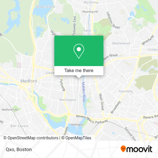
See Qxo, Malden, on the map
Public Transit to Qxo in Malden
Wondering how to get to Qxo in Malden? Moovit helps you find the best way to get to Qxo with step-by-step directions from the nearest public transit station.
Moovit provides free maps and live directions to help you navigate through your city. View schedules, routes, timetables, and find out how long does it take to get to Qxo in real time.
Looking for the nearest stop or station to Qxo? Check out this list of stops closest to your destination: Medford St @ Green St; Highland Ave @ Charles St; Assembly; Oak Grove; Medford/Tufts Station.
Bus: 101, 97, 108.Train: HAVERHILL.Subway: ORANGE LINE, GREEN LINE B, GREEN LINE C, GREEN LINE E.
Want to see if there’s another route that gets you there at an earlier time? Moovit helps you find alternative routes or times. Get directions from and directions to Qxo easily from the Moovit App or Website.
We make riding to Qxo easy, which is why over 1.7 million users, including users in Malden, trust Moovit as the best app for public transit. You don’t need to download an individual bus app or train app, Moovit is your all-in-one transit app that helps you find the best bus time or train time available.
For information on prices of bus, subway and train, costs and ride fares to Qxo, please check the Moovit app.
Use the app to navigate to popular places including to the airport, hospital, stadium, grocery store, mall, coffee shop, school, college, and university.
Qxo Address: 197 Commercial St street in Malden
- Super 88,
- Jornal dos Sports,
- Xfinity/Comcast,
- Social Security Office,
- Super 88 Market,
- City of Malden Council on Aging,
- Onemain Financial,
- Piantedosi Baking,
- South Cove Community Health Center,
- Cha Malden Care Center,
- Staff Realty,
- Amman Atlas Market,
- Dish Network,
- El Potro,
- Sylvia Cho, do,
- Malden Rotary Club,
- Canal Street Plumbing,
- Hibernian Club,
- American Reliability Labs,
- Joanna's Alterations & Dry Cleaning
Places Near Qxo (Malden)
- Boston Medical Center, Boston,
- Leader Bank Pavilion (Leader Bank Pavillion), Boston,
- House Of Blues, Boston,
- Mgm Music Hall, Boston,
- Museum Of Science, Boston,
- Castle Island, Boston,
- Boston Convention & Exhibition Center, Boston,
- Isabella Stewart Gardner Museum, Boston,
- Td Garden, Boston,
- Wang Theater, Boston,
- Massachusetts General Hospital, Boston,
- Quincy Market, Boston,
- Boston Common, Boston,
- North End, Boston,
- Wilbur Theatre, Boston,
- Seaport District, Boston,
- Cheers, Boston,
- Faneuil Hall, Boston,
- Boston Children's Hospital, Boston,
- Prudential Center, Boston
How to get to popular places in Boston with public transit
Get around Malden by public transit!
Traveling around Malden has never been so easy. See step by step directions as you travel to any attraction, street or major public transit station. View bus and train schedules, arrival times, service alerts and detailed routes on a map, so you know exactly how to get to anywhere in Malden.
When traveling to any destination around Malden use Moovit's Live Directions with Get Off Notifications to know exactly where and how far to walk, how long to wait for your line, and how many stops are left. Moovit will alert you when it's time to get off — no need to constantly re-check whether yours is the next stop.
Wondering how to use public transit in Malden or how to pay for public transit in Malden? Moovit public transit app can help you navigate your way with public transit easily, and at minimum cost. It includes public transit fees, ticket prices, and costs. Looking for a map of Malden public transit lines? Moovit public transit app shows all public transit maps in Malden with all Bus, Train, Subway and Ferry routes and stops on an interactive map.
Boston has 4 transit type(s), including: Bus, Train, Subway and Ferry, operated by several transit agencies, including MBTA, Southeastern Regional Transit Authority, MetroWest Regional Transit Authority, Rhode Island Public Transit Authority, WRTA, Lowell Regional Transit Authority, Merrimack Valley Transit, Montachusett Regional Transit Authority, Cape Cod Regional Transit Authority, Brockton Area Transit Authority, Martha's Vineyard Transit Authority, the WAVE - Nantucket Regional Transit Authority, GATRA, Cape Ann Transportation Authority and Massport