How to get to Rüdiger Schuster by bus?
Click on the bus route to see step by step directions with maps, line arrival times and updated time schedules.
From Thoraxklinik Heidelberg, Neuenheim
56 minFrom SAP Walldorf P18, Walldorf
75 minFrom SAP Campus, Walldorf
68 minFrom Luxor Filmpalast, Bahnstadt
46 minFrom Marie-Baum-Schule Heidelberg, Wieblingen
46 minFrom Agaplesion Bethanien Krankenhaus Heidelberg, Südstadt
47 minFrom GRN-Klinik Schwetzingen, Schwetzingen
76 minFrom Universitätsklinikum Heidelberg-Notaufnahme, Neuenheim
53 minFrom SAP Headquarters, Walldorf
72 minFrom Thingstätte, Handschuhsheim
58 min
How to get to Rüdiger Schuster by train?
Click on the train route to see step by step directions with maps, line arrival times and updated time schedules.
Bus stops near Rüdiger Schuster in Verwaltungsverband Neckargemünd
Train stations near Rüdiger Schuster in Verwaltungsverband Neckargemünd
Light Rail stations near Rüdiger Schuster in Verwaltungsverband Neckargemünd
- Neckargemünd, Altstadt, 43 min walk,VIEW
Bus lines to Rüdiger Schuster in Verwaltungsverband Neckargemünd
- 735, Eiterbach, Ortsende,VIEW
- 752, Mückenloch, Friedhof,VIEW
- 753, Dilsberg, Vor Dem Tor,VIEW
- 754, Wiesenbach, Löwen,VIEW
- 7940, Neckargemünd, Bahnhof,VIEW
- RNV 35, Heidelberg, Bismarckplatz,VIEW
- 35, Betriebshof,VIEW
- 755, Neckargemünd, Bahnhof,VIEW
- 8913, Neckargemünd, Bahnhof,VIEW
- 736, Kleingemünd, Felsenberg,VIEW
What are the closest stations to Rüdiger Schuster?
The closest stations to Rüdiger Schuster are:
- Neckargemünd, Neckarbrücke is 97 meters away, 2 min walk.
- Neckargemünd, Hanfmarkt is 143 meters away, 2 min walk.
- Hanfmarkt is 148 meters away, 3 min walk.
- Neckargemünd, Schützenhausbr. is 218 meters away, 3 min walk.
- Neckargemünd, M.-Luther-Haus is 229 meters away, 4 min walk.
- Kleingemünd, Ort is 710 meters away, 10 min walk.
- Neckargemünd, Altstadt is 3355 meters away, 43 min walk.
- Neckargemünd, Bahnhof is 4467 meters away, 57 min walk.
Which bus lines stop near Rüdiger Schuster?
These bus lines stop near Rüdiger Schuster: 35, 735, RNV 35.
Which train lines stop near Rüdiger Schuster?
These train lines stop near Rüdiger Schuster: RE10A, RE10B, S7.
What’s the nearest bus station to Rüdiger Schuster in Verwaltungsverband Neckargemünd?
The nearest bus stations to Rüdiger Schuster in Verwaltungsverband Neckargemünd are Neckargemünd, Neckarbrücke and Neckargemünd, Hanfmarkt. The closest one is a 2 min walk away.
What time is the first light rail to Rüdiger Schuster in Verwaltungsverband Neckargemünd?
The S1 is the first light rail that goes to Rüdiger Schuster in Verwaltungsverband Neckargemünd. It stops nearby at 4:58 AM.
What time is the last light rail to Rüdiger Schuster in Verwaltungsverband Neckargemünd?
The S2 is the last light rail that goes to Rüdiger Schuster in Verwaltungsverband Neckargemünd. It stops nearby at 12:55 AM.
What time is the first train to Rüdiger Schuster in Verwaltungsverband Neckargemünd?
The S7 is the first train that goes to Rüdiger Schuster in Verwaltungsverband Neckargemünd. It stops nearby at 5:10 AM.
What time is the last train to Rüdiger Schuster in Verwaltungsverband Neckargemünd?
The S7 is the last train that goes to Rüdiger Schuster in Verwaltungsverband Neckargemünd. It stops nearby at 12:59 AM.
What time is the first bus to Rüdiger Schuster in Verwaltungsverband Neckargemünd?
The 35 is the first bus that goes to Rüdiger Schuster in Verwaltungsverband Neckargemünd. It stops nearby at 4:47 AM.
What time is the last bus to Rüdiger Schuster in Verwaltungsverband Neckargemünd?
The 7940 is the last bus that goes to Rüdiger Schuster in Verwaltungsverband Neckargemünd. It stops nearby at 12:47 AM.
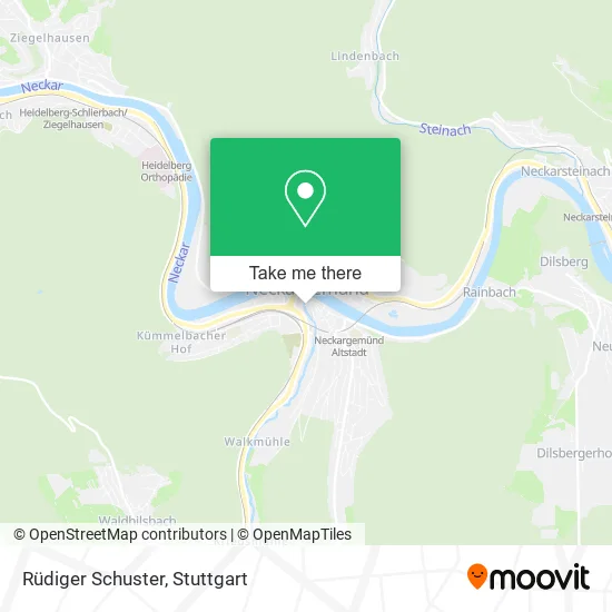
See Rüdiger Schuster, Verwaltungsverband Neckargemünd, on the map
Public Transit to Rüdiger Schuster in Verwaltungsverband Neckargemünd
Wondering how to get to Rüdiger Schuster in Verwaltungsverband Neckargemünd? Moovit helps you find the best way to get to Rüdiger Schuster with step-by-step directions from the nearest public transit station.
Moovit provides free maps and live directions to help you navigate through your city. View schedules, routes, timetables, and find out how long does it take to get to Rüdiger Schuster in real time.
Looking for the nearest stop or station to Rüdiger Schuster? Check out this list of stops closest to your destination: Neckargemünd; Neckargemünd; Hanfmarkt; Neckargemünd; Neckargemünd; Kleingemünd; Neckargemünd; Neckargemünd.
Bus: 35, 735, RNV 35, 752, 753, 754, 7940, 755.Train: RE10A, RE10B, S7, S3, RE2, RE7, S8.
Want to see if there’s another route that gets you there at an earlier time? Moovit helps you find alternative routes or times. Get directions from and directions to Rüdiger Schuster easily from the Moovit App or Website.
We make riding to Rüdiger Schuster easy, which is why over 1.5 million users, including users in Verwaltungsverband Neckargemünd, trust Moovit as the best app for public transit. You don’t need to download an individual bus app or train app, Moovit is your all-in-one transit app that helps you find the best bus time or train time available.
For information on prices of bus, train and light rail, costs and ride fares to Rüdiger Schuster, please check the Moovit app.
Use the app to navigate to popular places including to the airport, hospital, stadium, grocery store, mall, coffee shop, school, college, and university.
Rüdiger Schuster Address: Hauptstraße 79 69151 Neckargemünd street in Verwaltungsverband Neckargemünd
- Heiligers H. Dr.Med.Dent,
- Sk Rhein-Neckar,
- Hauptstr,
- Schmitt und Hahn Buch und Presse,
- Schmitt & Hahn,
- Theo Stetzelberger,
- 1824 - Ein Verhängnisvolles Hochwasser,
- Eugen-Gärtner-Plätzl,
- Evian-Brücke,
- Kanzlei Martina Tecza,
- Drogerie Werner Filial,
- Parfümerie Werner,
- Café Mühle,
- Ferienwohnung am Elsenzhafen,
- Sylvia Gruber Steuerberaterin,
- Siefert Uwe Steuerberater,
- Krauss,
- Metzgerei Dieter Krauß,
- Neckargemünd Stadtmitte,
- Radservice-Punkt Neckargemünd
Places Near Rüdiger Schuster (Verwaltungsverband Neckargemünd)
- Mercedes-Benz Museum (Mercedes Museum Stuttgart), Bad Cannstatt,
- Pariser Platz Stuttgart, Stuttgart-Mitte,
- Hanns-Martin-Schleyer-Halle, Bad Cannstatt,
- Porsche-Arena, Bad Cannstatt,
- Schleyerhalle, Bad Cannstatt,
- Gleis 101/102 (tief), Stuttgart-Mitte,
- Im Wizemann (Halle), Bad Cannstatt,
- Klinikum Stuttgart - Katharinenhospital, Stuttgart-Mitte,
- SI-Centrum, Möhringen,
- Mercedes-Benz Museum, Bad Cannstatt,
- FlixBus Haltestelle, Stuttgart,
- Marmorsaal Im Weissenburgpark, Stuttgart-Süd,
- Wilhelma (U-Bahn Wilhelma), Bad Cannstatt,
- Hanns-Martin-Schleyer-Halle (Stuttgart Hans-Martin-Schleyerhalle), Bad Cannstatt,
- Geilhaus Haus 33a, Reutlingen-Betzingen,
- Porsche Museum, Zuffenhausen,
- Mettingen Eros-Center Puff Laufhaus, Esslingen Am Neckar,
- Gasometer Pforzheim, Pforzheim,
- Hauptbahnhof Stuttgart, Stuttgart-Mitte,
- Waldfriedhof, Degerloch
How to get to popular places in Stuttgart with public transit
Get around Verwaltungsverband Neckargemünd by public transit!
Traveling around Verwaltungsverband Neckargemünd has never been so easy. See step by step directions as you travel to any attraction, street or major public transit station. View bus and train schedules, arrival times, service alerts and detailed routes on a map, so you know exactly how to get to anywhere in Verwaltungsverband Neckargemünd.
When traveling to any destination around Verwaltungsverband Neckargemünd use Moovit's Live Directions with Get Off Notifications to know exactly where and how far to walk, how long to wait for your line, and how many stops are left. Moovit will alert you when it's time to get off — no need to constantly re-check whether yours is the next stop.
Wondering how to use public transit in Verwaltungsverband Neckargemünd or how to pay for public transit in Verwaltungsverband Neckargemünd? Moovit public transit app can help you navigate your way with public transit easily, and at minimum cost. It includes public transit fees, ticket prices, and costs. Looking for a map of Verwaltungsverband Neckargemünd public transit lines? Moovit public transit app shows all public transit maps in Verwaltungsverband Neckargemünd with all Bus, Train, Subway, Light Rail, Ferry, S-Bahn and Funicular routes and stops on an interactive map.
Stuttgart has 7 transit type(s), including: Bus, Train, Subway, Light Rail, Ferry, S-Bahn and Funicular, operated by several transit agencies, including SSB - Stadtbahn, SSB, SSB - Seilbahn / Zacke, S-Bahn Stuttgart, Rhein-Neckar-Verkehr GmbH (rnv), Karlsruher Verkehrsverbund, DB AG, DB Regiobus BW, Arverio Baden-Württemberg GmbH, DB RegioNetz Verkehrs GmbH Westfrankenbahn, DB Regio AG Baden-Württemberg, Südwestdeutsche Verkehrs-AG, DB Regio AG Mitte Region Hessen, DB and Bodensee-Oberschwaben-Bahn