How to get to Rıfat Tunç by bus?
Click on the bus route to see step by step directions with maps, line arrival times and updated time schedules.
From 15 Temmuz Millet Bahçesi, Esenler
69 minFrom bagcılar minibüs durakları, Bagcilar
92 minFrom Metroport Avm, Bahçelievler
66 minFrom Sahrayıcedit, Kadıköy
89 minFrom Mecidiyeköy Meydanı, Mecidiyeköy, Şişli
52 minFrom İstanbul Optimum Avm Optimum, Kadıköy
112 minFrom Yıldız Parkı, Beşiktaş
45 minFrom Cumhurbaşkanlığı Konutu R.T.E, Küçükçamlıca, Üsküdar
84 minFrom Taksim ilkyardım hastanesi, Gaziosmanpasa
91 minFrom Bahçelievler Ağız ve Diş Sağlığı Merkezi, Bahçelievler
75 min
How to get to Rıfat Tunç by train?
Click on the train route to see step by step directions with maps, line arrival times and updated time schedules.
How to get to Rıfat Tunç by metro?
Click on the metro route to see step by step directions with maps, line arrival times and updated time schedules.
From 15 Temmuz Millet Bahçesi, Esenler
83 minFrom bagcılar minibüs durakları, Bagcilar
62 minFrom Metroport Avm, Bahçelievler
53 minFrom Mecidiyeköy Meydanı, Mecidiyeköy, Şişli
33 minFrom Yıldız Parkı, Beşiktaş
51 minFrom Taksim ilkyardım hastanesi, Gaziosmanpasa
59 minFrom Bahçelievler Ağız ve Diş Sağlığı Merkezi, Bahçelievler
62 min
Tram stations near Rıfat Tunç in Eminönü, Fatih
- Eminönü (T1), 2 min walk,VIEW
Ferry stations near Rıfat Tunç in Eminönü, Fatih
Bus stops near Rıfat Tunç in Eminönü, Fatih
- Eminönü (Sirkeci), 4 min walk,VIEW
- Sirkeci, 7 min walk,VIEW
- Sirkeci - Yenikapı Yönü, 7 min walk,VIEW
- Eminönü İskele, 8 min walk,VIEW
- Eminönü Kantarcılar - Son Durak(399) Yönü, 9 min walk,VIEW
- Eminönü - Sahil (4) Yönü, 11 min walk,VIEW
- Karaköy - Beşiktaş Yönü, 11 min walk,VIEW
- Eminönü - Peron Yönü, 11 min walk,VIEW
- Karaköy - Eminönü Yönü, 12 min walk,VIEW
Dolmus & Minibus station near Rıfat Tunç in Eminönü, Fatih
- Eminönü İskele - Yesilköy Yönü, 5 min walk,VIEW
Bus lines to Rıfat Tunç in Eminönü, Fatih
- 121CS, Sultanahmet,VIEW
- SIRKECI - AKVARYUM, Istanbul Aquarium (Gelen Yolcu),VIEW
- BN1, Halkalı Park-Halkalı Polis Merkezi,VIEW
- HVİST-11, İstanbul Havalimanı ✈,VIEW
- 336, Arnavutköy Peronlar-Eminönü Kantarcılar,VIEW
- 35, Eminönü-Koca Mustafapaşa,VIEW
- 336E, Malkoçoğlu-Cebeci Peronlar,VIEW
- 26, Eminönü Kantarcılar-Dikilitaş,VIEW
- 26A, Eminönü Kantarcılar-Fulya Mahallesi,VIEW
- 28, Beşiktaş Meydan-Topkapı,VIEW
- 28T, Topkapı-Beşiktaş Meydan,VIEW
- 30D, Yenikapı Marmaray-Vadi,VIEW
- 70KE, Kurtuluş-Eminönü Kantarcılar,VIEW
- 93, Zeytinburnu-Eminönü,VIEW
- EM1, Nişangah-Eminönü,VIEW
- EM2, Perpa 1-Eminönü,VIEW
- 31E, Kuyumcukent-Kuyumcukent Çarşı,VIEW
- 32, Cevatpaşa-Eminönü,VIEW
- 33, Giyimkent-Çamlık,VIEW
- 33B, Şehit Emrah Sağaz-Giyimkent,VIEW
What are the closest stations to Rıfat Tunç?
The closest stations to Rıfat Tunç are:
- Eminönü (T1) is 105 meters away, 2 min walk.
- Eminönü - 4 is 263 meters away, 4 min walk.
- Eminönü - 3 is 282 meters away, 4 min walk.
- Eminönü (Sirkeci) is 288 meters away, 4 min walk.
- Eminönü İskele - Yesilköy Yönü is 341 meters away, 5 min walk.
- Sirkeci is 510 meters away, 7 min walk.
- Sirkeci - Yenikapı Yönü is 516 meters away, 7 min walk.
- Eminönü İskele is 612 meters away, 8 min walk.
- Eminönü Kantarcılar - Son Durak(399) Yönü is 686 meters away, 9 min walk.
- Eminönü - Sahil (4) Yönü is 813 meters away, 11 min walk.
- Karaköy - Beşiktaş Yönü is 817 meters away, 11 min walk.
- Eminönü - Peron Yönü is 834 meters away, 11 min walk.
- Karaköy - Eminönü Yönü is 871 meters away, 12 min walk.
Which bus lines stop near Rıfat Tunç?
These bus lines stop near Rıfat Tunç: 146B, 30D, 38E, 50P, 54E, 66, 97GE.
Which train line stops near Rıfat Tunç?
B1 (Halkalı)
Which metro line stops near Rıfat Tunç?
M2 (Hacıosman→Yenikapı)
Which tram lines stop near Rıfat Tunç?
These tram lines stop near Rıfat Tunç: T1, T5.
What’s the nearest tram station to Rıfat Tunç in Eminönü, Fatih?
The nearest tram station to Rıfat Tunç in Eminönü, Fatih is Eminönü (T1). It’s a 2 min walk away.
What’s the nearest bus station to Rıfat Tunç in Eminönü, Fatih?
The nearest bus station to Rıfat Tunç in Eminönü, Fatih is Eminönü (Sirkeci). It’s a 4 min walk away.
What’s the nearest ferry station to Rıfat Tunç in Eminönü, Fatih?
The nearest ferry stations to Rıfat Tunç in Eminönü, Fatih are Eminönü - 4 and Eminönü - 3. The closest one is a 4 min walk away.
What’s the nearest Dolmus & Minibus station to Rıfat Tunç in Eminönü, Fatih?
The nearest Dolmus & Minibus station to Rıfat Tunç in Eminönü, Fatih is Eminönü İskele - Yesilköy Yönü. It’s a 5 min walk away.
What time is the first tram to Rıfat Tunç in Eminönü, Fatih?
The T1 is the first tram that goes to Rıfat Tunç in Eminönü, Fatih. It stops nearby at 6:08 AM.
What time is the last tram to Rıfat Tunç in Eminönü, Fatih?
The T1 is the last tram that goes to Rıfat Tunç in Eminönü, Fatih. It stops nearby at 12:28 AM.
What time is the first bus to Rıfat Tunç in Eminönü, Fatih?
The HVİST-11 is the first bus that goes to Rıfat Tunç in Eminönü, Fatih. It stops nearby at 3:02 AM.
What time is the last bus to Rıfat Tunç in Eminönü, Fatih?
The HVİST-11 is the last bus that goes to Rıfat Tunç in Eminönü, Fatih. It stops nearby at 1:32 AM.
What time is the first ferry to Rıfat Tunç in Eminönü, Fatih?
The ÜSKÜDAR - KARAKÖY - EMINÖNÜ is the first ferry that goes to Rıfat Tunç in Eminönü, Fatih. It stops nearby at 7:20 AM.
What time is the last ferry to Rıfat Tunç in Eminönü, Fatih?
The ÜSKÜDAR - KARAKÖY - EMINÖNÜ is the last ferry that goes to Rıfat Tunç in Eminönü, Fatih. It stops nearby at 10:50 PM.
What time is the first Dolmus & Minibus to Rıfat Tunç in Eminönü, Fatih?
The NIŞANTAŞI - EMINÖNÜ is the first Dolmus & Minibus that goes to Rıfat Tunç in Eminönü, Fatih. It stops nearby at 7:20 AM.
What time is the last Dolmus & Minibus to Rıfat Tunç in Eminönü, Fatih?
The NIŞANTAŞI - EMINÖNÜ is the last Dolmus & Minibus that goes to Rıfat Tunç in Eminönü, Fatih. It stops nearby at 7:00 PM.
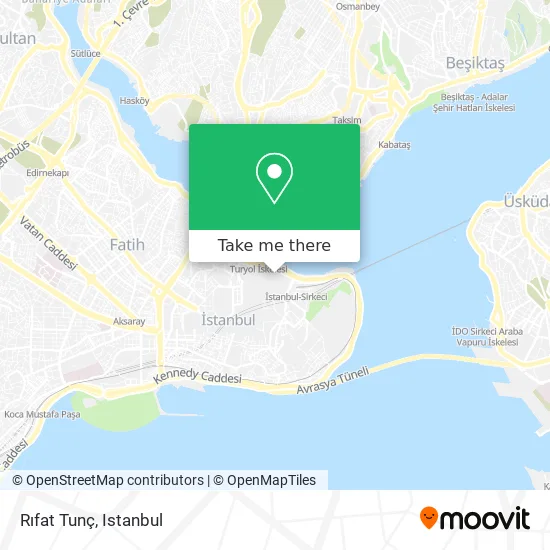
See Rıfat Tunç, Eminönü, Fatih, on the map
Public Transit to Rıfat Tunç in Eminönü, Fatih
Wondering how to get to Rıfat Tunç in Eminönü, Fatih? Moovit helps you find the best way to get to Rıfat Tunç with step-by-step directions from the nearest public transit station.
Moovit provides free maps and live directions to help you navigate through your city. View schedules, routes, timetables, and find out how long does it take to get to Rıfat Tunç in real time.
Looking for the nearest stop or station to Rıfat Tunç? Check out this list of stops closest to your destination: Eminönü (T1); Eminönü - 4; Eminönü - 3; Eminönü (Sirkeci); Eminönü İskele - Yesilköy Yönü; Sirkeci; Sirkeci - Yenikapı Yönü; Eminönü İskele; Eminönü Kantarcılar - Son Durak(399) Yönü; Eminönü - Sahil (4) Yönü; Karaköy - Beşiktaş Yönü; Eminönü - Peron Yönü; Karaköy - Eminönü Yönü.
Bus: 146B, 30D, 38E, 50P, 54E, 66, 97GE, 121CS, SIRKECI - AKVARYUM, BN1, HVİST-11.Train: B1.Metro: M2.Tram: T1, T5.Ferry: KADIKÖY - KARAKÖY - EMINÖNÜ.Dolmus & Minibus: NIŞANTAŞI - EMINÖNÜ.
Want to see if there’s another route that gets you there at an earlier time? Moovit helps you find alternative routes or times. Get directions from and directions to Rıfat Tunç easily from the Moovit App or Website.
We make riding to Rıfat Tunç easy, which is why over 1.5 million users, including users in Eminönü, Fatih, trust Moovit as the best app for public transit. You don’t need to download an individual bus app or train app, Moovit is your all-in-one transit app that helps you find the best bus time or train time available.
For information on prices of metro, bus, train, tram and Dolmus & Minibus, costs and ride fares to Rıfat Tunç, please check the Moovit app.
Use the app to navigate to popular places including to the airport, hospital, stadium, grocery store, mall, coffee shop, school, college, and university.
Location: Eminönü, Fatih, Istanbul
- Taksim Alman Hastanesi,
- LC Waikiki (Lc Waikiki Istanbul Eminonu Yenicami),
- Alpek Hotel Istanbul,
- Alpek Teras Restaurant,
- Alpek Hotel,
- ŞAHİN PİPO DÜNYASI,
- Arpacılar Cad. No:13,
- Ziraat Katılım Bankası Eminönü Şubesi,
- Bileşim Alternatif Dağıtım Kanalları ve Ödeme Sistemleri A.Ş.,
- Reşadiye Caddesi , Kömürcü Bekir Sokak 16,
- İzmir Pazarı Saat ve Gözlük,
- Nimet Abla Milli Piyango Bayi,
- سوق,
- Efe Av Ticaret,
- Kennedy Caddesi,
- Nimet Abla,
- Bankacılar Sokak 9/1,
- Delta Teknik Servis,
- İstanbul Ticaret Odası Oda Sicil Koordinatörlüğü,
- Karaköy Yarımada Meyhanesi
Places Near Rıfat Tunç (Eminönü, Fatih)
- Bakırköy Sosyete Pazarı, Bakirköy,
- Gebze-Harem Minibüs Hattı, Gebze,
- İstinye Park, Sariyer,
- İstanbul,
- Tersane İstanbul, Beyoğlu,
- Karaköy Genelevi, Karaköy, Beyoğlu,
- 41 Burda AVM, Kocaeli Merkezi,
- Şehit Prof. Dr. İlhan Varank Eğitim Ve Araştırma Hastanesi, Sancaktepe,
- METROPOL IsTaNBuL, Ataşehir,
- Mehmet Emin Tokadî Hz. Türbesi, Fatih,
- 2 Nolu Minibüss, Beylikduzu,
- Hz. Yuşa Tepesi, Beykoz,
- 212 AVM, Bagcilar,
- Beylikdüzü - 4 Nolu Minibüs Hattı, Beylikduzu,
- Mall Of İstanbul, Basaksehir,
- Gebze Koop Durağı, Gebze,
- VİALAND AVM, Eyüp,
- Topkule Kışlası 47.Komando Tugay Komutanlığı, Esenler,
- Hilltown AVM, Maltepe,
- Başakşehir Çam Ve Sakura Şehir Hastanesi, Basaksehir
How to get to popular places in Istanbul with public transit
Get around Eminönü, Fatih by public transit!
Traveling around Eminönü, Fatih has never been so easy. See step by step directions as you travel to any attraction, street or major public transit station. View bus and train schedules, arrival times, service alerts and detailed routes on a map, so you know exactly how to get to anywhere in Eminönü, Fatih.
When traveling to any destination around Eminönü, Fatih use Moovit's Live Directions with Get Off Notifications to know exactly where and how far to walk, how long to wait for your line, and how many stops are left. Moovit will alert you when it's time to get off — no need to constantly re-check whether yours is the next stop.
Wondering how to use public transit in Eminönü, Fatih or how to pay for public transit in Eminönü, Fatih? Moovit public transit app can help you navigate your way with public transit easily, and at minimum cost. It includes public transit fees, ticket prices, and costs. Looking for a map of Eminönü, Fatih public transit lines? Moovit public transit app shows all public transit maps in Eminönü, Fatih with all Bus, Train, Metro, Tram, Ferry, Metrobus and Dolmus & Minibus routes and stops on an interactive map.
Istanbul has 7 transit type(s), including: Bus, Train, Metro, Tram, Ferry, Metrobus and Dolmus & Minibus, operated by several transit agencies, including Marmaray, Metro İstanbul, Metrobüs, UAB, İETT, İETT ÇIFT KATLI HATLAR, İETT BÖLGESEL HATLAR, TCDD, Şehir Hatları, Dentur Avrasya, Beyden, Turyol, Mavi Marmara, Havaist and Prenstur
