How to get to RFEH by bus?
Click on the bus route to see step by step directions with maps, line arrival times and updated time schedules.
From Calle del Trueno 32, Leganés
81 minFrom Hospital Sanitas La Moraleja, Madrid
68 minFrom Hotel Compostela Suites, Madrid
49 minFrom Montecarmelo, Madrid
65 minFrom Campo de las Naciones, Madrid
80 minFrom DGT, Madrid
55 minFrom Ciudad Deportiva Del Rayo Vallecano, Área Metropolitana De Madrid Y Corredor Del Henares
64 minFrom Cuatro Vientos, Madrid
45 minFrom Coliseum Alfonso Pérez, Getafe
71 minFrom Hospital HM Sanchinarro, Madrid
66 min
How to get to RFEH by train?
Click on the train route to see step by step directions with maps, line arrival times and updated time schedules.
How to get to RFEH by metro?
Click on the metro route to see step by step directions with maps, line arrival times and updated time schedules.
From Calle del Trueno 32, Leganés
44 minFrom Hospital Sanitas La Moraleja, Madrid
65 minFrom Hotel Compostela Suites, Madrid
32 minFrom Montecarmelo, Madrid
57 minFrom Campo de las Naciones, Madrid
42 minFrom DGT, Madrid
45 minFrom Ciudad Deportiva Del Rayo Vallecano, Área Metropolitana De Madrid Y Corredor Del Henares
64 minFrom Coliseum Alfonso Pérez, Getafe
55 minFrom Hospital HM Sanchinarro, Madrid
62 min
Bus stops near RFEH in Madrid
Metro stations near RFEH in Madrid
Train station near RFEH in Madrid
- Príncipe Pío, 18 min walk,VIEW
Bus lines to RFEH in Madrid
- 25, Plaza de España - Casa de Campo,VIEW
- 33, Principe Pio - Casa de Campo,VIEW
- 39, Plaza de España - Colonia San Ignacio de Loyola,VIEW
- 138, Plaza de Cristo Rey - Colonia San Ignacio de Loyola,VIEW
- 158, Plaza de España - los Carmenes,VIEW
- N18, Plaza de Cibeles - las Águilas,VIEW
- N19, Plaza de Cibeles - Colonia San Ignacio de Loyola,VIEW
- 41, Col. Manzanares,VIEW
- 62, Los Puertos,VIEW
- C1, Circular 1,VIEW
- NC1, Cuatro Caminos,VIEW
- 31, Aluche,VIEW
- 65, Gran Capitan,VIEW
- 50, Avda. Manzanares,VIEW
- C2, Circular 2,VIEW
- NC2, Estacion Atocha,VIEW
- 36, Campamento,VIEW
What are the closest stations to RFEH?
The closest stations to RFEH are:
- Puente De Segovia is 42 meters away, 1 min walk.
- Puerta Del Ángel is 120 meters away, 2 min walk.
- Parque De Atenas is 143 meters away, 2 min walk.
- Virgen Del Puerto - Segovia is 149 meters away, 3 min walk.
- La Latina is 779 meters away, 11 min walk.
- Príncipe Pío is 1335 meters away, 18 min walk.
- Ópera is 1479 meters away, 19 min walk.
Which bus lines stop near RFEH?
These bus lines stop near RFEH: 138, 25, 31, 36, 39, 41, 62, 65, C1.
Which train lines stop near RFEH?
These train lines stop near RFEH: C10, C7.
Which metro lines stop near RFEH?
These metro lines stop near RFEH: M-10, M-6.
What’s the nearest metro station to RFEH in Madrid?
The nearest metro station to RFEH in Madrid is Puerta Del Ángel. It’s a 2 min walk away.
What’s the nearest train station to RFEH in Madrid?
The nearest train station to RFEH in Madrid is Príncipe Pío. It’s a 18 min walk away.
What’s the nearest bus station to RFEH in Madrid?
The nearest bus station to RFEH in Madrid is Puente De Segovia. It’s a 1 min walk away.
What time is the first metro to RFEH in Madrid?
The M-R is the first metro that goes to RFEH in Madrid. It stops nearby at 6:05 AM.
What time is the last metro to RFEH in Madrid?
The M-5 is the last metro that goes to RFEH in Madrid. It stops nearby at 2:03 AM.
What time is the first train to RFEH in Madrid?
The C7 is the first train that goes to RFEH in Madrid. It stops nearby at 6:09 AM.
What time is the last train to RFEH in Madrid?
The C7 is the last train that goes to RFEH in Madrid. It stops nearby at 12:12 AM.
What time is the first bus to RFEH in Madrid?
The C1 is the first bus that goes to RFEH in Madrid. It stops nearby at 7:07 AM.
What time is the last bus to RFEH in Madrid?
The N19 is the last bus that goes to RFEH in Madrid. It stops nearby at 3:17 AM.
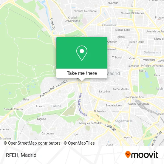
See RFEH, Madrid, on the map
Public Transit to RFEH in Madrid
Wondering how to get to RFEH in Madrid? Moovit helps you find the best way to get to RFEH with step-by-step directions from the nearest public transit station.
Moovit provides free maps and live directions to help you navigate through your city. View schedules, routes, timetables, and find out how long does it take to get to RFEH in real time.
Looking for the nearest stop or station to RFEH? Check out this list of stops closest to your destination: Puente De Segovia; Puerta Del Ángel; Parque De Atenas; Virgen Del Puerto - Segovia; La Latina; Príncipe Pío; Ópera.
Bus: 138, 25, 31, 36, 39, 41, 62, 65, C1, 33, 158.Train: C10, C7, MD, REG.Metro: M-10, M-6, M-5, M-R, M-2.
Want to see if there’s another route that gets you there at an earlier time? Moovit helps you find alternative routes or times. Get directions from and directions to RFEH easily from the Moovit App or Website.
We make riding to RFEH easy, which is why over 1.5 million users, including users in Madrid, trust Moovit as the best app for public transit. You don’t need to download an individual bus app or train app, Moovit is your all-in-one transit app that helps you find the best bus time or train time available.
For information on prices of bus, metro and train, costs and ride fares to RFEH, please check the Moovit app.
Use the app to navigate to popular places including to the airport, hospital, stadium, grocery store, mall, coffee shop, school, college, and university.
Location: Madrid
- Puente Segovia,
- Ciudad Rodrigo,
- La Ribera del Manzanares,
- Glorieta Puente de Segovia,
- centro budista camino del diamante madrid,
- Flick hockey,
- Parada 609 EMT,
- Centro de Salud de Madrid Calle de Linneo 3 (C.S. de Madrid Calle de Linneo 3),
- WE PARTY,
- Sala La Riviera,
- La Riviera,
- Taxi,
- Parada E. M. T. #608,
- Calle de Manzanares & Calle de Linneo,
- Ermita De La Virgen Del Puerto,
- Miss Carrusel,
- Calle de Manzanares 19,
- Miguelañez,
- Joma,
- Centro De Estudios Hidrográficos-Cedex
Places Near RFEH (Madrid)
- Plaza Mayor, Madrid,
- Calle de López de Hoyos 169, Madrid,
- Sala La Riviera, Madrid,
- Hospital Universitario Ramón y Cajal, Madrid,
- Centro Comercial La Vaguada, Área Metropolitana De Madrid Y Corredor Del Henares,
- Hospital Universitario La Paz, Madrid,
- Nassica, Área Metropolitana De Madrid Y Corredor Del Henares,
- Estacion de Chamartin, Madrid,
- Mercadillo de Majadahonda, Majadahonda,
- Hospital Clínico Universitario San Carlos, Madrid,
- Plenilunio, Área Metropolitana De Madrid Y Corredor Del Henares,
- Estadio Wanda Metropolitano, Área Metropolitana De Madrid Y Corredor Del Henares,
- Rastro De Madrid, Área Metropolitana De Madrid Y Corredor Del Henares,
- Centro Comercial La Gavia, Área Metropolitana De Madrid Y Corredor Del Henares,
- Tres Aguas, Alcorcón,
- Mendez Alvaro, Madrid,
- Palacio De Vistalegre, Área Metropolitana De Madrid Y Corredor Del Henares,
- Centro Comercial Islazul, Área Metropolitana De Madrid Y Corredor Del Henares,
- Centro Comercial Oasiz Madrid, Área Metropolitana De Madrid Y Corredor Del Henares,
- Wizink Center, Madrid
How to get to popular places in Madrid with public transit
Get around Madrid by public transit!
Traveling around Madrid has never been so easy. See step by step directions as you travel to any attraction, street or major public transit station. View bus and train schedules, arrival times, service alerts and detailed routes on a map, so you know exactly how to get to anywhere in Madrid.
When traveling to any destination around Madrid use Moovit's Live Directions with Get Off Notifications to know exactly where and how far to walk, how long to wait for your line, and how many stops are left. Moovit will alert you when it's time to get off — no need to constantly re-check whether yours is the next stop.
Wondering how to use public transit in Madrid or how to pay for public transit in Madrid? Moovit public transit app can help you navigate your way with public transit easily, and at minimum cost. It includes public transit fees, ticket prices, and costs. Looking for a map of Madrid public transit lines? Moovit public transit app shows all public transit maps in Madrid with all Bus, Train, Metro and Light Rail routes and stops on an interactive map.
Madrid has 4 transit type(s), including: Bus, Train, Metro and Light Rail, operated by several transit agencies, including Metro de Madrid, Metro Ligero, Tranvía de Parla, Renfe Cercanías - Servicios de Autobús especiales, Renfe Cercanias, Renfe Cercanías, EMT, Interurbanos, Urbanos de Alcalá de Henares, Urbanos de Alcobendas, Urbanos de Alcorcón, Urbanos de Algete, Urbanos de Aranjuez, Urbanos de Arganda del Rey and Urbanos de Arroyomolinos