Directions to ROSSLARE HARBOUR (Rosslare Harbour) with public transportation
The following transit lines have routes that pass near ROSSLARE HARBOUR
How to get to ROSSLARE HARBOUR by bus?
Click on the bus route to see step by step directions with maps, line arrival times and updated time schedules.
Bus stations near ROSSLARE HARBOUR in Rosslare Harbour
- Rosslare Harbour, 3 min walk,
- Rosslare Europort, 16 min walk,
Train stations near ROSSLARE HARBOUR in Rosslare Harbour
- Rosslare Europort, 10 min walk,
Bus lines to ROSSLARE HARBOUR in Rosslare Harbour
- 387, Hospital Newtown Rd,
- 40, Rosslare Harbour,
- 370, Rosslare Harbour,
- 385, Rosslare Harbour,
- 379, Gorey,
- 132, Dublin,
What are the closest stations to ROSSLARE HARBOUR?
The closest stations to ROSSLARE HARBOUR are:
- Rosslare Harbour is 179 meters away, 3 min walk.
- Rosslare Europort is 741 meters away, 10 min walk.
Which bus lines stop near ROSSLARE HARBOUR?
These bus lines stop near ROSSLARE HARBOUR: 387, 40.
What’s the nearest train station to ROSSLARE HARBOUR in Rosslare Harbour?
The nearest train station to ROSSLARE HARBOUR in Rosslare Harbour is Rosslare Europort. It’s a 10 min walk away.
What’s the nearest bus stop to ROSSLARE HARBOUR in Rosslare Harbour?
The nearest bus stop to ROSSLARE HARBOUR in Rosslare Harbour is Rosslare Harbour. It’s a 3 min walk away.
What time is the first bus to ROSSLARE HARBOUR in Rosslare Harbour?
The 387 is the first bus that goes to ROSSLARE HARBOUR in Rosslare Harbour. It stops nearby at 6:34 AM.
What time is the last bus to ROSSLARE HARBOUR in Rosslare Harbour?
The 387 is the last bus that goes to ROSSLARE HARBOUR in Rosslare Harbour. It stops nearby at 12:20 AM.
How much is the bus fare to ROSSLARE HARBOUR?
The bus fare to ROSSLARE HARBOUR costs about €1.55.
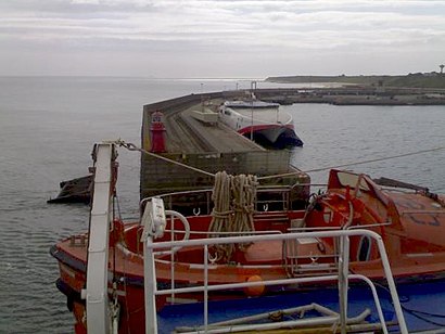
See ROSSLARE HARBOUR, Rosslare Harbour, on the map
Public Transit to ROSSLARE HARBOUR in Rosslare Harbour
Wondering how to get to ROSSLARE HARBOUR in Rosslare Harbour, Ireland? Moovit helps you find the best way to get to ROSSLARE HARBOUR with step-by-step directions from the nearest public transit station.
Moovit provides free maps and live directions to help you navigate through your city. View schedules, routes, timetables, and find out how long does it take to get to ROSSLARE HARBOUR in real time.
Looking for the nearest stop or station to ROSSLARE HARBOUR? Check out this list of stops closest to your destination: Rosslare Harbour; Rosslare Europort.
Bus:38740370385379132Train:RAIL
Want to see if there’s another route that gets you there at an earlier time? Moovit helps you find alternative routes or times. Get directions from and directions to ROSSLARE HARBOUR easily from the Moovit App or Website.
We make riding to ROSSLARE HARBOUR easy, which is why over 1.5 million users, including users in Rosslare Harbour, trust Moovit as the best app for public transit. You don’t need to download an individual bus app or train app, Moovit is your all-in-one transit app that helps you find the best bus time or train time available.
For information on prices of bus, costs and ride fares to ROSSLARE HARBOUR, please check the Moovit app.
Use the app to navigate to popular places including to the airport, hospital, stadium, grocery store, mall, coffee shop, school, college, and university.
ROSSLARE HARBOUR Address: ROSSLARE HARBOUR, St Patrick's Road, Wexford, County Wexford street in Rosslare Harbour
Attractions near ROSSLARE HARBOUR
Wexford Park,The Swan Bar,Wexford County Council,Home Focus at Hickeys,Fig Tree Garde,Eric de Brun,Carpetright 2315,Woodies Wexford,Holland & Barrett 5025,Argos,Galley Coffee Shop & Restaurant,Caroline's Cafe,Carnsore Broadband,IDS,Michael Brady International Transport,Eureka,Europort Business Park - Ebp06,Maguire's Hardware,Eureka Software,Bart's Cancer Charity ShopHow to get to popular attractions in Rosslare Harbour with public transit
Salthill Promenade, Salthill,Omni Park Shopping Centre Santry, Dublin,Phibsborough / Baile Phib, Dublin,Clayton Hotel Leopardstown, Glencullen,Radisson Blu Hotel & Spa, Galway, Galway,Stephen's Green Shopping Centre, Dublin,Stillorgan, Stillorgan,Stillorgan Luas, Dundrum,Dún Laoghaire Harbour,Dublin Heuston Railway Station, Dublin,Abbey Street, Dublin,Gate Theatre, Dublin,Microsoft Ireland, Dundrum,Dame Street, Dublin,Park West Industrial Park, Dublin,Rotunda Hospital, Dublin,IBM Technology Campus, Blanchardstown,IKEA, Dubber,Jervis Shopping Centre, Dublin,Blanchardstown Shopping Centre, BlanchardstownGet around Rosslare Harbour by public transit!
Traveling around Rosslare Harbour has never been so easy. See step by step directions as you travel to any attraction, street or major public transit station. View bus and train schedules, arrival times, service alerts and detailed routes on a map, so you know exactly how to get to anywhere in Rosslare Harbour.
When traveling to any destination around Rosslare Harbour use Moovit's Live Directions with Get Off Notifications to know exactly where and how far to walk, how long to wait for your line, and how many stops are left. Moovit will alert you when it's time to get off — no need to constantly re-check whether yours is the next stop.
Wondering how to use public transit in Rosslare Harbour or how to pay for public transit in Rosslare Harbour? Moovit public transit app can help you navigate your way with public transit easily, and at minimum cost. It includes public transit fees, ticket prices, and costs. Looking for a map of Rosslare Harbour public transit lines? Moovit public transit app shows all public transit maps in Rosslare Harbour with all bus routes and stops on an interactive map.
Rosslare Harbour has 1 transit type(s), including: bus, operated by several transit agencies, including Luas, Bus Átha Cliath – Dublin Bus, Bus Éireann, Go-Ahead Ireland, Nitelink, Dublin Bus, Citylink, Kenneally's Bus Service, Aircoach, TFI Local Link Mayo, Irish Rail, Express Bus, JJ/Bernard Kavanagh, Dublin Coach, Kearns Transport and Matthews Coach Hire