How to get to R.C. Briggs Insurance Agency by bus?
Click on the bus route to see step by step directions with maps, line arrival times and updated time schedules.
From Northern Essex Community College, Haverhill
34 minFrom Salisbury Beach, Salisbury
28 minFrom Parque de las ardillas, Lawrence
89 minFrom Lawrence, Massachusetts, Lawrence
90 minFrom Plum Island Beach, Newburyport
39 minFrom Lawrence, MA, Lawrence
92 minFrom Rockingham Mall Salem New Hampshire, Lawrence
91 minFrom Methuen, Methuen Town
119 min
Bus stop near R.C. Briggs Insurance Agency in Amesbury Town
- Elm Street & Ring St, 2 min walk,VIEW
Bus lines to R.C. Briggs Insurance Agency in Amesbury Town
What are the closest stations to R.C. Briggs Insurance Agency?
The closest stations to R.C. Briggs Insurance Agency are:
- Elm Street & Ring St is 112 yards away, 2 min walk.
Which bus lines stop near R.C. Briggs Insurance Agency?
These bus lines stop near R.C. Briggs Insurance Agency: 17, 19.
What’s the nearest bus station to R.C. Briggs Insurance Agency in Amesbury Town?
The nearest bus station to R.C. Briggs Insurance Agency in Amesbury Town is Elm Street & Ring St. It’s a 2 min walk away.
What time is the first bus to R.C. Briggs Insurance Agency in Amesbury Town?
The 17 is the first bus that goes to R.C. Briggs Insurance Agency in Amesbury Town. It stops nearby at 5:17 AM.
What time is the last bus to R.C. Briggs Insurance Agency in Amesbury Town?
The 17 is the last bus that goes to R.C. Briggs Insurance Agency in Amesbury Town. It stops nearby at 8:15 PM.
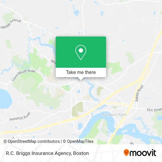
See R.C. Briggs Insurance Agency, Amesbury Town, on the map
Public Transit to R.C. Briggs Insurance Agency in Amesbury Town
Wondering how to get to R.C. Briggs Insurance Agency in Amesbury Town? Moovit helps you find the best way to get to R.C. Briggs Insurance Agency with step-by-step directions from the nearest public transit station.
Moovit provides free maps and live directions to help you navigate through your city. View schedules, routes, timetables, and find out how long does it take to get to R.C. Briggs Insurance Agency in real time.
Looking for the nearest stop or station to R.C. Briggs Insurance Agency? Check out this list of stops closest to your destination: Elm Street & Ring St.
Bus: 17, 19.
Want to see if there’s another route that gets you there at an earlier time? Moovit helps you find alternative routes or times. Get directions from and directions to R.C. Briggs Insurance Agency easily from the Moovit App or Website.
We make riding to R.C. Briggs Insurance Agency easy, which is why over 1.7 million users, including users in Amesbury Town, trust Moovit as the best app for public transit. You don’t need to download an individual bus app or train app, Moovit is your all-in-one transit app that helps you find the best bus time or train time available.
For information on prices of bus, costs and ride fares to R.C. Briggs Insurance Agency, please check the Moovit app.
Use the app to navigate to popular places including to the airport, hospital, stadium, grocery store, mall, coffee shop, school, college, and university.
R.C. Briggs Insurance Agency Address: 103 Main St street in Amesbury Town
- Chef Victor Andrade,
- R.C. Briggs Insurance,
- The Actors Studio of Newburyport,
- Amesbury Community Theatre,
- Merrimack Auction,
- Billie's,
- Imacake Bakery,
- Mkl Counseling & Coaching Services,
- Clear View Wealth Advisors - Steve Stanganelli Cfp - R,
- Chris Moore, Century 21 North East Amesbury, MA 01913,
- Cafe Blue Dream,
- Strong Empire Ent.,
- Pomeroy Law P.C.,
- Aumnii Emporium,
- Pinette Kenneth,
- Lallier/Munroe,
- Lucas A.- Insurance Agent,
- Nossiff and Giampa,
- Diana's Studio Nail Wax & Permanant Make Up,
- Reliable Co-Signer
Places Near R.C. Briggs Insurance Agency (Amesbury Town)
- Boston Children's Hospital, Boston,
- North End, Boston,
- Cheers, Boston,
- Wang Theater, Boston,
- Boston Convention & Exhibition Center, Boston,
- Museum Of Science, Boston,
- Mgm Music Hall, Boston,
- House Of Blues, Boston,
- Boston Medical Center, Boston,
- Wilbur Theatre, Boston,
- Boston Common, Boston,
- Leader Bank Pavilion (Leader Bank Pavillion), Boston,
- Massachusetts General Hospital, Boston,
- Prudential Center, Boston,
- Castle Island, Boston,
- Td Garden, Boston,
- Faneuil Hall, Boston,
- Isabella Stewart Gardner Museum, Boston,
- Seaport District, Boston,
- Quincy Market, Boston
How to get to popular places in Boston with public transit
Get around Amesbury Town by public transit!
Traveling around Amesbury Town has never been so easy. See step by step directions as you travel to any attraction, street or major public transit station. View bus and train schedules, arrival times, service alerts and detailed routes on a map, so you know exactly how to get to anywhere in Amesbury Town.
When traveling to any destination around Amesbury Town use Moovit's Live Directions with Get Off Notifications to know exactly where and how far to walk, how long to wait for your line, and how many stops are left. Moovit will alert you when it's time to get off — no need to constantly re-check whether yours is the next stop.
Wondering how to use public transit in Amesbury Town or how to pay for public transit in Amesbury Town? Moovit public transit app can help you navigate your way with public transit easily, and at minimum cost. It includes public transit fees, ticket prices, and costs. Looking for a map of Amesbury Town public transit lines? Moovit public transit app shows all public transit maps in Amesbury Town with all Bus, Train, Subway and Ferry routes and stops on an interactive map.
Boston has 4 transit type(s), including: Bus, Train, Subway and Ferry, operated by several transit agencies, including MBTA, Southeastern Regional Transit Authority, MetroWest Regional Transit Authority, Rhode Island Public Transit Authority, WRTA, Lowell Regional Transit Authority, Merrimack Valley Transit, Montachusett Regional Transit Authority, Cape Cod Regional Transit Authority, Brockton Area Transit Authority, Martha's Vineyard Transit Authority, the WAVE - Nantucket Regional Transit Authority, GATRA, Cape Ann Transportation Authority and Massport